Birmingham, West Midlands · Neighbourhood crime trends

Sandwell Rowley Regis

7 neighbourhoods - a quarterly race to the lowest crime rate.

Crime Trends: Neighbourhoods compared - each quarter from Q1 2023

How do the 7 neighbourhoods of Rowley Regis compare? In Q2 2026 the police recorded 733 crimes across them, 20.8 for every 1,000 residents. That is 2.1% above a year earlier and 5.7% below Q1 2023, the first quarter we track.

Dudley Port has the lowest rate of the everyday neighbourhoods (14.7 per 1,000), followed by Old Hill (20.0) and Grace Mary Estate (20.5). Langley Green has the highest (32.5).

Use the RACE CHARTS below to watch all 7 SANDWELL ROWLEY REGIS NEIGHBOURHOODs race across 14 quarter periods from Q1 2023 to Q2 2026 - one crime category at a time or all together.

Neighbourhood areas derived by CrimesLog from rail station locations (NaPTAN, Department for Transport) and OS Open Names. Contains OS data © Crown copyright and database right 2024; contains public sector information licensed under the Open Government Licence v3.0.
Lowest rate (everyday)
lowest rateDudley Port
14.7 crimes per 1,000 residents, Q2 2026
Highest rate
upLangley Green
32.5 per 1,000, Q2 2026
Whole area, Q2 2026
20.8 per 1,000
up 2.1% above a year earlier · down 5.7% below Q1 2023
Compared
7 neighbourhoods
35,305 residents · 14 quarters

Sandwell Rowley Regis neighbourhood quarterly crime race

Press ▶︎ to watch Q1 2023 to Q2 2026. Tick one crime category or several; hover a bar for the neighbourhood. Property crimes includes burglaries and thefts.

Crime categories
Indicated: crimes rate per 1000 residents per quarterAll · safest at the top · square-root scale · Q1 2023 to Q2 202601510255024.1Brades Village16.2Dudley Port23.4Grace Mary Estate48.8Langley Green20.4Old Hill2.5Portway25.0Rowley RegisNumbers are crimes per 1,000 residents per quarter. Zero-crime quarters show 0 and rank safest. Not included, no residents: Rounds Green.
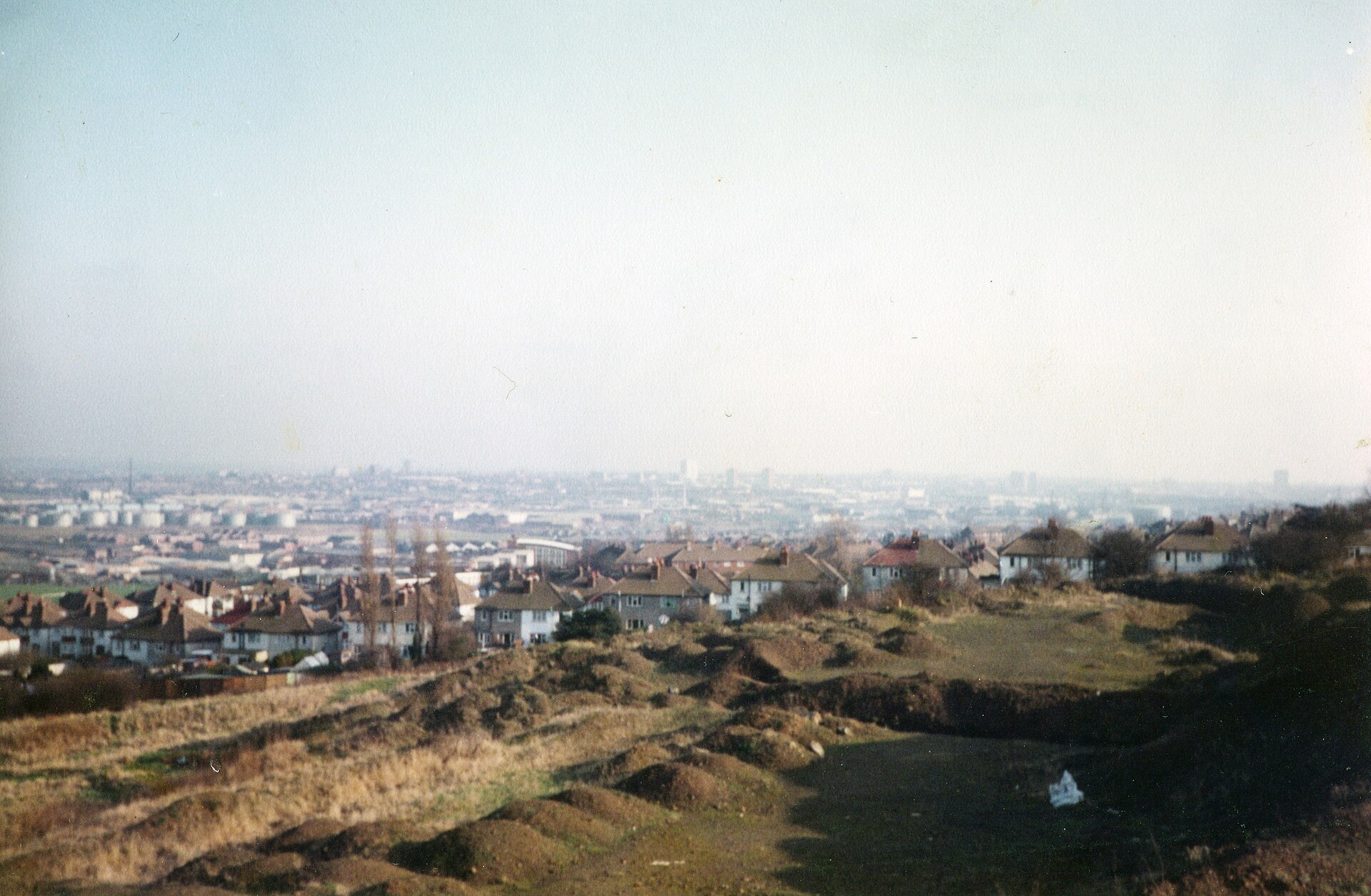
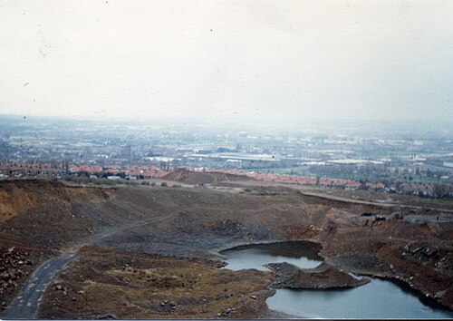
Fields Off Elm Terrace 1985, Dudley Port You checked the neighbourhood.Now check an address ! Photo: davidmicball, CC BY 3.0 · Wikimedia Commons

For £24.99 a CrimesLog™ Home Report provides: (where available)

  • Nearest 6 Pre-school Nurseries to Address
  • Nearest 6 Primary Schools to Address
  • Nearest 6 Secondary/High Schools to Address
  • Nearest College and University to Address
  • Nearest to Address GP Practice/Health Centres, Hospitals and Pharmacies
  • Nearest 2 Police Station details to Address

The Home Report also provides

  • The CrimesLog™ Home Score is a proprietary Home Safety Measure capturing crime frequency, severity, recency and proximity to Address from police crime reporting point
  • A map indicating police anonymised crime reporting points around Address
  • Crime category trendlines for Address neighbourhood
  • List of Reported Crime Incidents around Address radius
  • Downloadable PDF report — A Permanent Copy to Keep and Share to aid your Property Research
  • Our crimes database of almost 60 million records is UPDATED EVERY MONTH from US, UK, CA police sources
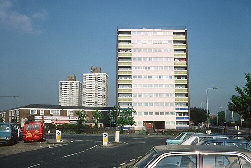
<Div Class='fn'> Tower Blocks UK: Newham London Eastbourne Road and Portway/Leabon Street, L32-14.Jpg</Div>, Portway
Portway · <Div Class='fn'> Tower Blocks UK: Newham London Eastbourne Road and Portway/Leabon Street, L32-14.Jpg</Div>
Photo: Miles Glendinning, CC BY 4.0 · Wikimedia Commons
Fields Off Elm Terrace 1985, Dudley Port
Dudley Port · Fields Off Elm Terrace 1985
Photo: davidmicball, CC BY 3.0 · Wikimedia Commons
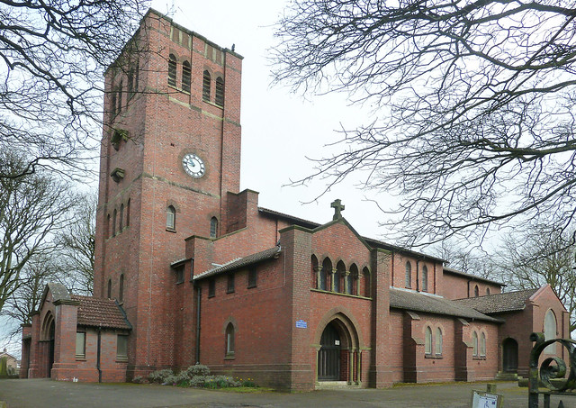
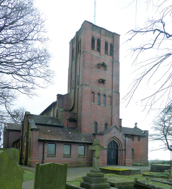
St Giles Church Rowley Regis 2, Rowley Regis
Rowley Regis · St Giles Church Rowley Regis 2
Photo: ahisgett, CC BY 2.0 · Flickr
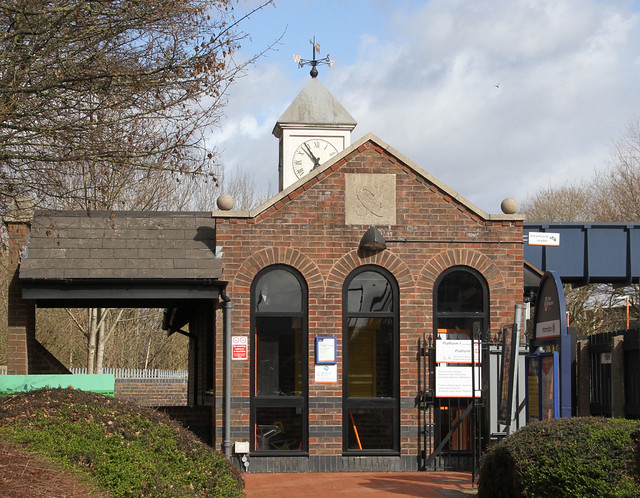
Langley Green Station 2, Langley Green
Langley Green · Langley Green Station 2
Photo: ahisgett, CC BY 2.0 · Flickr
Fields 1985, Dudley Port
Dudley Port · Fields 1985
Photo: davidmicball, CC BY 3.0 · Wikimedia Commons
St Giles Church Rowley Regis 3, Rowley Regis
Rowley Regis · St Giles Church Rowley Regis 3
Photo: ahisgett, CC BY 2.0 · Flickr
Langley Green Station 3, Langley Green
Langley Green · Langley Green Station 3
Photo: ahisgett, CC BY 2.0 · Flickr
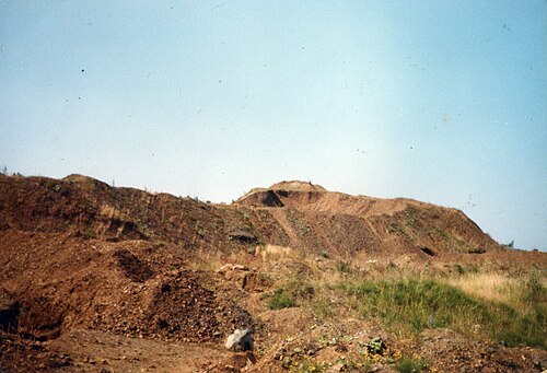
Quarry Tividale 1985, Dudley Port
Dudley Port · Quarry Tividale 1985
Photo: davidmicball, CC BY 3.0 · Wikimedia Commons

How neighbourhoods moved each quarter

2023

Whole-area crime rate 20.8 to 22.6 per 1,000 (high: Q2 2023).

Big moves (4+ places in a quarter): moved down Dudley Port 2nd→6th (Q2) moved up Dudley Port 6th→2nd (Q3) moved down Brades Village 2nd→6th (Q3)

2024

Whole-area crime rate 18.4 to 22.1 per 1,000 (high: Q1 2024).

No neighbourhood moved more than three places in a quarter.

2025

Whole-area crime rate 16.9 to 20.3 per 1,000 (high: Q2 2025).

No neighbourhood moved more than three places in a quarter.

2026

Whole-area crime rate 19.0 to 20.8 per 1,000 (high: Q2 2026). 2 quarters so far.

No neighbourhood moved more than three places in a quarter.

Reported Safety Incidents

In Q2 2026: violent incidents were 44% (322), property incidents were 30% (219), public order incidents were 17% (127) and vehicle crimes were 9% (65).

Recorded crime here is grouped into violent crime, property crime (burglary and theft), vehicle crime and public order offences, so you can compare how safe each neighbourhood is for the kind of crime that matters to you.

Places we left out, and places to read with care

Left out: Rounds Green. They have almost no residents: their crimes are against visitors, so a rate per resident says little about living there.

Portway (5.1 per 1,000 from 2 crimes among 392 residents) and Brades Village (10.5 per 1,000 from 7 crimes among 665 residents) are places with few residents (under 3,000): a rate on so few people says little about living there, so they are not named as the lowest or highest.

The 7 neighbourhoods on the map

Rowley Regis is made of 7 neighbourhoods compared here, each in its own colour on the map. They are neighbourhood areas derived by CrimesLog from rail station locations and OS Open Names: 35,305 residents between them.

  • Brades Village
  • Dudley Port
  • Grace Mary Estate
  • Langley Green
  • Old Hill
  • Portway
  • Rowley Regis

All 7 neighbourhoods, Q2 2026

Crimes per 1,000 residents, Q2 2026, lowest first. The last two columns compare with Q1 2023.
#NeighbourhoodResidentsAllViolentPropertyVehiclePublic orderRate vs Q1 2023Places gained
1Portway †3925.12.52.50.00.0up100%–
2Brades Village †66510.54.53.01.51.5down56%up3
3Dudley Port5,73114.75.24.72.62.1down10%down1
4Old Hill12,43020.09.54.12.14.3down2%down1
5Grace Mary Estate2,77820.513.02.91.13.6down12%down1
6Rowley Regis12,63324.79.99.71.53.6down1%–
7Langley Green67632.513.310.41.57.4down33%–

† Portway and Brades Village are places with few residents. A rate on a very small number of residents or crimes is not comparable with the others.

Photographs

227 photographs of the 7 neighbourhoods run along the reel; click one to see it full size. Each is credited here and under the large view.

All 227 photographs and their credits
  1. Portway · <Div Class='fn'> Tower Blocks UK: Newham London Eastbourne Road and Portway/Leabon Street, L32-14.Jpg</Div>. Photo: Miles Glendinning, CC BY 4.0 · Wikimedia Commons
  2. Dudley Port · Fields Off Elm Terrace 1985. Photo: davidmicball, CC BY 3.0 · Wikimedia Commons
  3. Rowley Regis · St Giles Church Rowley Regis 2. Photo: ahisgett, CC BY 2.0 · Flickr
  4. Langley Green · Langley Green Station 2. Photo: ahisgett, CC BY 2.0 · Flickr
  5. Dudley Port · Fields 1985. Photo: davidmicball, CC BY 3.0 · Wikimedia Commons
  6. Rowley Regis · St Giles Church Rowley Regis 3. Photo: ahisgett, CC BY 2.0 · Flickr
  7. Langley Green · Langley Green Station 3. Photo: ahisgett, CC BY 2.0 · Flickr
  8. Dudley Port · Quarry Tividale 1985. Photo: davidmicball, CC BY 3.0 · Wikimedia Commons
  9. Rowley Regis · Rowley Regis Station Street Art - Graffiti Box 2. Photo: ahisgett, CC BY 2.0 · Flickr
  10. Langley Green · Langley Green Station. Photo: ahisgett, CC BY 2.0 · Flickr
  11. Rowley Regis · Rowley Regis Station Street Art - Graffiti Box 3. Photo: ahisgett, CC BY 2.0 · Flickr
  12. Rowley Regis · Rowley Regis Station Brickwork - Julia Hinton 2. Photo: ahisgett, CC BY 2.0 · Flickr
  13. Rowley Regis · Rowley Regis Station Fencing Pennants - Peter Crownshaw 3. Photo: ahisgett, CC BY 2.0 · Flickr
  14. Rowley Regis · Rowley Regis Railway Station (April 2017) (1). Photo: User:Hassocks5489, CC0 · Wikimedia Commons
  15. Rowley Regis · Cobbs Engine House 2. Photo: ahisgett, CC BY 2.0 · Flickr
  16. Rowley Regis · H. DOULTON & Co ROWLEY REGIS. Photo: zimpenfish, CC BY 2.0 · Flickr
  17. Rowley Regis · Christian Heritage Centre, Rowley Regis, W. Midlands. Photo: revps100, Public domain · Flickr
  18. Rowley Regis · Christian Heritage Centre, Rowley Regis, W. Midlands. Photo: revps100, Public domain · Flickr
  19. Brades Village · The Hindu Temple of Shri Venkateswara 3. Photo: Tony Hisgett from Birmingham, UK, CC BY 2.0 · Wikimedia Commons
  20. Rowley Regis · Reel Cinema. Photo: Tony Hisgett from Birmingham, UK, CC BY 2.0 · Wikimedia Commons
  21. Bartley Green · Saint Michael and All Angels Church Bartley Green. Photo: ahisgett, CC BY 2.0 · Flickr
  22. Ridgacre · Ridgacre Methodist Church, World's End Lane, Ridgacre, Birmingham (August 2025) (4). Photo: User:Hassocks5489, CC0 · Wikimedia Commons
  23. Acocks Green · Stone Hall. Photo: Elliott Brown from Birmingham, United Kingdom, CC BY 2.0 · Wikimedia Commons
  24. Adderley Park · Church of St Mark Washwood Heath. Photo: Tony Hisgett from Birmingham, UK, CC BY 2.0 · Wikimedia Commons
  25. Aston · Aston Hall (1). Photo: Tony Hisgett from Birmingham, UK, CC BY 2.0 · Wikimedia Commons
  26. Birmingham Moor Street · Birmingham Moor Street Station - Centro Symbol. Photo: Elliott Brown from Birmingham, United Kingdom, CC BY 2.0 · Wikimedia Commons
  27. Birmingham New Street · Birmingham New Street. Photo: It's No Game, CC BY 2.0 · Wikimedia Commons
  28. Birmingham Snow Hill · 19 Newhall Street Birmingham 4. Photo: Tony Hisgett from Birmingham, UK, CC BY 2.0 · Wikimedia Commons
  29. Bordesley · Lenchs Trust Almshouse 3 (8142123165) (3). Photo: Tony Hisgett from Birmingham, UK, CC BY 2.0 · Wikimedia Commons
  30. Bournville · 2022 Commonwealth Games Final Bournville Continuation School. Photo: Tony Hisgett from Birmingham, UK, CC BY 2.0 · Wikimedia Commons
  31. Duddeston · Duddeston Station - Sculptures. Photo: Elliott Brown from Birmingham, United Kingdom, CC BY 2.0 · Wikimedia Commons
  32. Five Ways · St Bartholomew's Church, Church Road, Edgbaston, Birmingham - June 2023 - 01. Photo: Tony Hisgett, CC BY 2.0 · Wikimedia Commons
  33. Hall Green · Moseley School 3. Photo: Tony Hisgett from Birmingham, UK, CC BY 2.0 · Wikimedia Commons
  34. Jewellery Quarter · 23 Frederick Street. Photo: Tony Hisgett from Birmingham, UK, CC BY 2.0 · Wikimedia Commons
  35. Kings Heath · Kings Heath Library. Photo: Tony Hisgett from Birmingham, UK, CC BY 2.0 · Wikimedia Commons
  36. Kings Norton · Grant Arms, Pershore Road, Cotteridge. Photo: Elliott Brown from Birmingham, United Kingdom, CC BY 2.0 · Wikimedia Commons
  37. Moseley Village · 517 Moseley Road. Photo: Tony Hisgett from Birmingham, UK, CC BY 2.0 · Wikimedia Commons
  38. Perry Barr · Christ Church Baptist Church 2. Photo: Tony Hisgett from Birmingham, UK, CC BY 2.0 · Wikimedia Commons
  39. Pineapple Road · Cute House. Photo: Tanya Dedyukhina, CC BY 3.0 · Wikimedia Commons
  40. Selly Oak · St Stephens Church. Photo: fitzyt, CC BY 3.0 · Wikimedia Commons
  41. Small Heath · Ladypool Primary School 2. Photo: Tony Hisgett from Birmingham, UK, CC BY 2.0 · Wikimedia Commons
  42. Spring Road · The Shaftmoor - Shaftmoor Lane, Hall Green. Photo: Elliott Brown from Birmingham, United Kingdom, CC BY 2.0 · Wikimedia Commons
  43. Tyseley · Rood Ashton Hall 3. Photo: Tony Hisgett from Birmingham, UK, CC BY 2.0 · Wikimedia Commons
  44. University · Birmingham University of Birmingham. Photo: Tanya Dedyukhina, CC BY 3.0 · Wikimedia Commons
  45. Yardley Wood · Prefab Houses on Wake Green Road, Moseley. Photo: Elliott Brown from Birmingham, United Kingdom, CC BY 2.0 · Wikimedia Commons
  46. Butlers Lane · ATS Entrance. Photo: Olliec, Public domain · Wikimedia Commons
  47. Erdington · Erdington Station - 2006-06-30. Photo: Voice of Clam, Public domain · Wikimedia Commons
  48. Four Oaks · Moor Hall Ground Floor Plan (1930) - 2023-06-18 - Andy Mabbett (Cropped). Photo: AnonymousUnknown author, Public domain · Wikimedia Commons
  49. Stechford · 7.5.16 Castle Bromwich 40s Day 021. Photo: donald judge, CC BY 2.0 · Wikimedia Commons
  50. Sutton Coldfield · Odeon Cinema Sutton Coldfield. Photo: Tony Hisgett from Birmingham, UK, CC BY 2.0 · Wikimedia Commons
  51. Longbridge · Longbridge Station. Photo: Elliott Brown from Birmingham, United Kingdom, CC BY 2.0 · Wikimedia Commons
  52. Northfield · Church of St Laurence, Northfield. Photo: Elliott Brown from Birmingham, United Kingdom, CC BY 2.0 · Wikimedia Commons
  53. The Hawthorns · Parish Church of St Andrew, Oxhill Road, Birmingham (2). Photo: Tony Hisgett from Birmingham, UK, CC BY 2.0 · Wikimedia Commons
  54. Warley Woods · BCS. Photo: Tony Hisgett from Birmingham, UK, CC BY 2.0 · Wikimedia Commons
  55. Oldbury · New Oldbury Library. Photo: Tony Hisgett from Birmingham, UK, CC BY 2.0 · Wikimedia Commons
  56. Smethwick Galton Bridge · Galton Bridge - Smethwick - Panoramic. Photo: Elliott Brown from Birmingham, United Kingdom, CC BY 2.0 · Wikimedia Commons
  57. Smethwick Rolfe Street · Thimblemill Library (1). Photo: Tony Hisgett from Birmingham, UK, CC BY 2.0 · Wikimedia Commons
  58. Guns Village · Old Meeting House School Building. Photo: Tony Hisgett from Birmingham, UK, CC BY 2.0 · Wikimedia Commons
  59. Lambert's End · Oak House Roof. Photo: Tony Hisgett from Birmingham, UK, CC BY 2.0 · Wikimedia Commons
  60. Tame Bridge Parkway · Avenue. Photo: Tony Hisgett from Birmingham, UK, CC BY 2.0 · Wikimedia Commons
  61. West Bromwich · Kelvin Way House (1). Photo: Tony Hisgett from Birmingham, UK, CC BY 2.0 · Wikimedia Commons
  62. Brades Village · The Hindu Temple of Shri Venkateswara 2. Photo: Tony Hisgett from Birmingham, UK, CC BY 2.0 · Wikimedia Commons
  63. Rowley Regis · Even More Snow. Photo: Tony Hisgett from Birmingham, UK, CC BY 2.0 · Wikimedia Commons
  64. Bartley Green · Newman University Library. Photo: Tony Hisgett from Birmingham, UK, CC BY 2.0 · Wikimedia Commons
  65. Ridgacre · St Boniface Church, Quinton Road West, Ridgacre, Birmingham (August 2025) (1). Photo: User:Hassocks5489, CC0 · Wikimedia Commons
  66. Acocks Green · Acocks Green Police Station, Yardley Road. Photo: Elliott Brown from Birmingham, United Kingdom, CC BY 2.0 · Wikimedia Commons
  67. Aston · Aston Hall Dining Room. Photo: Tony Hisgett from Birmingham, UK, CC BY 2.0 · Wikimedia Commons
  68. Birmingham Moor Street · Birmingham Moor Street Station - Chiltern Railways Billboard. Photo: Elliott Brown from Birmingham, United Kingdom, CC BY 2.0 · Wikimedia Commons
  69. Birmingham New Street · British School. Photo: Tony Hisgett from Birmingham, UK, CC BY 2.0 · Wikimedia Commons
  70. Birmingham Snow Hill · Birmingham & Fazeley Canal - Fleet Street - Cable-Stay Footbridge1. Photo: Elliott Brown, CC BY 2.0 · Wikimedia Commons
  71. Bordesley · Lenchs Trust Almshouse 2. Photo: Tony Hisgett from Birmingham, UK, CC BY 2.0 · Wikimedia Commons
  72. Bournville · 2022 Commonwealth Games Final Bournville Continuation School 3. Photo: Tony Hisgett from Birmingham, UK, CC BY 2.0 · Wikimedia Commons
  73. Duddeston · Duddeston Station. Photo: Elliott Brown from Birmingham, United Kingdom, CC BY 2.0 · Wikimedia Commons
  74. Five Ways · Birmingham City University - Westbourne Road, Edgbaston - City South Campus - Lodge. Photo: Elliott Brown from Birmingham, United Kingdom, CC BY 2.0 · Wikimedia Commons
  75. Hall Green · Hall Green Station. Photo: Elliott Brown from Birmingham, United Kingdom, CC BY 2.0 · Wikimedia Commons
  76. Jewellery Quarter · Aquinas House Hockley 3. Photo: Tony Hisgett from Birmingham, UK, CC BY 2.0 · Wikimedia Commons
  77. Kings Heath · Kings Heath Library - High Street, Kings Heath - Detail. Photo: Elliott Brown from Birmingham, United Kingdom, CC BY 2.0 · Wikimedia Commons
  78. Moseley Village · St Anne's Church Moseley. Photo: Tony Hisgett from Birmingham, UK, CC BY 2.0 · Wikimedia Commons
  79. Perry Barr · Witton Station - Railway Bridge - Claret and Blue - Dennis Fire Engine. Photo: Elliott Brown from Birmingham, United Kingdom, CC BY 2.0 · Wikimedia Commons
  80. Selly Oak · Birmingham Church St.Marys. Photo: Tanya Dedyukhina, CC BY 3.0 · Wikimedia Commons
  81. Small Heath · Ladypool Primary School 3. Photo: Tony Hisgett from Birmingham, UK, CC BY 2.0 · Wikimedia Commons
  82. Tyseley · Rood Ashton Hall 2. Photo: Tony Hisgett from Birmingham, UK, CC BY 2.0 · Wikimedia Commons
  83. University · New Queen Elizabeth Hospital 2a. Photo: Tony Hisgett from Birmingham, UK, CC BY 2.0 · Wikimedia Commons
  84. Yardley Wood · Moseley Football Club War Memorial 20230526 1931. Photo: Murble2019, CC0 · Wikimedia Commons
  85. Erdington · Erdington Bridge - 2006-05-04. Photo: Voice of Clam, Public domain · Wikimedia Commons
  86. Four Oaks · Holy Trinity Methodist Church, Four Oaks.. Photo: Tanya Dedyukhina, CC BY 3.0 · Wikimedia Commons
  87. Stechford · 7.5.16 Castle Bromwich 40s Day 020. Photo: donald judge, CC BY 2.0 · Wikimedia Commons
  88. Sutton Coldfield · Odeon Cinema Sutton Coldfield 2. Photo: Tony Hisgett from Birmingham, England, CC BY 2.0 · Wikimedia Commons
  89. Longbridge · Longbridge Station - London Midland 323212. Photo: Elliott Brown from Birmingham, United Kingdom, CC BY 2.0 · Wikimedia Commons
  90. Northfield · Church of St Laurence, Northfield. Photo: Elliott Brown from Birmingham, United Kingdom, CC BY 2.0 · Wikimedia Commons
  91. The Hawthorns · Parish Church of St Andrew, Oxhill Road, Birmingham (3). Photo: Tony Hisgett from Birmingham, UK, CC BY 2.0 · Wikimedia Commons
  92. Oldbury · Oldbury Council House (3681948252) (2). Photo: Tony Hisgett from Birmingham, UK, CC BY 2.0 · Wikimedia Commons
  93. Smethwick Galton Bridge · Holly Lodge High School, Smethwick, West Midlands, England-11May2009. Photo: Tony Hisgett from Birmingham, UK, CC BY 2.0 · Wikimedia Commons
  94. Smethwick Rolfe Street · Galton Valley Canal Pumping Station. Photo: Tony Hisgett from Birmingham, UK, CC BY 2.0 · Wikimedia Commons
  95. Guns Village · 5960 "Saint Edmund Hall" at Swan Village. Photo: Tutenkhamun Sleeping, CC BY 2.0 · Wikimedia Commons
  96. Lambert's End · Oak House. Photo: Tony Hisgett from Birmingham, UK, CC BY 2.0 · Wikimedia Commons
  97. Tame Bridge Parkway · Forge Mill Lake. Photo: Tony Hisgett from Birmingham, UK, CC BY 2.0 · Wikimedia Commons
  98. West Bromwich · Kelvin Way House. Photo: Tony Hisgett from Birmingham, UK, CC BY 2.0 · Wikimedia Commons
  99. Brades Village · Hindu Temple 2. Photo: Tony Hisgett from Birmingham, UK, CC BY 2.0 · Wikimedia Commons
  100. Ridgacre · Ridgacre Methodist Church, World's End Lane, Ridgacre, Birmingham (August 2025) (1). Photo: User:Hassocks5489, CC0 · Wikimedia Commons
  101. Acocks Green · The Baptist Church, Yardley Road, Acocks Green. Photo: Elliott Brown from Birmingham, United Kingdom, CC BY 2.0 · Wikimedia Commons
  102. Aston · Aston Hall. Photo: Tony Hisgett from Birmingham, UK, CC BY 2.0 · Wikimedia Commons
  103. Birmingham Moor Street · A Walk Down the Centre of Moor Street Queensway. Photo: Elliott Brown from Birmingham, United Kingdom, CC BY 2.0 · Wikimedia Commons
  104. Birmingham New Street · British School - Severn Street, Birmingham. Photo: Elliott Brown from Birmingham, United Kingdom, CC BY 2.0 · Wikimedia Commons
  105. Birmingham Snow Hill · Birmingham & Fazeley Canal - Fleet Street - Cable-Stay Footbridge2. Photo: Elliott Brown, CC BY 2.0 · Wikimedia Commons
  106. Bordesley · Birmingham Skyline from Digbeth - Library of Birmingham. Photo: Elliott Brown from Birmingham, United Kingdom, CC BY 2.0 · Wikimedia Commons
  107. Bournville · 2022 Commonwealth Games Final Bournville Continuation School 2. Photo: Tony Hisgett from Birmingham, UK, CC BY 2.0 · Wikimedia Commons
  108. Five Ways · Birmingham Canal and Red-brick Houses. Photo: Bohao Zhao, CC BY 3.0 · Wikimedia Commons
  109. Jewellery Quarter · Soho House. Photo: Tony Hisgett from Birmingham, UK, CC BY 2.0 · Wikimedia Commons
  110. Kings Heath · Highbury Hall, Yew Tree Road. Photo: Elliott Brown from Birmingham, United Kingdom, CC BY 2.0 · Wikimedia Commons
  111. Moseley Village · Baptist Church Moseley 1. Photo: Tony Hisgett from Birmingham, UK, CC BY 2.0 · Wikimedia Commons
  112. Perry Barr · Witton Station - Railway Bridge - Claret and Blue - Dennis Fire Engine. Photo: Elliott Brown from Birmingham, United Kingdom, CC BY 2.0 · Wikimedia Commons
  113. Selly Oak · University of Birmingham - Bristol Road, Selly Oak - Selly Oak Colleges Library - Department of Drama and Theatre Arts. Photo: Elliott Brown from Birmingham, United Kingdom, CC BY 2.0 · Wikimedia Commons
  114. Small Heath · Ladypool Primary School 1. Photo: Tony Hisgett from Birmingham, UK, CC BY 2.0 · Wikimedia Commons
  115. Tyseley · The Bear Pub. Photo: fitzyt, CC BY 3.0 · Wikimedia Commons
  116. University · New Queen Elizabeth Hospital 1a. Photo: Tony Hisgett from Birmingham, UK, CC BY 2.0 · Wikimedia Commons
  117. Erdington · Erdington Church After Fire - 2007-10-05. Photo: Voice of Clam, Public domain · Wikimedia Commons
  118. Four Oaks · Four Oaks Station - 2008-01-26. Photo: Voice of Clam, Public domain · Wikimedia Commons
  119. Stechford · 7.5.16 Castle Bromwich 40s Day 024. Photo: donald judge, CC BY 2.0 · Wikimedia Commons
  120. Longbridge · Longbridge Station - London Midland 323212. Photo: Elliott Brown from Birmingham, United Kingdom, CC BY 2.0 · Wikimedia Commons
  121. The Hawthorns · Parish Church of St Andrew, Oxhill Road, Birmingham (1). Photo: Tony Hisgett from Birmingham, UK, CC BY 2.0 · Wikimedia Commons
  122. Oldbury · The Big House Oldbury. Photo: Tony Hisgett from Birmingham, UK, CC BY 2.0 · Wikimedia Commons
  123. Smethwick Galton Bridge · BCN New Main Line - Smethwick - Galton Tunnel, Galton Bridge and Smethwick Galton Bridge Station - High Level (718772245. Photo: Elliott Brown from Birmingham, United Kingdom, CC BY 2.0 · Wikimedia Commons
  124. Smethwick Rolfe Street · Galton Valley Pumping Station (3389627433) (2). Photo: Tony Hisgett from Birmingham, UK, CC BY 2.0 · Wikimedia Commons
  125. Guns Village · Krishna Temple 3b. Photo: Tony Hisgett from Birmingham, UK, CC BY 2.0 · Wikimedia Commons
  126. Lambert's End · Oak House Rear. Photo: Tony Hisgett from Birmingham, UK, CC BY 2.0 · Wikimedia Commons
  127. Ridgacre · St Boniface Church, Quinton Road West, Ridgacre, Birmingham (August 2025) (Signboard). Photo: User:Hassocks5489, CC0 · Wikimedia Commons
  128. Acocks Green · Acocks Green Police Station, Yardley Road. Photo: Elliott Brown from Birmingham, United Kingdom, CC BY 2.0 · Wikimedia Commons
  129. Aston · Aston Station - London Midland 323206. Photo: Elliott Brown from Birmingham, United Kingdom, CC BY 2.0 · Wikimedia Commons
  130. Birmingham Moor Street · A Walk Down the Centre of Moor Street Queensway. Photo: Elliott Brown from Birmingham, United Kingdom, CC BY 2.0 · Wikimedia Commons
  131. Birmingham New Street · Birmingham & Fazeley Canal - Cambrian Wharf - Library of Birmingham. Photo: Elliott Brown from Birmingham, United Kingdom, CC BY 2.0 · Wikimedia Commons
  132. Birmingham Snow Hill · 19 Newhall Street Birmingham 1. Photo: Tony Hisgett from Birmingham, UK, CC BY 2.0 · Wikimedia Commons
  133. Bordesley · Birmingham Theatre School in the Old Fire Station. Photo: Tony Hisgett from Birmingham, UK, CC BY 2.0 · Wikimedia Commons
  134. Bournville · Stirchley Public Baths and Free Library - Bournville Lane, Stirchley. Photo: Elliott Brown from Birmingham, United Kingdom, CC BY 2.0 · Wikimedia Commons
  135. Five Ways · Birmingham Oratory - Hagley Road - St Philip's Grammar School - Corridor to the Courtyard. Photo: Elliott Brown from Birmingham, United Kingdom, CC BY 2.0 · Wikimedia Commons
  136. Jewellery Quarter · Soho House Front. Photo: Tony Hisgett from Birmingham, UK, CC BY 2.0 · Wikimedia Commons
  137. Kings Heath · Uffculme Centre - The Old Coach House - Parkview Clinic - Queensbridge Road. Photo: Elliott Brown from Birmingham, United Kingdom, CC BY 2.0 · Wikimedia Commons
  138. Moseley Village · Houses Being Demolished - Pershore Road - Edgbaston Road - Edgbaston. Photo: Elliott Brown from Birmingham, United Kingdom, CC BY 2.0 · Wikimedia Commons
  139. Perry Barr · Witton Station - Railway Bridge - Claret and Blue. Photo: Elliott Brown from Birmingham, United Kingdom, CC BY 2.0 · Wikimedia Commons
  140. Selly Oak · Birmingham Church St.Marys. Photo: Tanya Dedyukhina, CC BY 3.0 · Wikimedia Commons
  141. University · New Queen Elizabeth Hospital 3a. Photo: Tony Hisgett from Birmingham, UK, CC BY 2.0 · Wikimedia Commons
  142. Erdington · ErdingtonLibrary. Photo: Simon Speed, Public domain · Wikimedia Commons
  143. Four Oaks · Pilgrims Football Club Results from the 1879–80 Season. Photo: Charles Alcock, Public domain · Wikimedia Commons
  144. Stechford · The Raven Pub. Photo: fitzyt, CC BY 3.0 · Wikimedia Commons
  145. The Hawthorns · The Hawthorns 2013-12-21. Photo: dom fellowes from UK, CC BY 2.0 · Wikimedia Commons
  146. Oldbury · New Oldbury Library (1). Photo: Tony Hisgett from Birmingham, UK, CC BY 2.0 · Wikimedia Commons
  147. Smethwick Galton Bridge · Galton Bridge - Smethwick - Direction Signs - Sandwell Valley. Photo: Elliott Brown from Birmingham, United Kingdom, CC BY 2.0 · Wikimedia Commons
  148. Smethwick Rolfe Street · Lightwoods House 1. Photo: Tony Hisgett from Birmingham, UK, CC BY 2.0 · Wikimedia Commons
  149. Guns Village · Shree Krishna Temple 3. Photo: Tony Hisgett from Birmingham, UK, CC BY 2.0 · Wikimedia Commons
  150. Ridgacre · Church of God of Prophecy, Firsby Road, Ridgacre, Birmingham (August 2025) (3). Photo: User:Hassocks5489, CC0 · Wikimedia Commons
  151. Acocks Green · Acocks Green Police Station, Yardley Road - West Midlands Police Lantern. Photo: Elliott Brown from Birmingham, United Kingdom, CC BY 2.0 · Wikimedia Commons
  152. Birmingham Moor Street · A Walk Down the Centre of Moor Street Queensway. Photo: Elliott Brown from Birmingham, United Kingdom, CC BY 2.0 · Wikimedia Commons
  153. Birmingham New Street · Birmingham New Street. Photo: Alex Liivet from Chester, United Kingdom, CC0 · Wikimedia Commons
  154. Birmingham Snow Hill · 41 Church Street. Photo: Tony Hisgett from Birmingham, UK, CC BY 2.0 · Wikimedia Commons
  155. Bordesley · Green Lane Public Library and Baths 4. Photo: Tony Hisgett from Birmingham, UK, CC BY 2.0 · Wikimedia Commons
  156. Bournville · Bournville Junior School 1. Photo: Tony Hisgett from Birmingham, UK, CC BY 2.0 · Wikimedia Commons
  157. Five Ways · Parish Church of St John and St Peter. Photo: Tony Hisgett from Birmingham, UK, CC BY 2.0 · Wikimedia Commons
  158. Jewellery Quarter · 60-64 Gt Hampton Street 2. Photo: Tony Hisgett from Birmingham, UK, CC BY 2.0 · Wikimedia Commons
  159. Kings Heath · Uffculme Centre - The Old Coach House - Parkview Clinic - Queensbridge Road. Photo: Elliott Brown from Birmingham, United Kingdom, CC BY 2.0 · Wikimedia Commons
  160. Moseley Village · Houses Being Demolished - Pershore Road - Edgbaston Road - Edgbaston. Photo: Elliott Brown from Birmingham, United Kingdom, CC BY 2.0 · Wikimedia Commons
  161. Perry Barr · Witton Arms - Witton Road, Witton. Photo: Elliott Brown from Birmingham, United Kingdom, CC BY 2.0 · Wikimedia Commons
  162. Selly Oak · University of Birmingham - Bristol Road, Selly Oak - Selly Oak Colleges Library - Department of Drama and Theatre Arts. Photo: Elliott Brown from Birmingham, United Kingdom, CC BY 2.0 · Wikimedia Commons
  163. University · Harborne Baths. Photo: Tony Hisgett from Birmingham, UK, CC BY 2.0 · Wikimedia Commons
  164. Erdington · The Leopard Pub, Flackwell Road Birmingham. Photo: fitzyt, CC BY 3.0 · Wikimedia Commons
  165. Stechford · The Barley Mow Pub, St Margarets Road. Photo: fitzyt, CC BY 3.0 · Wikimedia Commons
  166. Oldbury · Oldbury Library. Photo: Tony Hisgett from Birmingham, UK, CC BY 2.0 · Wikimedia Commons
  167. Smethwick Galton Bridge · Smethwick Galton Bridge Station - Smethwick Junction. Photo: Elliott Brown from Birmingham, United Kingdom, CC BY 2.0 · Wikimedia Commons
  168. Smethwick Rolfe Street · Methodist Church Bearwood (3). Photo: Tony Hisgett from Birmingham, UK, CC BY 2.0 · Wikimedia Commons
  169. Guns Village · Krishna Temple 3a. Photo: Tony Hisgett from Birmingham, UK, CC BY 2.0 · Wikimedia Commons
  170. Ridgacre · St Boniface Church, Quinton Road West, Ridgacre, Birmingham (August 2025) (Roof Lantern). Photo: User:Hassocks5489, CC0 · Wikimedia Commons
  171. Birmingham Moor Street · Class 170 Andover Street. Photo: kitmasterbloke, CC BY 4.0 · Wikimedia Commons
  172. Birmingham New Street · Birmingham New Street. Photo: It's No Game, CC BY 2.0 · Wikimedia Commons
  173. Bournville · Bournville Infant School (and Daffodils). Photo: Elliott Brown from Birmingham, United Kingdom, CC BY 2.0 · Wikimedia Commons
  174. Five Ways · Birmingham The Malt House. Photo: Tanya Dedyukhina, CC BY 3.0 · Wikimedia Commons
  175. Jewellery Quarter · 60-64 Gt Hampton Street 1 (5981589860) (2). Photo: Tony Hisgett from Birmingham, UK, CC BY 2.0 · Wikimedia Commons
  176. Perry Barr · Christ Church Baptist Church. Photo: Tony Hisgett from Birmingham, UK, CC BY 2.0 · Wikimedia Commons
  177. Selly Oak · Building by William Alexander Harvey. Photo: Unknown authorUnknown author, Public domain · Wikimedia Commons
  178. University · Maternity Statue at the Birmingham Women's Hospital. Photo: Elliott Brown (ell brown on Flickr), CC BY 2.0 · Wikimedia Commons
  179. Oldbury · 2 and 3 Church Square Oldbury. Photo: Tony Hisgett from Birmingham, UK, CC BY 2.0 · Wikimedia Commons
  180. Smethwick Galton Bridge · Holly Lodge High School, Smethwick, West Midlands, England-11May2009 (1). Photo: Tony Hisgett from Birmingham, UK, CC BY 2.0 · Wikimedia Commons
  181. Smethwick Rolfe Street · Inside Lightwoods House 2. Photo: Tony Hisgett from Birmingham, UK, CC BY 2.0 · Wikimedia Commons
  182. Guns Village · Shree Krishna Temple 1. Photo: Tony Hisgett from Birmingham, UK, CC BY 2.0 · Wikimedia Commons
  183. Ridgacre · Ridgacre Methodist Church, World's End Lane, Ridgacre, Birmingham (August 2025) (3). Photo: User:Hassocks5489, CC0 · Wikimedia Commons
  184. Birmingham New Street · Eden, 116 Sherlock Street (Formerly The White Swan). Photo: Elliott Brown from Birmingham, United Kingdom, CC BY 2.0 · Wikimedia Commons
  185. Bournville · School Clock. Photo: Les Hutchins from Berkeley, California, CC BY 2.0 · Wikimedia Commons
  186. Five Ways · Five Ways Clocktower. Photo: Elliott Brown from Birmingham, United Kingdom, CC BY 2.0 · Wikimedia Commons
  187. Jewellery Quarter · Soho House 5. Photo: Tony Hisgett from Birmingham, UK, CC BY 2.0 · Wikimedia Commons
  188. Oldbury · Oldbury Interchange - Halesowen Street, Oldbury. Photo: ozz13x uploaded by Elliott Brown, CC BY 2.0 · Wikimedia Commons
  189. Smethwick Galton Bridge · Galton Bridge - Smethwick - HD Video Clip. Photo: Elliott Brown from Birmingham, United Kingdom, CC BY 2.0 · Wikimedia Commons
  190. Smethwick Rolfe Street · Lightwoods House in the Snow 2. Photo: Tony Hisgett from Birmingham, UK, CC BY 2.0 · Wikimedia Commons
  191. Ridgacre · Church of God of Prophecy, Firsby Road, Ridgacre, Birmingham (August 2025) (Signboard). Photo: User:Hassocks5489, CC0 · Wikimedia Commons
  192. Birmingham New Street · Former Car Showrooms - Hurst Street - The Angel. Photo: Elliott Brown from Birmingham, United Kingdom, CC BY 2.0 · Wikimedia Commons
  193. Bournville · Bournville Baths - Clock Tower. Photo: Elliott Brown from Birmingham, United Kingdom, CC BY 2.0 · Wikimedia Commons
  194. Five Ways · Century Tower - Priory Road, Edgbaston. Photo: Elliott Brown from Birmingham, United Kingdom, CC BY 2.0 · Wikimedia Commons
  195. Jewellery Quarter · Aquinas House Hockley 2. Photo: Tony Hisgett from Birmingham, UK, CC BY 2.0 · Wikimedia Commons
  196. Oldbury · Old Trustee Savings Bank Oldbury. Photo: Tony Hisgett from Birmingham, UK, CC BY 2.0 · Wikimedia Commons
  197. Smethwick Galton Bridge · Chance House. Photo: Tony Hisgett from Birmingham, UK, CC BY 2.0 · Wikimedia Commons
  198. Smethwick Rolfe Street · Thimblemill Library. Photo: Tony Hisgett from Birmingham, UK, CC BY 2.0 · Wikimedia Commons
  199. Ridgacre · Church of God of Prophecy, Firsby Road, Ridgacre, Birmingham (August 2025) (1). Photo: User:Hassocks5489, CC0 · Wikimedia Commons
  200. Bournville · School Bells in Birmingham. Photo: Les Hutchins from Berkeley, California, CC BY 2.0 · Wikimedia Commons
  201. Five Ways · Pakenham House. Photo: Stephen Hartland, Public domain · Wikimedia Commons
  202. Jewellery Quarter · 28-29 Tenby Street. Photo: Tony Hisgett from Birmingham, UK, CC BY 2.0 · Wikimedia Commons
  203. Oldbury · Barclays Bank Oldbury. Photo: Tony Hisgett from Birmingham, UK, CC BY 2.0 · Wikimedia Commons
  204. Smethwick Galton Bridge · Chance House Memorial. Photo: Tony Hisgett from Birmingham, UK, CC BY 2.0 · Wikimedia Commons
  205. Smethwick Rolfe Street · Thimblemill Library (2). Photo: Tony Hisgett from Birmingham, UK, CC BY 2.0 · Wikimedia Commons
  206. Ridgacre · Ridgacre Shops 2. Photo: ahisgett, CC BY 2.0 · Flickr
  207. Bournville · 2022 Commonwealth Games Final Serbian Orthodox Church 14. Photo: Tony Hisgett from Birmingham, UK, CC BY 2.0 · Wikimedia Commons
  208. Jewellery Quarter · Birmingham Library from Edgbaston Reservoir. Photo: Tony Hisgett from Birmingham, UK, CC BY 2.0 · Wikimedia Commons
  209. Oldbury · Black Country Living Museum - Cobbled Road - Station Road Cottages and Ironmonger's Shop. Photo: ell brown, CC BY 2.0 · Flickr
  210. Smethwick Galton Bridge · Old School House 1. Photo: Tony Hisgett from Birmingham, UK, CC BY 2.0 · Wikimedia Commons
  211. Smethwick Rolfe Street · Cape House. Photo: Tony Hisgett from Birmingham, UK, CC BY 2.0 · Wikimedia Commons
  212. Ridgacre · Ridgacre Shops. Photo: ahisgett, CC BY 2.0 · Flickr
  213. Bournville · 2022 Commonwealth Games Final Serbian Orthodox Church 1. Photo: Tony Hisgett from Birmingham, UK, CC BY 2.0 · Wikimedia Commons
  214. Oldbury · Sandwell Peacock Detail 2. Photo: ahisgett, CC BY 2.0 · Flickr
  215. Smethwick Galton Bridge · West Bromwich Spring Company Limited, George Street, West Bromwich. Photo: Elliott Brown from Birmingham, United Kingdom, CC BY 2.0 · Wikimedia Commons
  216. Ridgacre · West Birmingham Christadelphian Ecclesia, Ridgacre Road, Ridgacre, Birmingham (August 2025) (3). Photo: User:Hassocks5489, CC0 · Wikimedia Commons
  217. Bournville · Serbian Orthodox Church of St Lazar 1. Photo: Tony Hisgett from Birmingham, UK, CC BY 2.0 · Wikimedia Commons
  218. Oldbury · Smethwick Galton Bridge Station - Main Entrance. Photo: ell brown, CC BY 2.0 · Flickr
  219. Ridgacre · Quinborne Community Centre (Reema Construction Hall), Ridgacre Road, Quinton, Birmingham (August 2025) (2). Photo: User:Hassocks5489, CC0 · Wikimedia Commons
  220. Bournville · Serbian Orthodox Church of St Lazar 2. Photo: Tony Hisgett from Birmingham, UK, CC BY 2.0 · Wikimedia Commons
  221. Oldbury · Peacock. Photo: ahisgett, CC BY 2.0 · Flickr
  222. Oldbury · Oldbury Power Station. Photo: Max Moreau, CC BY 2.0 · Flickr
  223. Oldbury · Oldbury Power Station. Photo: Max Moreau, CC BY 2.0 · Flickr
  224. Oldbury · Christ Church Oldbury. Photo: Tony Hisgett, CC BY 2.0 · Wikimedia Commons
  225. Oldbury · Wesleyan Church Oldbury. Photo: ahisgett, CC BY 2.0 · Flickr
  226. Oldbury · 2 and 3 Church Square Oldbury. Photo: ahisgett, CC BY 2.0 · Flickr
  227. Oldbury · St Arild, Oldbury-on-Hill. Photo: nicksarebi, CC BY 2.0 · Flickr

Sources and notes

CrimesLog sources crime incident data as published by the UK Home Office through their national data portal at data.police.uk and licensed under their Open Government Licence v3.0. Reported crime incidents originate from individual Territorial Police Forces of England, Wales and Northern Ireland

Contains ONS data © Crown copyright and database right. Contains NISRA data © Crown copyright. Licensed under the Open Government Licence v3.0.

First-place medal: 1st Place Medal emoji icon by Icons8.

Neighbourhood areas derived by CrimesLog from rail station locations (NaPTAN, Department for Transport) and OS Open Names. Contains OS data © Crown copyright and database right 2024; contains public sector information licensed under the Open Government Licence v3.0. The photographs are credited under each picture.

Rates are recorded crimes per 1,000 residents, quarter by quarter; where a neighbourhood has fewer than 100 residents the rate would be worked out on 100 (those places are left out of the race). A count of recorded crime is not a verdict on any neighbourhood.