Baltimore, Maryland · Neighborhood crime trends

Baltimore Western District

15 neighborhoods - a quarterly race to the lowest crime rate.

Crime Trends: Neighborhoods compared - each quarter from Q1 2022

Baltimore as a whole averaged 22.7 crimes for every 1,000 residents per quarter in Q2 2026, while Western District averaged 30.2, hence it is generally less safe when all crimes are considered.

How do the 15 neighborhoods of Western District compare? In Q2 2026 the police recorded 964 crimes across them, 30.2 for every 1,000 residents. That is 9.2% above a year earlier and 47.4% above Q1 2022, the first quarter we track.

Poppleton has the lowest rate of the everyday neighborhoods (14.4 per 1,000), followed by Sandtown-Winchester (23.5) and Harlem Park (31.8). Franklin Square has the highest (38.2).

Use the RACE CHARTS below to watch all 15 BALTIMORE WESTERN DISTRICT NEIGHBORHOODs race across 18 quarter periods from Q1 2022 to Q2 2026 - one crime category at a time or all together. The race chart can be used to compare average crime rates by category against Baltimore's average.

Neighborhood boundaries are defined by Baltimore City (Open Baltimore) and simplified by CrimesLog.
Lowest rate (everyday)
lowest ratePoppleton
14.4 crimes per 1,000 residents, Q2 2026
Highest rate
upFranklin Square
38.2 per 1,000, Q2 2026
Whole area, Q2 2026
30.2 per 1,000
up 9.2% above a year earlier · up 47.4% above Q1 2022
Compared
15 neighborhoods
31,927 residents · 18 quarters

Baltimore Western District neighborhood quarterly crime race

Press ▶︎ to watch Q1 2022 to Q2 2026. Tick one crime category or several; hover a bar for the neighborhood. Property crimes includes burglaries and thefts.

Crime categories
Indicated: crimes rate per 1000 residents per quarterAll · safest at the top · square-root scale · Q1 2022 to Q2 2026015102520.3Auchentoroly-Parkwood24.6Bridgeview/Greenlawn18.9Coppin Heights/Ash-Co-East20.8Easterwood19.7Evergreen Lawn24.0Franklin Square16.6Harlem Park37.8Midtown-Edmondson23.6Mondawmin22.1Mosher18.6Panway/Braddish Avenue36.2Penn North14.9Poppleton22.3Rosemont Homeowners/Tenants16.2Sandtown-WinchesterBaltimore Q2 2026 average all crimes (22.7)Numbers are crimes per 1,000 residents per quarter. Zero-crime quarters show 0 and rank safest.
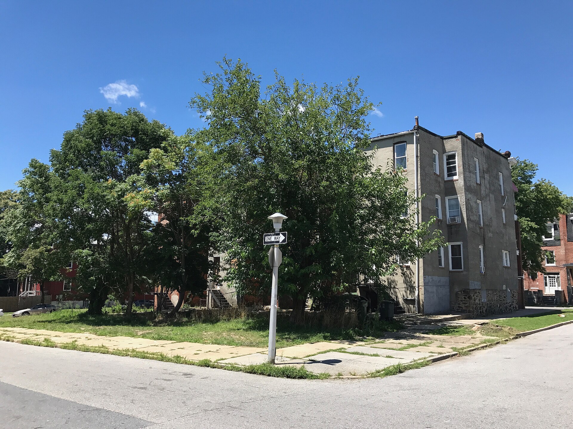
Rear View, Apartments, 2303-2309 Whittier Avenue, Baltimore, MD 21217, Auchentoroly-Parkwood You checked the neighborhood.Now check an address ! Photo: Baltimore Heritage from Baltimore, MD, USA, CC0 · Wikimedia Commons

For $34.00 a CrimesLog™ Home Report provides: (where available)

  • Nearest 6 Pre-school Nurseries to Address
  • Nearest 6 Primary Schools to Address
  • Nearest 6 Secondary/High Schools to Address
  • Nearest College and University to Address
  • Nearest to Address Medical Clinics, Hospitals and Pharmacies
  • Nearest 2 Police Station details to Address

The Home Report also provides

  • The CrimesLog™ Home Score is a proprietary Home Safety Measure capturing crime frequency, severity, recency and proximity to Address from police crime reporting point
  • A map indicating police anonymized crime reporting points around Address
  • Crime category trendlines for Address neighborhood
  • List of Reported Crime Incidents around Address radius
  • Downloadable PDF report — A Permanent Copy to Keep and Share to aid your Property Research
  • Our crimes database of almost 60 million records is UPDATED EVERY MONTH from US, UK, CA police sources
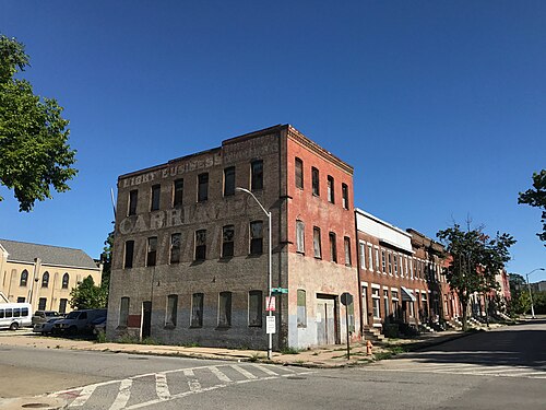
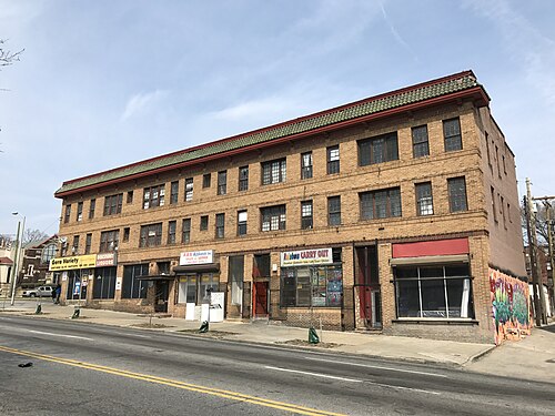
Gross & Stoops Carriage Works, 300-302 N. Carrollton Avenue, Baltimore, MD 21223, Poppleton
Poppleton · Gross & Stoops Carriage Works, 300-302 N. Carrollton Avenue, Baltimore, MD 21223
Photo: Baltimore Heritage from Baltimore, MD, USA, CC0 · Wikimedia Commons
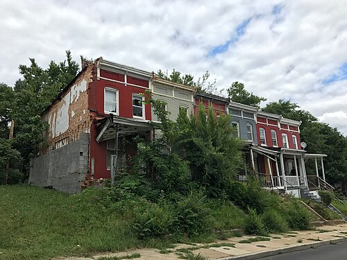
2700 Block of W. Lafayette Avenue (North Side), Baltimore, MD 21216, Mosher
Mosher · 2700 Block of W. Lafayette Avenue (North Side), Baltimore, MD 21216
Photo: Baltimore Heritage from Baltimore, MD, USA, CC0 · Wikimedia Commons
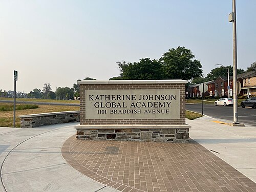
Sign, Katherine Johnson Global Academy, 1101 Braddish Avenue, Baltimore, MD 21216, Bridgeview/Greenlawn
Bridgeview/Greenlawn · Sign, Katherine Johnson Global Academy, 1101 Braddish Avenue, Baltimore, MD 21216
Photo: Baltimore Heritage from Baltimore, MD, USA, CC0 · Wikimedia Commons
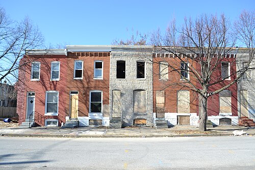
1522–1556 McKean Avenue, Baltimore, Sandtown-Winchester
Sandtown-Winchester · 1522–1556 McKean Avenue, Baltimore
Photo: Baltimore Heritage, CC BY 2.0 · Wikimedia Commons
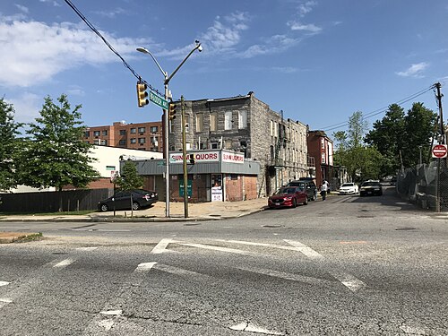
Sun M Liquors, 2700 W. North Avenue, Baltimore, MD 21216, Coppin Heights/Ash-Co-East
Coppin Heights/Ash-Co-East · Sun M Liquors, 2700 W. North Avenue, Baltimore, MD 21216
Photo: Baltimore Heritage from Baltimore, MD, USA, CC0 · Wikimedia Commons
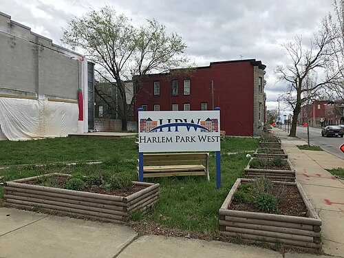
"Harlem Park West" Sign at Community Walk Through Theater, W. Lanvale Street and N. Monroe Street (Southeast Corner), Ba, Harlem Park
Harlem Park · "Harlem Park West" Sign at Community Walk Through Theater, W. Lanvale Street and N. Monroe Street (Southeast Corner), Ba
Photo: Baltimore Heritage from Baltimore, MD, USA, CC0 · Wikimedia Commons
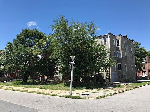
Rear View, Apartments, 2303-2309 Whittier Avenue, Baltimore, MD 21217, Auchentoroly-Parkwood
Auchentoroly-Parkwood · Rear View, Apartments, 2303-2309 Whittier Avenue, Baltimore, MD 21217
Photo: Baltimore Heritage from Baltimore, MD, USA, CC0 · Wikimedia Commons
Commercial Building, 2439 Reisterstown Road, Baltimore, MD, Mondawmin
Mondawmin · Commercial Building, 2439 Reisterstown Road, Baltimore, MD
Photo: Baltimore Heritage from Baltimore, MD, USA, CC0 · Wikimedia Commons

How neighborhoods moved each quarter

2022

Whole-area crime rate 20.5 to 26.8 per 1,000 (high: Q3 2022).

Big moves (4+ places in a quarter): moved up Evergreen Lawn 6th→1st (Q2) moved up Bridgeview/Greenlawn 13th→2nd (Q2) moved up Mosher 9th→3rd (Q2) moved down Poppleton 1st→7th (Q2) moved down Harlem Park 3rd→9th (Q2) moved down Auchentoroly-Parkwood 7th→11th (Q2) moved up Panway/Braddish Avenue 6th→1st (Q3) moved up Auchentoroly-Parkwood 11th→3rd (Q3) moved up Rosemont Homeowners/Tenants 13th→8th (Q3) moved down Coppin Heights/Ash-Co-East 4th→9th (Q3) moved down Bridgeview/Greenlawn 2nd→11th (Q3) moved up Harlem Park 7th→3rd (Q4) moved down Panway/Braddish Avenue 1st→5th (Q4) moved up Easterwood 12th→6th (Q4) moved down Evergreen Lawn 2nd→10th (Q4) moved down Rosemont Homeowners/Tenants 8th→13th (Q4)

2023

Whole-area crime rate 26.0 to 33.4 per 1,000 (high: Q3 2023).

Big moves (4+ places in a quarter): moved up Evergreen Lawn 10th→1st (Q1) moved down Harlem Park 3rd→7th (Q1) moved up Franklin Square 12th→8th (Q1) moved up Rosemont Homeowners/Tenants 13th→9th (Q1) moved down Easterwood 6th→12th (Q1) moved down Coppin Heights/Ash-Co-East 8th→13th (Q1) moved up Coppin Heights/Ash-Co-East 13th→2nd (Q2) moved down Panway/Braddish Avenue 2nd→6th (Q2) moved up Mondawmin 11th→7th (Q2) moved up Easterwood 12th→8th (Q2) moved down Evergreen Lawn 1st→10th (Q2) moved down Franklin Square 8th→13th (Q2) moved up Evergreen Lawn 10th→3rd (Q3) moved up Bridgeview/Greenlawn 11th→5th (Q3) moved down Coppin Heights/Ash-Co-East 2nd→6th (Q3) moved down Auchentoroly-Parkwood 1st→6th (Q4) moved up Easterwood 11th→7th (Q4)

2024

Whole-area crime rate 26.6 to 29.7 per 1,000 (high: Q3 2024).

Big moves (4+ places in a quarter): moved up Panway/Braddish Avenue 9th→5th (Q1) moved up Rosemont Homeowners/Tenants 13th→6th (Q1) moved down Coppin Heights/Ash-Co-East 3rd→10th (Q1) moved down Easterwood 7th→11th (Q1) moved up Auchentoroly-Parkwood 9th→4th (Q2) moved up Mondawmin 14th→10th (Q2) moved down Bridgeview/Greenlawn 8th→12th (Q2) moved down Auchentoroly-Parkwood 4th→8th (Q3)

2025

Whole-area crime rate 23.3 to 27.7 per 1,000 (high: Q2 2025).

Big moves (4+ places in a quarter): moved up Bridgeview/Greenlawn 11th→7th (Q1) moved up Rosemont Homeowners/Tenants 12th→8th (Q1) moved down Evergreen Lawn 1st→10th (Q1) moved down Easterwood 9th→14th (Q1) moved up Evergreen Lawn 10th→3rd (Q2) moved up Easterwood 14th→10th (Q2) moved down Auchentoroly-Parkwood 6th→11th (Q2) moved up Rosemont Homeowners/Tenants 8th→1st (Q3) moved up Harlem Park 13th→8th (Q4) moved down Rosemont Homeowners/Tenants 1st→9th (Q4) moved down Coppin Heights/Ash-Co-East 7th→13th (Q4)

2026

Whole-area crime rate 23.7 to 30.2 per 1,000 (high: Q2 2026). 2 quarters so far.

Big moves (4+ places in a quarter): moved up Coppin Heights/Ash-Co-East 13th→6th (Q1) moved up Franklin Square 12th→7th (Q1) moved down Mondawmin 6th→11th (Q1) moved down Harlem Park 8th→12th (Q1) moved up Bridgeview/Greenlawn 8th→4th (Q2) moved down Panway/Braddish Avenue 1st→6th (Q2) moved up Harlem Park 12th→8th (Q2) moved down Franklin Square 7th→12th (Q2)

Reported Safety Incidents

In Q2 2026: property incidents were 41% (398), violent incidents were 41% (393), vehicle crimes were 17% (168) and public order incidents were 1% (5).

Recorded crime here is grouped into violent crime, property crime (burglary and theft), vehicle crime and public order offences, so you can compare how safe each neighborhood is for the kind of crime that matters to you.

Places we left out, and places to read with care

No place is left out: every neighborhood in this race has residents to count.

Midtown-Edmondson (47.5 per 1,000 from 39 crimes among 821 residents), Evergreen Lawn (19.7 per 1,000 from 18 crimes among 914 residents), Rosemont Homeowners/Tenants (36.8 per 1,000 from 38 crimes among 1,032 residents), Easterwood (39.9 per 1,000 from 46 crimes among 1,154 residents), Panway/Braddish Avenue (27.5 per 1,000 from 34 crimes among 1,235 residents), Penn North (66.6 per 1,000 from 92 crimes among 1,382 residents), Bridgeview/Greenlawn (22.4 per 1,000 from 31 crimes among 1,383 residents), Mosher (20.8 per 1,000 from 31 crimes among 1,494 residents), Auchentoroly-Parkwood (35.7 per 1,000 from 58 crimes among 1,626 residents) and Coppin Heights/Ash-Co-East (31.4 per 1,000 from 55 crimes among 1,749 residents) are places with few residents (under 3,000): a rate on so few people says little about living there, so they are not named as the lowest or highest.

The 15 neighborhoods on the map

Western District is made of 15 neighborhoods compared here, each in its own colour on the map. They are the Neighborhood Statistical Areas of Baltimore City (Open Baltimore), grouped into police districts by CrimesLog: 31,927 residents between them.

  • Auchentoroly-Parkwood
  • Bridgeview/Greenlawn
  • Coppin Heights/Ash-Co-East
  • Easterwood
  • Evergreen Lawn
  • Franklin Square
  • Harlem Park
  • Midtown-Edmondson
  • Mondawmin
  • Mosher
  • Panway/Braddish Avenue
  • Penn North
  • Poppleton
  • Rosemont Homeowners/Tenants
  • Sandtown-Winchester

All 15 neighborhoods, Q2 2026

Crimes per 1,000 residents, Q2 2026, lowest first. The last two columns compare with Q1 2022.
#NeighborhoodResidentsAllViolentPropertyVehiclePublic orderRate vs Q1 2022Places gained
1Poppleton3,48214.44.07.52.90.0down4%–
2Evergreen Lawn †91419.76.63.39.80.0down0%up4
3Mosher †1,49420.88.78.73.40.0down6%up6
4Bridgeview/Greenlawn †1,38322.412.36.53.60.0down9%up9
5Sandtown-Winchester6,97923.511.08.04.30.1up45%down3
6Panway/Braddish Avenue †1,23527.57.39.79.70.8up48%down2
7Coppin Heights/Ash-Co-East †1,74931.414.313.73.40.0up67%down2
8Harlem Park2,70631.810.713.77.40.0up91%down5
9Auchentoroly-Parkwood †1,62635.714.818.42.50.0up76%down2
10Mondawmin3,64036.515.717.63.00.3up55%up1
11Rosemont Homeowners/Tenants †1,03236.812.614.58.71.0up65%down1
12Franklin Square2,33038.215.015.97.30.0up59%–
13Easterwood †1,15439.914.718.26.10.9up92%down5
14Midtown-Edmondson †82147.525.613.48.50.0up26%up1
15Penn North †1,38266.626.128.911.60.0up84%down1

† Midtown-Edmondson, Evergreen Lawn, Rosemont Homeowners/Tenants, Easterwood, Panway/Braddish Avenue, Penn North, Bridgeview/Greenlawn, Mosher, Auchentoroly-Parkwood and Coppin Heights/Ash-Co-East are places with few residents. A rate on a very small number of residents or crimes is not comparable with the others.

Photographs

87 photographs of the 15 neighborhoods run along the reel; click one to see it full size. Each is credited here and under the large view.

All 87 photographs and their credits
  1. Poppleton · Gross & Stoops Carriage Works, 300-302 N. Carrollton Avenue, Baltimore, MD 21223. Photo: Baltimore Heritage from Baltimore, MD, USA, CC0 · Wikimedia Commons
  2. Mosher · 2700 Block of W. Lafayette Avenue (North Side), Baltimore, MD 21216. Photo: Baltimore Heritage from Baltimore, MD, USA, CC0 · Wikimedia Commons
  3. Bridgeview/Greenlawn · Sign, Katherine Johnson Global Academy, 1101 Braddish Avenue, Baltimore, MD 21216. Photo: Baltimore Heritage from Baltimore, MD, USA, CC0 · Wikimedia Commons
  4. Sandtown-Winchester · 1522–1556 McKean Avenue, Baltimore. Photo: Baltimore Heritage, CC BY 2.0 · Wikimedia Commons
  5. Coppin Heights/Ash-Co-East · Sun M Liquors, 2700 W. North Avenue, Baltimore, MD 21216. Photo: Baltimore Heritage from Baltimore, MD, USA, CC0 · Wikimedia Commons
  6. Harlem Park · "Harlem Park West" Sign at Community Walk Through Theater, W. Lanvale Street and N. Monroe Street (Southeast Corner), Ba. Photo: Baltimore Heritage from Baltimore, MD, USA, CC0 · Wikimedia Commons
  7. Auchentoroly-Parkwood · Rear View, Apartments, 2303-2309 Whittier Avenue, Baltimore, MD 21217. Photo: Baltimore Heritage from Baltimore, MD, USA, CC0 · Wikimedia Commons
  8. Mondawmin · Commercial Building, 2439 Reisterstown Road, Baltimore, MD. Photo: Baltimore Heritage from Baltimore, MD, USA, CC0 · Wikimedia Commons
  9. Franklin Square · Rowhouses, 200 Block of N. Fulton Avenue (West Side), Baltimore, MD 21223. Photo: Baltimore Heritage from Baltimore, MD, USA, CC0 · Wikimedia Commons
  10. Easterwood · Rowhouses, 1900 Block of W. North Avenue (South Side), Baltimore, MD 21217. Photo: Baltimore Heritage, CC0 · Flickr
  11. Midtown-Edmondson · Green's Hardware, 1901 W. Lafayette Avenue, Baltimore, MD 21217. Photo: Baltimore Heritage from Baltimore, MD, USA, CC0 · Wikimedia Commons
  12. Penn North · 2508–2514 Salem Street, Baltimore. Photo: Baltimore Heritage, CC BY 2.0 · Wikimedia Commons
  13. Poppleton · Rowhouses, 200 Block of N. Carey Street (West Side), Baltimore, MD 21223. Photo: Baltimore Heritage from Baltimore, MD, USA, CC0 · Wikimedia Commons
  14. Mosher · Rehoboth Church of God in Christ Jesus Apostolic, 700 Poplar Grove Street, Baltimore, MD 21216. Photo: Baltimore Heritage from Baltimore, MD, USA, CC0 · Wikimedia Commons
  15. Bridgeview/Greenlawn · Rowhouses, Edmondson Avenue Historic District. Photo: Baltimore Heritage, CC BY 2.0 · Wikimedia Commons
  16. Sandtown-Winchester · 1138 Mosher Street, Baltimore. Photo: Baltimore Heritage, CC BY 2.0 · Wikimedia Commons
  17. Coppin Heights/Ash-Co-East · Mount Hebron Baptist Church, 2651 W. North Avenue, Baltimore, MD 21216. Photo: Baltimore Heritage from Baltimore, MD, USA, CC0 · Wikimedia Commons
  18. Harlem Park · New Mount Zion Baptist Church, 817 N. Mount Street, Baltimore, MD 21217. Photo: Baltimore Heritage from Baltimore, MD, USA, CC0 · Wikimedia Commons
  19. Auchentoroly-Parkwood · Family Life Global Ministries, 2320 Reisterstown Road, Baltimore, MD 21217. Photo: Baltimore Heritage from Baltimore, MD, USA, CC0 · Wikimedia Commons
  20. Mondawmin · Mondawmin Urban Green Space, 2414 – 2416 Reisterstown Road, Baltimore, MD 21217. Photo: Baltimore Heritage from Baltimore, MD, USA, CC0 · Wikimedia Commons
  21. Franklin Square · "Wall Painting Project" Mural (1974; August Bill Schmidt, Artist), 1631 Mulberry Street, Baltimore, MD 21223 (4677615819. Photo: Baltimore Heritage from Baltimore, MD, USA, CC0 · Wikimedia Commons
  22. Midtown-Edmondson · West Baltimore Farmer's Market Walking Tour. Photo: Baltimore Heritage, CC BY 2.0 · Wikimedia Commons
  23. Penn North · Baltimore Gas & Electric Substation (1924), 2530 Woodbrook Avenue, Baltimore, MD 21217. Photo: Baltimore Heritage from Baltimore, MD, USA, CC0 · Wikimedia Commons
  24. Poppleton · Francis M. Wood Alternative High School (1950), 1001 W. Saratoga Street, Baltimore, MD 21223. Photo: Baltimore Heritage from Baltimore, MD, USA, CC0 · Wikimedia Commons
  25. Mosher · Rowhouses, 2800 Block of Rayner Avenue (North Side), Baltimore, MD 21216. Photo: Baltimore Heritage from Baltimore, MD, USA, CC0 · Wikimedia Commons
  26. Bridgeview/Greenlawn · Rowhouses, Edmondson Avenue Historic District. Photo: Baltimore Heritage, CC BY 2.0 · Wikimedia Commons
  27. Sandtown-Winchester · 1040–1044 N. Stockton Street, Baltimore, 21217. Photo: Baltimore Heritage, CC BY 2.0 · Wikimedia Commons
  28. Harlem Park · Vacant Rowhouses, 500 Block of N. Calhoun Street, Baltimore, MD 21223. Photo: Baltimore Heritage from Baltimore, MD, USA, CC0 · Wikimedia Commons
  29. Auchentoroly-Parkwood · Family Life Global Ministries, 2320 Reisterstown Road, Baltimore, MD 21217. Photo: Baltimore Heritage from Baltimore, MD, USA, CC0 · Wikimedia Commons
  30. Mondawmin · View Northeast of Intersection at N. Monroe Street and Gwynns Falls Parkway, Baltimore, MD 21217. Photo: Baltimore Heritage from Baltimore, MD, USA, CC0 · Wikimedia Commons
  31. Franklin Square · Mural (2004; Lyle Kissack, Artist), 325 N. Fulton Avenue, Baltimore, MD 21223. Photo: Baltimore Heritage from Baltimore, MD, USA, CC0 · Wikimedia Commons
  32. Penn North · Solid Rock & Redeemer Assembly of God, 2308 N. Fulton Avenue, Baltimore, MD 21217. Photo: Baltimore Heritage from Baltimore, MD, USA, CC0 · Wikimedia Commons
  33. Poppleton · Francis M. Wood Alternative High School (1950), 1001 W. Saratoga Street, Baltimore, MD 21223. Photo: Baltimore Heritage from Baltimore, MD, USA, CC0 · Wikimedia Commons
  34. Mosher · Helen Mackall Park Former Nichols Playground (C. 1930s), 600 Bradish Avenue, Baltimore, MD 21216. Photo: Baltimore Heritage from Baltimore, MD, USA, CC0 · Wikimedia Commons
  35. Bridgeview/Greenlawn · Rowhouses, Edmondson Avenue Historic District. Photo: Baltimore Heritage, CC BY 2.0 · Wikimedia Commons
  36. Sandtown-Winchester · Green's Hardware, 1901 W. Lafayette Avenue, Baltimore, MD 21217. Photo: Baltimore Heritage from Baltimore, MD, USA, CC0 · Wikimedia Commons
  37. Harlem Park · Dr. John E.T. Camper House, 639 N. Carey Street, Baltimore, MD 21217. Photo: Baltimore Heritage from Baltimore, MD, USA, CC0 · Wikimedia Commons
  38. Auchentoroly-Parkwood · Mount Hope Baptist Church, 1716 Gwynns Falls Parkway, Baltimore, MD 21217. Photo: Baltimore Heritage from Baltimore, MD, USA, CC0 · Wikimedia Commons
  39. Mondawmin · James Wheldon Johnson Auditorium, Coppin State University, 2500 W. North Avenue, Baltimore, MD 21216. Photo: Baltimore Heritage from Baltimore, MD, USA, CC0 · Wikimedia Commons
  40. Franklin Square · Vivien T. Thomas Medical Arts Academy, 100 N. Calhoun Street, Baltimore, MD 21223. Photo: Baltimore Heritage from Baltimore, MD, USA, CC0 · Wikimedia Commons
  41. Penn North · Baltimore Gas & Electric Substation (1924), 2530 Woodbrook Avenue, Baltimore, MD 21217. Photo: Baltimore Heritage from Baltimore, MD, USA, CC0 · Wikimedia Commons
  42. Poppleton · Commercial Buildings, 1100-1106 W. Baltimore Street, Baltimore, MD 21223. Photo: Baltimore Heritage from Baltimore, MD, USA, CC0 · Wikimedia Commons
  43. Mosher · Helen Mackall Park Former Nichols Playground (C. 1930s), 600 Bradish Avenue, Baltimore, MD 21216. Photo: Baltimore Heritage from Baltimore, MD, USA, CC0 · Wikimedia Commons
  44. Bridgeview/Greenlawn · Rowhouses, Edmondson Avenue Historic District. Photo: Baltimore Heritage, CC BY 2.0 · Wikimedia Commons
  45. Sandtown-Winchester · Rowhouses, 1126-1130 N. Fulton Avenue (West Side), Baltimore, MD 21217. Photo: Baltimore Heritage, CC0 · Wikimedia Commons
  46. Harlem Park · Dr. John E.T. Camper House, 639 N. Carey Street, Baltimore, MD 21217. Photo: Baltimore Heritage from Baltimore, MD, USA, CC0 · Wikimedia Commons
  47. Auchentoroly-Parkwood · Mount Hope Baptist Church, 1716 Gwynns Falls Parkway, Baltimore, MD 21217. Photo: Baltimore Heritage from Baltimore, MD, USA, CC0 · Wikimedia Commons
  48. Mondawmin · Commercial Building, 2439 Reisterstown Road, Baltimore, MD. Photo: Baltimore Heritage from Baltimore, MD, USA, CC0 · Wikimedia Commons
  49. Franklin Square · Rowhouses, 200 Block of N. Calhoun Street, Baltimore, MD 21223. Photo: Baltimore Heritage from Baltimore, MD, USA, CC0 · Wikimedia Commons
  50. Penn North · Solid Rock & Redeemer Assembly of God, 2308 N. Fulton Avenue, Baltimore, MD 21217. Photo: Baltimore Heritage from Baltimore, MD, USA, CC0 · Wikimedia Commons
  51. Poppleton · Saint Luke's Episcopal Church Parish House, 222 N. Carrollton Avenue, Baltimore, MD 21223. Photo: Baltimore Heritage, CC0 · Flickr
  52. Mosher · Sign, Helen Mackall Park Former Nichols Playground (C. 1930s), 600 Bradish Avenue, Baltimore, MD 21216. Photo: Baltimore Heritage from Baltimore, MD, USA, CC0 · Wikimedia Commons
  53. Bridgeview/Greenlawn · Rowhouses, Edmondson Avenue Historic District. Photo: Baltimore Heritage, CC BY 2.0 · Wikimedia Commons
  54. Sandtown-Winchester · 1522–1556 McKean Avenue, Baltimore. Photo: Baltimore Heritage, CC BY 2.0 · Wikimedia Commons
  55. Harlem Park · Rowhouses, N. Carrollton Avenue, Baltimore, MD. Photo: Baltimore Heritage from Baltimore, MD, USA, CC0 · Wikimedia Commons
  56. Auchentoroly-Parkwood · Rowhouses, 1628-1636 Gwynns Falls Parkway, Baltimore, MD 21217. Photo: Baltimore Heritage from Baltimore, MD, USA, CC0 · Wikimedia Commons
  57. Mondawmin · J. Millard Tawes Student Center, Coppin State University, 2500 W. North Avenue, Baltimore, MD 21216. Photo: Baltimore Heritage from Baltimore, MD, USA, CC0 · Wikimedia Commons
  58. Franklin Square · Franklin Square Club, Salvation Army Boys and Girls Club, 215 N. Calhoun Street, Baltimore, MD 21223. Photo: Baltimore Heritage from Baltimore, MD, USA, CC0 · Wikimedia Commons
  59. Penn North · Gethsemane Baptist Church, 2520 Francis Street, Baltimore, MD 21217. Photo: Baltimore Heritage from Baltimore, MD, USA, CC0 · Wikimedia Commons
  60. Poppleton · Saint Luke's Episcopal Church Parish House, 222 N. Carrollton Avenue, Baltimore, MD 21223. Photo: Baltimore Heritage, CC0 · Flickr
  61. Mosher · St. Edward Roman Catholic Church, 901 Poplar Grove Street, Baltimore, MD 21216. Photo: Baltimore Heritage from Baltimore, MD, USA, CC0 · Wikimedia Commons
  62. Bridgeview/Greenlawn · Rowhouses, Edmondson Avenue Historic District. Photo: Baltimore Heritage, CC BY 2.0 · Wikimedia Commons
  63. Sandtown-Winchester · 1138 Mosher Street, Baltimore. Photo: Baltimore Heritage, CC BY 2.0 · Wikimedia Commons
  64. Harlem Park · Rowhouses, 702-709 N. Calhoun Street, Baltimore, MD 21223. Photo: Baltimore Heritage from Baltimore, MD, USA, CC0 · Wikimedia Commons
  65. Auchentoroly-Parkwood · Mount Hope Baptist Church, 1716 Gwynns Falls Parkway, Baltimore, MD 21217. Photo: Baltimore Heritage from Baltimore, MD, USA, CC0 · Wikimedia Commons
  66. Mondawmin · James Wheldon Johnson Auditorium, Coppin State University, 2500 W. North Avenue, Baltimore, MD 21216. Photo: Baltimore Heritage from Baltimore, MD, USA, CC0 · Wikimedia Commons
  67. Franklin Square · Franklin Square Park (Southeast Corner), W. Fayette Street and N. Carey Street, Baltimore, MD 21223. Photo: Baltimore Heritage from Baltimore, MD, USA, CC0 · Wikimedia Commons
  68. Penn North · Gethsemane Baptist Church, 2520 Francis Street, Baltimore, MD 21217. Photo: Baltimore Heritage from Baltimore, MD, USA, CC0 · Wikimedia Commons
  69. Mosher · 801–817 N. Dukeland Street, Baltimore. Photo: Baltimore Heritage, CC BY 2.0 · Wikimedia Commons
  70. Sandtown-Winchester · Former Branch No. 1, Enoch Pratt Free Library, 1101 N. Fremont Avenue, Baltimore, MD 21217. Photo: Baltimore Heritage from Baltimore, MD, USA, CC0 · Wikimedia Commons
  71. Harlem Park · Rowhouses, 615-621 N. Calhoun Street, Baltimore, MD 21223. Photo: Baltimore Heritage from Baltimore, MD, USA, CC0 · Wikimedia Commons
  72. Auchentoroly-Parkwood · Mount Hope Baptist Church, 1716 Gwynns Falls Parkway, Baltimore, MD 21217. Photo: Baltimore Heritage from Baltimore, MD, USA, CC0 · Wikimedia Commons
  73. Mondawmin · James Wheldon Johnson Auditorium, Coppin State University, 2500 W. North Avenue, Baltimore, MD 21216. Photo: Baltimore Heritage from Baltimore, MD, USA, CC0 · Wikimedia Commons
  74. Franklin Square · Franklin Square Park (Southeast Corner), W. Fayette Street and N. Carey Street, Baltimore, MD 21223. Photo: Baltimore Heritage, CC0 · Flickr
  75. Penn North · Cloverdale Courts, 2529-2571 Druid Hill Avenue, Baltimore, MD 21217. Photo: Baltimore Heritage from Baltimore, MD, USA, CC0 · Wikimedia Commons
  76. Mosher · Vacant Rowhouse, 1138 Mosher Street, Baltimore, MD 21217. Photo: Baltimore Heritage, CC BY 2.0 · Flickr
  77. Harlem Park · Rowhouses, Harlem Avenue, Baltimore, MD. Photo: Baltimore Heritage from Baltimore, MD, USA, CC0 · Wikimedia Commons
  78. Auchentoroly-Parkwood · Commercial Building, 2439 Reisterstown Road, Baltimore, MD. Photo: Baltimore Heritage from Baltimore, MD, USA, CC0 · Wikimedia Commons
  79. Mondawmin · J. Millard Tawes Student Center, Coppin State University, 2500 W. North Avenue, Baltimore, MD 21216. Photo: Baltimore Heritage from Baltimore, MD, USA, CC0 · Wikimedia Commons
  80. Penn North · Clubhouse, Cloverdale Courts, 2529-2571 Druid Hill Avenue, Baltimore, MD 21217. Photo: Baltimore Heritage from Baltimore, MD, USA, CC0 · Wikimedia Commons
  81. Harlem Park · N.M. Carroll Manor Apartments, 701 N. Arlington Avenue, Baltimore, MD 21217. Photo: Baltimore Heritage from Baltimore, MD, USA, CC0 · Wikimedia Commons
  82. Auchentoroly-Parkwood · Rowhouses, Gwynns Falls Parkway, Baltimore, MD. Photo: Baltimore Heritage from Baltimore, MD, USA, CC0 · Wikimedia Commons
  83. Penn North · Harvest Christian Worship Center, 2601 Pennsylvania Avenue, Baltimore, MD 21217. Photo: Baltimore Heritage from Baltimore, MD, USA, CC0 · Wikimedia Commons
  84. Harlem Park · N.M. Carroll Manor Apartments, 701 N. Arlington Avenue, Baltimore, MD 21217. Photo: Baltimore Heritage from Baltimore, MD, USA, CC0 · Wikimedia Commons
  85. Auchentoroly-Parkwood · Faded "Historic Auchentoroly Terrace" Sign, Swann Drive and Auchentoroly Terrace, Baltimore, MD 21217. Photo: Baltimore Heritage from Baltimore, MD, USA, CC0 · Wikimedia Commons
  86. Penn North · Second Floor Interior, Arch Social Club-Former Schanze Theater (1912), 2426 Pennsylvania Avenue, Baltimore, MD 21217 (27. Photo: Baltimore Heritage from Baltimore, MD, USA, CC0 · Wikimedia Commons
  87. Auchentoroly-Parkwood · Faded "Historic Auchentoroly Terrace" Sign, Swann Drive and Auchentoroly Terrace, Baltimore, MD 21217. Photo: Baltimore Heritage from Baltimore, MD, USA, CC0 · Wikimedia Commons

Sources and notes

CrimesLog sources crime incident data published by the Baltimore Police Department (BPD) through the City of Baltimore Open Data Hub, containing public sector information made available under the City of Baltimore Open Data Terms of Service.

Population: U.S. Census Bureau, American Community Survey 5-year estimates (public domain).

First-place medal: 1st Place Medal emoji icon by Icons8.

Neighborhood boundaries are the Neighborhood Statistical Areas defined by Baltimore City (Open Baltimore), grouped into police districts by CrimesLog and simplified by CrimesLog. The photographs are credited under each picture.

Rates are recorded crimes per 1,000 residents, quarter by quarter; where a neighborhood has fewer than 100 residents the rate would be worked out on 100 (those places are left out of the race). A count of recorded crime is not a verdict on any neighborhood.