Washington, District of Columbia · Neighborhood crime trends

Washington DC North

22 neighborhoods - a quarterly race to the lowest crime rate.

Crime Trends: Neighborhoods compared - each quarter from Q1 2022

Washington DC as a whole averaged 8.0 crimes for every 1,000 residents per quarter in Q2 2026, while north Washington DC averaged 7.5 (leaving out 1 place with almost no residents), hence it is generally safer when all crimes are considered.

How do the 22 neighborhoods of north Washington DC compare? In Q2 2026 the police recorded 2,666 crimes across them, 7.5 for every 1,000 residents. That is 14.2% below a year earlier and 9.3% below Q1 2022, the first quarter we track.

Spring Valley, Palisades, Wesley Heights, Foxhall Crescent, Foxhall Village, Georgetown Reservoir has the lowest rate of the everyday neighborhoods (2.3 per 1,000), followed by North Cleveland Park, Forest Hills, Van Ness (3.1) and Cathedral Heights, McLean Gardens, Glover Park (3.7). Howard University, Le Droit Park, Cardozo/Shaw has the highest (15.7).

Use the RACE CHARTS below to watch all 22 WASHINGTON DC NORTH NEIGHBORHOODs race across 18 quarter periods from Q1 2022 to Q2 2026 - one crime category at a time or all together. The race chart can be used to compare average crime rates by category against Washington DC's average.

Neighborhood boundaries are defined by Open Data DC (CC BY 4.0) and simplified by CrimesLog.
Lowest rate (everyday)
lowest rateSpring Valley, Palisades, Wesley Heights, Foxhall Crescent, Foxhall Village, Georgetown Reservoir
2.3 crimes per 1,000 residents, Q2 2026
Highest rate
upHoward University, Le Droit Park, Cardozo/Shaw
15.7 per 1,000, Q2 2026
Whole area, Q2 2026
7.5 per 1,000
down 14.2% below a year earlier · down 9.3% below Q1 2022
Compared
22 neighborhoods
354,343 residents · 18 quarters

Washington DC North neighborhood quarterly crime race

Press ▶︎ to watch Q1 2022 to Q2 2026. Tick one crime category or several; hover a bar for the neighborhood. Property crimes includes burglaries and thefts.

Crime categories
Indicated: crimes rate per 1000 residents per quarterAll · safest at the top · square-root scale · Q1 2022 to Q2 202601510259.1Brightwood Park, Crestwood, Petworth16.6Brookland, Brentwood, Langdon3.8Cathedral Heights, McLean Gardens, Glover Park5.8Cleveland Park, Woodley Park, Massachusetts Avenue…9.1Colonial Village, Shepherd Park, North Portal Esta…7.6Columbia Heights, Mt. Pleasant, Pleasant Plains, P…6.7Eastland Gardens, Kenilworth10.3Edgewood, Bloomingdale, Truxton Circle, Eckington7.3Friendship Heights, American University Park, Tenl…7.4Georgetown, Burleith/Hillandale3.0Hawthorne, Barnaby Woods, Chevy Chase17.9Howard University, Le Droit Park, Cardozo/Shaw8.9Kalorama Heights, Adams Morgan, Lanier Heights6.8Lamont Riggs, Queens Chapel, Fort Totten, Pleasant…4.0North Cleveland Park, Forest Hills, Van Ness7.8North Michigan Park, Michigan Park, University Hei…0.0Rock Creek Park12.0Shaw, Logan Circle1.4Spring Valley, Palisades, Wesley Heights, Foxhall…7.4Takoma, Brightwood, Manor Park29.4Walter Reed12.4Woodridge, Fort Lincoln, GatewayWashington DC Q2 2026 average all crimes (8.0)Numbers are crimes per 1,000 residents per quarter. Zero-crime quarters show 0 and rank safest. Not included, no residents: Observatory Circle.
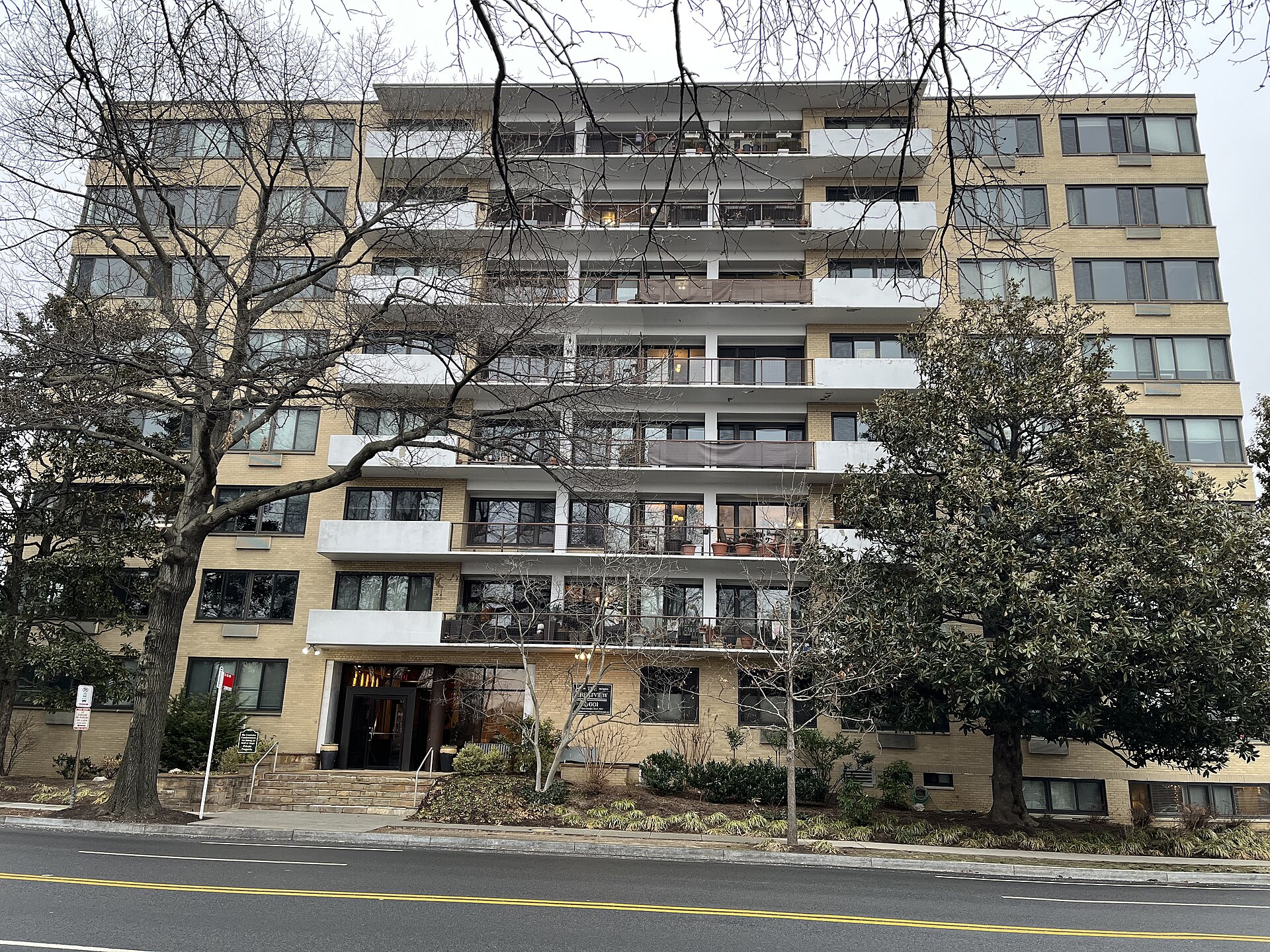
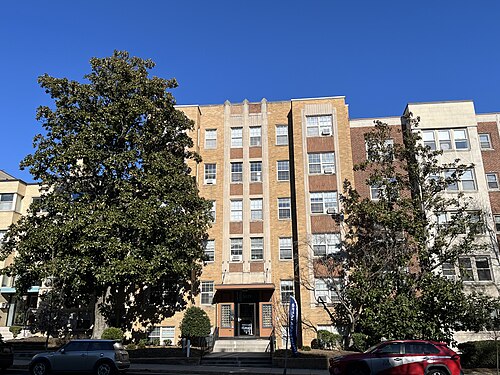
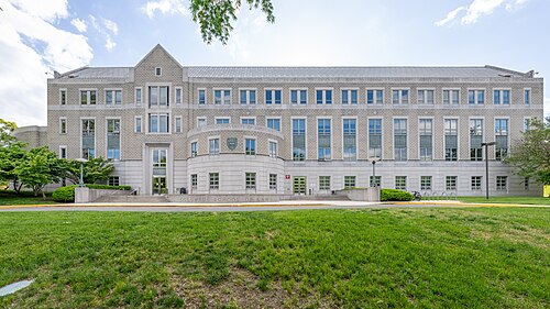
Crestview Apartments, Cathedral Heights, McLean Gardens, Glover Park You checked the neighborhood.Now check an address ! Photo: Nvss132, CC0 · Wikimedia Commons

For $34.00 a CrimesLog™ Home Report provides: (where available)

  • Nearest 6 Pre-school Nurseries to Address
  • Nearest 6 Primary Schools to Address
  • Nearest 6 Secondary/High Schools to Address
  • Nearest College and University to Address
  • Nearest to Address Medical Clinics, Hospitals and Pharmacies
  • Nearest 2 Police Station details to Address

The Home Report also provides

  • The CrimesLog™ Home Score is a proprietary Home Safety Measure capturing crime frequency, severity, recency and proximity to Address from police crime reporting point
  • A map indicating police anonymized crime reporting points around Address
  • Crime category trendlines for Address neighborhood
  • List of Reported Crime Incidents around Address radius
  • Downloadable PDF report — A Permanent Copy to Keep and Share to aid your Property Research
  • Our crimes database of almost 60 million records is UPDATED EVERY MONTH from US, UK, CA police sources
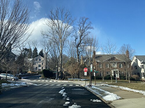
Colony Hill, Washington, DC February 2021, Spring Valley, Palisades, Wesley Heights, Foxhall Crescent, Foxhall Village, Georgetown Reservoir
Spring Valley, Palisades, Wesley Heights, Foxhall Crescent, Foxhall Village, Georgetown Reservoir · Colony Hill, Washington, DC February 2021
Photo: Eric T Gunther, CC BY 3.0 · Wikimedia Commons
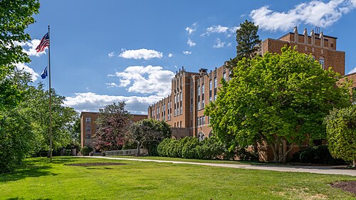
Howard School of Law, North Cleveland Park, Forest Hills, Van Ness
North Cleveland Park, Forest Hills, Van Ness · Howard School of Law
Photo: ajay_suresh, CC BY 4.0 · Wikimedia Commons
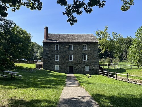
Peirce Mill Front View, Rock Creek Park
Rock Creek Park · Peirce Mill Front View
Photo: Cornflower123, CC0 · Wikimedia Commons
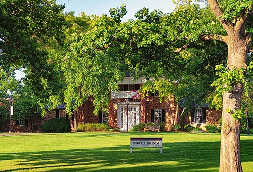
Sidwell Friends School in Washington DC, Cathedral Heights, McLean Gardens, Glover Park
Cathedral Heights, McLean Gardens, Glover Park · Sidwell Friends School in Washington DC
Photo: Tony Webster, CC BY 2.0 · Wikimedia Commons
The Roberta (5429 Connecticut Avenue), Hawthorne, Barnaby Woods, Chevy Chase
Hawthorne, Barnaby Woods, Chevy Chase · The Roberta (5429 Connecticut Avenue)
Photo: Nvss132, CC0 · Wikimedia Commons
North Gate Washington DC, Colonial Village, Shepherd Park, North Portal Estates
Colonial Village, Shepherd Park, North Portal Estates · North Gate Washington DC
Photo: Eric T Gunther, CC BY 3.0 · Wikimedia Commons
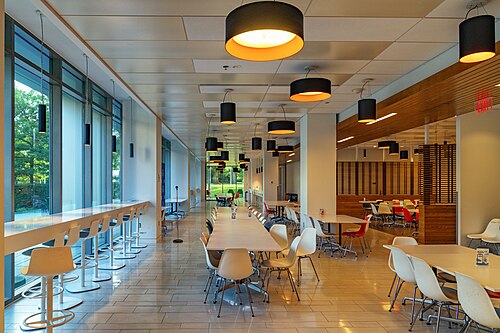
Dining Area - Washington College of Law - American University - Yuma Building, Friendship Heights, American University Park, Tenleytown
Friendship Heights, American University Park, Tenleytown · Dining Area - Washington College of Law - American University - Yuma Building
Photo: Tony Webster, CC BY 2.0 · Wikimedia Commons
Columbus School of Law - Catholic University of America, North Michigan Park, Michigan Park, University Heights
North Michigan Park, Michigan Park, University Heights · Columbus School of Law - Catholic University of America
Photo: ajay_suresh, CC BY 4.0 · Wikimedia Commons

How neighborhoods moved each quarter

2022

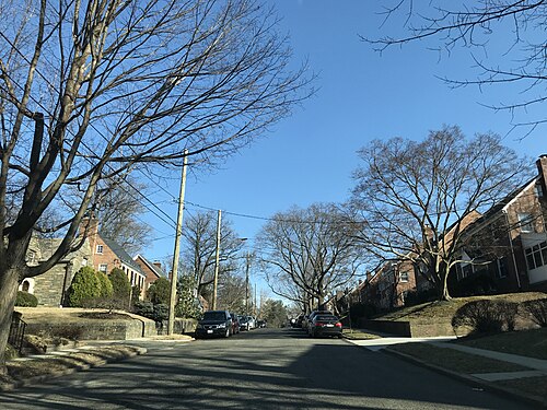
Whole-area crime rate 8.3 to 9.6 per 1,000 (high: Q4 2022).

Big moves (4+ places in a quarter): moved up North Michigan Park, Michigan Park, University Heights 13th→5th (Q2) moved down Rock Creek Park 1st→14th (Q2) moved down Georgetown, Burleith/Hillandale 11th→15th (Q2) moved up Rock Creek Park 14th→3rd (Q3) moved up Eastland Gardens, Kenilworth 8th→4th (Q3) moved up Colonial Village, Shepherd Park, North Portal Estates 17th→11th (Q3) moved down Lamont Riggs, Queens Chapel, Fort Totten, Pleasant Hill 6th→13th (Q3) moved down Columbia Heights, Mt. Pleasant, Pleasant Plains, Park View 11th→16th (Q3) moved down Kalorama Heights, Adams Morgan, Lanier Heights 12th→17th (Q3) moved up Cathedral Heights, McLean Gardens, Glover Park 5th→1st (Q4) moved up Takoma, Brightwood, Manor Park 12th→8th (Q4) moved up Lamont Riggs, Queens Chapel, Fort Totten, Pleasant Hill 13th→9th (Q4) moved down Cleveland Park, Woodley Park, Massachusetts Avenue Heights, Woodland-Normanstone Terrace 7th→11th (Q4) moved up Kalorama Heights, Adams Morgan, Lanier Heights 17th→12th (Q4) moved down Rock Creek Park 3rd→14th (Q4) moved down Colonial Village, Shepherd Park, North Portal Estates 11th→16th (Q4)

2023

Whole-area crime rate 10.1 to 12.4 per 1,000 (high: Q3 2023).

Big moves (4+ places in a quarter): moved up Rock Creek Park 14th→5th (Q1) moved up Colonial Village, Shepherd Park, North Portal Estates 16th→11th (Q1) moved down Takoma, Brightwood, Manor Park 8th→15th (Q1) moved down Kalorama Heights, Adams Morgan, Lanier Heights 12th→16th (Q1) moved up Eastland Gardens, Kenilworth 8th→4th (Q2) moved up Takoma, Brightwood, Manor Park 15th→7th (Q2) moved down Friendship Heights, American University Park, Tenleytown 7th→11th (Q2) moved down Colonial Village, Shepherd Park, North Portal Estates 11th→15th (Q2) moved up Colonial Village, Shepherd Park, North Portal Estates 15th→1st (Q3) moved down Eastland Gardens, Kenilworth 4th→9th (Q3) moved down Takoma, Brightwood, Manor Park 7th→12th (Q3) moved down Cleveland Park, Woodley Park, Massachusetts Avenue Heights, Woodland-Normanstone Terrace 12th→16th (Q3) moved up Rock Creek Park 7th→1st (Q4) moved up Eastland Gardens, Kenilworth 9th→5th (Q4) moved down Colonial Village, Shepherd Park, North Portal Estates 1st→7th (Q4)

2024

Whole-area crime rate 8.8 to 10.8 per 1,000 (high: Q4 2024).

Big moves (4+ places in a quarter): moved up Friendship Heights, American University Park, Tenleytown 10th→5th (Q1) moved up Cleveland Park, Woodley Park, Massachusetts Avenue Heights, Woodland-Normanstone Terrace 17th→13th (Q1) moved down Friendship Heights, American University Park, Tenleytown 5th→9th (Q2) moved up Colonial Village, Shepherd Park, North Portal Estates 8th→4th (Q3) moved up North Michigan Park, Michigan Park, University Heights 12th→6th (Q3) moved down Eastland Gardens, Kenilworth 5th→9th (Q3) moved down North Cleveland Park, Forest Hills, Van Ness 6th→10th (Q3) moved up Cleveland Park, Woodley Park, Massachusetts Avenue Heights, Woodland-Normanstone Terrace 14th→8th (Q4) moved down Friendship Heights, American University Park, Tenleytown 8th→16th (Q4) moved up Woodridge, Fort Lincoln, Gateway 21st→17th (Q4)

2025

Whole-area crime rate 7.0 to 8.8 per 1,000 (high: Q3 2025).

Big moves (4+ places in a quarter): moved up North Cleveland Park, Forest Hills, Van Ness 10th→6th (Q1) moved up Kalorama Heights, Adams Morgan, Lanier Heights 13th→7th (Q1) moved up Friendship Heights, American University Park, Tenleytown 16th→10th (Q1) moved down North Michigan Park, Michigan Park, University Heights 7th→12th (Q1) moved up Columbia Heights, Mt. Pleasant, Pleasant Plains, Park View 18th→14th (Q1) moved down Eastland Gardens, Kenilworth 6th→15th (Q1) moved down Takoma, Brightwood, Manor Park 12th→16th (Q1) moved down Woodridge, Fort Lincoln, Gateway 17th→21st (Q1) moved up Friendship Heights, American University Park, Tenleytown 10th→6th (Q2) moved up Columbia Heights, Mt. Pleasant, Pleasant Plains, Park View 14th→9th (Q2) moved down Colonial Village, Shepherd Park, North Portal Estates 5th→13th (Q2) moved up Lamont Riggs, Queens Chapel, Fort Totten, Pleasant Hill 11th→7th (Q3) moved up North Michigan Park, Michigan Park, University Heights 12th→8th (Q3) moved down Friendship Heights, American University Park, Tenleytown 6th→10th (Q3) moved down Cleveland Park, Woodley Park, Massachusetts Avenue Heights, Woodland-Normanstone Terrace 7th→12th (Q3) moved up Shaw, Logan Circle 18th→14th (Q3) moved down Georgetown, Burleith/Hillandale 14th→20th (Q3) moved up Eastland Gardens, Kenilworth 15th→3rd (Q4) moved up Colonial Village, Shepherd Park, North Portal Estates 11th→7th (Q4) moved down Lamont Riggs, Queens Chapel, Fort Totten, Pleasant Hill 7th→11th (Q4) moved up Takoma, Brightwood, Manor Park 18th→13th (Q4) moved down Columbia Heights, Mt. Pleasant, Pleasant Plains, Park View 9th→15th (Q4) moved down Kalorama Heights, Adams Morgan, Lanier Heights 13th→17th (Q4)

2026

Whole-area crime rate 6.4 to 7.5 per 1,000 (high: Q2 2026). 2 quarters so far.

Big moves (4+ places in a quarter): moved up Cathedral Heights, McLean Gardens, Glover Park 6th→2nd (Q1) moved up Kalorama Heights, Adams Morgan, Lanier Heights 17th→6th (Q1) moved down Eastland Gardens, Kenilworth 3rd→9th (Q1) moved up Woodridge, Fort Lincoln, Gateway 18th→10th (Q1) moved up Shaw, Logan Circle 16th→11th (Q1) moved down Colonial Village, Shepherd Park, North Portal Estates 7th→16th (Q1) moved down Cleveland Park, Woodley Park, Massachusetts Avenue Heights, Woodland-Normanstone Terrace 10th→17th (Q1) moved down Takoma, Brightwood, Manor Park 13th→18th (Q1) moved up North Cleveland Park, Forest Hills, Van Ness 7th→2nd (Q2) moved up Colonial Village, Shepherd Park, North Portal Estates 16th→6th (Q2) moved up Friendship Heights, American University Park, Tenleytown 14th→8th (Q2) moved down North Michigan Park, Michigan Park, University Heights 4th→9th (Q2) moved down Kalorama Heights, Adams Morgan, Lanier Heights 6th→17th (Q2) moved down Woodridge, Fort Lincoln, Gateway 10th→18th (Q2)

Reported Safety Incidents

In Q2 2026: property incidents were 85% (2,263), vehicle crimes were 10% (267), violent incidents were 5% (136) and public order incidents were 0% (0).

Recorded crime here is grouped into violent crime, property crime (burglary and theft), vehicle crime and public order offences, so you can compare how safe each neighborhood is for the kind of crime that matters to you.

Places we left out, and places to read with care

Left out: Observatory Circle. They have almost no residents: their crimes are against visitors, so a rate per resident says little about living there.

Walter Reed (29.4 per 1,000 from 8 crimes among 272 residents), Rock Creek Park (3.6 per 1,000 from 2 crimes among 560 residents) and Eastland Gardens, Kenilworth (4.8 per 1,000 from 10 crimes among 2,084 residents) are places with few residents (under 3,000): a rate on so few people says little about living there, so they are not named as the lowest or highest.

The 22 neighborhoods on the map

North is made of 22 neighborhoods compared here, each in its own colour on the map. They are the neighborhood clusters of Open Data DC (CC BY 4.0), grouped into north and south by CrimesLog: 354,343 residents between them.

  • Brightwood Park, Crestwood, Petworth
  • Brookland, Brentwood, Langdon
  • Cathedral Heights, McLean Gardens, Glover Park
  • Cleveland Park, Woodley Park, Massachusetts Avenue Heights, Woodland-Normanstone Terrace
  • Colonial Village, Shepherd Park, North Portal Estates
  • Columbia Heights, Mt. Pleasant, Pleasant Plains, Park View
  • Eastland Gardens, Kenilworth
  • Edgewood, Bloomingdale, Truxton Circle, Eckington
  • Friendship Heights, American University Park, Tenleytown
  • Georgetown, Burleith/Hillandale
  • Hawthorne, Barnaby Woods, Chevy Chase
  • Howard University, Le Droit Park, Cardozo/Shaw
  • Kalorama Heights, Adams Morgan, Lanier Heights
  • Lamont Riggs, Queens Chapel, Fort Totten, Pleasant Hill
  • North Cleveland Park, Forest Hills, Van Ness
  • North Michigan Park, Michigan Park, University Heights
  • Rock Creek Park
  • Shaw, Logan Circle
  • Spring Valley, Palisades, Wesley Heights, Foxhall Crescent, Foxhall Village, Georgetown Reservoir
  • Takoma, Brightwood, Manor Park
  • Walter Reed
  • Woodridge, Fort Lincoln, Gateway

All 22 neighborhoods, Q2 2026

Crimes per 1,000 residents, Q2 2026, lowest first. The last two columns compare with Q1 2022.
#NeighborhoodResidentsAllViolentPropertyVehiclePublic orderRate vs Q1 2022Places gained
1Spring Valley, Palisades, Wesley Heights, Foxhall Crescent, Foxhall Village, Georgetown Reservoir15,4122.30.11.80.30.0up67%up1
2North Cleveland Park, Forest Hills, Van Ness12,3313.10.12.50.50.0down22%up3
3Rock Creek Park †5603.60.03.60.00.0upInfinity%down2
4Cathedral Heights, McLean Gardens, Glover Park19,8503.70.13.40.20.0down3%–
5Hawthorne, Barnaby Woods, Chevy Chase14,5634.10.03.50.60.0up40%down2
6Colonial Village, Shepherd Park, North Portal Estates4,8154.40.02.71.70.0down52%up9
7Eastland Gardens, Kenilworth †2,0844.80.52.91.40.0down29%–
8Friendship Heights, American University Park, Tenleytown11,5645.10.34.60.20.0down30%up1
9North Michigan Park, Michigan Park, University Heights11,6746.40.34.71.40.0down18%up4
10Lamont Riggs, Queens Chapel, Fort Totten, Pleasant Hill17,1726.60.54.21.90.0down3%down2
11Edgewood, Bloomingdale, Truxton Circle, Eckington27,2296.70.75.10.90.0down35%up6
12Brightwood Park, Crestwood, Petworth39,0657.20.36.20.70.0down22%up4
13Shaw, Logan Circle19,8848.10.37.20.50.0down33%up5
14Columbia Heights, Mt. Pleasant, Pleasant Plains, Park View48,1848.20.67.20.50.0up8%down2
15Cleveland Park, Woodley Park, Massachusetts Avenue Heights, Woodland-Normanstone Terrace14,2698.20.18.00.10.0up41%down9
16Takoma, Brightwood, Manor Park25,2738.90.27.41.30.0up20%down6
17Kalorama Heights, Adams Morgan, Lanier Heights18,6319.20.48.40.50.0up4%down3
18Woodridge, Fort Lincoln, Gateway7,7259.60.86.22.60.0down23%up1
19Brookland, Brentwood, Langdon13,71510.00.68.11.30.0down40%up1
20Georgetown, Burleith/Hillandale13,87412.50.112.30.10.0up68%down9
21Howard University, Le Droit Park, Cardozo/Shaw16,19715.71.113.70.90.0down12%–
22Walter Reed †27229.43.725.70.00.0down0%–

† Walter Reed, Rock Creek Park and Eastland Gardens, Kenilworth are places with few residents. A rate on a very small number of residents or crimes is not comparable with the others.

Photographs

98 photographs of the 22 neighborhoods run along the reel; click one to see it full size. Each is credited here and under the large view.

All 98 photographs and their credits
  1. Spring Valley, Palisades, Wesley Heights, Foxhall Crescent, Foxhall Village, Georgetown Reservoir · Colony Hill, Washington, DC February 2021. Photo: Eric T Gunther, CC BY 3.0 · Wikimedia Commons
  2. North Cleveland Park, Forest Hills, Van Ness · Howard School of Law. Photo: ajay_suresh, CC BY 4.0 · Wikimedia Commons
  3. Rock Creek Park · Peirce Mill Front View. Photo: Cornflower123, CC0 · Wikimedia Commons
  4. Cathedral Heights, McLean Gardens, Glover Park · Sidwell Friends School in Washington DC. Photo: Tony Webster, CC BY 2.0 · Wikimedia Commons
  5. Hawthorne, Barnaby Woods, Chevy Chase · The Roberta (5429 Connecticut Avenue). Photo: Nvss132, CC0 · Wikimedia Commons
  6. Colonial Village, Shepherd Park, North Portal Estates · North Gate Washington DC. Photo: Eric T Gunther, CC BY 3.0 · Wikimedia Commons
  7. Friendship Heights, American University Park, Tenleytown · Dining Area - Washington College of Law - American University - Yuma Building. Photo: Tony Webster, CC BY 2.0 · Wikimedia Commons
  8. North Michigan Park, Michigan Park, University Heights · Columbus School of Law - Catholic University of America. Photo: ajay_suresh, CC BY 4.0 · Wikimedia Commons
  9. Lamont Riggs, Queens Chapel, Fort Totten, Pleasant Hill · Fort Totten Pylon. Photo: Niagara, CC BY 3.0 · Wikimedia Commons
  10. Edgewood, Bloomingdale, Truxton Circle, Eckington · Ariel Rios Federal Building. Photo: ajay_suresh, CC BY 4.0 · Wikimedia Commons
  11. Brightwood Park, Crestwood, Petworth · Saint Gabriel Catholic Church. Photo: Kurt Kaiser, CC0 · Wikimedia Commons
  12. Columbia Heights, Mt. Pleasant, Pleasant Plains, Park View · Benjamin Banneker Academic High School. Photo: Nyttend, Public domain · Wikimedia Commons
  13. Cleveland Park, Woodley Park, Massachusetts Avenue Heights, Woodland-Normanstone Terrace · St. Albans School - Washington - DC. Photo: Tony Webster, CC BY 2.0 · Wikimedia Commons
  14. Takoma, Brightwood, Manor Park · Ida B. Wells Middle School. Photo: Gnupratchett, CC0 · Wikimedia Commons
  15. Kalorama Heights, Adams Morgan, Lanier Heights · Embassy of Venezuela - Bolivarian Hall. Photo: ajay_suresh, CC BY 4.0 · Wikimedia Commons
  16. Brookland, Brentwood, Langdon · Howard University School of Divinity. Photo: Jim McIntosh, CC BY 2.0 · Wikimedia Commons
  17. Georgetown, Burleith/Hillandale · Book Hill Park Washington DC 2025-08-27 11-13-15 1. Photo: G. Edward Johnson, CC BY 4.0 · Wikimedia Commons
  18. Howard University, Le Droit Park, Cardozo/Shaw · Howard University School of Business. Photo: ajay_suresh, CC BY 4.0 · Wikimedia Commons
  19. Walter Reed · AFIP Building (NCP 004195-2), National Museum of Health and Medicine. Photo: National Museum of Health and Medicine, CC BY 2.0 · Wikimedia Commons
  20. Observatory Circle · Observatory Circle Avenue Washington DC 2021. Photo: Eric T Gunther, CC BY 3.0 · Wikimedia Commons
  21. Spring Valley, Palisades, Wesley Heights, Foxhall Crescent, Foxhall Village, Georgetown Reservoir · DC, Metropolitan Methodist Church, July 28, 2007. Photo: taylor janis, CC BY 3.0 · Wikimedia Commons
  22. North Cleveland Park, Forest Hills, Van Ness · School of Divinity - Howard University. Photo: ajay_suresh, CC BY 4.0 · Wikimedia Commons
  23. Rock Creek Park · Peirce Mill Dam. Photo: John Brighenti from Rockville, MD, United States, CC BY 2.0 · Wikimedia Commons
  24. Cathedral Heights, McLean Gardens, Glover Park · District of Columbia Fire and EMS - Ambulance on Wisconsin Avenue - Washington DC. Photo: Tony Webster, CC BY 2.0 · Wikimedia Commons
  25. Hawthorne, Barnaby Woods, Chevy Chase · Barnaby Woods Washington DC July 2021. Photo: Eric T Gunther, CC BY 3.0 · Wikimedia Commons
  26. Colonial Village, Shepherd Park, North Portal Estates · Colonial Village Washington DC July 2021. Photo: Eric T Gunther, CC BY 3.0 · Wikimedia Commons
  27. Friendship Heights, American University Park, Tenleytown · Tenley Friendship Library - Washington D.C.. Photo: Tony Webster, CC BY 2.0 · Wikimedia Commons
  28. North Michigan Park, Michigan Park, University Heights · Catholic University of America. Photo: ajay_suresh, CC BY 4.0 · Wikimedia Commons
  29. Edgewood, Bloomingdale, Truxton Circle, Eckington · Church Washington, DC. Photo: Kurt Kaiser, CC0 · Wikimedia Commons
  30. Brightwood Park, Crestwood, Petworth · Saint Gabriel Catholic Church 2. Photo: Kurt Kaiser, CC0 · Wikimedia Commons
  31. Columbia Heights, Mt. Pleasant, Pleasant Plains, Park View · Building in Washington DC. Photo: Kurt Kaiser, CC0 · Wikimedia Commons
  32. Cleveland Park, Woodley Park, Massachusetts Avenue Heights, Woodland-Normanstone Terrace · St. Albans Marriott Hall. Photo: Rimstone, CC0 · Wikimedia Commons
  33. Takoma, Brightwood, Manor Park · Aspen Street NW - Flickr - Treegrow (1). Photo: Katja Schulz from Washington, D. C., USA, CC BY 2.0 · Wikimedia Commons
  34. Kalorama Heights, Adams Morgan, Lanier Heights · Embassy Tower - Washington, D.C. Photo: APK, CC BY 4.0 · Wikimedia Commons
  35. Brookland, Brentwood, Langdon · Howard University School of Divinity. Photo: Jim McIntosh, CC BY 2.0 · Wikimedia Commons
  36. Georgetown, Burleith/Hillandale · School of Medicine & School of Dentistry - Georgetown University. Photo: ajay_suresh, CC BY 2.0 · Wikimedia Commons
  37. Howard University, Le Droit Park, Cardozo/Shaw · Howard University Cathy Hughes School of Communications. Photo: ajay_suresh, CC BY 4.0 · Wikimedia Commons
  38. Spring Valley, Palisades, Wesley Heights, Foxhall Crescent, Foxhall Village, Georgetown Reservoir · Abner Cloud House 4. Photo: Kathleen Tyler Conklin from Falls Church, USA, CC BY 2.0 · Wikimedia Commons
  39. North Cleveland Park, Forest Hills, Van Ness · Howard University Law Library. Photo: ajay_suresh, CC BY 4.0 · Wikimedia Commons
  40. Cathedral Heights, McLean Gardens, Glover Park · Highview Towers, 2700 Wisconsin Avenue NW. Photo: Nvss132, CC0 · Wikimedia Commons
  41. Hawthorne, Barnaby Woods, Chevy Chase · Woodmont Washington DC July 2021. Photo: Eric T Gunther, CC BY 3.0 · Wikimedia Commons
  42. Friendship Heights, American University Park, Tenleytown · Georgetown Day School - 4200 Davenport Street - Washington DC. Photo: Tony Webster, CC BY 2.0 · Wikimedia Commons
  43. Edgewood, Bloomingdale, Truxton Circle, Eckington · Faith Temple Church. Photo: Nvss132, CC0 · Wikimedia Commons
  44. Brightwood Park, Crestwood, Petworth · Grant Circle. Photo: Kurt Kaiser, CC0 · Wikimedia Commons
  45. Columbia Heights, Mt. Pleasant, Pleasant Plains, Park View · DC Row Houses. Photo: Kurt Kaiser, CC0 · Wikimedia Commons
  46. Cleveland Park, Woodley Park, Massachusetts Avenue Heights, Woodland-Normanstone Terrace · 2929 Connecticut Avenue. Photo: Nvss132, CC0 · Wikimedia Commons
  47. Takoma, Brightwood, Manor Park · Aspen Street NW - Flickr - Treegrow. Photo: Katja Schulz from Washington, D. C., USA, CC BY 2.0 · Wikimedia Commons
  48. Kalorama Heights, Adams Morgan, Lanier Heights · 2539 Massachusetts Avenue NW, Washington, D.C. Photo: APK, CC BY 4.0 · Wikimedia Commons
  49. Brookland, Brentwood, Langdon · Brentwood-DC. Photo: Eric T Gunther, CC BY 3.0 · Wikimedia Commons
  50. Georgetown, Burleith/Hillandale · McDonough School of Business - Georgetown University. Photo: ajay_suresh, CC BY 2.0 · Wikimedia Commons
  51. Howard University, Le Droit Park, Cardozo/Shaw · 2235 - 2245 13th Street, N.W.. Photo: Carol M. Highsmith, Public domain · Wikimedia Commons
  52. Spring Valley, Palisades, Wesley Heights, Foxhall Crescent, Foxhall Village, Georgetown Reservoir · Georgetown Pumping Station Castle. Photo: F.T. Eyre, U.S. Army Corps of Engineers, Public domain · Wikimedia Commons
  53. North Cleveland Park, Forest Hills, Van Ness · David A. Clarke School of Law - University of the District of Columbia. Photo: ajay_suresh, CC BY 4.0 · Wikimedia Commons
  54. Cathedral Heights, McLean Gardens, Glover Park · Crestview Apartments. Photo: Nvss132, CC0 · Wikimedia Commons
  55. Hawthorne, Barnaby Woods, Chevy Chase · Hawthorne Washington DC July 2021. Photo: Eric T Gunther, CC BY 3.0 · Wikimedia Commons
  56. Friendship Heights, American University Park, Tenleytown · 5225 Wisconsin Avenue NW - Friendship Medical Center - Washington DC. Photo: Tony Webster, CC BY 2.0 · Wikimedia Commons
  57. Edgewood, Bloomingdale, Truxton Circle, Eckington · Main Building, Trinity Washington University, Washington, DC. Photo: w_lemay, CC0 · Wikimedia Commons
  58. Brightwood Park, Crestwood, Petworth · 16th St Heights Washington, DC 2019. Photo: Eric T Gunther, CC BY 3.0 · Wikimedia Commons
  59. Columbia Heights, Mt. Pleasant, Pleasant Plains, Park View · The Greater First Baptist Church DC. Photo: Kurt Kaiser, CC0 · Wikimedia Commons
  60. Cleveland Park, Woodley Park, Massachusetts Avenue Heights, Woodland-Normanstone Terrace · Cleveland Park Congregational Church, Washington, D.C. Photo: Nvss132, CC0 · Wikimedia Commons
  61. Takoma, Brightwood, Manor Park · 8th Street NW - Flickr - Treegrow (1). Photo: Katja Schulz from Washington, D. C., USA, CC BY 2.0 · Wikimedia Commons
  62. Kalorama Heights, Adams Morgan, Lanier Heights · 2829 16th Street NW. Photo: APK, CC BY 4.0 · Wikimedia Commons
  63. Brookland, Brentwood, Langdon · Laudes Creaturarum 1. Photo: Jim McIntosh, CC BY 2.0 · Wikimedia Commons
  64. Georgetown, Burleith/Hillandale · Buildings in Washington, D.C. 02439. Photo: Sebastian Wallroth, CC BY 3.0 · Wikimedia Commons
  65. Howard University, Le Droit Park, Cardozo/Shaw · Frederick Douglas Memorial Hall - Howard University. Photo: ajay_suresh, CC BY 4.0 · Wikimedia Commons
  66. Spring Valley, Palisades, Wesley Heights, Foxhall Crescent, Foxhall Village, Georgetown Reservoir · Intersection of Cathedral Avenue and 45th St. NW in February 2021. Photo: Eric T Gunther, CC BY 3.0 · Wikimedia Commons
  67. North Cleveland Park, Forest Hills, Van Ness · J. Edgar Hoover House (4936 30th Place NW). Photo: Nvss132, CC0 · Wikimedia Commons
  68. Cathedral Heights, McLean Gardens, Glover Park · Sherry Hall. Photo: Nvss132, CC0 · Wikimedia Commons
  69. Hawthorne, Barnaby Woods, Chevy Chase · Chevy Chase Arcade. Photo: Payton Chung from DCA, USA, CC BY 2.0 · Wikimedia Commons
  70. Friendship Heights, American University Park, Tenleytown · Wisconsin Avenue in Friendship Heights - Northwest Washington DC. Photo: Tony Webster, CC BY 2.0 · Wikimedia Commons
  71. Edgewood, Bloomingdale, Truxton Circle, Eckington · Main Building, Trinity Washington University, Washington, DC. Photo: w_lemay, CC0 · Wikimedia Commons
  72. Brightwood Park, Crestwood, Petworth · Billy Simpson DC 3rd from Left. Photo: Smallbones, CC0 · Wikimedia Commons
  73. Columbia Heights, Mt. Pleasant, Pleasant Plains, Park View · DC Row Houses 2. Photo: Kurt Kaiser, CC0 · Wikimedia Commons
  74. Cleveland Park, Woodley Park, Massachusetts Avenue Heights, Woodland-Normanstone Terrace · John Eaton Elementary School. Photo: Nvss132, CC0 · Wikimedia Commons
  75. Takoma, Brightwood, Manor Park · Missouri Avenue Market After Dark (Washington, DC). Photo: takomabibelot, CC BY 2.0 · Wikimedia Commons
  76. Kalorama Heights, Adams Morgan, Lanier Heights · 2558 Massachusetts Avenue NW. Photo: APK, CC BY 4.0 · Wikimedia Commons
  77. Brookland, Brentwood, Langdon · LLDM Washington DC. Photo: Daniel Lobo, CC BY 2.0 · Wikimedia Commons
  78. Georgetown, Burleith/Hillandale · Buildings in Washington, D.C. 02440. Photo: Sebastian Wallroth, CC BY 3.0 · Wikimedia Commons
  79. Howard University, Le Droit Park, Cardozo/Shaw · Miner Hall 2. Photo: Kurt Kaiser, CC0 · Wikimedia Commons
  80. North Cleveland Park, Forest Hills, Van Ness · Hillwood Estate - Rear View. Photo: Fletcher, CC BY 4.0 · Wikimedia Commons
  81. Cathedral Heights, McLean Gardens, Glover Park · Giant Food in Washington D.C. - Grocery Store. Photo: Tony Webster, CC BY 2.0 · Wikimedia Commons
  82. Friendship Heights, American University Park, Tenleytown · Friendship Heights Metro Station - Washington DC. Photo: Tony Webster, CC BY 2.0 · Wikimedia Commons
  83. Edgewood, Bloomingdale, Truxton Circle, Eckington · Michigan Avenue NE, Edgewood, Washington, DC. Photo: w_lemay, CC0 · Wikimedia Commons
  84. Columbia Heights, Mt. Pleasant, Pleasant Plains, Park View · Miner Hall - Howard University. Photo: ajay_suresh, CC BY 4.0 · Wikimedia Commons
  85. Cleveland Park, Woodley Park, Massachusetts Avenue Heights, Woodland-Normanstone Terrace · 3524-26 Connecticut Avenue. Photo: Nvss132, CC0 · Wikimedia Commons
  86. Kalorama Heights, Adams Morgan, Lanier Heights · 2000 24th St NW. Photo: ajay_suresh, CC BY 4.0 · Wikimedia Commons
  87. Brookland, Brentwood, Langdon · Bonaventura. Photo: Jim McIntosh, CC BY 2.0 · Wikimedia Commons
  88. Georgetown, Burleith/Hillandale · C&O Canal and Rock Creek in Washington, D.C. 02470. Photo: Sebastian Wallroth, CC BY 3.0 · Wikimedia Commons
  89. Howard University, Le Droit Park, Cardozo/Shaw · Row Houses, Washington DC. Photo: Kurtkaiser, CC0 · Wikimedia Commons
  90. North Cleveland Park, Forest Hills, Van Ness · Dining Room of Hillwood Estate. Photo: Fletcher, CC BY 4.0 · Wikimedia Commons
  91. Cathedral Heights, McLean Gardens, Glover Park · Upton Place Apartments - Washington DC. Photo: Tony Webster, CC BY 2.0 · Wikimedia Commons
  92. Friendship Heights, American University Park, Tenleytown · Broadcast House in Washington D.C.. Photo: Tony Webster, CC BY 2.0 · Wikimedia Commons
  93. Columbia Heights, Mt. Pleasant, Pleasant Plains, Park View · General Oliver Otis Howard House. Photo: Kurt Kaiser, CC0 · Wikimedia Commons
  94. Cleveland Park, Woodley Park, Massachusetts Avenue Heights, Woodland-Normanstone Terrace · 3433 Connecticut Avenue. Photo: Nvss132, CC0 · Wikimedia Commons
  95. Georgetown, Burleith/Hillandale · Dahlgren Memorial Library - Georgetown University Medical Center. Photo: ajay_suresh, CC BY 2.0 · Wikimedia Commons
  96. Howard University, Le Droit Park, Cardozo/Shaw · True Baptist Gospel Church, Washington, D.C. Photo: Nvss132, CC0 · Wikimedia Commons
  97. Cleveland Park, Woodley Park, Massachusetts Avenue Heights, Woodland-Normanstone Terrace · Alban Towers. Photo: APK, CC BY 4.0 · Wikimedia Commons
  98. Howard University, Le Droit Park, Cardozo/Shaw · Miner Hall. Photo: Kurt Kaiser, CC0 · Wikimedia Commons

Sources and notes

CrimesLog sources crime incident data published by the Metropolitan Police Department (MPD) of the District of Columbia through the Open Data DC portal (opendata.dc.gov), containing public sector information released under a Creative Commons CC0 1.0 Universal public domain dedication.

Population: U.S. Census Bureau, American Community Survey 5-year estimates (public domain).

First-place medal: 1st Place Medal emoji icon by Icons8.

Neighborhood boundaries are the neighborhood clusters defined by Open Data DC (CC BY 4.0), grouped into north and south and simplified by CrimesLog. The photographs are credited under each picture.

Rates are recorded crimes per 1,000 residents, quarter by quarter; where a neighborhood has fewer than 100 residents the rate would be worked out on 100 (those places are left out of the race). A count of recorded crime is not a verdict on any neighborhood.