Minneapolis, Minnesota · Neighborhood crime trends

Minneapolis North West

20 neighborhoods - a quarterly race to the lowest crime rate.

Crime Trends: Neighborhoods compared - each quarter from Q1 2022

Minneapolis as a whole averaged 14.2 crimes for every 1,000 residents per quarter in Q2 2026, while northwest Minneapolis averaged 17.6 (leaving out 2 places with almost no residents), hence it is generally less safe when all crimes are considered.

How do the 20 neighborhoods of northwest Minneapolis compare? In Q2 2026 the police recorded 1,794 crimes across them, 17.6 for every 1,000 residents. That is 5.9% above a year earlier and 14.2% above Q1 2022, the first quarter we track.

Cleveland has the lowest rate of the everyday neighborhoods (7.4 per 1,000), followed by Shingle Creek (7.7) and McKinley (8.3). Downtown West has the highest (47.2).

Use the RACE CHARTS below to watch all 20 MINNEAPOLIS NORTH WEST NEIGHBORHOODs race across 18 quarter periods from Q1 2022 to Q2 2026 - one crime category at a time or all together. The race chart can be used to compare average crime rates by category against Minneapolis's average.

Neighborhood boundaries are defined by the City of Minneapolis and simplified by CrimesLog.
Lowest rate (everyday)
lowest rateCleveland
7.4 crimes per 1,000 residents, Q2 2026
Highest rate
upDowntown West
47.2 per 1,000, Q2 2026
Whole area, Q2 2026
17.6 per 1,000
up 5.9% above a year earlier · up 14.2% above Q1 2022
Compared
20 neighborhoods
102,136 residents · 18 quarters

Minneapolis North West neighborhood quarterly crime race

Press ▶︎ to watch Q1 2022 to Q2 2026. Tick one crime category or several; hover a bar for the neighborhood. Property crimes includes burglaries and thefts.

Crime categories
Indicated: crimes rate per 1000 residents per quarterAll · safest at the top · square-root scale · Q1 2022 to Q2 202601510259.0Bryn - Mawr10.0Cleveland46.0Downtown West10.9Folwell8.1Harrison26.2Hawthorne14.9Jordan9.2Lind - Bohanon15.2Loring Park9.4Lowry Hill8.2Marshall Terrace11.0McKinley17.7Near - North16.2North Loop9.3Shingle Creek13.5Steven's Square - Loring Heights9.6Sumner - Glenwood7.7Victory10.7Webber - Camden10.5Willard - HayMinneapolis Q2 2026 average all crimes (14.2)Numbers are crimes per 1,000 residents per quarter. Zero-crime quarters show 0 and rank safest. Not included, no residents: Camden Industrial; Humboldt Industrial Area.
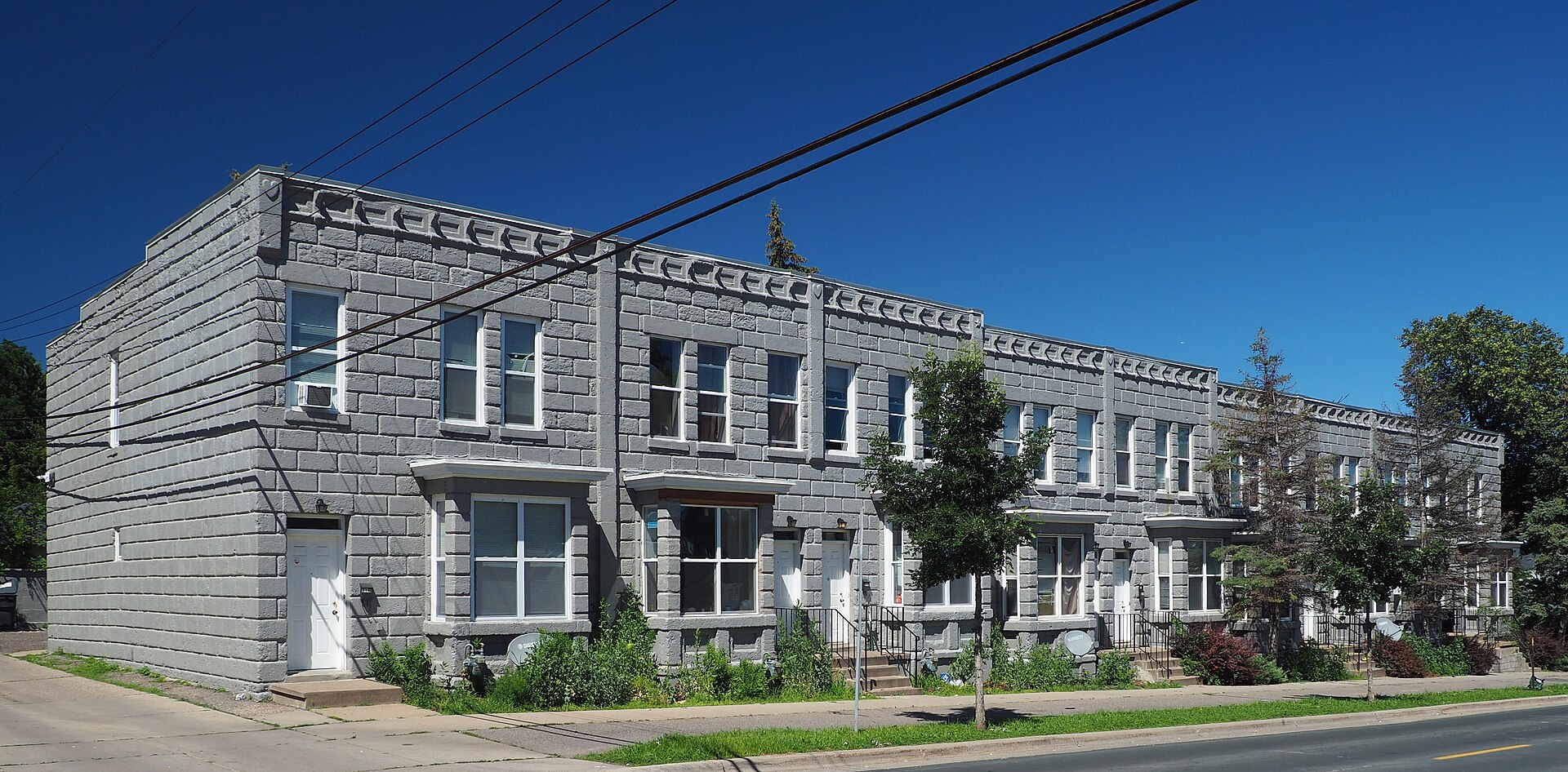
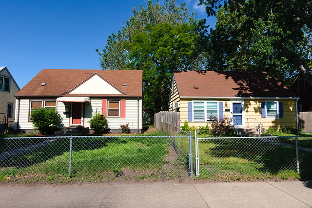
Concrete Block Rowhouses, Hawthorne You checked the neighborhood.Now check an address ! Photo: McGhiever, CC BY 4.0 · Wikimedia Commons

For $34.00 a CrimesLog™ Home Report provides: (where available)

  • Nearest 6 Pre-school Nurseries to Address
  • Nearest 6 Primary Schools to Address
  • Nearest 6 Secondary/High Schools to Address
  • Nearest College and University to Address
  • Nearest to Address Medical Clinics, Hospitals and Pharmacies
  • Nearest 2 Police Station details to Address

The Home Report also provides

  • The CrimesLog™ Home Score is a proprietary Home Safety Measure capturing crime frequency, severity, recency and proximity to Address from police crime reporting point
  • A map indicating police anonymized crime reporting points around Address
  • Crime category trendlines for Address neighborhood
  • List of Reported Crime Incidents around Address radius
  • Downloadable PDF report — A Permanent Copy to Keep and Share to aid your Property Research
  • Our crimes database of almost 60 million records is UPDATED EVERY MONTH from US, UK, CA police sources
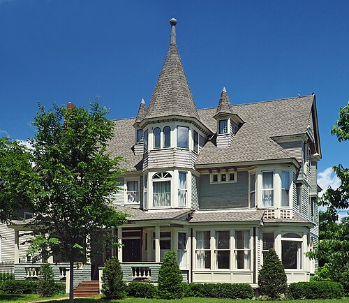
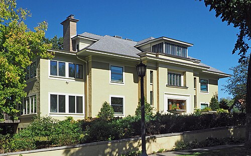
Viehman House, Bryn - Mawr
Bryn - Mawr · Viehman House
Photo: McGhiever, CC BY 4.0 · Wikimedia Commons
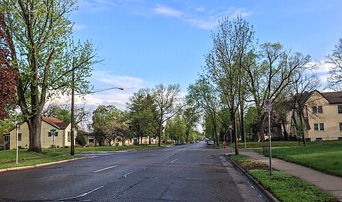
Minneapolis Neighborhood Cleveland, Cleveland
Cleveland · Minneapolis Neighborhood Cleveland
Photo: Fibonacci Blue from Minnesota, USA, CC BY 2.0 · Wikimedia Commons
Minneapolis Neighborhood: Shingle Creek, Shingle Creek
Shingle Creek · Minneapolis Neighborhood: Shingle Creek
Photo: Fibonacci Blue, CC BY 2.0 · Flickr
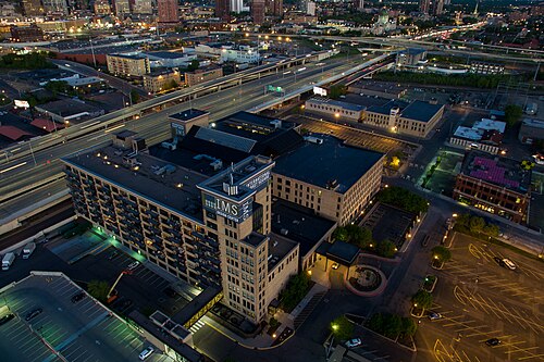
International Market Square, Minneapolis, Sumner - Glenwood
Sumner - Glenwood · International Market Square, Minneapolis
Photo: Chad Davis from Minneapolis, United States, CC BY 2.0 · Wikimedia Commons
A Sacred Stupa at Minnesota Buddhist Vihara, McKinley
McKinley · A Sacred Stupa at Minnesota Buddhist Vihara
Photo: Dhamma26, CC BY 4.0 · Wikimedia Commons
Penn Avenue North, Minneapolis, Victory
Victory · Penn Avenue North, Minneapolis
Photo: Tony Webster from Minneapolis, Minnesota, United States, CC BY 2.0 · Wikimedia Commons
Winton House Mpls, Lowry Hill
Lowry Hill · Winton House Mpls
Photo: McGhiever, CC BY 4.0 · Wikimedia Commons
Minneapolis Neighborhood: Lind-Bohanon, Lind - Bohanon
Lind - Bohanon · Minneapolis Neighborhood: Lind-Bohanon
Photo: Fibonacci Blue, CC BY 2.0 · Flickr

How neighborhoods moved each quarter

2022

Whole-area crime rate 15.4 to 23.5 per 1,000 (high: Q3 2022).

Big moves (4+ places in a quarter): moved up Shingle Creek 6th→2nd (Q2) moved up McKinley 13th→5th (Q2) moved up Webber - Camden 11th→7th (Q2) moved down Marshall Terrace 3rd→8th (Q2) moved down Harrison 2nd→12th (Q2) moved down Cleveland 6th→11th (Q3) moved up Marshall Terrace 8th→1st (Q4) moved up Lowry Hill 13th→3rd (Q4) moved down Lind - Bohanon 2nd→7th (Q4) moved up Loring Park 12th→8th (Q4) moved down Webber - Camden 4th→9th (Q4) moved down Sumner - Glenwood 7th→12th (Q4)

2023

Whole-area crime rate 17.0 to 20.0 per 1,000 (high: Q3 2023).

Big moves (4+ places in a quarter): moved up Cleveland 10th→2nd (Q1) moved down Lowry Hill 3rd→7th (Q1) moved down Marshall Terrace 1st→8th (Q1) moved up North Loop 17th→11th (Q1) moved down Loring Park 8th→12th (Q1) moved down Webber - Camden 9th→13th (Q1) moved up Marshall Terrace 8th→2nd (Q2) moved up Webber - Camden 13th→6th (Q2) moved down Cleveland 2nd→8th (Q2) moved down Lowry Hill 7th→11th (Q2) moved up Folwell 15th→10th (Q3) moved up Lind - Bohanon 7th→2nd (Q4) moved down Marshall Terrace 2nd→6th (Q4) moved up North Loop 17th→8th (Q4) moved up Near - North 16th→12th (Q4) moved down Harrison 11th→16th (Q4) moved down Folwell 10th→17th (Q4)

2024

Whole-area crime rate 14.5 to 21.2 per 1,000 (high: Q3 2024).

Big moves (4+ places in a quarter): moved up McKinley 7th→2nd (Q1) moved down Shingle Creek 1st→5th (Q1) moved down Sumner - Glenwood 5th→9th (Q1) moved down Marshall Terrace 6th→12th (Q1) moved down Steven's Square - Loring Heights 15th→19th (Q1) moved up Shingle Creek 5th→1st (Q2) moved up Harrison 15th→5th (Q2) moved up Loring Park 14th→10th (Q2) moved down Victory 3rd→13th (Q2) moved down North Loop 6th→14th (Q2) moved down Near - North 11th→17th (Q2) moved up Victory 13th→5th (Q3) moved down Harrison 5th→11th (Q3) moved up Jordan 16th→12th (Q3) moved down Loring Park 10th→16th (Q3) moved down North Loop 14th→18th (Q3) moved up Marshall Terrace 13th→8th (Q4) moved up North Loop 18th→10th (Q4) moved up Folwell 17th→12th (Q4) moved down Cleveland 9th→17th (Q4)

2025

Whole-area crime rate 13.8 to 18.3 per 1,000 (high: Q3 2025).

Big moves (4+ places in a quarter): moved up Lowry Hill 11th→2nd (Q1) moved up Cleveland 17th→9th (Q1) moved down Willard - Hay 9th→14th (Q1) moved down North Loop 10th→16th (Q1) moved down Lowry Hill 2nd→6th (Q2) moved up Willard - Hay 14th→9th (Q2) moved up Steven's Square - Loring Heights 18th→10th (Q2) moved down Cleveland 9th→13th (Q2) moved up Sumner - Glenwood 8th→3rd (Q3) moved up Cleveland 13th→9th (Q3) moved down McKinley 5th→10th (Q3) moved down Steven's Square - Loring Heights 10th→16th (Q3) moved up McKinley 10th→3rd (Q4) moved down Sumner - Glenwood 3rd→8th (Q4) moved down Folwell 14th→18th (Q4)

2026

Whole-area crime rate 14.7 to 17.6 per 1,000 (high: Q2 2026). 2 quarters so far.

Big moves (4+ places in a quarter): moved up Victory 7th→1st (Q1) moved down Webber - Camden 4th→8th (Q1) moved up Folwell 18th→10th (Q1) moved up Jordan 15th→11th (Q1) moved down Sumner - Glenwood 8th→15th (Q1) moved up Cleveland 7th→2nd (Q2) moved up Sumner - Glenwood 15th→4th (Q2) moved down Victory 1st→6th (Q2) moved down Jordan 11th→18th (Q2)

Reported Safety Incidents

In Q2 2026: property incidents were 44% (797), vehicle crimes were 37% (670), violent incidents were 18% (327) and public order incidents were 0% (0).

Recorded crime here is grouped into violent crime, property crime (burglary and theft), vehicle crime and public order offences, so you can compare how safe each neighborhood is for the kind of crime that matters to you.

Read category comparisons with care. A category that jumps while the total hardly moves looks like a change in how offences are classified, not in what happened: Q2 2023: property up 32% while the total moved 9%; Q3 2023: property up 27% while the total moved 8%. The whole-area rate is the steadier guide.

Places we left out, and places to read with care

Left out: Camden Industrial; Humboldt Industrial Area. They have almost no residents: their crimes are against visitors, so a rate per resident says little about living there.

Marshall Terrace (10.2 per 1,000 from 15 crimes among 1,472 residents), Sumner - Glenwood (7.8 per 1,000 from 17 crimes among 2,181 residents) and Bryn - Mawr (5.8 per 1,000 from 16 crimes among 2,770 residents) are places with few residents (under 3,000): a rate on so few people says little about living there, so they are not named as the lowest or highest.

The 20 neighborhoods on the map

North West is made of 20 neighborhoods compared here, each in its own colour on the map. They are the neighborhoods of the City of Minneapolis, grouped into four quarters of the city by CrimesLog: 102,136 residents between them.

  • Bryn - Mawr
  • Cleveland
  • Downtown West
  • Folwell
  • Harrison
  • Hawthorne
  • Jordan
  • Lind - Bohanon
  • Loring Park
  • Lowry Hill
  • Marshall Terrace
  • McKinley
  • Near - North
  • North Loop
  • Shingle Creek
  • Steven's Square - Loring Heights
  • Sumner - Glenwood
  • Victory
  • Webber - Camden
  • Willard - Hay

All 20 neighborhoods, Q2 2026

Crimes per 1,000 residents, Q2 2026, lowest first. The last two columns compare with Q1 2022.
#NeighborhoodResidentsAllViolentPropertyVehiclePublic orderRate vs Q1 2022Places gained
1Bryn - Mawr †2,7705.80.04.01.80.0down36%up3
2Cleveland3,3927.41.52.43.50.0down26%up7
3Shingle Creek3,1037.71.31.64.80.0down17%up3
4Sumner - Glenwood †2,1817.81.42.83.70.0down19%up4
5McKinley3,7428.32.13.52.70.0down24%up8
6Victory4,7918.60.82.35.40.0up11%down5
7Lowry Hill4,0559.61.04.04.70.0up3%–
8Lind - Bohanon4,9899.61.05.43.20.0up4%down3
9Marshall Terrace †1,47210.20.02.08.20.0up25%down6
10Folwell5,34112.43.25.63.60.0up14%up2
11Webber - Camden5,98312.42.24.85.30.0up16%–
12Willard - Hay7,50014.33.54.86.00.0up36%down2
13Steven's Square - Loring Heights4,28916.13.34.78.20.0up19%up1
14Near - North6,33218.66.37.35.00.0up5%up4
15Harrison3,97418.93.56.58.80.0up134%down13
16Loring Park9,66519.43.98.76.80.0up28%–
17North Loop7,73720.21.99.78.50.0up25%–
18Jordan8,43920.64.68.17.90.0up38%down3
19Hawthorne4,15729.67.211.610.80.0up13%–
20Downtown West8,22447.25.828.612.80.0up3%–

† Marshall Terrace, Sumner - Glenwood and Bryn - Mawr are places with few residents. A rate on a very small number of residents or crimes is not comparable with the others.

Photographs

64 photographs of the 20 neighborhoods run along the reel; click one to see it full size. Each is credited here and under the large view.

All 64 photographs and their credits
  1. Bryn - Mawr · Viehman House. Photo: McGhiever, CC BY 4.0 · Wikimedia Commons
  2. Cleveland · Minneapolis Neighborhood Cleveland. Photo: Fibonacci Blue from Minnesota, USA, CC BY 2.0 · Wikimedia Commons
  3. Shingle Creek · Minneapolis Neighborhood: Shingle Creek. Photo: Fibonacci Blue, CC BY 2.0 · Flickr
  4. Sumner - Glenwood · International Market Square, Minneapolis. Photo: Chad Davis from Minneapolis, United States, CC BY 2.0 · Wikimedia Commons
  5. McKinley · A Sacred Stupa at Minnesota Buddhist Vihara. Photo: Dhamma26, CC BY 4.0 · Wikimedia Commons
  6. Victory · Penn Avenue North, Minneapolis. Photo: Tony Webster from Minneapolis, Minnesota, United States, CC BY 2.0 · Wikimedia Commons
  7. Lowry Hill · Winton House Mpls. Photo: McGhiever, CC BY 4.0 · Wikimedia Commons
  8. Lind - Bohanon · Minneapolis Neighborhood: Lind-Bohanon. Photo: Fibonacci Blue, CC BY 2.0 · Flickr
  9. Marshall Terrace · Lowry Avenue Bridge - Rainbow Colors, Minneapolis. Photo: Tony Webster from Minneapolis, Minnesota, United States, CC BY 2.0 · Wikimedia Commons
  10. Folwell · North Regional Library. Photo: McGhiever, CC BY 4.0 · Wikimedia Commons
  11. Webber - Camden · New Webber Park Library, Hennepin County Library, North Minneapolis. Photo: Tony Webster, CC BY 2.0 · Wikimedia Commons
  12. Steven's Square - Loring Heights · Mayor Sharon Sayles Belton Bridge (Third Avenue South Bridge) Minneapolis Minnesota. Photo: Tony Webster from New York City, CC BY 2.0 · Wikimedia Commons
  13. Near - North · Mikro Kodesh Synagogue. Photo: McGhiever, CC BY 4.0 · Wikimedia Commons
  14. Harrison · Minneapolis Neighborhood: Harrison. Photo: Fibonacci Blue, CC BY 2.0 · Flickr
  15. Loring Park · French Corner Bistro. Photo: Sharon Mollerus, CC BY 2.0 · Wikimedia Commons
  16. North Loop · Royalston Avenue Station in 2024. Photo: Eóin, CC BY 4.0 · Wikimedia Commons
  17. Jordan · Minneapolis Neighborhood: Jordan. Photo: Fibonacci Blue, CC BY 2.0 · Flickr
  18. Hawthorne · Concrete Block Rowhouses. Photo: McGhiever, CC BY 4.0 · Wikimedia Commons
  19. Downtown West · 10th Avenue Bridge, Minneapolis. Photo: Sharon Mollerus, CC BY 2.0 · Wikimedia Commons
  20. Camden Industrial · Camden Park State Bank. Photo: McGhiever, CC BY 4.0 · Wikimedia Commons
  21. Bryn - Mawr · Minneapolis Neighborhood Bryn Mawr. Photo: Fibonacci Blue from Minnesota, USA, CC BY 2.0 · Wikimedia Commons
  22. Cleveland · Minneapolis Neighborhood: Cleveland. Photo: Fibonacci Blue, CC BY 2.0 · Flickr
  23. Sumner - Glenwood · Minneapolis Neighborhood: Sumner-Glenwood. Photo: Fibonacci Blue, CC BY 2.0 · Flickr
  24. McKinley · Lowry Avenue Bridge Lit Up in Ukrainian Colors. Photo: schwerdf, CC BY 2.0 · Flickr
  25. Victory · Minneapolis Neighborhood: Victory. Photo: Fibonacci Blue, CC BY 2.0 · Flickr
  26. Lowry Hill · Pierson-Wold House. Photo: McGhiever, CC BY 4.0 · Wikimedia Commons
  27. Lind - Bohanon · Minneapolis Neighborhood: Lind-Bohanon. Photo: Fibonacci Blue, CC BY 2.0 · Flickr
  28. Marshall Terrace · Industrial Buildings on Mississippi River, North Minneapolis Riverfront. Photo: Tony Webster from Minneapolis, Minnesota, United States, CC BY 2.0 · Wikimedia Commons
  29. Webber - Camden · North Market - Grocery Store in North Minneapolis. Photo: Tony Webster from Minneapolis, Minnesota, United States, CC BY 2.0 · Wikimedia Commons
  30. Steven's Square - Loring Heights · Menage Cottage. Photo: McGhiever, CC BY 4.0 · Wikimedia Commons
  31. Near - North · Rappaport Residence. Photo: McGhiever, CC BY 4.0 · Wikimedia Commons
  32. Harrison · Minneapolis Neighborhood: Harrison. Photo: Fibonacci Blue, CC BY 2.0 · Flickr
  33. Loring Park · Loring Park Neighborhood. Photo: Jason Riedy, CC BY 2.0 · Flickr
  34. North Loop · Minneapolis Fire Station 4. Photo: McGhiever, CC BY 4.0 · Wikimedia Commons
  35. Jordan · Minneapolis Neighborhood: Jordan. Photo: Fibonacci Blue, CC BY 2.0 · Flickr
  36. Hawthorne · Minneapolis August Night. Photo: Greg Gjerdingen from Willmar, USA, CC BY 2.0 · Wikimedia Commons
  37. Downtown West · 2nd Avenue North, Minneapolis. Photo: Chad Davis from Minneapolis, United States, CC BY 2.0 · Wikimedia Commons
  38. Camden Industrial · Minneapolis Neighborhood: Camden Industrial Area. Photo: Fibonacci Blue, CC BY 2.0 · Flickr
  39. Bryn - Mawr · Minneapolis Neighborhood: Bryn Mawr. Photo: Fibonacci Blue, CC BY 2.0 · Flickr
  40. Lowry Hill · Minneapolis Neighborhood: Lowry Hill East. Photo: Fibonacci Blue, CC BY 2.0 · Flickr
  41. Lind - Bohanon · Minneapolis Neighborhood: Lind-Bohanon. Photo: Fibonacci Blue, CC BY 2.0 · Flickr
  42. Marshall Terrace · Lowry Avenue Bridge - Rainbow Colors. Photo: Tony Webster, CC BY 2.0 · Wikimedia Commons
  43. Webber - Camden · Shipping Container Farm - Pillsbury United Farms at North Market - Minneapolis. Photo: Tony Webster, CC BY 2.0 · Wikimedia Commons
  44. Near - North · Minneapolis Neighborhood: Willard-Hay. Photo: Fibonacci Blue, CC BY 2.0 · Flickr
  45. Harrison · Minneapolis Neighborhood: Harrison. Photo: Fibonacci Blue, CC BY 2.0 · Flickr
  46. Loring Park · Minneapolis Neighborhood: Loring Park. Photo: Fibonacci Blue, CC BY 2.0 · Flickr
  47. North Loop · Colonial Warehouse. Photo: McGhiever, CC BY 4.0 · Wikimedia Commons
  48. Jordan · Minneapolis Neighborhood: Jordan. Photo: Fibonacci Blue, CC BY 2.0 · Flickr
  49. Hawthorne · 2705 3rd St N Minneapolis. Photo: McGhiever, CC BY 4.0 · Wikimedia Commons
  50. Downtown West · AT&T Tower, Minneapolis. Photo: Sharon Mollerus, CC BY 2.0 · Wikimedia Commons
  51. Bryn - Mawr · Bryn Mawr to Kenwood Pedestrian Bridge. Photo: edkohler, CC BY 2.0 · Flickr
  52. Lowry Hill · 7.5.2024 - Lowry Hill East, Minneapolis. Photo: Taylor Dahlin, CC BY 2.0 · Flickr
  53. Webber - Camden · Victory Memorial Ice Arena. Photo: Tony Webster from Portland, Oregon, United States, CC BY 2.0 · Wikimedia Commons
  54. Near - North · Minneapolis Neighborhood: Willard-Hay. Photo: Fibonacci Blue, CC BY 2.0 · Flickr
  55. North Loop · Downtown Minneapolis Skyline Across the Mississippi River. Photo: Guywelch2000, CC BY 4.0 · Wikimedia Commons
  56. Downtown West · Architects & Engineers Building. Photo: McGhiever, CC BY 4.0 · Wikimedia Commons
  57. Bryn - Mawr · Minneapolis Neighborhood: Bryn Mawr. Photo: Fibonacci Blue, CC BY 2.0 · Flickr
  58. Lowry Hill · 7.4.2024 - Stained Glass Window Depicting the Replacements “Let It Be” Cover in the House Where the Photo Was Taken, Lowry Hill East, Minnea. Photo: Taylor Dahlin, CC BY 2.0 · Flickr
  59. North Loop · Minneapolis, MN. Photo: Gabriel Vanslette, CC BY 3.0 · Wikimedia Commons
  60. Downtown West · AT&T Tower, Minneapolis. Photo: Sharon Mollerus, CC BY 2.0 · Wikimedia Commons
  61. North Loop · River Station Condominiums - North Loop - Minneapolis. Photo: Tony Webster, CC BY 2.0 · Flickr
  62. North Loop · The Hive 905 Apartments - North Loop Minneapolis - Washington Avenue. Photo: Tony Webster, CC BY 2.0 · Flickr
  63. North Loop · Viridium Apartments - North Loop - Minneapolis. Photo: Tony Webster, CC BY 2.0 · Flickr
  64. North Loop · Bassett Creek Business Center and Lofts - North Loop - Minneapolis. Photo: Tony Webster, CC BY 2.0 · Flickr

Sources and notes

CrimesLog sources crime incident data published by the Minneapolis Police Department (MPD) through the Minneapolis Open Data portal (opendata.minneapolismn.gov), containing public sector information released under a Creative Commons CC0 1.0 Universal public domain dedication.

Population: U.S. Census Bureau, American Community Survey 5-year estimates (public domain).

First-place medal: 1st Place Medal emoji icon by Icons8.

Neighborhood boundaries are defined by the City of Minneapolis, grouped into four quarters of the city and simplified by CrimesLog. The photographs are credited under each picture.

Rates are recorded crimes per 1,000 residents, quarter by quarter; where a neighborhood has fewer than 100 residents the rate would be worked out on 100 (those places are left out of the race). A count of recorded crime is not a verdict on any neighborhood.