Baltimore, Maryland · Neighborhood crime trends

Baltimore Northern District (south)

27 neighborhoods - a quarterly race to the lowest crime rate.

Crime Trends: Neighborhoods compared - each quarter from Q1 2022

Baltimore as a whole averaged 22.7 crimes for every 1,000 residents per quarter in Q2 2026, while south Northern District averaged 17.8 (leaving out 1 place with almost no residents), hence it is generally safer when all crimes are considered.

How do the 27 neighborhoods of south Northern District compare? In Q2 2026 the police recorded 967 crimes across them, 17.8 for every 1,000 residents. That is 4.9% above a year earlier and 56.2% above Q1 2022, the first quarter we track.

Tuscany-Canterbury has the lowest rate of the everyday neighborhoods (4.8 per 1,000), followed by Roland Park (7.2) and Charles Village (12.0). Pen Lucy has the highest (20.7).

Use the RACE CHARTS below to watch all 27 BALTIMORE NORTHERN DISTRICT (SOUTH) NEIGHBORHOODs race across 18 quarter periods from Q1 2022 to Q2 2026 - one crime category at a time or all together. The race chart can be used to compare average crime rates by category against Baltimore's average.

Neighborhood boundaries are defined by Baltimore City (Open Baltimore) and simplified by CrimesLog.
Lowest rate (everyday)
lowest rateTuscany-Canterbury
4.8 crimes per 1,000 residents, Q2 2026
Highest rate
upPen Lucy
20.7 per 1,000, Q2 2026
Whole area, Q2 2026
17.8 per 1,000
up 4.9% above a year earlier · up 56.2% above Q1 2022
Compared
27 neighborhoods
54,205 residents · 18 quarters

Baltimore Northern District (south) neighborhood quarterly crime race

Press ▶︎ to watch Q1 2022 to Q2 2026. Tick one crime category or several; hover a bar for the neighborhood. Property crimes includes burglaries and thefts.

Crime categories
Indicated: crimes rate per 1000 residents per quarterAll · safest at the top · square-root scale · Q1 2022 to Q2 202601510255017.7Abell24.7Better Waverly10.8Charles Village7.4Cylburn5.2Evergreen8.8Greenspring7.8Guilford13.0Hampden17.3Harwood20.6Hoes Heights3.4Johns Hopkins Homewood32.8Jones Falls Area4.6Kernewood6.3Keswick8.1Medfield4.6Oakenshawe58.4Old Goucher15.8Parklane13.3Pen Lucy16.7Remington12.2Richnor Springs2.5Roland Park3.0Tuscany-Canterbury12.4Waverly25.7Wilson Park9.3Woodberry10.8Wyman ParkBaltimore Q2 2026 average all crimes (22.7)Numbers are crimes per 1,000 residents per quarter. Zero-crime quarters show 0 and rank safest. Not included, no residents: Druid Hill Park.
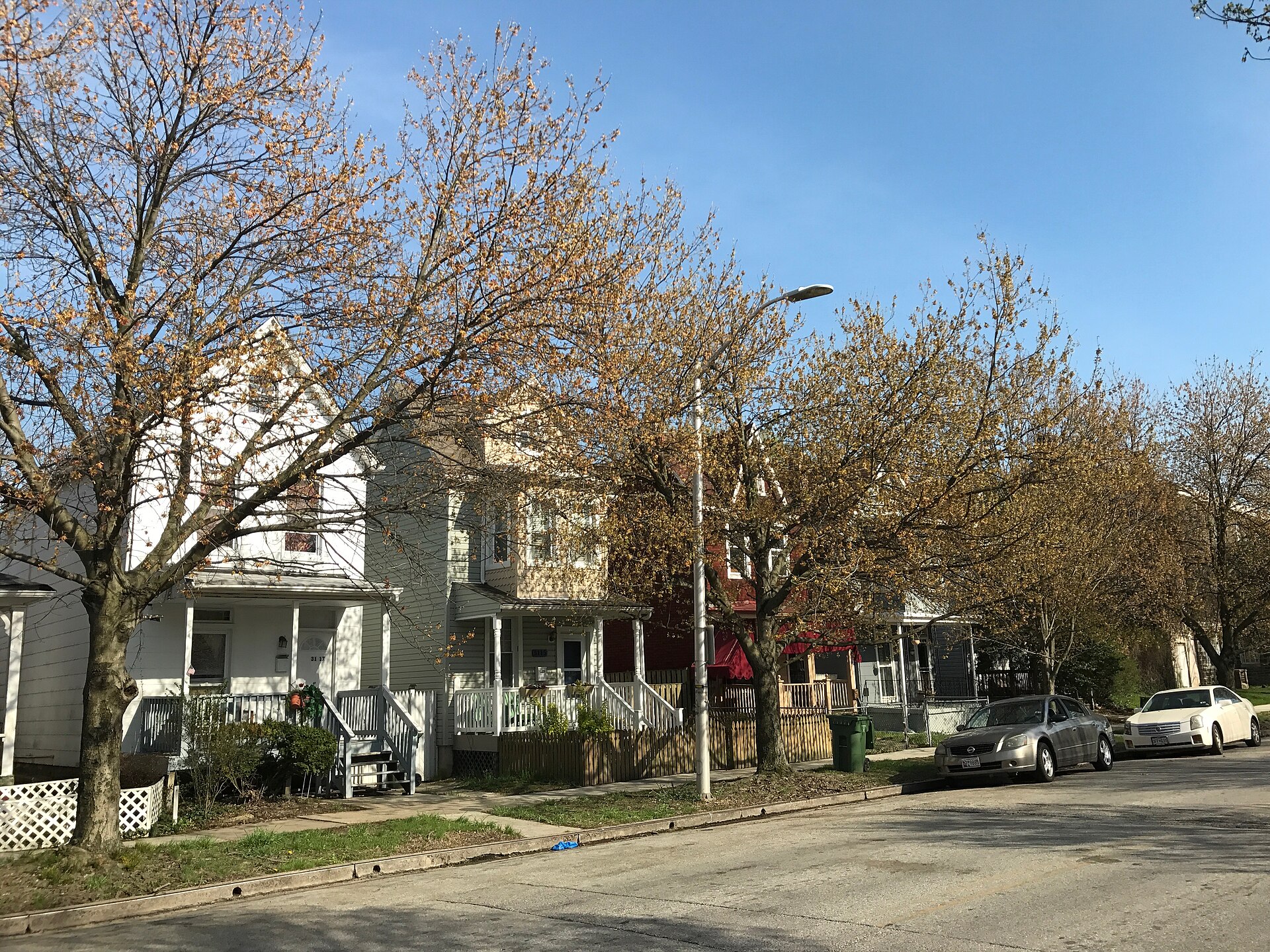
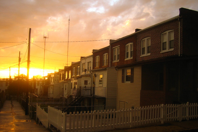
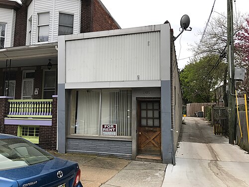
Houses, 3037-3033 Barclay Street, Baltimore, MD 21218, Abell You checked the neighborhood.Now check an address ! Photo: Baltimore Heritage from Baltimore, MD, USA, CC0 · Wikimedia Commons

For $34.00 a CrimesLog™ Home Report provides: (where available)

  • Nearest 6 Pre-school Nurseries to Address
  • Nearest 6 Primary Schools to Address
  • Nearest 6 Secondary/High Schools to Address
  • Nearest College and University to Address
  • Nearest to Address Medical Clinics, Hospitals and Pharmacies
  • Nearest 2 Police Station details to Address

The Home Report also provides

  • The CrimesLog™ Home Score is a proprietary Home Safety Measure capturing crime frequency, severity, recency and proximity to Address from police crime reporting point
  • A map indicating police anonymized crime reporting points around Address
  • Crime category trendlines for Address neighborhood
  • List of Reported Crime Incidents around Address radius
  • Downloadable PDF report — A Permanent Copy to Keep and Share to aid your Property Research
  • Our crimes database of almost 60 million records is UPDATED EVERY MONTH from US, UK, CA police sources
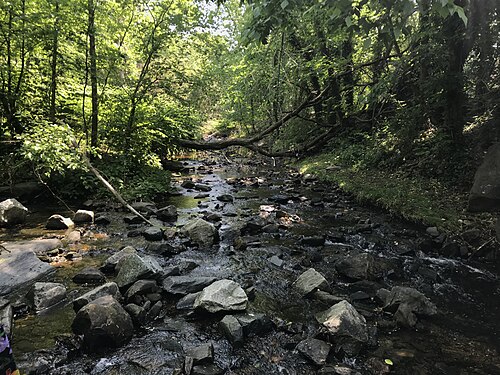
Stony Run North of Bolton Street Synagogue, 212 W. Coldspring Lane, Baltimore, MD 21210, Evergreen
Evergreen · Stony Run North of Bolton Street Synagogue, 212 W. Coldspring Lane, Baltimore, MD 21210
Photo: Baltimore Heritage from Baltimore, MD, USA, CC0 · Wikimedia Commons
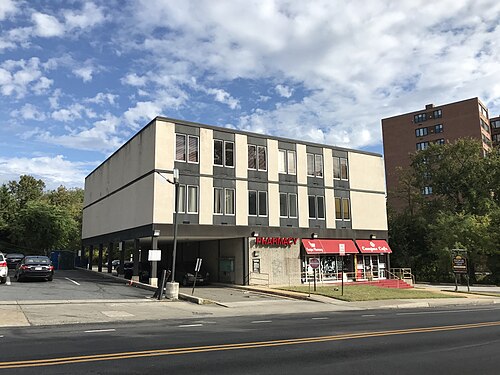
Campus Pharmacy Campus Cafe, 200 W. Cold Spring Lane, Baltimore, MD 21210, Keswick
Keswick · Campus Pharmacy Campus Cafe, 200 W. Cold Spring Lane, Baltimore, MD 21210
Photo: Baltimore Heritage from Baltimore, MD, USA, CC0 · Wikimedia Commons
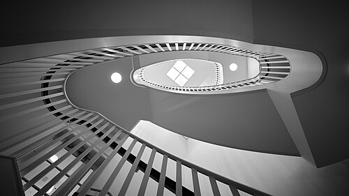
Spiral Staircase in Gilman Hall - Flickr - Chris.Rycroft, Johns Hopkins Homewood
Johns Hopkins Homewood · Spiral Staircase in Gilman Hall - Flickr - Chris.Rycroft
Photo: Chris Rycroft from Madison, Wisconsin, United States, CC BY 2.0 · Wikimedia Commons
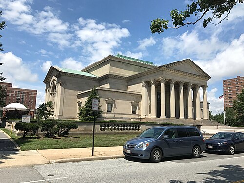
Scottish Rite Temple (1930, Clyde N. Friz, Architect; John Russell Pope, Consulting Architect), 3800 N. Charles Street, Tuscany-Canterbury
Tuscany-Canterbury · Scottish Rite Temple (1930, Clyde N. Friz, Architect; John Russell Pope, Consulting Architect), 3800 N. Charles Street
Photo: Baltimore Heritage from Baltimore, MD, USA, CC0 · Wikimedia Commons
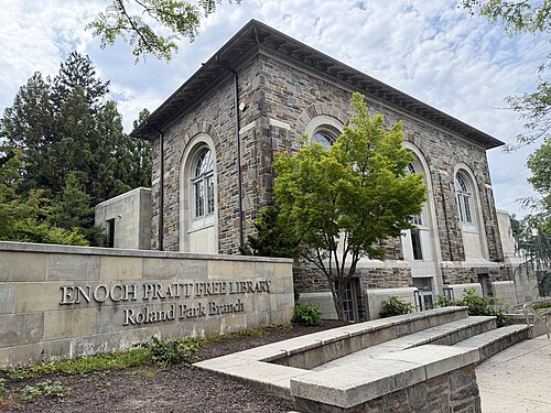
Roland Park Branch of the Enoch Pratt Free Library, Roland Park
Roland Park · Roland Park Branch of the Enoch Pratt Free Library
Photo: Nolabob, CC0 · Wikimedia Commons
Autumn in Her Post-Storm Colors, Medfield
Medfield · Autumn in Her Post-Storm Colors
Photo: sneakerdog, CC BY 2.0 · Flickr
The Academy on Charles, 3700 N. Charles Street, Baltimore, MD 21218, Guilford
Guilford · The Academy on Charles, 3700 N. Charles Street, Baltimore, MD 21218
Photo: Baltimore Heritage, CC0 · Wikimedia Commons
Midcentury Modern Small Commercial Building, 305 E. 31st Street, Baltimore, MD 21218, Charles Village
Charles Village · Midcentury Modern Small Commercial Building, 305 E. 31st Street, Baltimore, MD 21218
Photo: Baltimore Heritage from Baltimore, MD, USA, CC0 · Wikimedia Commons

How neighborhoods moved each quarter

2022

Whole-area crime rate 11.4 to 18.1 per 1,000 (high: Q3 2022).

Big moves (4+ places in a quarter): moved up Guilford 9th→4th (Q2) moved up Greenspring 11th→5th (Q2) moved up Hoes Heights 23rd→7th (Q2) moved up Parklane 19th→8th (Q2) moved up Hampden 17th→12th (Q2) moved down Oakenshawe 4th→13th (Q2) moved down Johns Hopkins Homewood 3rd→15th (Q2) moved down Woodberry 12th→16th (Q2) moved up Jones Falls Area 26th→17th (Q2) moved down Evergreen 6th→20th (Q2) moved down Richnor Springs 15th→21st (Q2) moved down Abell 22nd→26th (Q2) moved up Keswick 6th→2nd (Q3) moved up Evergreen 20th→5th (Q3) moved down Kernewood 2nd→6th (Q3) moved up Woodberry 16th→11th (Q3) moved up Waverly 19th→14th (Q3) moved up Richnor Springs 21st→16th (Q3) moved up Abell 26th→17th (Q3) moved down Parklane 8th→19th (Q3) moved down Wyman Park 14th→21st (Q3) moved down Hampden 12th→22nd (Q3) moved down Jones Falls Area 17th→26th (Q3) moved up Johns Hopkins Homewood 15th→5th (Q4) moved up Waverly 14th→10th (Q4) moved up Richnor Springs 16th→11th (Q4) moved down Greenspring 8th→12th (Q4) moved down Cylburn 10th→14th (Q4) moved up Parklane 19th→15th (Q4) moved up Remington 23rd→16th (Q4) moved down Oakenshawe 13th→18th (Q4) moved down Hoes Heights 7th→20th (Q4) moved down Abell 17th→24th (Q4)

2023

Whole-area crime rate 15.3 to 22.2 per 1,000 (high: Q3 2023).

Big moves (4+ places in a quarter): moved up Oakenshawe 18th→3rd (Q1) moved up Kernewood 9th→5th (Q1) moved up Greenspring 12th→6th (Q1) moved down Roland Park 2nd→8th (Q1) moved up Cylburn 14th→9th (Q1) moved down Johns Hopkins Homewood 5th→11th (Q1) moved up Hoes Heights 20th→12th (Q1) moved down Keswick 3rd→14th (Q1) moved down Richnor Springs 11th→16th (Q1) moved up Jones Falls Area 26th→17th (Q1) moved down Waverly 10th→19th (Q1) moved up Abell 24th→20th (Q1) moved down Remington 16th→21st (Q1) moved down Wilson Park 21st→25th (Q1) moved up Johns Hopkins Homewood 11th→4th (Q2) moved up Keswick 14th→9th (Q2) moved up Pen Lucy 18th→11th (Q2) moved down Kernewood 5th→12th (Q2) moved down Cylburn 9th→13th (Q2) moved up Waverly 19th→15th (Q2) moved up Wyman Park 23rd→16th (Q2) moved down Oakenshawe 3rd→18th (Q2) moved up Wilson Park 25th→20th (Q2) moved down Parklane 15th→23rd (Q2) moved down Jones Falls Area 17th→25th (Q2) moved up Keswick 9th→3rd (Q3) moved up Hoes Heights 14th→4th (Q3) moved down Evergreen 2nd→9th (Q3) moved up Oakenshawe 18th→11th (Q3) moved down Guilford 3rd→12th (Q3) moved up Hampden 19th→15th (Q3) moved down Pen Lucy 11th→16th (Q3) moved down Richnor Springs 17th→21st (Q3) moved down Wyman Park 16th→23rd (Q3) moved up Evergreen 9th→5th (Q4) moved up Waverly 17th→6th (Q4) moved up Kernewood 13th→8th (Q4) moved up Pen Lucy 16th→11th (Q4) moved up Remington 19th→12th (Q4) moved down Oakenshawe 11th→15th (Q4) moved down Medfield 7th→16th (Q4) moved up Harwood 22nd→17th (Q4) moved down Hoes Heights 4th→18th (Q4) moved down Hampden 15th→22nd (Q4) moved down Abell 20th→24th (Q4)

2024

Whole-area crime rate 16.3 to 19.6 per 1,000 (high: Q3 2024).

Big moves (4+ places in a quarter): moved down Johns Hopkins Homewood 3rd→7th (Q1) moved up Cylburn 14th→9th (Q1) moved up Medfield 16th→11th (Q1) moved down Waverly 6th→12th (Q1) moved down Pen Lucy 11th→15th (Q1) moved up Wyman Park 20th→16th (Q1) moved down Guilford 13th→17th (Q1) moved down Oakenshawe 15th→19th (Q1) moved up Medfield 11th→3rd (Q2) moved down Roland Park 1st→5th (Q2) moved up Guilford 17th→10th (Q2) moved up Hoes Heights 18th→13th (Q2) moved up Oakenshawe 19th→15th (Q2) moved down Waverly 12th→17th (Q2) moved down Cylburn 9th→19th (Q2) moved down Wyman Park 16th→23rd (Q2) moved up Evergreen 7th→1st (Q3) moved up Guilford 10th→4th (Q3) moved up Greenspring 9th→5th (Q3) moved down Johns Hopkins Homewood 4th→8th (Q3) moved up Cylburn 19th→9th (Q3) moved down Keswick 2nd→10th (Q3) moved down Medfield 3rd→12th (Q3) moved down Harwood 14th→19th (Q3) moved down Oakenshawe 15th→21st (Q3) moved up Cylburn 9th→5th (Q4) moved up Oakenshawe 21st→10th (Q4) moved down Evergreen 1st→13th (Q4) moved up Jones Falls Area 25th→15th (Q4) moved down Remington 14th→19th (Q4) moved down Hoes Heights 16th→23rd (Q4)

2025

Whole-area crime rate 13.8 to 17.6 per 1,000 (high: Q3 2025).

Big moves (4+ places in a quarter): moved up Keswick 9th→2nd (Q1) moved up Evergreen 13th→5th (Q1) moved up Waverly 18th→11th (Q1) moved up Remington 19th→12th (Q1) moved down Woodberry 6th→13th (Q1) moved down Cylburn 5th→14th (Q1) moved down Oakenshawe 10th→16th (Q1) moved up Hoes Heights 23rd→18th (Q1) moved down Parklane 16th→20th (Q1) moved down Jones Falls Area 15th→22nd (Q1) moved up Greenspring 7th→3rd (Q2) moved up Harwood 19th→5th (Q2) moved down Keswick 2nd→7th (Q2) moved up Pen Lucy 15th→8th (Q2) moved up Wyman Park 25th→11th (Q2) moved down Johns Hopkins Homewood 8th→12th (Q2) moved up Hoes Heights 18th→14th (Q2) moved down Waverly 11th→15th (Q2) moved down Remington 12th→17th (Q2) moved down Richnor Springs 17th→22nd (Q2) moved down Kernewood 6th→23rd (Q2) moved up Keswick 7th→2nd (Q3) moved up Johns Hopkins Homewood 12th→3rd (Q3) moved up Kernewood 23rd→5th (Q3) moved down Greenspring 3rd→7th (Q3) moved up Cylburn 13th→9th (Q3) moved up Waverly 15th→11th (Q3) moved up Parklane 18th→13th (Q3) moved up Richnor Springs 22nd→14th (Q3) moved down Pen Lucy 8th→16th (Q3) moved down Harwood 5th→17th (Q3) moved up Hampden 24th→20th (Q3) moved down Hoes Heights 14th→21st (Q3) moved down Wyman Park 11th→23rd (Q3) moved down Jones Falls Area 21st→26th (Q3) moved up Evergreen 8th→4th (Q4) moved up Woodberry 15th→5th (Q4) moved down Keswick 2nd→10th (Q4) moved up Remington 19th→13th (Q4) moved up Wyman Park 23rd→14th (Q4) moved down Charles Village 12th→16th (Q4) moved down Parklane 13th→17th (Q4) moved down Waverly 11th→18th (Q4) moved down Harwood 17th→22nd (Q4) moved down Wilson Park 18th→23rd (Q4)

2026

Whole-area crime rate 15.2 to 17.8 per 1,000 (high: Q2 2026). 2 quarters so far.

Big moves (4+ places in a quarter): moved up Keswick 10th→1st (Q1) moved up Guilford 9th→5th (Q1) moved up Oakenshawe 21st→10th (Q1) moved up Waverly 18th→11th (Q1) moved down Woodberry 5th→12th (Q1) moved down Kernewood 8th→14th (Q1) moved down Remington 13th→19th (Q1) moved up Jones Falls Area 26th→22nd (Q1) moved down Parklane 17th→23rd (Q1) moved up Evergreen 6th→1st (Q2) moved up Medfield 13th→6th (Q2) moved up Kernewood 14th→7th (Q2) moved up Charles Village 17th→9th (Q2) moved up Parklane 23rd→17th (Q2) moved down Richnor Springs 8th→21st (Q2) moved down Hoes Heights 20th→24th (Q2) moved down Jones Falls Area 22nd→26th (Q2)

Reported Safety Incidents

In Q2 2026: property incidents were 52% (507), violent incidents were 25% (243), vehicle crimes were 22% (216) and public order incidents were 0% (1).

Recorded crime here is grouped into violent crime, property crime (burglary and theft), vehicle crime and public order offences, so you can compare how safe each neighborhood is for the kind of crime that matters to you.

Places we left out, and places to read with care

Left out: Druid Hill Park. They have almost no residents: their crimes are against visitors, so a rate per resident says little about living there.

Jones Falls Area (60.1 per 1,000 from 11 crimes among 183 residents), Keswick (2.1 per 1,000 from 1 crime among 478 residents), Old Goucher (153.3 per 1,000 from 84 crimes among 548 residents), Richnor Springs (29.6 per 1,000 from 17 crimes among 575 residents), Evergreen (1.7 per 1,000 from 1 crime among 576 residents), Johns Hopkins Homewood (3.4 per 1,000 from 2 crimes among 592 residents), Kernewood (10.8 per 1,000 from 7 crimes among 646 residents), Hoes Heights (37.1 per 1,000 from 27 crimes among 727 residents), Oakenshawe (12.8 per 1,000 from 11 crimes among 862 residents), Wilson Park (28.0 per 1,000 from 25 crimes among 894 residents), Wyman Park (16.3 per 1,000 from 15 crimes among 923 residents), Abell (32.3 per 1,000 from 31 crimes among 960 residents), Harwood (36.0 per 1,000 from 50 crimes among 1,390 residents), Parklane (17.9 per 1,000 from 26 crimes among 1,452 residents), Woodberry (14.9 per 1,000 from 24 crimes among 1,607 residents), Remington (19.2 per 1,000 from 39 crimes among 2,035 residents), Guilford (11.7 per 1,000 from 24 crimes among 2,059 residents), Cylburn (14.4 per 1,000 from 33 crimes among 2,297 residents), Better Waverly (56.5 per 1,000 from 135 crimes among 2,390 residents), Medfield (7.3 per 1,000 from 18 crimes among 2,463 residents) and Waverly (16.1 per 1,000 from 43 crimes among 2,662 residents) are places with few residents (under 3,000): a rate on so few people says little about living there, so they are not named as the lowest or highest.

The 27 neighborhoods on the map

Northern District (south) is made of 27 neighborhoods compared here, each in its own colour on the map. They are the Neighborhood Statistical Areas of Baltimore City (Open Baltimore), grouped into police districts by CrimesLog: 54,205 residents between them.

  • Abell
  • Better Waverly
  • Charles Village
  • Cylburn
  • Evergreen
  • Greenspring
  • Guilford
  • Hampden
  • Harwood
  • Hoes Heights
  • Johns Hopkins Homewood
  • Jones Falls Area
  • Kernewood
  • Keswick
  • Medfield
  • Oakenshawe
  • Old Goucher
  • Parklane
  • Pen Lucy
  • Remington
  • Richnor Springs
  • Roland Park
  • Tuscany-Canterbury
  • Waverly
  • Wilson Park
  • Woodberry
  • Wyman Park

All 27 neighborhoods, Q2 2026

Crimes per 1,000 residents, Q2 2026, lowest first. The last two columns compare with Q1 2022.
#NeighborhoodResidentsAllViolentPropertyVehiclePublic orderRate vs Q1 2022Places gained
1Evergreen †5761.71.70.00.00.0down67%up5
2Keswick †4782.10.00.02.10.0down67%up5
3Johns Hopkins Homewood †5923.40.01.71.70.0down0%–
4Tuscany-Canterbury3,3384.81.52.70.60.0up60%down2
5Roland Park4,3187.20.54.42.30.0up182%down4
6Medfield †2,4637.32.43.31.60.0down10%up4
7Kernewood †64610.86.23.11.60.0up134%down2
8Guilford †2,05911.71.96.82.90.0up50%up1
9Charles Village7,02112.03.05.83.10.0up11%up4
10Greenspring3,96112.16.63.52.00.0up37%up1
11Oakenshawe †86212.82.35.84.60.0up175%down7
12Cylburn †2,29714.47.05.22.20.0up94%down4
13Woodberry †1,60714.95.05.05.00.0up60%down1
14Waverly †2,66216.13.47.94.90.0up30%up2
15Hampden6,15816.22.96.56.80.0up25%up2
16Wyman Park †92316.30.013.03.30.0up50%down2
17Parklane †1,45217.99.65.52.10.7up13%up2
18Remington †2,03519.22.513.83.00.0up15%up2
19Pen Lucy3,09020.75.59.45.80.0up56%down1
20Wilson Park †89428.014.58.94.50.0up9%up5
21Richnor Springs †57529.613.98.77.00.0up143%down6
22Abell †96032.39.415.67.30.0up82%–
23Harwood †1,39036.010.116.69.30.0up108%down2
24Hoes Heights †72737.15.527.54.10.0up80%down1
25Better Waverly †2,39056.512.637.26.70.0up129%down1
26Jones Falls Area †18360.110.938.310.90.0up83%–
27Old Goucher †548153.39.1125.918.30.0up163%–

† Jones Falls Area, Keswick, Old Goucher, Richnor Springs, Evergreen, Johns Hopkins Homewood, Kernewood, Hoes Heights, Oakenshawe, Wilson Park, Wyman Park, Abell, Harwood, Parklane, Woodberry, Remington, Guilford, Cylburn, Better Waverly, Medfield and Waverly are places with few residents. A rate on a very small number of residents or crimes is not comparable with the others.

Photographs

179 photographs of the 27 neighborhoods run along the reel; click one to see it full size. Each is credited here and under the large view.

All 179 photographs and their credits
  1. Evergreen · Stony Run North of Bolton Street Synagogue, 212 W. Coldspring Lane, Baltimore, MD 21210. Photo: Baltimore Heritage from Baltimore, MD, USA, CC0 · Wikimedia Commons
  2. Keswick · Campus Pharmacy Campus Cafe, 200 W. Cold Spring Lane, Baltimore, MD 21210. Photo: Baltimore Heritage from Baltimore, MD, USA, CC0 · Wikimedia Commons
  3. Johns Hopkins Homewood · Spiral Staircase in Gilman Hall - Flickr - Chris.Rycroft. Photo: Chris Rycroft from Madison, Wisconsin, United States, CC BY 2.0 · Wikimedia Commons
  4. Tuscany-Canterbury · Scottish Rite Temple (1930, Clyde N. Friz, Architect; John Russell Pope, Consulting Architect), 3800 N. Charles Street. Photo: Baltimore Heritage from Baltimore, MD, USA, CC0 · Wikimedia Commons
  5. Roland Park · Roland Park Branch of the Enoch Pratt Free Library. Photo: Nolabob, CC0 · Wikimedia Commons
  6. Medfield · Autumn in Her Post-Storm Colors. Photo: sneakerdog, CC BY 2.0 · Flickr
  7. Guilford · The Academy on Charles, 3700 N. Charles Street, Baltimore, MD 21218. Photo: Baltimore Heritage, CC0 · Wikimedia Commons
  8. Charles Village · Midcentury Modern Small Commercial Building, 305 E. 31st Street, Baltimore, MD 21218. Photo: Baltimore Heritage from Baltimore, MD, USA, CC0 · Wikimedia Commons
  9. Greenspring · Sidewalk Ending in Steps, Park Heights Avenue and Springhill Avenue (Northeast Corner), Baltimore, MD 21215 (33718912568. Photo: Baltimore Heritage from Baltimore, MD, USA, CC0 · Wikimedia Commons
  10. Oakenshawe · Hair With Class, 354 E. University Parkway, Baltimore, MD 21218. Photo: Baltimore Heritage from Baltimore, MD, USA, CC0 · Wikimedia Commons
  11. Cylburn · Azalea Trail, Cylburn Arboretum, 4915 Greenspring Avenue, Baltimore, MD 21209. Photo: Baltimore Heritage, CC0 · Flickr
  12. Woodberry · Meadow Mill at Night, Woodberry, Baltimore, MD. Photo: aelietzau5, CC BY 2.0 · Flickr
  13. Waverly · Houses, 602-608 E. 34th Street, Baltimore, MD 21218. Photo: Baltimore Heritage from Baltimore, MD, USA, CC0 · Wikimedia Commons
  14. Hampden · Union Mill (1865-1872), 1500 Union Avenue, Baltimore, MD 21211. Photo: Baltimore Heritage from Baltimore, MD, USA, CC0 · Wikimedia Commons
  15. Wyman Park · Rowhouses, 500 Block of W. 33rd Street, Baltimore, MD 21211. Photo: Baltimore Heritage from Baltimore, MD, USA, CC0 · Wikimedia Commons
  16. Remington · The Dizz, 300 W. 30th Street, Baltimore, MD 21211. Photo: Baltimore Heritage from Baltimore, MD, USA, CC0 · Wikimedia Commons
  17. Abell · Huntingdon Baptist Church, 400 E. 31st Street, Baltimore, MD 21218. Photo: Baltimore Heritage from Baltimore, MD, USA, CC0 · Wikimedia Commons
  18. Harwood · Rowhouses (Chinese Food, Barber Shop, and Tax Outlet), 2527-2535 Greenmount Avenue, Baltimore, MD 21218. Photo: Baltimore Heritage from Baltimore, MD, USA, CC0 · Wikimedia Commons
  19. Better Waverly · Duplex Houses, 500 Block of E. 30th Street, Baltimore, MD 21218. Photo: Baltimore Heritage from Baltimore, MD, USA, CC0 · Wikimedia Commons
  20. Jones Falls Area · Jones Falls Trail, Baltimore, MD 21211. Photo: Baltimore Heritage from Baltimore, MD, USA, CC0 · Wikimedia Commons
  21. Old Goucher · Entrance, Rowhouse, 2301 Maryland Avenue, Baltimore, MD 21218. Photo: Baltimore Heritage from Baltimore, MD, USA, CC0 · Wikimedia Commons
  22. Druid Hill Park · William Wallace Monument (1893, D.W. Stevenson, Sculptor), Druid Hill Park, Lake Drive, Baltimore, MD 21217 (33248792780. Photo: Baltimore Heritage from Baltimore, MD, USA, CC0 · Wikimedia Commons
  23. Evergreen · Stony Run North of Bolton Street Synagogue, 212 W. Coldspring Lane, Baltimore, MD 21210. Photo: Baltimore Heritage from Baltimore, MD, USA, CC0 · Wikimedia Commons
  24. Keswick · Royal Farms Store, 206 W. Cold Spring Lane, Baltimore, MD 21210. Photo: Baltimore Heritage from Baltimore, MD, USA, CC0 · Wikimedia Commons
  25. Johns Hopkins Homewood · Baltimore Museum of Art (1929; John Russell Pope, Architect), 10 Art Museum Drive, Baltimore, MD 21218. Photo: Baltimore Heritage from Baltimore, MD, USA, CC0 · Wikimedia Commons
  26. Tuscany-Canterbury · Stone Base at Site of Confederate Women’s Monument (1917; J. Maxwell Miller, Sculptor), Bishop Square Park, W. Universit. Photo: Baltimore Heritage from Baltimore, MD, USA, CC0 · Wikimedia Commons
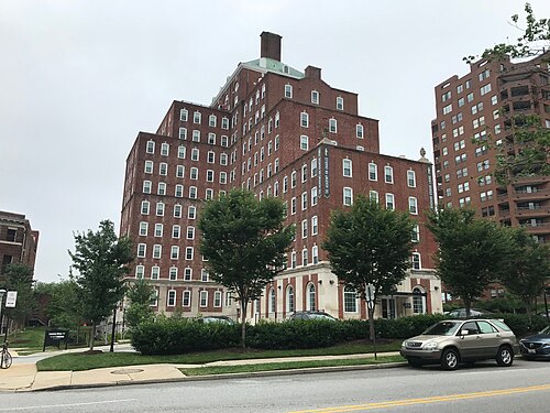
  27. Roland Park · Apartment Building, 526 W. University Parkway, Baltimore, MD 21210. Photo: Baltimore Heritage from Baltimore, MD, USA, CC0 · Wikimedia Commons
  28. Medfield · Television Hill in North Baltimore. Photo: sneakerdog, CC BY 2.0 · Flickr
  29. Guilford · Scottish Rite Temple (1930, Clyde N. Friz, Architect; John Russell Pope, Consulting Architect), 3800 N. Charles Street. Photo: Baltimore Heritage from Baltimore, MD, USA, CC0 · Wikimedia Commons
  30. Charles Village · 2600 Block of Maryland Avenue, Baltimore, MD 21218. Photo: Baltimore Heritage from Baltimore, MD, USA, CC0 · Wikimedia Commons
  31. Greenspring · Former Maryland Zoo Reptile House, Druid Hill Park, Greenspring Avenue and Beechwood Drive, Baltimore, MD 21215. Photo: Baltimore Heritage, CC0 · Flickr
  32. Oakenshawe · House, Guilford, Baltimore, MD. Photo: Baltimore Heritage from Baltimore, MD, USA, CC0 · Wikimedia Commons
  33. Cylburn · Cylburn Mansion (1868; George A. Frederick, Architect), Cylburn Arboretum, 4915 Greenspring Avenue, Baltimore, MD 21209. Photo: Baltimore Heritage, CC0 · Flickr
  34. Woodberry · Baltimore Streetcar Museum. Photo: sneakerdog, CC BY 2.0 · Flickr
  35. Waverly · Houses, 611-615 E. 34th Street, Baltimore, MD 21218. Photo: Baltimore Heritage from Baltimore, MD, USA, CC0 · Wikimedia Commons
  36. Hampden · Stone Duplex Houses, 1300 Block of Union Avenue, Baltimore, MD 21211. Photo: Baltimore Heritage from Baltimore, MD, USA, CC0 · Wikimedia Commons
  37. Wyman Park · Wyman Park. Photo: sneakerdog, CC BY 2.0 · Flickr
  38. Remington · U.S. Marine Hospital Former Wyman Park Health System (1934), 3100 Wyman Park Drive, Baltimore, MD 21211. Photo: Baltimore Heritage from Baltimore, MD, USA, CC0 · Wikimedia Commons
  39. Abell · Houses, 3037-3033 Barclay Street, Baltimore, MD 21218. Photo: Baltimore Heritage from Baltimore, MD, USA, CC0 · Wikimedia Commons
  40. Harwood · Rowhouses (Chinese Food and Barber Shop), 2527-2533 Greenmount Avenue, Baltimore, MD 21218. Photo: Baltimore Heritage from Baltimore, MD, USA, CC0 · Wikimedia Commons
  41. Better Waverly · Duplex Houses, 500 Block of E. 30th Street, Baltimore, MD 21218. Photo: Baltimore Heritage from Baltimore, MD, USA, CC0 · Wikimedia Commons
  42. Jones Falls Area · DOT Highway Maintenance Division Facility Former Ma & Pa Railroad Roundhouse (1910), 2601 Falls Road, Baltimore, MD 2121. Photo: Baltimore Heritage from Baltimore, MD, USA, CC0 · Wikimedia Commons
  43. Old Goucher · Former Carriage House, W. 23rd Street and Morton Street, Baltimore, MD. Photo: Baltimore Heritage from Baltimore, MD, USA, CC0 · Wikimedia Commons
  44. Druid Hill Park · View of Druid Lake from the West, Druid Hill Park, Lake Drive, Baltimore, MD. Photo: Baltimore Heritage from Baltimore, MD, USA, CC0 · Wikimedia Commons
  45. Evergreen · Lahar (Thirty Nine Mile Volcanics, Upper Eocene; 34-36 Ma; Evergreen Station South Roadcut, Colorado, USA) 75. Photo: James St. John, CC BY 2.0 · Flickr
  46. Johns Hopkins Homewood · Union Soldiers and Sailors Monument (1909; Adolph Weinman, Sculptor), Wyman Park Dell, N. Charles Street and W. 29th Str. Photo: Baltimore Heritage from Baltimore, MD, USA, CC0 · Wikimedia Commons
  47. Tuscany-Canterbury · Stone Base at Site of Confederate Women’s Monument (1917; J. Maxwell Miller, Sculptor), Bishop Square Park, W. Universit. Photo: Baltimore Heritage from Baltimore, MD, USA, CC0 · Wikimedia Commons
  48. Roland Park · Detached House, 103 Edgevale Road, Baltimore, MD 21210. Photo: Baltimore Heritage from Baltimore, MD, USA, CC0 · Wikimedia Commons
  49. Guilford · House, Guilford, Baltimore, MD. Photo: Baltimore Heritage from Baltimore, MD, USA, CC0 · Wikimedia Commons
  50. Charles Village · "United Not Blighted" Campaign Sign, Maryland Avenue and 26th Street, Baltimore, MD 21218. Photo: Baltimore Heritage from Baltimore, MD, USA, CC0 · Wikimedia Commons
  51. Greenspring · Interior Doors, Former Maryland Zoo Reptile House, Druid Hill Park, Greenspring Avenue and Beechwood Drive, Baltimore, MD 21215. Photo: Baltimore Heritage, CC0 · Flickr
  52. Oakenshawe · Carrollton Condominium, 3601 Greenway, Baltimore, MD 21218. Photo: Baltimore Heritage from Baltimore, MD, USA, CC0 · Wikimedia Commons
  53. Cylburn · Cylburn Mansion (1868; George A. Frederick, Architect), Cylburn Arboretum, 4915 Greenspring Avenue, Baltimore, MD 21209. Photo: Baltimore Heritage, CC0 · Flickr
  54. Waverly · House, 612 E. 34th Street, Baltimore, MD 21218. Photo: Baltimore Heritage from Baltimore, MD, USA, CC0 · Wikimedia Commons
  55. Hampden · Independence School Local I High School, 1300 W. 36th Street, Baltimore, MD 21211. Photo: Baltimore Heritage from Baltimore, MD, USA, CC0 · Wikimedia Commons
  56. Wyman Park · View East on University Parkway Bridge Over Stony Run (1908), Wyman Park, Baltimore, MD 21210. Photo: Baltimore Heritage, CC0 · Flickr
  57. Remington · U.S. Marine Hospital Former Wyman Park Health System (1934), 3100 Wyman Park Drive, Baltimore, MD 21211. Photo: Baltimore Heritage from Baltimore, MD, USA, CC0 · Wikimedia Commons
  58. Abell · Houses, 3037-3033 Barclay Street, Baltimore, MD 21218. Photo: Baltimore Heritage from Baltimore, MD, USA, CC0 · Wikimedia Commons
  59. Harwood · Partially Collapsed Vacant Rowhouse, 2707 Greenmount Avenue, Baltimore, MD 21218. Photo: Baltimore Heritage from Baltimore, MD, USA, CC0 · Wikimedia Commons
  60. Better Waverly · Outreach Temple Apostolic, Inc. 2940 Greenmount Avenue, Baltimore, MD 21218. Photo: Baltimore Heritage from Baltimore, MD, USA, CC0 · Wikimedia Commons
  61. Jones Falls Area · DOT Highway Maintenance Division Facility Former Ma & Pa Railroad Roundhouse (1910), 2601 Falls Road, Baltimore, MD 2121. Photo: Baltimore Heritage from Baltimore, MD, USA, CC0 · Wikimedia Commons
  62. Old Goucher · 2227-2233 Saint Paul Street, Baltimore, MD 21218. Photo: Baltimore Heritage from Baltimore, MD, USA, CC0 · Wikimedia Commons
  63. Druid Hill Park · George Washington Sculpture (1857, Edward Sheffield Bartholomew, Sculptor; George Mann and Son, Niche-Base), Druid Hill. Photo: Baltimore Heritage from Baltimore, MD, USA, CC0 · Wikimedia Commons
  64. Johns Hopkins Homewood · Baltimore Museum of Art (1929; John Russell Pope, Architect), 10 Art Museum Drive, Baltimore, MD 21218. Photo: Baltimore Heritage from Baltimore, MD, USA, CC0 · Wikimedia Commons
  65. Tuscany-Canterbury · Stone Base at Site of Confederate Women’s Monument (1917; J. Maxwell Miller, Sculptor), Bishop Square Park, W. Universit. Photo: Baltimore Heritage from Baltimore, MD, USA, CC0 · Wikimedia Commons
  66. Roland Park · Brick Entrance Gate, Briar Path from Saint Johns Road to Indian Lane, Roland Park, Baltimore, MD 21211. Photo: Baltimore Heritage from Baltimore, MD, USA, CC0 · Wikimedia Commons
  67. Guilford · House, 3816 Juniper Road, Baltimore, MD 21218. Photo: Baltimore Heritage from Baltimore, MD, USA, CC0 · Wikimedia Commons
  68. Charles Village · 2535 N. Charles Street, Baltimore, MD 21218. Photo: Baltimore Heritage from Baltimore, MD, USA, CC0 · Wikimedia Commons
  69. Greenspring · Rear, Former Maryland Zoo Reptile House, Druid Hill Park, Greenspring Avenue and Beechwood Drive, Baltimore, MD 21215. Photo: Baltimore Heritage, CC0 · Flickr
  70. Oakenshawe · Detached Houses, 3407-3409 Barclay Street, Baltimore, MD 21218. Photo: Baltimore Heritage, CC0 · Flickr
  71. Cylburn · Carriage House/Former Cylburn Nature Museum, Cylburn Arboretum, 4915 Greenspring Avenue, Baltimore, MD 21209. Photo: Baltimore Heritage, CC0 · Flickr
  72. Waverly · House, 620 E. 34th Street, Baltimore, MD 21218. Photo: Baltimore Heritage from Baltimore, MD, USA, CC0 · Wikimedia Commons
  73. Hampden · Former Hampden Presbyterian Church (1877), 3647 Falls Road, Baltimore, MD 21211. Photo: Baltimore Heritage from Baltimore, MD, USA, CC0 · Wikimedia Commons
  74. Wyman Park · Union Soldiers and Sailors Monument (1909; Adolph Weinman, Sculptor), Wyman Park Dell, N. Charles Street and W. 29th Street, Baltimore, MD 2. Photo: Baltimore Heritage, CC0 · Flickr
  75. Remington · American Ice Company Baltimore Plant No. 2 (1905-1919), 330 W. 23rd Street, Baltimore, MD 21212. Photo: Baltimore Heritage from Baltimore, MD, USA, CC0 · Wikimedia Commons
  76. Abell · Houses, 3037-3033 Barclay Street, Baltimore, MD 21218. Photo: Baltimore Heritage from Baltimore, MD, USA, CC0 · Wikimedia Commons
  77. Harwood · “Missing Pieces Can Be Found” (2013; Ellisa Yates, Muralist) at Harwood Park, 414 E. 27th Street, Baltimore, MD 21218 (3. Photo: Baltimore Heritage from Baltimore, MD, USA, CC0 · Wikimedia Commons
  78. Better Waverly · Commercial Buildings, 2942–2946 Greenmount Avenue, Baltimore, MD 21218. Photo: Baltimore Heritage from Baltimore, MD, USA, CC0 · Wikimedia Commons
  79. Jones Falls Area · Meadow Mill (1877), 3600 Clipper Mill Road, Baltimore, MD 21211. Photo: Baltimore Heritage from Baltimore, MD, USA, CC0 · Wikimedia Commons
  80. Old Goucher · Breeze Block Detail, Paul Chen Hong Kong Restaurant, 2426 N. Charles Street, Baltimore, MD 21218. Photo: Baltimore Heritage from Baltimore, MD, USA, CC0 · Wikimedia Commons
  81. Druid Hill Park · Chinese Pavilion, Druid Hill Park, Swann Drive, Baltimore, MD 21217. Photo: Baltimore Heritage from Baltimore, MD, USA, CC0 · Wikimedia Commons
  82. Johns Hopkins Homewood · Empty Plinth for Lee-Jackson Statue, Art Museum Drive, Baltimore, MD. Photo: Baltimore Heritage from Baltimore, MD, USA, CC0 · Wikimedia Commons
  83. Tuscany-Canterbury · Scottish Rite Temple (1930, Clyde N. Friz, Architect; John Russell Pope, Consulting Architect), 3800 N. Charles Street. Photo: Baltimore Heritage from Baltimore, MD, USA, CC0 · Wikimedia Commons
  84. Roland Park · Roland Park House. Photo: Kathleen Tyler Conklin, CC BY 2.0 · Flickr
  85. Guilford · House, 3816 Juniper Road, Baltimore, MD 21218. Photo: Baltimore Heritage from Baltimore, MD, USA, CC0 · Wikimedia Commons
  86. Charles Village · 2535 N. Charles Street, Baltimore, MD 21218. Photo: Baltimore Heritage from Baltimore, MD, USA, CC0 · Wikimedia Commons
  87. Greenspring · Pavilion, Grove of Remembrance (1919; E.L. Palmer, Architect), Beechwood Drive Near Greenspring Avenue, Baltimore, MD 21217. Photo: Baltimore Heritage, CC0 · Flickr
  88. Oakenshawe · Entrance, Guilford Hall, 300 E. University Parkway, Baltimore, MD 21218. Photo: Baltimore Heritage, CC0 · Flickr
  89. Cylburn · Garden Beds and Carriage House, Cylburn Arboretum, 4915 Greenspring Avenue, Baltimore, MD 21209. Photo: Baltimore Heritage, CC0 · Flickr
  90. Waverly · "A Little Help From Our Friends" (1966; Robert Hieronimus, Muralist), Venable Avenue and Greenmount Avenue (Southeast Co. Photo: Baltimore Heritage from Baltimore, MD, USA, CC0 · Wikimedia Commons
  91. Hampden · Hampden Mennonite Church, 1234 W. 36th Street, Baltimore, MD 21211. Photo: Baltimore Heritage from Baltimore, MD, USA, CC0 · Wikimedia Commons
  92. Wyman Park · New Wyman Park Restaurant, 138 W. 25th Street, Baltimore, MD 21218. Photo: Baltimore Heritage, CC0 · Flickr
  93. Remington · Rowhouses, 400 Block of Fawcett Street, Baltimore, MD 21211. Photo: Baltimore Heritage from Baltimore, MD, USA, CC0 · Wikimedia Commons
  94. Abell · Condemned House, 401 E. 31st Street, Baltimore, MD 21218. Photo: Baltimore Heritage from Baltimore, MD, USA, CC0 · Wikimedia Commons
  95. Harwood · Rowhouses at Night, 400 Block of E. 27th Street (South Side), Baltimore, MD 21218. Photo: Baltimore Heritage from Baltimore, MD, USA, CC0 · Wikimedia Commons
  96. Better Waverly · The BBQ, 2602 Greenmount Avenue, Baltimore, MD 21218. Photo: Baltimore Heritage from Baltimore, MD, USA, CC0 · Wikimedia Commons
  97. Jones Falls Area · North Avenue Bridge (View East from the North Side), Baltimore, MD 21217. Photo: Baltimore Heritage from Baltimore, MD, USA, CC0 · Wikimedia Commons
  98. Old Goucher · Building, 2223 Maryland Avenue, Baltimore, MD. Photo: Baltimore Heritage from Baltimore, MD, USA, CC0 · Wikimedia Commons
  99. Druid Hill Park · Chinese Pavilion, Druid Hill Park, Swann Drive, Baltimore, MD 21217. Photo: Baltimore Heritage from Baltimore, MD, USA, CC0 · Wikimedia Commons
  100. Johns Hopkins Homewood · Gatehouse Homewood Lodge (C. 1875)Johns Hopkins University (JHU) Homewood Campus, 3400 N. Charles Street, Baltimore, MD. Photo: Baltimore Heritage from Baltimore, MD, USA, CC0 · Wikimedia Commons
  101. Tuscany-Canterbury · 102 W. University Parkway, Baltimore, MD 21210. Photo: Baltimore Heritage, CC0 · Wikimedia Commons
  102. Roland Park · Roland Park Condominium, 6 Upland Road, Baltimore, MD 21210. Photo: Baltimore Heritage, CC0 · Flickr
  103. Guilford · House, Guilford, Baltimore, MD. Photo: Baltimore Heritage from Baltimore, MD, USA, CC0 · Wikimedia Commons
  104. Charles Village · 2535 N. Charles Street, Baltimore, MD 21218. Photo: Baltimore Heritage from Baltimore, MD, USA, CC0 · Wikimedia Commons
  105. Oakenshawe · Detached Houses, Calvin Street and Barclay Street (Southeast Corner), Baltimore, MD 21218. Photo: Baltimore Heritage, CC0 · Flickr
  106. Cylburn · Entrance, Vollmer Center (2010; GWWO, Inc., Architects), Cylburn Arboretum, 4915 Greenspring Avenue, Baltimore, MD 21209. Photo: Baltimore Heritage, CC0 · Flickr
  107. Waverly · Cornerstone, George J. Riester Memorial Educational Building (1955), United in Christ Seventh Day Adventist Church (1917. Photo: Baltimore Heritage from Baltimore, MD, USA, CC0 · Wikimedia Commons
  108. Hampden · Former Hampden Presbyterian Church (1877), 3647 Falls Road, Baltimore, MD 21211. Photo: Baltimore Heritage from Baltimore, MD, USA, CC0 · Wikimedia Commons
  109. Remington · Rowhouses, 400 Block of Fawcett Street, Baltimore, MD 21211. Photo: Baltimore Heritage from Baltimore, MD, USA, CC0 · Wikimedia Commons
  110. Abell · Entrance, Barclay Elementary Middle School, 2900 Barclay Street, Baltimore, MD 21218. Photo: Baltimore Heritage from Baltimore, MD, USA, CC0 · Wikimedia Commons
  111. Harwood · 2620-2628 Guilford Avenue, Baltimore, MD 21218. Photo: Baltimore Heritage from Baltimore, MD, USA, CC0 · Wikimedia Commons
  112. Better Waverly · Oak Hill Townhomes, Exeter Hall Avenue, Baltimore, MD 21218. Photo: Baltimore Heritage from Baltimore, MD, USA, CC0 · Wikimedia Commons
  113. Jones Falls Area · Industrial Building, 2801 Sisson Street, Baltimore, MD 21211. Photo: Baltimore Heritage from Baltimore, MD, USA, CC0 · Wikimedia Commons
  114. Old Goucher · Audacity of Health Behavivoral Health Building, 2211 Maryland Avenue, Baltimore, MD 21218. Photo: Baltimore Heritage from Baltimore, MD, USA, CC0 · Wikimedia Commons
  115. Druid Hill Park · Latrobe Pavilion (1864), Druid Hill Park, East Drive, Baltimore, MD 21217. Photo: Baltimore Heritage from Baltimore, MD, USA, CC0 · Wikimedia Commons
  116. Johns Hopkins Homewood · Johns Hopkins Monument (1935, Hans Schuler), N. Charles Street and 33rd Street, Baltimore, MD 21218. Photo: Baltimore Heritage from Baltimore, MD, USA, CC0 · Wikimedia Commons
  117. Tuscany-Canterbury · St. James Condominiums, 3704 N. Charles Street, Baltimore, MD 21218. Photo: Baltimore Heritage from Baltimore, MD, USA, CC0 · Wikimedia Commons
  118. Roland Park · Roland Park Condominium, 6 Upland Road, Baltimore, MD 21210. Photo: Baltimore Heritage, CC0 · Flickr
  119. Guilford · Sherwood Gardens, Greenway and Stratford Road (Southeast Corner), Baltimore, MD 21218. Photo: Baltimore Heritage from Baltimore, MD, USA, CC0 · Wikimedia Commons
  120. Charles Village · 2535 N. Charles Street, Baltimore, MD 21218. Photo: Baltimore Heritage from Baltimore, MD, USA, CC0 · Wikimedia Commons
  121. Oakenshawe · Oakenshawe Green Space (1974), 3498 Barclay Street, Baltimore, MD 21218. Photo: Baltimore Heritage, CC0 · Flickr
  122. Cylburn · Decorative Urn in Front of Cylburn Mansion (1868; George A. Frederick, Architect), Cylburn Arboretum, 4915 Greenspring Avenue, Baltimore, MD. Photo: Baltimore Heritage, CC0 · Flickr
  123. Hampden · Commercial Buildings, 800 Block of W. 36th Street, Baltimore, MD 21211. Photo: Baltimore Heritage from Baltimore, MD, USA, CC0 · Wikimedia Commons
  124. Remington · U.S. Marine Hospital Former Wyman Park Health System (1934), 3100 Wyman Park Drive, Baltimore, MD 21211. Photo: Baltimore Heritage from Baltimore, MD, USA, CC0 · Wikimedia Commons
  125. Abell · Abell Open Space 32nd Street Park, E. 32nd Street Between Abell and Guilford Avenues, Baltimore, MD 21218. Photo: Baltimore Heritage from Baltimore, MD, USA, CC0 · Wikimedia Commons
  126. Harwood · 300 Block of E. 26th Street (North Side), Baltimore, MD 21218. Photo: Baltimore Heritage from Baltimore, MD, USA, CC0 · Wikimedia Commons
  127. Better Waverly · Oak Hill Townhomes, Exeter Hall Avenue, Baltimore, MD 21218. Photo: Baltimore Heritage from Baltimore, MD, USA, CC0 · Wikimedia Commons
  128. Jones Falls Area · Meadow Mill in Baltimore. Photo: Andrew Parlette from Elkridge,MD, US, CC BY 2.0 · Wikimedia Commons
  129. Old Goucher · 2500 Block of N. Saint Paul Street (East Side), Baltimore, MD 21218. Photo: Baltimore Heritage from Baltimore, MD, USA, CC0 · Wikimedia Commons
  130. Druid Hill Park · Latrobe Pavilion (1864), Druid Hill Park, East Drive, Baltimore, MD 21217. Photo: Baltimore Heritage from Baltimore, MD, USA, CC0 · Wikimedia Commons
  131. Johns Hopkins Homewood · Exhibit Panels on Lobby Murals, Shriver Hall (1954; Buckler, Fenhagen, Meyer and Ayers, Architects), Johns Hopkins Unive. Photo: Baltimore Heritage from Baltimore, MD, USA, CC0 · Wikimedia Commons
  132. Roland Park · Roland Park Condominium, 6 Upland Road, Baltimore, MD 21210. Photo: Baltimore Heritage, CC0 · Flickr
  133. Guilford · St. James Condominiums, 3704 N. Charles Street, Baltimore, MD 21218. Photo: Baltimore Heritage from Baltimore, MD, USA, CC0 · Wikimedia Commons
  134. Charles Village · Graffiti on Rowhouse Window, 54 E. 26th Street, Baltimore, MD 21218. Photo: Baltimore Heritage from Baltimore, MD, USA, CC0 · Wikimedia Commons
  135. Oakenshawe · Duplex Houses, 400 Block of Venable Avenue (North Side), Baltimore, MD 21218. Photo: Baltimore Heritage, CC0 · Flickr
  136. Cylburn · Path to Greenhouses, Cylburn Arboretum, 4915 Greenspring Avenue, Baltimore, MD 21209. Photo: Baltimore Heritage, CC0 · Flickr
  137. Hampden · Commercial Buildings, 800 Block of W. 36th Street, Baltimore, MD 21211. Photo: Baltimore Heritage from Baltimore, MD, USA, CC0 · Wikimedia Commons
  138. Remington · Roland Slate Service Company, Inc. 329 W. 23rd Street, Baltimore, MD 21211. Photo: Baltimore Heritage from Baltimore, MD, USA, CC0 · Wikimedia Commons
  139. Abell · Huntingdon Baptist Church, 400 E. 31st Street, Baltimore, MD 21218. Photo: Baltimore Heritage from Baltimore, MD, USA, CC0 · Wikimedia Commons
  140. Harwood · 300 Block of E. 27th Street (North Side), Baltimore, MD 21218. Photo: Baltimore Heritage from Baltimore, MD, USA, CC0 · Wikimedia Commons
  141. Better Waverly · Oak Hill Townhomes, Exeter Hall Avenue, Baltimore, MD 21218. Photo: Baltimore Heritage from Baltimore, MD, USA, CC0 · Wikimedia Commons
  142. Druid Hill Park · Dr. Ralph W.E. Jones, Jr. Administration Building, 3001 East Drive, Baltimore, MD 21211. Photo: Baltimore Heritage from Baltimore, MD, USA, CC0 · Wikimedia Commons
  143. Johns Hopkins Homewood · "Famous Beauties" Lobby Mural (1956; Leon Kroll, Painter), Shriver Hall (1954; Buckler, Fenhagen, Meyer and Ayers, Archi. Photo: Baltimore Heritage from Baltimore, MD, USA, CC0 · Wikimedia Commons
  144. Roland Park · Roland Park Elementary/Middle School, 5207 Roland Avenue, Baltimore, MD 21210. Photo: Baltimore Heritage, CC0 · Flickr
  145. Guilford · House, Guilford, Baltimore, MD. Photo: Baltimore Heritage from Baltimore, MD, USA, CC0 · Wikimedia Commons
  146. Charles Village · Building, 25th Street, Baltimore, MD. Photo: Baltimore Heritage from Baltimore, MD, USA, CC0 · Wikimedia Commons
  147. Oakenshawe · Carrollton Condominium/The Carrollton Apartments (1956), 3601 Greenway, Baltimore, MD 21218. Photo: Baltimore Heritage, CC0 · Flickr
  148. Hampden · Hampden Hall, 929 W. 36th Street, Baltimore, MD 21211. Photo: Baltimore Heritage from Baltimore, MD, USA, CC0 · Wikimedia Commons
  149. Abell · Huntingdon Baptist Church, 400 E. 31st Street, Baltimore, MD 21218. Photo: Baltimore Heritage from Baltimore, MD, USA, CC0 · Wikimedia Commons
  150. Better Waverly · Entrance, Metro Cleaners-Former McCarthy-Hicks Inc. Warehouse, 2728 Loch Raven Road, Baltimore, MD 21218. Photo: Baltimore Heritage from Baltimore, MD, USA, CC0 · Wikimedia Commons
  151. Druid Hill Park · Dr. Ralph W.E. Jones, Jr. Administration Building, 3001 East Drive, Baltimore, MD 21211. Photo: Baltimore Heritage from Baltimore, MD, USA, CC0 · Wikimedia Commons
  152. Johns Hopkins Homewood · "Class of 1891" Lobby Mural (1956; Leon Kroll, Painter), Shriver Hall (1954; Buckler, Fenhagen, Meyer and Ayers, Archite. Photo: Baltimore Heritage from Baltimore, MD, USA, CC0 · Wikimedia Commons
  153. Guilford · Brick Gate, Guilford, Baltimore, MD. Photo: Baltimore Heritage from Baltimore, MD, USA, CC0 · Wikimedia Commons
  154. Charles Village · Margaret Brent Elementary-Middle School (School No. 53), 100 E. 26th Street, Baltimore, MD 21218. Photo: Baltimore Heritage from Baltimore, MD, USA, CC0 · Wikimedia Commons
  155. Abell · Barclay Elementary Middle School, 2900 Barclay Street, Baltimore, MD 21218. Photo: Baltimore Heritage from Baltimore, MD, USA, CC0 · Wikimedia Commons
  156. Better Waverly · Oak Hill Townhomes, Exeter Hall Avenue, Baltimore, MD 21218. Photo: Baltimore Heritage from Baltimore, MD, USA, CC0 · Wikimedia Commons
  157. Druid Hill Park · Dr. Ralph W.E. Jones, Jr. Administration Building, 3001 East Drive, Baltimore, MD 21211. Photo: Baltimore Heritage from Baltimore, MD, USA, CC0 · Wikimedia Commons
  158. Johns Hopkins Homewood · Front, Shriver Hall (1954; Buckler, Fenhagen, Meyer and Ayers, Architects), Johns Hopkins University (JHU) Homewood Camp. Photo: Baltimore Heritage from Baltimore, MD, USA, CC0 · Wikimedia Commons
  159. Guilford · Guilford Apartments, 231-233 E. North Avenue, Baltimore. Photo: Baltimore Heritage, CC0 · Flickr
  160. Charles Village · 2600 Block of N. Calvert Street (East Side), Baltimore, MD 21218. Photo: Baltimore Heritage from Baltimore, MD, USA, CC0 · Wikimedia Commons
  161. Abell · Driveway North of Barclay Elementary School, 2900 Barclay Street, Baltimore, MD 21218. Photo: Baltimore Heritage from Baltimore, MD, USA, CC0 · Wikimedia Commons
  162. Better Waverly · Baltimore CIty Archives, 2615 Mathews Street, Baltimore, MD 21218. Photo: Baltimore Heritage from Baltimore, MD, USA, CC0 · Wikimedia Commons
  163. Druid Hill Park · View from North Side of Druid Lake Towards Reservoir Hill, Druid Hill Park, 900 Druid Park Lake Drive, Baltimore, MD 212. Photo: Baltimore Heritage from Baltimore, MD, USA, CC0 · Wikimedia Commons
  164. Johns Hopkins Homewood · U.S. Marine Hospital Former Wyman Park Health System (1934), 3100 Wyman Park Drive, Baltimore, MD 21211. Photo: Baltimore Heritage from Baltimore, MD, USA, CC0 · Wikimedia Commons
  165. Guilford · Guilford Apartments, 231-233 E. North Avenue, Baltimore. Photo: Baltimore Heritage, CC0 · Flickr
  166. Charles Village · Charles Village. Photo: taberandrew, CC BY 2.0 · Flickr
  167. Abell · Detached Frame Houses, 409-410 E. 31st Street, Baltimore, MD 21218. Photo: Baltimore Heritage from Baltimore, MD, USA, CC0 · Wikimedia Commons
  168. Better Waverly · Rowhouses, 2600 Block of Boone Street (East Side), Baltimore, MD 21218. Photo: Baltimore Heritage from Baltimore, MD, USA, CC0 · Wikimedia Commons
  169. Johns Hopkins Homewood · Chapin A. Harris Bust (1922; Edward Berge, Sculptor), Wyman Park Drive and 31st Street, Baltimore, MD 21211 (47223998751. Photo: Baltimore Heritage from Baltimore, MD, USA, CC0 · Wikimedia Commons
  170. Charles Village · Charles Village Mural, 2439 N. Charles Street, Baltimore, MD 21218. Photo: Baltimore Heritage, CC0 · Flickr
  171. Abell · Commercial Buildings, 2911-2915 Greenmount Avenue, Baltimore, MD 21218. Photo: Baltimore Heritage from Baltimore, MD, USA, CC0 · Wikimedia Commons
  172. Better Waverly · Rowhouses, 500 Block of E. 27th Street (North Side), Baltimore, MD 21218. Photo: Baltimore Heritage from Baltimore, MD, USA, CC0 · Wikimedia Commons
  173. Johns Hopkins Homewood · Rear, Shriver Hall (1954; Buckler, Fenhagen, Meyer and Ayers, Architects), Johns Hopkins University (JHU) Homewood Campu. Photo: Baltimore Heritage from Baltimore, MD, USA, CC0 · Wikimedia Commons
  174. Abell · Commercial Buildings, 2911-2915 Greenmount Avenue, Baltimore, MD 21218. Photo: Baltimore Heritage from Baltimore, MD, USA, CC0 · Wikimedia Commons
  175. Better Waverly · Rowhouses, 500 Block of E. 27th Street (North Side), Baltimore, MD 21218. Photo: Baltimore Heritage from Baltimore, MD, USA, CC0 · Wikimedia Commons
  176. Abell · "Waverly" Sign, Merryman Lane and E. 32nd Street, Baltimore, MD 21218. Photo: Baltimore Heritage from Baltimore, MD, USA, CC0 · Wikimedia Commons
  177. Better Waverly · Rowhouses, 2711-2717 Boone Street, Baltimore, MD 21218. Photo: Baltimore Heritage from Baltimore, MD, USA, CC0 · Wikimedia Commons
  178. Better Waverly · Mimi's Liquors, 2607 Greenmount Avenue, Baltimore, MD 21218. Photo: Baltimore Heritage from Baltimore, MD, USA, CC0 · Wikimedia Commons
  179. Better Waverly · Rowhouses, 2537-2545 Greenmount Avenue, Baltimore, MD 21218. Photo: Baltimore Heritage from Baltimore, MD, USA, CC0 · Wikimedia Commons

Sources and notes

CrimesLog sources crime incident data published by the Baltimore Police Department (BPD) through the City of Baltimore Open Data Hub, containing public sector information made available under the City of Baltimore Open Data Terms of Service.

Population: U.S. Census Bureau, American Community Survey 5-year estimates (public domain).

First-place medal: 1st Place Medal emoji icon by Icons8.

Neighborhood boundaries are the Neighborhood Statistical Areas defined by Baltimore City (Open Baltimore), grouped into police districts by CrimesLog and simplified by CrimesLog. The photographs are credited under each picture.

Rates are recorded crimes per 1,000 residents, quarter by quarter; where a neighborhood has fewer than 100 residents the rate would be worked out on 100 (those places are left out of the race). A count of recorded crime is not a verdict on any neighborhood.