New York City · Neighborhood crime trends

New York Staten Island

17 neighborhoods - a quarterly race to the lowest crime rate.

Crime Trends: Neighborhoods compared - each quarter from Q1 2022

New York as a whole averaged 16.5 crimes for every 1,000 residents per quarter in Q2 2026, while Staten Island averaged 10.5 (leaving out 6 places with almost no residents), hence it is generally safer when all crimes are considered.

How do the 17 neighborhoods of Staten Island compare? In Q2 2026 the police recorded 5,192 crimes across them, 10.5 for every 1,000 residents. That is 16.7% below a year earlier and 8.9% above Q1 2022, the first quarter we track.

Arden Heights-Rossville has the lowest rate of the everyday neighborhoods (4.2 per 1,000), followed by Great Kills-Eltingville (4.7) and Annadale-Huguenot-Prince's Bay-Woodrow (5.6). Tompkinsville-Stapleton-Clifton-Fox Hills has the highest (29.7).

Use the RACE CHARTS below to watch all 17 NEW YORK STATEN ISLAND NEIGHBORHOODs race across 18 quarter periods from Q1 2022 to Q2 2026 - one crime category at a time or all together. The race chart can be used to compare average crime rates by category against New York's average.

Neighborhood boundaries are defined by NYC Department of City Planning, 2020 Neighborhood Tabulation Areas.
Lowest rate (everyday)
lowest rateArden Heights-Rossville
4.2 crimes per 1,000 residents, Q2 2026
Highest rate
upTompkinsville-Stapleton-Clifton-Fox Hills
29.7 per 1,000, Q2 2026
Whole area, Q2 2026
10.5 per 1,000
down 16.7% below a year earlier · up 8.9% above Q1 2022
Compared
17 neighborhoods
494,772 residents · 18 quarters

New York Staten Island neighborhood quarterly crime race

Press ▶︎ to watch Q1 2022 to Q2 2026. Tick one crime category or several; hover a bar for the neighborhood. Property crimes includes burglaries and thefts.

Crime categories
Indicated: crimes rate per 1000 residents per quarterAll · safest at the top · square-root scale · Q1 2022 to Q2 2026015105.7Annadale-Huguenot-Prince's Bay-Woodrow3.9Arden Heights-Rossville0.0Fort Wadsworth8.5Grasmere-Arrochar-South Beach-Dongan Hills4.1Great Kills-Eltingville16.0Mariner's Harbor-Arlington-Graniteville10.1New Dorp-Midland Beach9.0New Springville-Willowbrook-Bulls Head-Travis7.1Oakwood-Richmondtown16.5Port Richmond12.3Rosebank-Shore Acres-Park Hill22.0St. George-New Brighton6.1Todt Hill-Emerson Hill-Lighthouse Hill-Manor Heights23.2Tompkinsville-Stapleton-Clifton-Fox Hills10.0Tottenville-Charleston9.9West New Brighton-Silver Lake-Grymes Hill8.6Westerleigh-Castleton CornersNew York Q2 2026 average all crimes (16.5)Numbers are crimes per 1,000 residents per quarter. Zero-crime quarters show 0 and rank safest. Not included, no residents: Freshkills Park (North); Freshkills Park (South); Great Kills Park; Hoffman & SwinburneIslands; Miller Field; Snug Harbor.
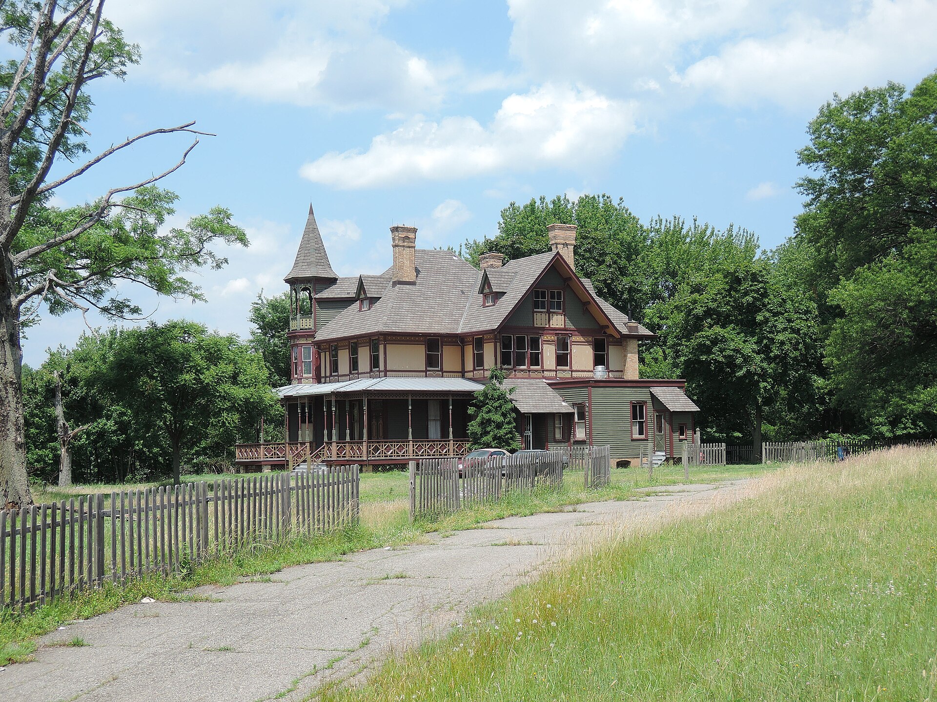
Kreischer House Uncut, Tottenville-Charleston You checked the neighborhood.Now check an address ! Photo: Jim.henderson, CC0 · Wikimedia Commons

For $34.00 a CrimesLog™ Home Report provides: (where available)

  • Nearest 6 Pre-school Nurseries to Address
  • Nearest 6 Primary Schools to Address
  • Nearest 6 Secondary/High Schools to Address
  • Nearest College and University to Address
  • Nearest to Address Medical Clinics, Hospitals and Pharmacies
  • Nearest 2 Police Station details to Address

The Home Report also provides

  • The CrimesLog™ Home Score is a proprietary Home Safety Measure capturing crime frequency, severity, recency and proximity to Address from police crime reporting point
  • A map indicating police anonymized crime reporting points around Address
  • Crime category trendlines for Address neighborhood
  • List of Reported Crime Incidents around Address radius
  • Downloadable PDF report — A Permanent Copy to Keep and Share to aid your Property Research
  • Our crimes database of almost 60 million records is UPDATED EVERY MONTH from US, UK, CA police sources
Woodrow U Meth Ch Huguenot, Arden Heights-Rossville
Arden Heights-Rossville · Woodrow U Meth Ch Huguenot
Photo: Jim.henderson, Public domain · Wikimedia Commons
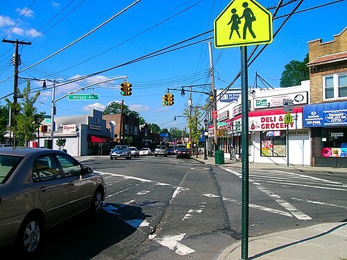
Downtown Great Kills, Great Kills-Eltingville
Great Kills-Eltingville · Downtown Great Kills
Photo: Mikeaigotti89, CC BY 3.0 · Wikimedia Commons
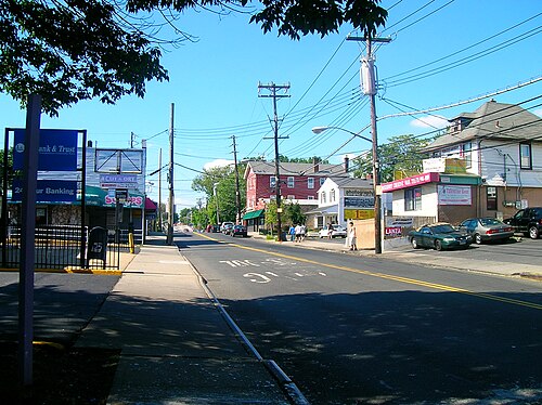
Huguenot Town, Annadale-Huguenot-Prince's Bay-Woodrow
Annadale-Huguenot-Prince's Bay-Woodrow · Huguenot Town
Photo: Mikeaigotti89, CC BY 3.0 · Wikimedia Commons
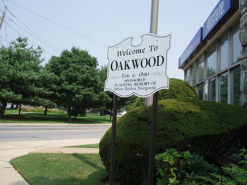
Oakwood, Staten Island, New York, Oakwood-Richmondtown
Oakwood-Richmondtown · Oakwood, Staten Island, New York
Photo: TGoodman at English Wikipedia, Public domain · Wikimedia Commons
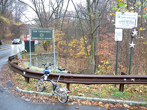
Richmond Creek Bluebelt, Todt Hill-Emerson Hill-Lighthouse Hill-Manor Heights
Todt Hill-Emerson Hill-Lighthouse Hill-Manor Heights · Richmond Creek Bluebelt
Photo: Jim.henderson, CC0 · Wikimedia Commons
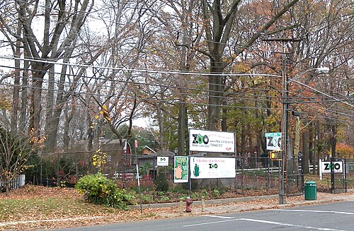
SI Zoo Martling, Westerleigh-Castleton Corners
Westerleigh-Castleton Corners · SI Zoo Martling
Photo: Jim.henderson, CC0 · Wikimedia Commons
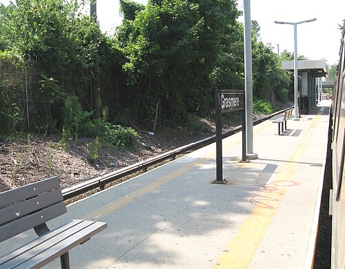
Grassmere Staten Island Railway, Grasmere-Arrochar-South Beach-Dongan Hills
Grasmere-Arrochar-South Beach-Dongan Hills · Grassmere Staten Island Railway
Photo: Jim.henderson, Public domain · Wikimedia Commons
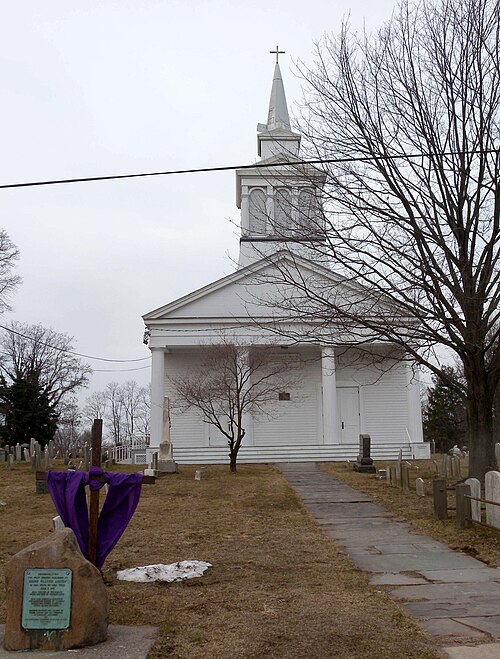
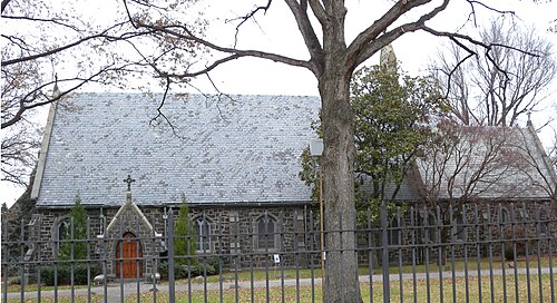
St. Mary's Episcopal Church, Castleton, Staten Island, West New Brighton-Silver Lake-Grymes Hill
West New Brighton-Silver Lake-Grymes Hill · St. Mary's Episcopal Church, Castleton, Staten Island
Photo: Jim.henderson, CC0 · Wikimedia Commons

How neighborhoods moved each quarter

2022

Whole-area crime rate 9.6 to 12.1 per 1,000 (high: Q3 2022).

Big moves (4+ places in a quarter): moved down Fort Wadsworth 1st→5th (Q4)

2023

Whole-area crime rate 11.5 to 12.6 per 1,000 (high: Q2 2023).

Big moves (4+ places in a quarter): moved up Fort Wadsworth 5th→1st (Q1)

2024

Whole-area crime rate 11.4 to 12.4 per 1,000 (high: Q2 2024).

Big moves (4+ places in a quarter): moved up Arden Heights-Rossville 5th→1st (Q3) moved down Fort Wadsworth 1st→5th (Q3)

2025

Whole-area crime rate 10.6 to 12.6 per 1,000 (high: Q2 2025).

Big moves (4+ places in a quarter): moved down Fort Wadsworth 6th→13th (Q1) moved up Fort Wadsworth 15th→8th (Q3) moved down Fort Wadsworth 8th→15th (Q4)

2026

Whole-area crime rate 9.8 to 10.5 per 1,000 (high: Q2 2026). 2 quarters so far.

No neighborhood moved more than three places in a quarter.

Reported Safety Incidents

In Q2 2026: public order incidents were 44% (2,307), property incidents were 20% (1,042), violent incidents were 18% (951) and vehicle crimes were 10% (528).

Recorded crime here is grouped into violent crime, property crime (burglary and theft), vehicle crime and public order offences, so you can compare how safe each neighborhood is for the kind of crime that matters to you.

Read category comparisons with care. A category that jumps while the total hardly moves looks like a change in how offences are classified, not in what happened: Q1 2026: violent down 55% while the total moved 8%. The whole-area rate is the steadier guide.

Places we left out, and places to read with care

Left out: Freshkills Park (North); Freshkills Park (South); Great Kills Park; Hoffman & Swinburne Islands; Miller Field; Snug Harbor. They have almost no residents: their crimes are against visitors, so a rate per resident says little about living there.

Fort Wadsworth is a former Army fort with only about 450 residents (49.0 per 1,000 from 22 crimes among 449 residents), so it is not named as the lowest or highest.

The 17 neighborhoods on the map

Staten Island is made of 17 neighborhoods compared here, each in its own colour on the map. They are the City Planning “Neighborhood Tabulation Areas”: 494,772 residents between them.

  • Annadale-Huguenot-Prince's Bay-Woodrow
  • Arden Heights-Rossville
  • Fort Wadsworth
  • Grasmere-Arrochar-South Beach-Dongan Hills
  • Great Kills-Eltingville
  • Mariner's Harbor-Arlington-Graniteville
  • New Dorp-Midland Beach
  • New Springville-Willowbrook-Bulls Head-Travis
  • Oakwood-Richmondtown
  • Port Richmond
  • Rosebank-Shore Acres-Park Hill
  • St. George-New Brighton
  • Todt Hill-Emerson Hill-Lighthouse Hill-Manor Heights
  • Tompkinsville-Stapleton-Clifton-Fox Hills
  • Tottenville-Charleston
  • West New Brighton-Silver Lake-Grymes Hill
  • Westerleigh-Castleton Corners

All 17 neighborhoods, Q2 2026

Crimes per 1,000 residents, Q2 2026, lowest first. The last two columns compare with Q1 2022.
#NeighborhoodResidentsAllViolentPropertyVehiclePublic orderRate vs Q1 2022Places gained
1Arden Heights-Rossville31,8244.20.80.90.31.8up10%up1
2Great Kills-Eltingville58,2534.70.61.20.32.3up15%up1
3Annadale-Huguenot-Prince's Bay-Woodrow42,1595.60.81.70.42.2down1%up1
4Oakwood-Richmondtown21,1546.20.51.80.23.4down14%up2
5New Springville-Willowbrook-Bulls Head-Travis42,6016.71.21.90.82.4down26%up4
6Todt Hill-Emerson Hill-Lighthouse Hill-Manor Heights33,9107.00.91.60.83.5up15%down1
7Westerleigh-Castleton Corners31,5427.21.21.50.83.3down17%up1
8Grasmere-Arrochar-South Beach-Dongan Hills35,37210.31.62.10.75.0up20%down1
9New Dorp-Midland Beach29,10310.72.41.80.75.2up5%up3
10West New Brighton-Silver Lake-Grymes Hill35,95710.81.82.11.64.5up9%–
11Tottenville-Charleston17,42511.82.22.70.65.7up18%–
12Rosebank-Shore Acres-Park Hill23,02712.02.41.91.95.1down2%up1
13Mariner's Harbor-Arlington-Graniteville32,24016.33.33.10.97.4up1%up1
14Port Richmond20,57722.14.74.11.910.1up34%up1
15St. George-New Brighton21,00927.67.24.41.812.6up25%up1
16Tompkinsville-Stapleton-Clifton-Fox Hills18,17029.74.64.36.411.6up28%up1
17Fort Wadsworth †44949.00.06.728.94.5upInfinity%down16

† Fort Wadsworth is a former Army fort with only about 450 residents. A rate on a very small number of residents or crimes is not comparable with the others.

Photographs

83 photographs of the 17 neighborhoods run along the reel; click one to see it full size. Each is credited here and under the large view.

All 83 photographs and their credits
  1. Arden Heights-Rossville · Woodrow U Meth Ch Huguenot. Photo: Jim.henderson, Public domain · Wikimedia Commons
  2. Great Kills-Eltingville · Downtown Great Kills. Photo: Mikeaigotti89, CC BY 3.0 · Wikimedia Commons
  3. Annadale-Huguenot-Prince's Bay-Woodrow · Huguenot Town. Photo: Mikeaigotti89, CC BY 3.0 · Wikimedia Commons
  4. Oakwood-Richmondtown · Oakwood, Staten Island, New York. Photo: TGoodman at English Wikipedia, Public domain · Wikimedia Commons
  5. Todt Hill-Emerson Hill-Lighthouse Hill-Manor Heights · Richmond Creek Bluebelt. Photo: Jim.henderson, CC0 · Wikimedia Commons
  6. Westerleigh-Castleton Corners · SI Zoo Martling. Photo: Jim.henderson, CC0 · Wikimedia Commons
  7. Grasmere-Arrochar-South Beach-Dongan Hills · Grassmere Staten Island Railway. Photo: Jim.henderson, Public domain · Wikimedia Commons
  8. West New Brighton-Silver Lake-Grymes Hill · St. Mary's Episcopal Church, Castleton, Staten Island. Photo: Jim.henderson, CC0 · Wikimedia Commons
  9. Tottenville-Charleston · Kreischer House Uncut. Photo: Jim.henderson, CC0 · Wikimedia Commons
  10. Rosebank-Shore Acres-Park Hill · Meucci Monument Staten Island. Photo: Jim.henderson, CC0 · Wikimedia Commons
  11. Mariner's Harbor-Arlington-Graniteville · Mariners Harbor Houses. Photo: Jim.henderson, CC BY 4.0 · Wikimedia Commons
  12. Port Richmond · Castleton Bus Depot. Photo: Jim.henderson, Public domain · Wikimedia Commons
  13. St. George-New Brighton · Staten Island Boro Hall Hyatt Street. Photo: Jim.henderson, Public domain · Wikimedia Commons
  14. Tompkinsville-Stapleton-Clifton-Fox Hills · Hungerford PS721 155 Tompkins Avenue. Photo: Jim.henderson, CC0 · Wikimedia Commons
  15. Freshkills Park (South) · Freshkills Park in Staten Island, New York. Photo: Jonathan Warren, CC0 · Wikimedia Commons
  16. Miller Field · Miller Field SI. Photo: Jim.henderson, Public domain · Wikimedia Commons
  17. Snug Harbor · Snug Harbor Gazebo Plaque. Photo: Jim.henderson, CC0 · Wikimedia Commons
  18. Great Kills-Eltingville · Eltingville Staten Island Railway. Photo: Jim.henderson, Public domain · Wikimedia Commons
  19. Annadale-Huguenot-Prince's Bay-Woodrow · Wolfes Pond. Photo: Jim.henderson, Public domain · Wikimedia Commons
  20. Todt Hill-Emerson Hill-Lighthouse Hill-Manor Heights · Seaview Hospital 5. Photo: H.L.I.T., CC BY 2.0 · Wikimedia Commons
  21. Westerleigh-Castleton Corners · Staten Island Armory Midday. Photo: Jim.henderson, CC0 · Wikimedia Commons
  22. Grasmere-Arrochar-South Beach-Dongan Hills · Old Town SI Welcome. Photo: Jim.henderson, CC0 · Wikimedia Commons
  23. West New Brighton-Silver Lake-Grymes Hill · Haven Esplanade St SI 2021. Photo: Jim.henderson, CC BY 4.0 · Wikimedia Commons
  24. Rosebank-Shore Acres-Park Hill · Firehouse Tompkins Hylan. Photo: Jim.henderson, CC0 · Wikimedia Commons
  25. Mariner's Harbor-Arlington-Graniteville · Warehouse. Photo: H.L.I.T., CC BY 2.0 · Wikimedia Commons
  26. Port Richmond · SI CYO Park Anderson Avenue. Photo: Jim.henderson, Public domain · Wikimedia Commons
  27. St. George-New Brighton · Brighton Heights Reformed Ch SI. Photo: Jim.henderson, Public domain · Wikimedia Commons
  28. Tompkinsville-Stapleton-Clifton-Fox Hills · Tappen Park. Photo: Mikeaigotti89, CC BY 3.0 · Wikimedia Commons
  29. Snug Harbor · Snug Harbor Gazebo NW. Photo: Jim.henderson, CC0 · Wikimedia Commons
  30. Great Kills-Eltingville · Great Kills Vet Mem. Photo: Jim.henderson, Public domain · Wikimedia Commons
  31. Annadale-Huguenot-Prince's Bay-Woodrow · Lemon Creek SI. Photo: Jim.henderson, Public domain · Wikimedia Commons
  32. Todt Hill-Emerson Hill-Lighthouse Hill-Manor Heights · Saint Rita Roman Catholic Church Staten Island. Photo: Jim.henderson, CC0 · Wikimedia Commons
  33. Westerleigh-Castleton Corners · Holy Family Roman Catholic Church Staten Island. Photo: Jim.henderson, CC0 · Wikimedia Commons
  34. Rosebank-Shore Acres-Park Hill · Rosebank SI Pigeon Coop. Photo: Jim.henderson, CC0 · Wikimedia Commons
  35. Port Richmond · Bodine Creek. Photo: Lmenon06, Public domain · Wikimedia Commons
  36. St. George-New Brighton · Curtis High Sch SI. Photo: Jim.henderson, Public domain · Wikimedia Commons
  37. Tompkinsville-Stapleton-Clifton-Fox Hills · Stapelton Houses Staten Island 03 2008. Photo: T L Miles, Public domain · Wikimedia Commons
  38. Snug Harbor · Snug Harbor Gazebo West. Photo: Jim.henderson, CC0 · Wikimedia Commons
  39. Great Kills-Eltingville · Great Kills PO. Photo: Jim.henderson, Public domain · Wikimedia Commons
  40. Annadale-Huguenot-Prince's Bay-Woodrow · Princess Bay Boatmens Assoc. Photo: Jim.henderson, Public domain · Wikimedia Commons
  41. Rosebank-Shore Acres-Park Hill · Hylan Boulevard East End. Photo: Jim.henderson, CC0 · Wikimedia Commons
  42. Port Richmond · Staten Island Rapid Transit Port Richmond Park Avenue. Photo: Jim.henderson, CC0 · Wikimedia Commons
  43. St. George-New Brighton · StPeters. Photo: Lr2368, Public domain · Wikimedia Commons
  44. Tompkinsville-Stapleton-Clifton-Fox Hills · John Bap de la Salle Roman Catholic Church. Photo: Jim.henderson, CC0 · Wikimedia Commons
  45. Great Kills-Eltingville · Great Kills Station HS. Photo: Jim.henderson, Public domain · Wikimedia Commons
  46. Annadale-Huguenot-Prince's Bay-Woodrow · SIUH South. Photo: Jim.henderson, Public domain · Wikimedia Commons
  47. Rosebank-Shore Acres-Park Hill · ICP Fabozzi HQ Hylan Boulevard. Photo: Jim.henderson, CC0 · Wikimedia Commons
  48. Port Richmond · Bayonne Bridge from Nicholas Avenue Overpass. Photo: Jim.henderson, CC0 · Wikimedia Commons
  49. St. George-New Brighton · Christ Church New Brighton. Photo: Jim.henderson, CC0 · Wikimedia Commons
  50. Tompkinsville-Stapleton-Clifton-Fox Hills · SI Savings Bank Water St. Photo: Jim.henderson, CC0 · Wikimedia Commons
  51. Great Kills-Eltingville · Great Kills NYPL. Photo: Jim.henderson, Public domain · Wikimedia Commons
  52. Annadale-Huguenot-Prince's Bay-Woodrow · Pleasant Plains Staten Island Railway. Photo: Jim.henderson, Public domain · Wikimedia Commons
  53. Rosebank-Shore Acres-Park Hill · Buono Beach Fountain SI. Photo: Jim.henderson, CC0 · Wikimedia Commons
  54. Port Richmond · Port Richmond DRC. Photo: Jim.henderson, CC0 · Wikimedia Commons
  55. St. George-New Brighton · Peters Girls HS Richmond Terrace. Photo: Jim.henderson, CC0 · Wikimedia Commons
  56. Tompkinsville-Stapleton-Clifton-Fox Hills · Edgewater Village Hall Plaque. Photo: Jim.henderson, CC0 · Wikimedia Commons
  57. Great Kills-Eltingville · Michael-Mena Coptic Ch. Photo: Jim.henderson, CC0 · Wikimedia Commons
  58. Annadale-Huguenot-Prince's Bay-Woodrow · Princes Bay Staten Island Railway. Photo: MyName (Jim.henderson (talk)), Public domain · Wikimedia Commons
  59. Port Richmond · Port Richmond S59 and NYPD Tower. Photo: Jim.henderson, CC0 · Wikimedia Commons
  60. St. George-New Brighton · Christ Church New Brighton Back Sunny. Photo: Jim.henderson, CC0 · Wikimedia Commons
  61. Tompkinsville-Stapleton-Clifton-Fox Hills · Stapleton NYPL. Photo: Jim.henderson, CC0 · Wikimedia Commons
  62. Annadale-Huguenot-Prince's Bay-Woodrow · Lemon Creek Park. Photo: Jim.henderson, Public domain · Wikimedia Commons
  63. Port Richmond · Port Richmond Police Cars. Photo: Jim.henderson, CC0 · Wikimedia Commons
  64. St. George-New Brighton · Mt Sinai United Christian Church 15 Pike St in 2021. Photo: Jim.henderson, CC BY 4.0 · Wikimedia Commons
  65. Tompkinsville-Stapleton-Clifton-Fox Hills · Stapleton NYCHA. Photo: Jim.henderson, CC0 · Wikimedia Commons
  66. Annadale-Huguenot-Prince's Bay-Woodrow · Sandy Creek Drumgoole. Photo: Jim.henderson, Public domain · Wikimedia Commons
  67. Port Richmond · Temple Emanu-El Port Richmond. Photo: Jim.henderson, CC0 · Wikimedia Commons
  68. St. George-New Brighton · Tompkinsville Theatre 2021. Photo: Jim.henderson, CC BY 4.0 · Wikimedia Commons
  69. Tompkinsville-Stapleton-Clifton-Fox Hills · Vanderbilt School SI. Photo: Jim.henderson, CC0 · Wikimedia Commons
  70. Annadale-Huguenot-Prince's Bay-Woodrow · VZ SI South Alvine Avenue. Photo: Jim.henderson, Public domain · Wikimedia Commons
  71. Port Richmond · Port Richmond Square. Photo: TGoodman at English Wikipedia, Public domain · Wikimedia Commons
  72. Tompkinsville-Stapleton-Clifton-Fox Hills · Elizabeth Ann HC N Rehab. Photo: Jim.henderson, CC0 · Wikimedia Commons
  73. Annadale-Huguenot-Prince's Bay-Woodrow · Huguenot NYPL. Photo: Jim.henderson, Public domain · Wikimedia Commons
  74. Port Richmond · Port Richmond DRC Sunny E. Photo: Jim.henderson, CC0 · Wikimedia Commons
  75. Tompkinsville-Stapleton-Clifton-Fox Hills · NYPL Canal St Stapleton. Photo: Jim.henderson, CC0 · Wikimedia Commons
  76. Annadale-Huguenot-Prince's Bay-Woodrow · Huguenot SI SB Hi. Photo: Jim.henderson, Public domain · Wikimedia Commons
  77. Port Richmond · Port Richmond RDC Square Sun. Photo: Jim.henderson, CC0 · Wikimedia Commons
  78. Tompkinsville-Stapleton-Clifton-Fox Hills · Salvation Army Stapleton 15 Broad St. Photo: Jim.henderson, CC0 · Wikimedia Commons
  79. Annadale-Huguenot-Prince's Bay-Woodrow · Annadale Staten Island Railway. Photo: Jim.henderson, Public domain · Wikimedia Commons
  80. Port Richmond · Port Richmond RDC Rotunda Sun. Photo: Jim.henderson, CC0 · Wikimedia Commons
  81. Tompkinsville-Stapleton-Clifton-Fox Hills · Marine Hospital, Staten Island. Photo: NIAID, CC BY 2.0 · Wikimedia Commons
  82. Port Richmond · Park Baptist Vreeland St Port Richmond. Photo: Jim.henderson, CC0 · Wikimedia Commons
  83. Port Richmond · Philips Baptist Bennett St Port Richmond. Photo: Jim.henderson, CC0 · Wikimedia Commons

Sources and notes

CrimesLog sources crime incident data published by the New York City Police Department (NYPD) through the NYC Open Data Portal, containing public sector information governed by the NYC Open Data Law (Local Law 11 of 2012) and the NYC.gov Terms of Use.

Population: U.S. Census Bureau, American Community Survey 5-year estimates (public domain).

First-place medal: 1st Place Medal emoji icon by Icons8.

Neighborhood boundaries are defined by NYC Department of City Planning, 2020 Neighborhood Tabulation Areas (NYC Open Data), merged and simplified by CrimesLog. The photographs are credited under each picture.

Rates are recorded crimes per 1,000 residents, quarter by quarter; where a neighborhood has fewer than 100 residents the rate would be worked out on 100 (those places are left out of the race). A count of recorded crime is not a verdict on any neighborhood.