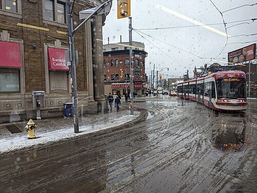
Toronto, Ontario · Neighborhood crime trends

Old Toronto

50 neighborhoods - a quarterly race to the lowest crime rate.

Crime Trends: Neighborhoods compared - each quarter from Q1 2022

Toronto as a whole averaged 3.3 crimes for every 1,000 residents per quarter in Q2 2026, while Old Toronto averaged 3.9, hence it is generally less safe when all crimes are considered.

How do the 50 neighborhoods of Old Toronto compare? In Q2 2026 the police recorded 3,268 crimes across them, 3.9 for every 1,000 residents. That is 0.6% above a year earlier and 16.2% above Q1 2022, the first quarter we track.

Forest Hill South has the lowest rate of the everyday neighborhoods (0.8 per 1,000), followed by Yonge-St.Clair (1.2) and Lawrence Park North (1.2). Yonge-Bay Corridor has the highest (10.7).

Use the RACE CHARTS below to watch all 50 OLD TORONTO NEIGHBORHOODs race across 18 quarter periods from Q1 2022 to Q2 2026 - one crime category at a time or all together. The race chart can be used to compare average crime rates by category against Toronto's average.

Neighborhood boundaries are defined by the City of Toronto (Open Government Licence – Toronto) and simplified by CrimesLog.
Lowest rate (everyday)
lowest rateForest Hill South
0.8 crimes per 1,000 residents, Q2 2026
Highest rate
upYonge-Bay Corridor
10.7 per 1,000, Q2 2026
Whole area, Q2 2026
3.9 per 1,000
up 0.6% above a year earlier · up 16.2% above Q1 2022
Compared
50 neighborhoods
838,206 residents · 18 quarters

Old Toronto neighborhood quarterly crime race

Press ▶︎ to watch Q1 2022 to Q2 2026. Tick one crime category or several; hover a bar for the neighborhood. Property crimes includes burglaries and thefts.

Crime categories
Indicated: crimes rate per 1000 residents per quarterAll · safest at the top · square-root scale · Q1 2022 to Q2 2026015103.6Annex1.8Bay-Cloverhill2.7Blake-Jones6.7Cabbagetown-South St.James Town1.9Casa Loma3.2Church-Wellesley2.0Corso Italia-Davenport2.8Danforth1.7Dovercourt Village11.1Downtown Yonge East2.8Dufferin Grove3.6East End-Danforth1.1Forest Hill North1.7Forest Hill South2.6Fort York-Liberty Village4.0Greenwood-Coxwell3.2Harbourfront-CityPlace1.9High Park North2.7High Park-Swansea3.4Junction Area1.4Junction-Wallace Emerson5.1Kensington-Chinatown1.6Lawrence Park North1.7Lawrence Park South1.9Little Portugal6.7Moss Park2.5Mount Pleasant East3.3North Riverdale3.0North St.James Town2.9North Toronto3.3Palmerston-Little Italy2.2Playter Estates-Danforth2.5Regent Park2.4Roncesvalles5.0Rosedale-Moore Park2.3South Eglinton-Davisville3.7South Parkdale3.2South Riverdale4.2St Lawrence-East Bayfront-The Islands2.5The Beaches3.2Trinity-Bellwoods5.8University5.6Wellington Place2.5West Queen West2.7Weston-Pelham Park2.5Woodbine Corridor2.8Wychwood8.4Yonge-Bay Corridor2.2Yonge-Eglinton1.8Yonge-St.ClairToronto Q2 2026 average all crimes (3.3)Numbers are crimes per 1,000 residents per quarter. Zero-crime quarters show 0 and rank safest.
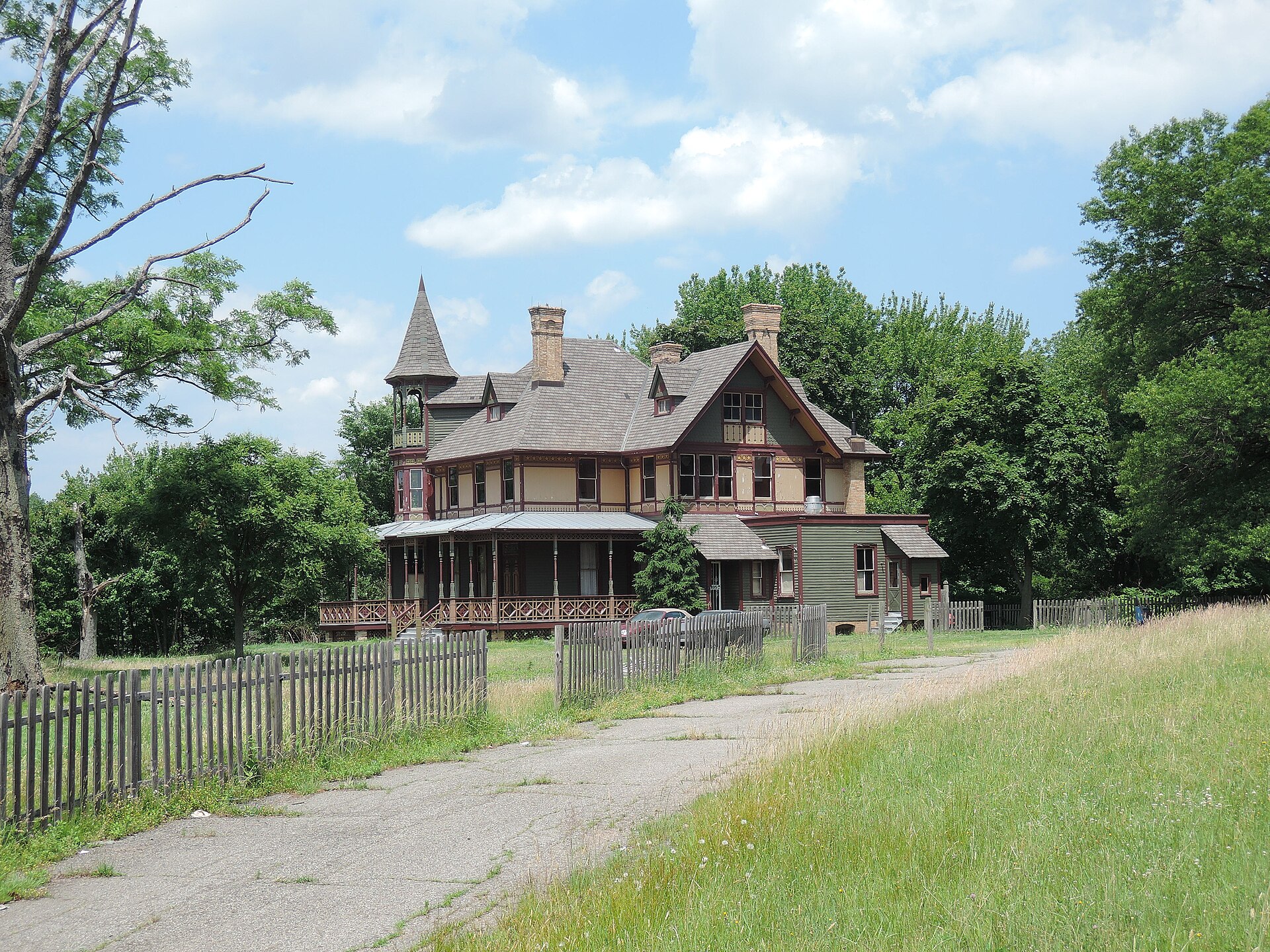
Kreischer House Uncut, Tottenville-Charleston You checked the neighborhood.Now check an address ! Photo: Jim.henderson, CC0 · Wikimedia Commons

For C$40.00 a CrimesLog™ Home Report provides: (where available)

  • Nearest 6 Pre-school Nurseries to Address
  • Nearest 6 Primary Schools to Address
  • Nearest 6 Secondary/High Schools to Address
  • Nearest College and University to Address
  • Nearest to Address Medical Clinics, Hospitals and Pharmacies
  • Nearest 2 Police Station details to Address

The Home Report also provides

  • The CrimesLog™ Home Score is a proprietary Home Safety Measure capturing crime frequency, severity, recency and proximity to Address from police crime reporting point
  • A map indicating police anonymized crime reporting points around Address
  • Crime category trendlines for Address neighborhood
  • List of Reported Crime Incidents around Address radius
  • Downloadable PDF report — A Permanent Copy to Keep and Share to aid your Property Research
  • Our crimes database of almost 60 million records is UPDATED EVERY MONTH from US, UK, CA police sources
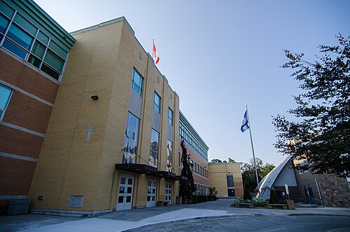
St. Michael's College School, Forest Hill South
Forest Hill South · St. Michael's College School
Photo: Jeff Hitchcock, CC BY 2.0 · Wikimedia Commons
Yonge St Between St Clair and Davisville Avenue, Yonge-St.Clair
Yonge-St.Clair · Yonge St Between St Clair and Davisville Avenue
Photo: Vladislav Litvinov, CC0 · Wikimedia Commons
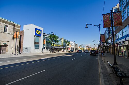
Yonge Street (Between Roselawn & Broadway), North Toronto
North Toronto · Yonge Street (Between Roselawn & Broadway)
Photo: Jeff Hitchcock from Seattle, WA, USA, CC BY 2.0 · Wikimedia Commons
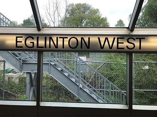
Eglinton West Station’s Original Name, Forest Hill North
Forest Hill North · Eglinton West Station’s Original Name
Photo: AmaMcG, CC0 · Wikimedia Commons
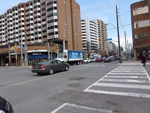
Intersection of Bayview and Eglinton, 2023 04 28, Mount Pleasant East
Mount Pleasant East · Intersection of Bayview and Eglinton, 2023 04 28
Photo: Geo Swan from Toronto, Canada, CC0 · Wikimedia Commons
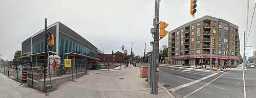
Parts of Panoramas of Intersections Where There Will be Eglinton Crosstown LRT Stations, GPS Embedded, Taken 2013 04 25, South Eglinton-Davisville
South Eglinton-Davisville · Parts of Panoramas of Intersections Where There Will be Eglinton Crosstown LRT Stations, GPS Embedded, Taken 2013 04 25
Photo: booledozer, Public domain · Wikimedia Commons
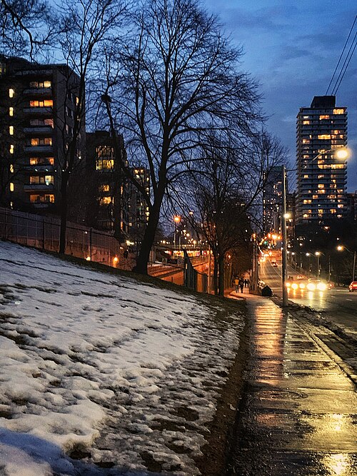
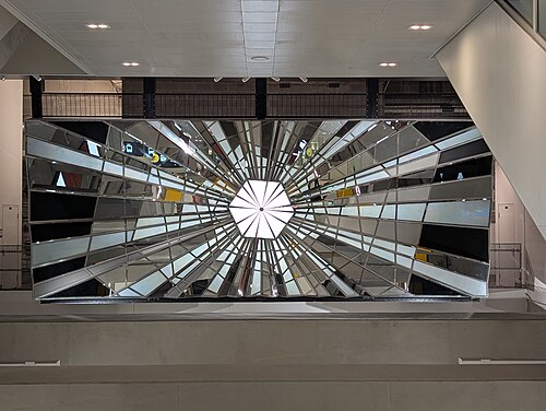
Light from Within at Eglinton Station, Yonge-Eglinton
Yonge-Eglinton · Light from Within at Eglinton Station
Photo: HardDaysNightOwl, CC0 · Wikimedia Commons
Intersection of Broadview and Danforth, 2022 11 15, Playter Estates-Danforth
Playter Estates-Danforth · Intersection of Broadview and Danforth, 2022 11 15
Photo: Geo Swan from Toronto, Canada, CC0 · Wikimedia Commons

How neighborhoods moved each quarter

2022

Whole-area crime rate 3.4 to 4.1 per 1,000 (high: Q3 2022).

Big moves (4+ places in a quarter): moved up Yonge-St.Clair 8th→1st (Q2) moved up Bay-Cloverhill 7th→2nd (Q2) moved up North Toronto 29th→6th (Q2) moved down Forest Hill North 1st→7th (Q2) moved up Yonge-Eglinton 13th→8th (Q2) moved up Fort York-Liberty Village 22nd→9th (Q2) moved up North St.James Town 30th→11th (Q2) moved up Blake-Jones 24th→13th (Q2) moved up Mount Pleasant East 20th→14th (Q2) moved down Forest Hill South 5th→15th (Q2) moved up Danforth 27th→17th (Q2) moved down Corso Italia-Davenport 12th→18th (Q2) moved down High Park North 9th→19th (Q2) moved up Wychwood 28th→21st (Q2) moved down Lawrence Park South 6th→23rd (Q2) moved down Playter Estates-Danforth 14th→24th (Q2) moved down Woodbine Corridor 21st→25th (Q2) moved up East End-Danforth 38th→26th (Q2) moved down Roncesvalles 16th→27th (Q2) moved up Trinity-Bellwoods 33rd→28th (Q2) moved down West Queen West 18th→29th (Q2) moved up Junction Area 37th→31st (Q2) moved down The Beaches 17th→32nd (Q2) moved up Greenwood-Coxwell 41st→34th (Q2) moved up Annex 39th→35th (Q2) moved up St Lawrence-East Bayfront-The Islands 42nd→36th (Q2) moved down South Riverdale 32nd→37th (Q2) moved up Rosedale-Moore Park 43rd→39th (Q2) moved down Weston-Pelham Park 25th→40th (Q2) moved down Dufferin Grove 26th→41st (Q2) moved down Church-Wellesley 34th→42nd (Q2) moved down North Riverdale 35th→43rd (Q2) moved up Blake-Jones 13th→1st (Q3) moved up South Eglinton-Davisville 16th→3rd (Q3) moved up High Park North 19th→4th (Q3) moved up Mount Pleasant East 14th→6th (Q3) moved down Bay-Cloverhill 2nd→7th (Q3) moved up Forest Hill South 15th→8th (Q3) moved up Lawrence Park South 23rd→9th (Q3) moved down Junction-Wallace Emerson 5th→11th (Q3) moved down Dovercourt Village 3rd→12th (Q3) moved up The Beaches 32nd→14th (Q3) moved up Wychwood 21st→15th (Q3) moved down North Toronto 6th→16th (Q3) moved up High Park-Swansea 22nd→17th (Q3) moved down Lawrence Park North 4th→18th (Q3) moved down Yonge-Eglinton 8th→19th (Q3) moved up Woodbine Corridor 25th→20th (Q3) moved up Weston-Pelham Park 40th→21st (Q3) moved up Roncesvalles 27th→22nd (Q3) moved down Danforth 17th→23rd (Q3) moved down North St.James Town 11th→24th (Q3) moved down Fort York-Liberty Village 9th→25th (Q3) moved up North Riverdale 43rd→26th (Q3) moved down Corso Italia-Davenport 18th→31st (Q3) moved up Dufferin Grove 41st→32nd (Q3) moved down East End-Danforth 26th→34th (Q3) moved down Regent Park 20th→36th (Q3) moved down Palmerston-Little Italy 33rd→37th (Q3) moved down West Queen West 29th→40th (Q3) moved down Greenwood-Coxwell 34th→41st (Q3) moved down St Lawrence-East Bayfront-The Islands 36th→43rd (Q3) moved up University 49th→44th (Q3) moved down Cabbagetown-South St.James Town 45th→49th (Q3) moved up Fort York-Liberty Village 25th→1st (Q4) moved up North Toronto 16th→4th (Q4) moved up Yonge-Eglinton 19th→7th (Q4) moved up Little Portugal 13th→8th (Q4) moved up High Park-Swansea 17th→10th (Q4) moved up Regent Park 36th→12th (Q4) moved down Mount Pleasant East 6th→15th (Q4) moved up North St.James Town 24th→17th (Q4) moved down Junction-Wallace Emerson 11th→18th (Q4) moved down Blake-Jones 1st→19th (Q4) moved up Trinity-Bellwoods 30th→21st (Q4) moved up Palmerston-Little Italy 37th→23rd (Q4) moved down Woodbine Corridor 20th→24th (Q4) moved up South Riverdale 35th→25th (Q4) moved up Corso Italia-Davenport 31st→27th (Q4) moved down Casa Loma 10th→28th (Q4) moved down Forest Hill South 8th→29th (Q4) moved up West Queen West 40th→30th (Q4) moved down Danforth 23rd→33rd (Q4) moved up South Parkdale 38th→34th (Q4) moved down Lawrence Park South 9th→36th (Q4) moved down North Riverdale 26th→39th (Q4) moved down Playter Estates-Danforth 27th→41st (Q4)

2023

Whole-area crime rate 3.8 to 4.5 per 1,000 (high: Q3 2023).

Big moves (4+ places in a quarter): moved up Dovercourt Village 13th→1st (Q1) moved up Bay-Cloverhill 9th→3rd (Q1) moved up Blake-Jones 19th→4th (Q1) moved up Palmerston-Little Italy 23rd→6th (Q1) moved down South Eglinton-Davisville 3rd→7th (Q1) moved down North Toronto 4th→9th (Q1) moved up Junction-Wallace Emerson 18th→12th (Q1) moved up Roncesvalles 20th→13th (Q1) moved down High Park-Swansea 10th→14th (Q1) moved up Casa Loma 28th→17th (Q1) moved down Forest Hill North 6th→18th (Q1) moved down High Park North 5th→20th (Q1) moved up Forest Hill South 29th→21st (Q1) moved down Little Portugal 8th→22nd (Q1) moved up West Queen West 30th→23rd (Q1) moved down Lawrence Park North 16th→24th (Q1) moved up Playter Estates-Danforth 41st→28th (Q1) moved up Danforth 33rd→29th (Q1) moved down Regent Park 12th→31st (Q1) moved up East End-Danforth 37th→32nd (Q1) moved up Greenwood-Coxwell 38th→33rd (Q1) moved down Junction Area 26th→38th (Q1) moved down South Riverdale 25th→39th (Q1) moved down South Parkdale 34th→40th (Q1) moved up Lawrence Park North 24th→3rd (Q2) moved up Mount Pleasant East 16th→5th (Q2) moved up High Park North 20th→6th (Q2) moved up Wychwood 11th→7th (Q2) moved up Little Portugal 22nd→10th (Q2) moved down Dovercourt Village 1st→11th (Q2) moved down Fort York-Liberty Village 2nd→14th (Q2) moved up Danforth 29th→15th (Q2) moved down Yonge-Eglinton 10th→16th (Q2) moved up Junction Area 38th→18th (Q2) moved up West Queen West 23rd→19th (Q2) moved down Blake-Jones 4th→20th (Q2) moved up East End-Danforth 32nd→22nd (Q2) moved up Playter Estates-Danforth 28th→23rd (Q2) moved down North St.James Town 15th→25th (Q2) moved down Roncesvalles 13th→26th (Q2) moved down Trinity-Bellwoods 19th→28th (Q2) moved down Palmerston-Little Italy 6th→30th (Q2) moved down Forest Hill South 21st→32nd (Q2) moved up St Lawrence-East Bayfront-The Islands 41st→34th (Q2) moved down Harbourfront-CityPlace 30th→38th (Q2) moved down Dufferin Grove 35th→42nd (Q2) moved up Yonge-Eglinton 16th→2nd (Q3) moved up Forest Hill North 21st→4th (Q3) moved up North Toronto 12th→5th (Q3) moved down Lawrence Park North 3rd→7th (Q3) moved down Yonge-St.Clair 2nd→8th (Q3) moved up High Park-Swansea 13th→9th (Q3) moved up Blake-Jones 20th→13th (Q3) moved up Woodbine Corridor 29th→14th (Q3) moved up Lawrence Park South 36th→15th (Q3) moved down Wychwood 7th→16th (Q3) moved down High Park North 6th→17th (Q3) moved up Trinity-Bellwoods 28th→18th (Q3) moved down Danforth 15th→20th (Q3) moved down Junction-Wallace Emerson 9th→21st (Q3) moved up Greenwood-Coxwell 31st→22nd (Q3) moved up North Riverdale 39th→24th (Q3) moved down Casa Loma 17th→25th (Q3) moved up Annex 35th→28th (Q3) moved down Fort York-Liberty Village 14th→29th (Q3) moved down West Queen West 19th→30th (Q3) moved up Harbourfront-CityPlace 38th→31st (Q3) moved down Junction Area 18th→32nd (Q3) moved down Corso Italia-Davenport 27th→33rd (Q3) moved down Forest Hill South 32nd→36th (Q3) moved down Regent Park 33rd→37th (Q3) moved up Rosedale-Moore Park 43rd→38th (Q3) moved down Palmerston-Little Italy 30th→39th (Q3) moved down Weston-Pelham Park 24th→40th (Q3) moved up Lawrence Park North 7th→2nd (Q4) moved up Little Portugal 10th→4th (Q4) moved down South Eglinton-Davisville 1st→5th (Q4) moved up Fort York-Liberty Village 29th→8th (Q4) moved up Woodbine Corridor 14th→10th (Q4) moved up Lawrence Park South 15th→11th (Q4) moved down Yonge-Eglinton 2nd→12th (Q4) moved up Playter Estates-Danforth 23rd→13th (Q4) moved down North Toronto 5th→14th (Q4) moved up Weston-Pelham Park 40th→15th (Q4) moved down Mount Pleasant East 6th→16th (Q4) moved up Casa Loma 25th→20th (Q4) moved down Blake-Jones 13th→22nd (Q4) moved up North St.James Town 27th→23rd (Q4) moved up South Riverdale 35th→24th (Q4) moved down High Park North 17th→25th (Q4) moved up West Queen West 30th→26th (Q4) moved down Greenwood-Coxwell 22nd→27th (Q4) moved down Dovercourt Village 12th→29th (Q4) moved up Forest Hill South 36th→30th (Q4) moved down Trinity-Bellwoods 18th→31st (Q4) moved up Palmerston-Little Italy 39th→32nd (Q4) moved down Roncesvalles 26th→33rd (Q4) moved down North Riverdale 24th→35th (Q4) moved down Corso Italia-Davenport 33rd→37th (Q4) moved down Junction Area 32nd→38th (Q4) moved up South Parkdale 43rd→39th (Q4) moved down Annex 28th→41st (Q4)

2024

Whole-area crime rate 3.9 to 4.4 per 1,000 (high: Q2 2024).

Big moves (4+ places in a quarter): moved up Yonge-St.Clair 7th→2nd (Q1) moved up Blake-Jones 22nd→4th (Q1) moved up Yonge-Eglinton 12th→5th (Q1) moved up Forest Hill South 30th→6th (Q1) moved down Lawrence Park North 2nd→7th (Q1) moved up North Toronto 14th→8th (Q1) moved up High Park North 25th→9th (Q1) moved up Junction-Wallace Emerson 19th→10th (Q1) moved down South Eglinton-Davisville 5th→11th (Q1) moved down High Park-Swansea 6th→12th (Q1) moved down The Beaches 9th→13th (Q1) moved down Woodbine Corridor 10th→14th (Q1) moved down Fort York-Liberty Village 8th→15th (Q1) moved down Lawrence Park South 11th→16th (Q1) moved up Harbourfront-CityPlace 28th→17th (Q1) moved down Playter Estates-Danforth 13th→18th (Q1) moved down Little Portugal 4th→20th (Q1) moved up Trinity-Bellwoods 31st→22nd (Q1) moved up North Riverdale 35th→23rd (Q1) moved up Roncesvalles 33rd→25th (Q1) moved up Palmerston-Little Italy 32nd→26th (Q1) moved down Danforth 17th→27th (Q1) moved down North St.James Town 23rd→29th (Q1) moved down Mount Pleasant East 16th→30th (Q1) moved down West Queen West 26th→31st (Q1) moved down East End-Danforth 21st→32nd (Q1) moved down South Riverdale 24th→33rd (Q1) moved up Rosedale-Moore Park 40th→34th (Q1) moved up South Parkdale 39th→35th (Q1) moved up Annex 41st→36th (Q1) moved down Weston-Pelham Park 15th→38th (Q1) moved down Regent Park 34th→40th (Q1) moved down Junction Area 38th→42nd (Q1) moved up Lawrence Park North 7th→3rd (Q2) moved up Mount Pleasant East 30th→6th (Q2) moved up Little Portugal 20th→10th (Q2) moved up Wychwood 21st→11th (Q2) moved up Danforth 27th→12th (Q2) moved up Casa Loma 19th→13th (Q2) moved up East End-Danforth 32nd→14th (Q2) moved down North Toronto 8th→15th (Q2) moved down Yonge-Eglinton 5th→16th (Q2) moved down Junction-Wallace Emerson 10th→17th (Q2) moved down The Beaches 13th→19th (Q2) moved up Dovercourt Village 28th→20th (Q2) moved down Harbourfront-CityPlace 17th→21st (Q2) moved down High Park North 9th→23rd (Q2) moved down Fort York-Liberty Village 15th→24th (Q2) moved down Lawrence Park South 16th→25th (Q2) moved down Woodbine Corridor 14th→26th (Q2) moved up Corso Italia-Davenport 37th→27th (Q2) moved up Weston-Pelham Park 38th→30th (Q2) moved down North Riverdale 23rd→33rd (Q2) moved down Trinity-Bellwoods 22nd→34th (Q2) moved down Greenwood-Coxwell 24th→35th (Q2) moved up Regent Park 40th→36th (Q2) moved up Junction Area 42nd→37th (Q2) moved down Rosedale-Moore Park 34th→39th (Q2) moved down Annex 36th→40th (Q2) moved up Danforth 12th→1st (Q3) moved up Dovercourt Village 20th→7th (Q3) moved down Bay-Cloverhill 4th→8th (Q3) moved up High Park North 23rd→10th (Q3) moved up Junction-Wallace Emerson 17th→11th (Q3) moved up Lawrence Park South 25th→13th (Q3) moved up The Beaches 19th→15th (Q3) moved up Woodbine Corridor 26th→16th (Q3) moved down Casa Loma 13th→18th (Q3) moved up Weston-Pelham Park 30th→19th (Q3) moved up Palmerston-Little Italy 29th→20th (Q3) moved down Mount Pleasant East 6th→21st (Q3) moved down Wychwood 11th→22nd (Q3) moved down Little Portugal 10th→23rd (Q3) moved up Trinity-Bellwoods 34th→24th (Q3) moved up North Riverdale 33rd→26th (Q3) moved up Rosedale-Moore Park 39th→27th (Q3) moved up West Queen West 32nd→28th (Q3) moved up Regent Park 36th→29th (Q3) moved up Greenwood-Coxwell 35th→30th (Q3) moved up Junction Area 37th→31st (Q3) moved down Roncesvalles 22nd→32nd (Q3) moved down East End-Danforth 14th→33rd (Q3) moved down North St.James Town 28th→34th (Q3) moved down Harbourfront-CityPlace 21st→35th (Q3) moved up Annex 40th→36th (Q3) moved down Fort York-Liberty Village 24th→37th (Q3) moved down Playter Estates-Danforth 18th→38th (Q3) moved down South Riverdale 31st→40th (Q3) moved up University 49th→45th (Q3) moved down Cabbagetown-South St.James Town 43rd→47th (Q3) moved up Bay-Cloverhill 8th→2nd (Q4) moved up The Beaches 15th→3rd (Q4) moved up Blake-Jones 9th→5th (Q4) moved up Fort York-Liberty Village 37th→6th (Q4) moved up High Park-Swansea 12th→7th (Q4) moved up Lawrence Park South 13th→8th (Q4) moved up Yonge-Eglinton 14th→9th (Q4) moved up Wychwood 22nd→11th (Q4) moved up North Toronto 17th→12th (Q4) moved up Mount Pleasant East 21st→14th (Q4) moved down Junction-Wallace Emerson 11th→15th (Q4) moved down South Eglinton-Davisville 5th→16th (Q4) moved up Playter Estates-Danforth 38th→17th (Q4) moved down Yonge-St.Clair 4th→18th (Q4) moved down High Park North 10th→19th (Q4) moved down Danforth 1st→21st (Q4) moved up East End-Danforth 33rd→22nd (Q4) moved up Annex 36th→23rd (Q4) moved down Forest Hill South 2nd→24th (Q4) moved up Harbourfront-CityPlace 35th→25th (Q4) moved up North St.James Town 34th→26th (Q4) moved down Palmerston-Little Italy 20th→28th (Q4) moved down Little Portugal 23rd→29th (Q4) moved up South Riverdale 40th→30th (Q4) moved down West Queen West 28th→32nd (Q4) moved down Regent Park 29th→33rd (Q4) moved down Weston-Pelham Park 19th→35th (Q4) moved down Trinity-Bellwoods 24th→36th (Q4) moved down Junction Area 31st→37th (Q4) moved down North Riverdale 26th→39th (Q4) moved up St Lawrence-East Bayfront-The Islands 44th→40th (Q4) moved down Rosedale-Moore Park 27th→43rd (Q4)

2025

Whole-area crime rate 3.5 to 4.0 per 1,000 (high: Q3 2025).

Big moves (4+ places in a quarter): moved up Forest Hill South 24th→1st (Q1) moved up High Park North 19th→6th (Q1) moved up Woodbine Corridor 13th→7th (Q1) moved up South Eglinton-Davisville 16th→8th (Q1) moved up Yonge-St.Clair 18th→10th (Q1) moved down High Park-Swansea 7th→12th (Q1) moved up North St.James Town 26th→13th (Q1) moved down Yonge-Eglinton 9th→15th (Q1) moved down Fort York-Liberty Village 6th→16th (Q1) moved down Blake-Jones 5th→17th (Q1) moved up Weston-Pelham Park 35th→18th (Q1) moved down Mount Pleasant East 14th→19th (Q1) moved up Greenwood-Coxwell 31st→20th (Q1) moved up Little Portugal 29th→21st (Q1) moved up West Queen West 32nd→22nd (Q1) moved down Wychwood 11th→24th (Q1) moved down Playter Estates-Danforth 17th→25th (Q1) moved down Junction-Wallace Emerson 15th→26th (Q1) moved up Trinity-Bellwoods 36th→27th (Q1) moved up Junction Area 37th→30th (Q1) moved down Danforth 21st→31st (Q1) moved down Corso Italia-Davenport 27th→32nd (Q1) moved down Annex 23rd→33rd (Q1) moved up North Riverdale 39th→35th (Q1) moved down Harbourfront-CityPlace 25th→36th (Q1) moved up Church-Wellesley 42nd→37th (Q1) moved down Casa Loma 20th→38th (Q1) moved up Rosedale-Moore Park 43rd→39th (Q1) moved down Regent Park 33rd→40th (Q1) moved up Yonge-St.Clair 10th→3rd (Q2) moved up Yonge-Eglinton 15th→4th (Q2) moved up Blake-Jones 17th→5th (Q2) moved down Lawrence Park North 2nd→7th (Q2) moved up Little Portugal 21st→8th (Q2) moved down Bay-Cloverhill 5th→9th (Q2) moved up North Toronto 14th→10th (Q2) moved down The Beaches 3rd→12th (Q2) moved up Junction-Wallace Emerson 26th→13th (Q2) moved up Danforth 31st→14th (Q2) moved up Mount Pleasant East 19th→15th (Q2) moved up Wychwood 24th→17th (Q2) moved down Dovercourt Village 9th→19th (Q2) moved down Woodbine Corridor 7th→20th (Q2) moved up Roncesvalles 34th→21st (Q2) moved down High Park North 6th→22nd (Q2) moved up Corso Italia-Davenport 32nd→25th (Q2) moved up Casa Loma 38th→26th (Q2) moved down High Park-Swansea 12th→27th (Q2) moved up Rosedale-Moore Park 39th→28th (Q2) moved down North St.James Town 13th→29th (Q2) moved up Harbourfront-CityPlace 36th→30th (Q2) moved down Trinity-Bellwoods 27th→32nd (Q2) moved up Regent Park 40th→33rd (Q2) moved down Junction Area 30th→34th (Q2) moved down Greenwood-Coxwell 20th→35th (Q2) moved down Palmerston-Little Italy 28th→36th (Q2) moved down West Queen West 22nd→37th (Q2) moved down Annex 33rd→38th (Q2) moved down North Riverdale 35th→41st (Q2) moved down Church-Wellesley 37th→43rd (Q2) moved up Cabbagetown-South St.James Town 48th→44th (Q2) moved up Lawrence Park North 7th→1st (Q3) moved up Lawrence Park South 11th→5th (Q3) moved up High Park-Swansea 27th→7th (Q3) moved up Dovercourt Village 19th→8th (Q3) moved up Mount Pleasant East 15th→9th (Q3) moved down Yonge-Eglinton 4th→11th (Q3) moved down South Eglinton-Davisville 6th→12th (Q3) moved up High Park North 22nd→14th (Q3) moved down Bay-Cloverhill 9th→16th (Q3) moved up Greenwood-Coxwell 35th→18th (Q3) moved up Casa Loma 26th→19th (Q3) moved down Little Portugal 8th→21st (Q3) moved down The Beaches 12th→23rd (Q3) moved down Wychwood 17th→24th (Q3) moved up North Riverdale 41st→25th (Q3) moved up West Queen West 37th→28th (Q3) moved down Fort York-Liberty Village 18th→29th (Q3) moved down Corso Italia-Davenport 25th→32nd (Q3) moved up Annex 38th→33rd (Q3) moved down Harbourfront-CityPlace 30th→34th (Q3) moved up St Lawrence-East Bayfront-The Islands 42nd→38th (Q3) moved down Rosedale-Moore Park 28th→39th (Q3) moved down Palmerston-Little Italy 36th→41st (Q3) moved up The Beaches 23rd→4th (Q4) moved up Bay-Cloverhill 16th→5th (Q4) moved up Yonge-Eglinton 11th→6th (Q4) moved down Forest Hill South 2nd→9th (Q4) moved up High Park North 14th→10th (Q4) moved down Yonge-St.Clair 6th→11th (Q4) moved down Lawrence Park South 5th→12th (Q4) moved up Fort York-Liberty Village 29th→14th (Q4) moved down Junction-Wallace Emerson 10th→15th (Q4) moved up Little Portugal 21st→17th (Q4) moved up West Queen West 28th→19th (Q4) moved down North Toronto 13th→21st (Q4) moved up Trinity-Bellwoods 35th→22nd (Q4) moved up Harbourfront-CityPlace 34th→24th (Q4) moved down Mount Pleasant East 9th→25th (Q4) moved down Greenwood-Coxwell 18th→26th (Q4) moved up Junction Area 37th→27th (Q4) moved up Corso Italia-Davenport 32nd→28th (Q4) moved down Woodbine Corridor 20th→29th (Q4) moved down Wychwood 24th→30th (Q4) moved up St Lawrence-East Bayfront-The Islands 38th→31st (Q4) moved up Palmerston-Little Italy 41st→32nd (Q4) moved down North St.James Town 30th→34th (Q4) moved down Danforth 17th→35th (Q4) moved down South Riverdale 31st→36th (Q4) moved down North Riverdale 25th→37th (Q4) moved down Playter Estates-Danforth 27th→40th (Q4) moved down Annex 33rd→42nd (Q4)

2026

Whole-area crime rate 3.6 to 3.9 per 1,000 (high: Q2 2026). 2 quarters so far.

Big moves (4+ places in a quarter): moved up Dovercourt Village 8th→3rd (Q1) moved up Yonge-St.Clair 11th→5th (Q1) moved down The Beaches 4th→9th (Q1) moved up Playter Estates-Danforth 40th→11th (Q1) moved up Little Portugal 17th→12th (Q1) moved up Corso Italia-Davenport 28th→14th (Q1) moved up West Queen West 19th→15th (Q1) moved up Mount Pleasant East 25th→16th (Q1) moved up Wychwood 30th→18th (Q1) moved up Palmerston-Little Italy 32nd→19th (Q1) moved up Woodbine Corridor 29th→20th (Q1) moved down Junction-Wallace Emerson 15th→21st (Q1) moved down Lawrence Park South 12th→23rd (Q1) moved down High Park-Swansea 7th→25th (Q1) moved down Weston-Pelham Park 18th→26th (Q1) moved down High Park North 10th→27th (Q1) moved down Roncesvalles 20th→28th (Q1) moved up Danforth 35th→29th (Q1) moved up South Riverdale 36th→30th (Q1) moved down Greenwood-Coxwell 26th→31st (Q1) moved down East End-Danforth 23rd→32nd (Q1) moved up North Riverdale 37th→33rd (Q1) moved down Junction Area 27th→35th (Q1) moved down Trinity-Bellwoods 22nd→36th (Q1) moved up Annex 42nd→38th (Q1) moved down Regent Park 33rd→39th (Q1) moved down St Lawrence-East Bayfront-The Islands 31st→42nd (Q1) moved up Forest Hill South 7th→1st (Q2) moved up North Toronto 22nd→4th (Q2) moved down Forest Hill North 1st→5th (Q2) moved up Mount Pleasant East 16th→6th (Q2) moved down Blake-Jones 2nd→9th (Q2) moved up Lawrence Park South 23rd→10th (Q2) moved down Bay-Cloverhill 6th→12th (Q2) moved down Dovercourt Village 3rd→13th (Q2) moved up High Park-Swansea 25th→15th (Q2) moved up Woodbine Corridor 20th→16th (Q2) moved up High Park North 27th→17th (Q2) moved down Little Portugal 12th→19th (Q2) moved up Roncesvalles 28th→20th (Q2) moved up Weston-Pelham Park 26th→21st (Q2) moved up Junction Area 35th→22nd (Q2) moved down Corso Italia-Davenport 14th→24th (Q2) moved down Fort York-Liberty Village 17th→25th (Q2) moved up Rosedale-Moore Park 37th→27th (Q2) moved down West Queen West 15th→28th (Q2) moved up Regent Park 39th→31st (Q2) moved down Harbourfront-CityPlace 24th→34th (Q2) moved down The Beaches 9th→35th (Q2) moved down South Riverdale 30th→36th (Q2) moved down Palmerston-Little Italy 19th→38th (Q2) moved down Trinity-Bellwoods 36th→40th (Q2)

Reported Safety Incidents

In Q2 2026: violent incidents were 65% (2,123), property incidents were 27% (891), vehicle crimes were 8% (254) and public order incidents were 0% (0).

Recorded crime here is grouped into violent crime, property crime (burglary and theft), vehicle crime and public order offences, so you can compare how safe each neighborhood is for the kind of crime that matters to you.

Places we left out, and places to read with care

No place is left out: every neighborhood in this race has residents to count.

The 50 neighborhoods on the map

Old Toronto is made of 50 neighborhoods compared here, each in its own colour on the map. They are the City of Toronto’s neighborhood areas, grouped into six areas of the city by CrimesLog: 838,206 residents between them.

  • Annex
  • Bay-Cloverhill
  • Blake-Jones
  • Cabbagetown-South St.James Town
  • Casa Loma
  • Church-Wellesley
  • Corso Italia-Davenport
  • Danforth
  • Dovercourt Village
  • Downtown Yonge East
  • Dufferin Grove
  • East End-Danforth
  • Forest Hill North
  • Forest Hill South
  • Fort York-Liberty Village
  • Greenwood-Coxwell
  • Harbourfront-CityPlace
  • High Park North
  • High Park-Swansea
  • Junction Area
  • Junction-Wallace Emerson
  • Kensington-Chinatown
  • Lawrence Park North
  • Lawrence Park South
  • Little Portugal
  • Moss Park
  • Mount Pleasant East
  • North Riverdale
  • North St.James Town
  • North Toronto
  • Palmerston-Little Italy
  • Playter Estates-Danforth
  • Regent Park
  • Roncesvalles
  • Rosedale-Moore Park
  • South Eglinton-Davisville
  • South Parkdale
  • South Riverdale
  • St Lawrence-East Bayfront-The Islands
  • The Beaches
  • Trinity-Bellwoods
  • University
  • Wellington Place
  • West Queen West
  • Weston-Pelham Park
  • Woodbine Corridor
  • Wychwood
  • Yonge-Bay Corridor
  • Yonge-Eglinton
  • Yonge-St.Clair

All 50 neighborhoods, Q2 2026

Crimes per 1,000 residents, Q2 2026, lowest first. The last two columns compare with Q1 2022.
#NeighborhoodResidentsAllViolentPropertyVehiclePublic orderRate vs Q1 2022Places gained
1Forest Hill South11,0590.80.40.40.10.0down53%up4
2Yonge-St.Clair13,1771.20.30.70.20.0down34%up6
3Lawrence Park North14,7351.20.30.40.50.0down22%–
4North Toronto16,0071.60.90.60.10.0down47%up25
5Forest Hill North12,4321.60.90.50.20.0up42%down4
6Mount Pleasant East16,3731.60.80.60.20.0down34%up14
7South Eglinton-Davisville23,3801.71.30.30.10.0down25%up8
8Yonge-Eglinton12,4241.81.00.40.40.0down18%up5
9Blake-Jones7,4941.91.30.50.00.0down30%up15
10Lawrence Park South15,0181.90.40.70.90.0up12%down4
11Playter Estates-Danforth7,7122.11.60.30.30.0down6%up3
12Bay-Cloverhill17,5912.21.11.00.10.0up19%down5
13Dovercourt Village12,3782.21.10.60.60.0up28%down9
14Casa Loma11,3692.20.90.80.50.0up13%down3
15High Park-Swansea22,9702.41.30.70.30.0down12%up8
16Woodbine Corridor12,2832.41.70.50.20.0down3%up5
17High Park North22,1622.51.80.50.20.0up31%down8
18Wychwood13,8282.51.10.90.60.0down10%up10
19Little Portugal15,6692.72.00.60.10.0up40%down9
20Roncesvalles14,7252.81.70.90.10.0up17%down4
21Weston-Pelham Park10,6802.82.00.80.10.0up3%up4
22Junction Area14,2052.91.90.80.10.0down14%up15
23Junction-Wallace Emerson23,4842.91.90.80.30.0up100%down21
24Corso Italia-Davenport13,2153.01.70.40.80.0up45%down12
25Fort York-Liberty Village20,0713.02.40.50.10.0up17%down3
26Danforth9,3643.22.20.50.40.0up15%up1
27Rosedale-Moore Park20,2683.31.61.40.30.0down35%up16
28West Queen West13,5993.41.81.30.30.0up35%down10
29Greenwood-Coxwell14,1463.42.00.80.50.0down16%up12
30North Riverdale11,4913.41.90.70.80.0up2%up5
31Regent Park12,7973.82.90.70.20.0up53%down12
32North St.James Town18,7333.82.80.90.10.0up26%down2
33East End-Danforth22,0553.93.00.50.40.0up9%up5
34Harbourfront-CityPlace28,1994.02.61.40.00.0up26%down3
35The Beaches21,6024.02.40.90.80.0up64%down18
36South Riverdale28,2644.22.71.00.50.0up31%down4
37Annex30,7054.22.61.20.50.0up16%up2
38Palmerston-Little Italy13,1714.32.91.10.20.0up27%down2
39South Parkdale21,6634.43.11.00.30.0up20%up1
40Trinity-Bellwoods15,6914.72.91.30.50.0up46%down7
41St Lawrence-East Bayfront-The Islands31,3605.03.61.20.20.0up20%up1
42Dufferin Grove11,2765.53.61.60.30.0up100%down16
43Church-Wellesley22,4155.84.01.60.10.0up79%down9
44Cabbagetown-South St.James Town11,2056.54.61.50.40.0down3%up3
45Wellington Place25,7297.24.92.10.20.0up29%–
46University7,5958.05.12.80.10.0up39%–
47Kensington-Chinatown18,5978.14.82.90.40.0up58%down3
48Moss Park22,7018.35.92.20.30.0up23%–
49Downtown Yonge East18,25110.67.43.00.20.0down5%up1
50Yonge-Bay Corridor12,88810.77.52.80.40.0up28%down1

Photographs

168 photographs of the 50 neighborhoods run along the reel; click one to see it full size. Each is credited here and under the large view.

All 168 photographs and their credits
  1. Forest Hill South · St. Michael's College School. Photo: Jeff Hitchcock, CC BY 2.0 · Wikimedia Commons
  2. Yonge-St.Clair · Yonge St Between St Clair and Davisville Avenue. Photo: Vladislav Litvinov, CC0 · Wikimedia Commons
  3. North Toronto · Yonge Street (Between Roselawn & Broadway). Photo: Jeff Hitchcock from Seattle, WA, USA, CC BY 2.0 · Wikimedia Commons
  4. Forest Hill North · Eglinton West Station’s Original Name. Photo: AmaMcG, CC0 · Wikimedia Commons
  5. Mount Pleasant East · Intersection of Bayview and Eglinton, 2023 04 28. Photo: Geo Swan from Toronto, Canada, CC0 · Wikimedia Commons
  6. South Eglinton-Davisville · Parts of Panoramas of Intersections Where There Will be Eglinton Crosstown LRT Stations, GPS Embedded, Taken 2013 04 25. Photo: booledozer, Public domain · Wikimedia Commons
  7. Yonge-Eglinton · Light from Within at Eglinton Station. Photo: HardDaysNightOwl, CC0 · Wikimedia Commons
  8. Playter Estates-Danforth · Intersection of Broadview and Danforth, 2022 11 15. Photo: Geo Swan from Toronto, Canada, CC0 · Wikimedia Commons
  9. Bay-Cloverhill · Brennan Hall. Photo: Jeff Hitchcock from Seattle, WA, USA, CC BY 2.0 · Wikimedia Commons
  10. Dovercourt Village · The Domes of St. Mary's Ukranian Catholic Church Above Christie Pitts. Photo: Robert Taylor from Stirling, ON, Canada, CC BY 2.0 · Wikimedia Commons
  11. Casa Loma · Brown Public School. Photo: Jeff Hitchcock from Seattle, WA, USA, CC BY 2.0 · Wikimedia Commons
  12. High Park-Swansea · Buildings - Toronto, Ontario, Canada - August 10, 2015. Photo: Giorgio Galeotti, CC BY 3.0 · Wikimedia Commons
  13. Woodbine Corridor · Beach Cinemas. Photo: William Mewes from Oakville Ontario, Canada, CC BY 2.0 · Wikimedia Commons
  14. Wychwood · Bathurst, Outside the TTC Hillcrest Complex. Photo: booledozer, Public domain · Wikimedia Commons
  15. Little Portugal · No Frills. Photo: Jeff Hitchcock from Seattle, WA, USA, CC BY 2.0 · Wikimedia Commons
  16. Roncesvalles · TTC Streetcar, Roncesvalles Car House. Photo: David Wilson from Oak Park, Illinois, USA, CC BY 2.0 · Wikimedia Commons
  17. Junction Area · CN Tower Sunset. Photo: Michael from Calgary, AB, Canada, CC BY 2.0 · Wikimedia Commons
  18. Junction-Wallace Emerson · Dupont Street & Edwin Avenue. Photo: Jeff Hitchcock from Seattle, WA, USA, CC BY 2.0 · Wikimedia Commons
  19. Corso Italia-Davenport · 15 Northcliffe Boulevard 20241125 Little Free Library. Photo: ArthurGron, CC0 · Wikimedia Commons
  20. Fort York-Liberty Village · Hanna Avenue (Between Snooker & Liberty). Photo: Jeff Hitchcock from Seattle, WA, USA, CC BY 2.0 · Wikimedia Commons
  21. Danforth · Donland Station New Exit 2025. Photo: Canmenwalker, CC BY 4.0 · Wikimedia Commons
  22. Rosedale-Moore Park · 120 Bloor Street East. Photo: Jeff Hitchcock from Seattle, WA, USA, CC BY 2.0 · Wikimedia Commons
  23. West Queen West · Saint Nicholas Ukrainian Catholic Church. Photo: Jeff Hitchcock from Seattle, WA, USA, CC BY 2.0 · Wikimedia Commons
  24. North Riverdale · Bridgepoint Health Hospital. Photo: Jeff Hitchcock from Seattle, WA, USA, CC BY 2.0 · Wikimedia Commons
  25. Regent Park · Dominion Hotel, 498 Queen Street East 0250126. Photo: 22:23, 27 January 2025 (UTC), Public domain · Wikimedia Commons
  26. North St.James Town · 7 Glen Road. Photo: Jeff Hitchcock from Seattle, WA, USA, CC BY 2.0 · Wikimedia Commons
  27. Harbourfront-CityPlace · Canadian National 6213 at Toronto Railway Museum. Photo: VynedJ, CC BY 4.0 · Wikimedia Commons
  28. The Beaches · Panorama of Queen Street East, 2023 06 01. Photo: Geo Swan from Toronto, Canada, CC0 · Wikimedia Commons
  29. South Riverdale · Intersection of Broadview and Gerrard, 2017 07 18 -a. Photo: booledozer, CC0 · Wikimedia Commons
  30. Annex · Bay Station. Photo: Jeff Hitchcock from Seattle, WA, USA, CC BY 2.0 · Wikimedia Commons
  31. Palmerston-Little Italy · Café Diplomatico October 2011. Photo: Missi1005 from Mississauga, Canada, CC BY 2.0 · Wikimedia Commons
  32. South Parkdale · Memorial-Polish-Soviet-Labour-Camps-Beaty-Boulevard-Park-Toronto-June-2024. Photo: Acediscovery, CC BY 4.0 · Wikimedia Commons
  33. Trinity-Bellwoods · John Gibson House in Trinity Bellwoods Park. Photo: Richard Eriksson from Toronto, Canada, CC BY 2.0 · Wikimedia Commons
  34. St Lawrence-East Bayfront-The Islands · CN Tower 6-2025 2. Photo: Erik Drost, CC BY 4.0 · Wikimedia Commons
  35. Dufferin Grove · MoCA Toronto Lower Junction Factory Building. Photo: Shrinks99, CC0 · Wikimedia Commons
  36. Church-Wellesley · Construction, SW Corner of Yonge and Bloor Streets, 2023 05 20. Photo: Geo Swan from Toronto, Canada, CC0 · Wikimedia Commons
  37. Cabbagetown-South St.James Town · Elizabeth Cuthbert House Plaque 333 Wellesley St East Toronto ON M4X 1H2 Canada. Photo: Spudgun67, CC0 · Wikimedia Commons
  38. Wellington Place · Adelaide Street West & Duncan Street. Photo: Jeff Hitchcock from Seattle, WA, USA, CC BY 2.0 · Wikimedia Commons
  39. University · Convocation Hall. Photo: Jeff Hitchcock from Seattle, WA, USA, CC BY 2.0 · Wikimedia Commons
  40. Kensington-Chinatown · Panorama of the Old Fire Station 315, on College, Between Spadina and Bathurst, 2016 07 21 (1).JPG. Photo: OldYorkGuy, Public domain · Wikimedia Commons
  41. Moss Park · Carlton Street (Between Berkeley & Parliament). Photo: Jeff Hitchcock from Seattle, WA, USA, CC BY 2.0 · Wikimedia Commons
  42. Downtown Yonge East · Cafe at the Gooderham Building. Photo: Mark, CC BY 2.0 · Wikimedia Commons
  43. Yonge-Bay Corridor · 357 Bay Street. Photo: Jeff Hitchcock from Seattle, WA, USA, CC BY 2.0 · Wikimedia Commons
  44. Forest Hill South · St. Michael's College School. Photo: Jeff Hitchcock, CC BY 2.0 · Wikimedia Commons
  45. North Toronto · The Capitol Event Theatre. Photo: Jeff Hitchcock from Seattle, WA, USA, CC BY 2.0 · Wikimedia Commons
  46. Mount Pleasant East · Bayview and Eglinton, SE Corner. Photo: booledozer, Public domain · Wikimedia Commons
  47. South Eglinton-Davisville · Parts of Panoramas of Intersections Where There Will be Eglinton Crosstown LRT Stations, GPS Embedded, Taken 2013 04 25. Photo: booledozer, Public domain · Wikimedia Commons
  48. Playter Estates-Danforth · Tim Horton, SE Corner of Broadview and Danforth, 2022 11 15. Photo: Geo Swan from Toronto, Canada, CC0 · Wikimedia Commons
  49. Bay-Cloverhill · E.J. Pratt Library. Photo: Jeff Hitchcock from Seattle, WA, USA, CC BY 2.0 · Wikimedia Commons
  50. Dovercourt Village · Ossington Station. Photo: Knehcsg, CC BY 3.0 · Wikimedia Commons
  51. Casa Loma · Brown Public School. Photo: Jeff Hitchcock from Seattle, WA, USA, CC BY 2.0 · Wikimedia Commons
  52. High Park-Swansea · Colborne Lodge Toronto 2009. Photo: Robert Taylor from Stirling, Canada, CC BY 2.0 · Wikimedia Commons
  53. Wychwood · 609 Delaware Avenue North 20241125 Little Library. Photo: ArthurGron, CC0 · Wikimedia Commons
  54. Little Portugal · Gladstone Hotel in 2009 -B. Photo: James Cridland from London, UK, CC BY 2.0 · Wikimedia Commons
  55. Roncesvalles · Roncesvalles Lofts. Photo: JasonParis from Toronto, Canada, CC BY 2.0 · Wikimedia Commons
  56. Junction Area · Lights of December December 6, 2011. Photo: Michael from Calgary, AB, Canada, CC BY 2.0 · Wikimedia Commons
  57. Junction-Wallace Emerson · Bloor Station Toronto. Photo: Poe8toe, CC0 · Wikimedia Commons
  58. Corso Italia-Davenport · Lights Of December December 2, 2011. Photo: Michael from Calgary, AB, Canada, CC BY 2.0 · Wikimedia Commons
  59. Fort York-Liberty Village · Atlantic Avenue, in Liberty Village, 2014 07 06 (1). Photo: booledozer, Public domain · Wikimedia Commons
  60. Danforth · Woodbine Avenue in Toronto Near TTC Subway 2023. Photo: Canmenwalker, CC BY 4.0 · Wikimedia Commons
  61. Rosedale-Moore Park · Moore Park Homes. Photo: Oreo Priest, CC0 · Wikimedia Commons
  62. West Queen West · Massey-Harris Building. Photo: Richard Eriksson from Toronto, Canada, CC BY 2.0 · Wikimedia Commons
  63. North Riverdale · Bridgepoint Health Hospital. Photo: Jeff Hitchcock from Seattle, WA, USA, CC BY 2.0 · Wikimedia Commons
  64. Regent Park · Tim Hortons, Toronto, 688 Dundas Street East (at River) 2023 12 13. Photo: Geo Swan from Toronto, Canada, CC0 · Wikimedia Commons
  65. North St.James Town · Howard Street (Between Redrocket & Ontario). Photo: Jeff Hitchcock from Seattle, WA, USA, CC BY 2.0 · Wikimedia Commons
  66. Harbourfront-CityPlace · CN Tower from the Toronto Music Garden. Photo: Mark, CC BY 2.0 · Wikimedia Commons
  67. The Beaches · Queen Street East & Kenilworth Avenue. Photo: Jeff Hitchcock from Seattle, WA, USA, CC BY 2.0 · Wikimedia Commons
  68. Annex · Henry V. Cawthra House. Photo: Jeff Hitchcock from Seattle, WA, USA, CC BY 2.0 · Wikimedia Commons
  69. South Parkdale · 53 Fraser Avenue. Photo: Jeff Hitchcock from Seattle, WA, USA, CC BY 2.0 · Wikimedia Commons
  70. Trinity-Bellwoods · Hip Shops of Queen Street West. Photo: Richie Diesterheft from Santa Barbara, CA, USA, CC BY 2.0 · Wikimedia Commons
  71. Dufferin Grove · Value Village in Bloor Street W Toronto 2022. Photo: Canmenwalker, CC BY 4.0 · Wikimedia Commons
  72. Church-Wellesley · Construction, NW Corner of Church and Charles, 2023 05 20. Photo: Geo Swan from Toronto, Canada, CC0 · Wikimedia Commons
  73. Cabbagetown-South St.James Town · 294 Carlton Street. Photo: Jeff Hitchcock from Seattle, WA, USA, CC BY 2.0 · Wikimedia Commons
  74. Wellington Place · TTC Streetcar, King St. at Spadina St.. Photo: David Wilson from Oak Park, Illinois, USA, CC BY 2.0 · Wikimedia Commons
  75. University · College Street (Between Henry & McCaul). Photo: Jeff Hitchcock from Seattle, WA, USA, CC BY 2.0 · Wikimedia Commons
  76. Kensington-Chinatown · Holy Trinity Russian Orthodox Church. Photo: Jeff Hitchcock from Seattle, WA, USA, CC BY 2.0 · Wikimedia Commons
  77. Moss Park · 180 Sherbourne Street, 2013 05 26 -a. Photo: Geo Swan (talk), Public domain · Wikimedia Commons
  78. Downtown Yonge East · Adelaide Street East (Between Toronto & Church). Photo: Jeff Hitchcock from Seattle, WA, USA, CC BY 2.0 · Wikimedia Commons
  79. Yonge-Bay Corridor · Emily Street (Between King & Wellington). Photo: Jeff Hitchcock from Seattle, WA, USA, CC BY 2.0 · Wikimedia Commons
  80. Forest Hill South · Spadina House Greenhouse 2012. Photo: julie corsi from near Chicago, IL, USA, CC BY 2.0 · Wikimedia Commons
  81. North Toronto · The Capitol Event Theatre. Photo: Jeff Hitchcock from Seattle, WA, USA, CC BY 2.0 · Wikimedia Commons
  82. Mount Pleasant East · Bayview and Eglinton, SE Corner. Photo: booledozer, Public domain · Wikimedia Commons
  83. South Eglinton-Davisville · Beltline Bridge Over Yonge St. Photo: Vladislav Litvinov, CC0 · Wikimedia Commons
  84. Playter Estates-Danforth · Tim Horton, SE Corner of Broadview and Danforth, 2022 11 15. Photo: Geo Swan from Toronto, Canada, CC0 · Wikimedia Commons
  85. Bay-Cloverhill · E.J. Pratt Library. Photo: Richard Eriksson, CC BY 2.0 · Wikimedia Commons
  86. Dovercourt Village · Naked Trees. Photo: Diego Torres Silvestre from Sao Paulo, Brazil, CC BY 2.0 · Wikimedia Commons
  87. Casa Loma · CN Tower, Toronto from Casa Loma. Photo: simon*** from England, CC BY 2.0 · Wikimedia Commons
  88. Little Portugal · The Gladstone Hotel. Photo: sookie, CC BY 2.0 · Wikimedia Commons
  89. Roncesvalles · Salvador Darling. Photo: Jeff Hitchcock from Seattle, WA, USA, CC BY 2.0 · Wikimedia Commons
  90. Junction Area · BMW 740i Is Nice But Look at Those Gas Prices!. Photo: Michael Gil from Calgary, AB, Canada, CC BY 2.0 · Wikimedia Commons
  91. Junction-Wallace Emerson · Toronto Public Library - Junction Triangle. Photo: Goyston, CC0 · Wikimedia Commons
  92. Fort York-Liberty Village · CN Tower. Photo: Michael from Calgary, AB, Canada, CC BY 2.0 · Wikimedia Commons
  93. Danforth · Circus Books & Music. Photo: Jeff Hitchcock from Seattle, WA, USA, CC BY 2.0 · Wikimedia Commons
  94. West Queen West · Wall-mounted Solar Panels on Building. Photo: MattWelkeGreen, CC0 · Wikimedia Commons
  95. North Riverdale · 16 Victor Avenue. Photo: Jeff Hitchcock from Seattle, WA, USA, CC BY 2.0 · Wikimedia Commons
  96. Regent Park · Future Site of a Tim Hortons, 688 Dundas Street East, Toronto, 2023 06 21. Photo: Geo Swan from Toronto, Canada, CC0 · Wikimedia Commons
  97. North St.James Town · 7 Glen Road. Photo: Jeff Hitchcock from Seattle, WA, USA, CC BY 2.0 · Wikimedia Commons
  98. Harbourfront-CityPlace · Condo Buildings. Photo: 500photos.com, CC BY 3.0 · Wikimedia Commons
  99. The Beaches · Queen Street East & Kenilworth Avenue. Photo: Jeff Hitchcock from Seattle, WA, USA, CC BY 2.0 · Wikimedia Commons
  100. Annex · Henry V. Cawthra House. Photo: Jeff Hitchcock from Seattle, WA, USA, CC BY 2.0 · Wikimedia Commons
  101. South Parkdale · Alley (South of King, West of Fraser). Photo: Jeff Hitchcock from Seattle, WA, USA, CC BY 2.0 · Wikimedia Commons
  102. Trinity-Bellwoods · Toronto. Photo: L-BBE, CC BY 3.0 · Wikimedia Commons
  103. Dufferin Grove · Paradise Theatre. Photo: William Mewes from Oakville Ontario, Canada, CC BY 2.0 · Wikimedia Commons
  104. Church-Wellesley · Casey House, SE Corner of Jarvis Isabella Street, Toronto, 2023 05 14. Photo: Geo Swan from Toronto, Canada, CC0 · Wikimedia Commons
  105. Cabbagetown-South St.James Town · 337 Wellesley Street East Plaque Toronto ON M4X 1H2 Canada. Photo: Spudgun67, CC0 · Wikimedia Commons
  106. University · Central Technical School. Photo: Jeff Hitchcock from Seattle, WA, USA, CC BY 2.0 · Wikimedia Commons
  107. Kensington-Chinatown · George Brown House. Photo: Jeff Hitchcock from Seattle, WA, USA, CC BY 2.0 · Wikimedia Commons
  108. Moss Park · 180 Sherbourne Street, 2013 05 26 -B. Photo: Geo Swan (talk), Public domain · Wikimedia Commons
  109. Downtown Yonge East · Adelaide Street East & Victoria Street. Photo: Jeff Hitchcock from Seattle, WA, USA, CC BY 2.0 · Wikimedia Commons
  110. Yonge-Bay Corridor · Barberians Steak House and Tavern Toronto. Photo: Alaney2k, CC BY 4.0 · Wikimedia Commons
  111. Forest Hill South · Peacock Building. Photo: User:Miesianiacal, Public domain · Wikimedia Commons
  112. Mount Pleasant East · House on Mount Pleasant Road. Photo: Vladislav Litvinov, CC0 · Wikimedia Commons
  113. South Eglinton-Davisville · Minto Midtown Open Space 2023. Photo: Canmenwalker, CC BY 4.0 · Wikimedia Commons
  114. Playter Estates-Danforth · Greek Orthodox Church of St. Irene Chrisovalantou Toronto. Photo: PvOberstein, CC0 · Wikimedia Commons
  115. Bay-Cloverhill · Canada Day in Queen's Park. Photo: VynedJ, CC BY 4.0 · Wikimedia Commons
  116. Casa Loma · Remote View of Toronto's CN Tower Against a Very Blue Sky. Photo: erik forsberg from Helsingborg, Sweden, CC BY 2.0 · Wikimedia Commons
  117. Little Portugal · Gladstone Hotel in 2011 -a. Photo: Ryan from Toronto, Canada, CC BY 2.0 · Wikimedia Commons
  118. Junction Area · Here Goes the Dark Clouds.... Photo: Diego Torres Silvestre from Sao Paulo, Brazil, CC BY 2.0 · Wikimedia Commons
  119. Fort York-Liberty Village · CN Tower. Photo: Tino Rossini from Toronto, Canada, CC BY 2.0 · Wikimedia Commons
  120. Danforth · Formerly a Classy Old Movie Theatre, Now a Tim Hortons, 2021 092 02 -a. Photo: Geo Swan (talk), Public domain · Wikimedia Commons
  121. West Queen West · Saint Nicholas Ukrainian Catholic Church. Photo: Jeff Hitchcock from Seattle, WA, USA, CC BY 2.0 · Wikimedia Commons
  122. North Riverdale · 320 L1070205 27-020. Photo: Randolph Croft, CC BY 2.0 · Wikimedia Commons
  123. North St.James Town · The Keg Mansion on Jarvis Street. Photo: Sandip Bhattacharya from Toronto, Canada, CC BY 2.0 · Wikimedia Commons
  124. Harbourfront-CityPlace · CN Tower, Toronto. Photo: Mustang Joe, CC0 · Wikimedia Commons
  125. Annex · Church of the Redeemer - Toronto. Photo: Mark, CC BY 2.0 · Wikimedia Commons
  126. South Parkdale · Lamport Stadium. Photo: Jeff Hitchcock from Seattle, WA, USA, CC BY 2.0 · Wikimedia Commons
  127. Trinity-Bellwoods · College St and Bathurst St Northeast Corner at Night. Photo: Jason Zhang, CC BY 4.0 · Wikimedia Commons
  128. Dufferin Grove · Academy Theatre. Photo: William Mewes from Oakville Ontario, Canada, CC BY 2.0 · Wikimedia Commons
  129. Church-Wellesley · Casey House, SE Corner of Jarvis Isabella Street, Toronto, 2023 05 14. Photo: Geo Swan from Toronto, Canada, CC0 · Wikimedia Commons
  130. University · Central Technical School. Photo: Jeff Hitchcock from Seattle, WA, USA, CC BY 2.0 · Wikimedia Commons
  131. Kensington-Chinatown · College Street (Between Henry & McCaul). Photo: Jeff Hitchcock from Seattle, WA, USA, CC BY 2.0 · Wikimedia Commons
  132. Moss Park · 180 Sherbourne Street, 2013 05 26 -C. Photo: Geo Swan (talk), Public domain · Wikimedia Commons
  133. Downtown Yonge East · Adelaide Street East (Between Toronto & Church). Photo: Jeff Hitchcock from Seattle, WA, USA, CC BY 2.0 · Wikimedia Commons
  134. Yonge-Bay Corridor · Front and York Streets Toronto. Photo: James Cridland from London, UK, CC BY 2.0 · Wikimedia Commons
  135. Forest Hill South · Headmaster's House. Photo: User:Miesianiacal, Public domain · Wikimedia Commons
  136. South Eglinton-Davisville · Eglinton and Mount Pleasant NW Corner. Photo: booledozer, Public domain · Wikimedia Commons
  137. Playter Estates-Danforth · Sunset Over Greektown. Photo: Vladislav Litvinov, CC0 · Wikimedia Commons
  138. Bay-Cloverhill · Legislative Assembly of Ontario Building. Photo: User:Saforrest, CC BY 3.0 · Wikimedia Commons
  139. Casa Loma · Spadina House. Photo: Vlad Litvinov, CC0 · Wikimedia Commons
  140. Fort York-Liberty Village · Beanfield Centre. Photo: Jeff Hitchcock from Seattle, WA, USA, CC BY 2.0 · Wikimedia Commons
  141. Danforth · Formerly a Classy Old Movie Theatre, Now a Tim Hortons, 2021 092 02 -C. Photo: Geo Swan (talk), Public domain · Wikimedia Commons
  142. West Queen West · DNA3. Photo: Richard Eriksson from Toronto, Canada, CC BY 2.0 · Wikimedia Commons
  143. North Riverdale · DVP Viaduct Air Photo. Photo: Mathew Campbell, CC BY 2.5 · Wikimedia Commons
  144. North St.James Town · 7 Glen Road. Photo: Jeff Hitchcock from Seattle, WA, USA, CC BY 2.0 · Wikimedia Commons
  145. Annex · Walmer Road Baptist Church. Photo: Bohao Zhao, CC BY 3.0 · Wikimedia Commons
  146. South Parkdale · Lamport Stadium. Photo: Jeff Hitchcock from Seattle, WA, USA, CC BY 2.0 · Wikimedia Commons
  147. Trinity-Bellwoods · I Can’t Believe I Live in Toronto. Photo: Richard Eriksson from Toronto, Canada, CC BY 2.0 · Wikimedia Commons
  148. Dufferin Grove · Academy Theatre. Photo: William Mewes from Oakville Ontario, Canada, CC BY 2.0 · Wikimedia Commons
  149. Church-Wellesley · Carlton Street. Photo: JasonParis from Toronto, Canada, CC BY 2.0 · Wikimedia Commons
  150. Kensington-Chinatown · Cecil Street & Henry Street. Photo: Jeff Hitchcock from Seattle, WA, USA, CC BY 2.0 · Wikimedia Commons
  151. Moss Park · 188 Sherbourne Street, 2013 05 26. Photo: Geo Swan (talk), Public domain · Wikimedia Commons
  152. Yonge-Bay Corridor · 357 Bay Street. Photo: Jeff Hitchcock from Seattle, WA, USA, CC BY 2.0 · Wikimedia Commons
  153. Forest Hill South · UCC Tower 1. Photo: User:Miesianiacal, Public domain · Wikimedia Commons
  154. Bay-Cloverhill · Ontario Legislative Building. Photo: 松林 L from Toronto, Canada, CC BY 2.0 · Wikimedia Commons
  155. Casa Loma · Spadina House. Photo: Vlad Litvinov, CC0 · Wikimedia Commons
  156. Fort York-Liberty Village · Liberty Grand Entertainment Complex. Photo: Jeff Hitchcock from Seattle, WA, USA, CC BY 2.0 · Wikimedia Commons
  157. Danforth · 1414 Danforth Avenue, Toronto - South-east Aspect - August 2026. Photo: Johnath, CC BY 4.0 · Wikimedia Commons
  158. North St.James Town · Hotel Isabella on Sherbourne, 2022 11 12. Photo: Geo Swan from Toronto, Canada, CC0 · Wikimedia Commons
  159. Annex · 134 Avenue Road. Photo: Sheila Thomson from London, England, CC BY 2.0 · Wikimedia Commons
  160. Trinity-Bellwoods · Spadina TTC Second Exit. Photo: Duane Brown, CC BY 2.0 · Wikimedia Commons
  161. Church-Wellesley · The Rundle House. Photo: Jeff Hitchcock from Seattle, WA, USA, CC BY 2.0 · Wikimedia Commons
  162. Kensington-Chinatown · Cecil Street & Henry Street. Photo: Jeff Hitchcock from Seattle, WA, USA, CC BY 2.0 · Wikimedia Commons
  163. Yonge-Bay Corridor · Emily Street (Between King & Wellington). Photo: Jeff Hitchcock from Seattle, WA, USA, CC BY 2.0 · Wikimedia Commons
  164. Casa Loma · GBC Casa Loma 02. Photo: PvOberstein, CC0 · Wikimedia Commons
  165. Danforth · Mr. Sub on Danforth East of Coxwell at Night.. Photo: jeremybanks, CC BY 3.0 · Wikimedia Commons
  166. North St.James Town · Hotel Isabella on Sherbourne, 2022 11 12. Photo: Geo Swan from Toronto, Canada, CC0 · Wikimedia Commons
  167. Church-Wellesley · Betty Oliphant Theatre Heritage Building in Toronto, Canada 2025. Photo: Alaney2k, CC BY 4.0 · Wikimedia Commons
  168. North St.James Town · Hotel Isabella. Photo: Geo Swan from Toronto, Canada, CC0 · Wikimedia Commons

Sources and notes

CrimesLog sources crime incident data originated by the Toronto Police Service (TPS) and published through the City of Toronto Open Data Portal under the Open Data Licence – Toronto.

Contains information licensed under the Open Government Licence – Canada. Source: Statistics Canada, 2021 Census of Population.

First-place medal: 1st Place Medal emoji icon by Icons8.

Neighborhood boundaries are defined by the City of Toronto (Open Government Licence – Toronto), grouped into six areas of the city by CrimesLog and simplified by CrimesLog. The photographs are credited under each picture.

Rates are recorded crimes per 1,000 residents, quarter by quarter; where a neighborhood has fewer than 100 residents the rate would be worked out on 100 (those places are left out of the race). A count of recorded crime is not a verdict on any neighborhood.