Vancouver, British Columbia · Neighborhood crime trends

Vancouver

22 neighborhoods - a quarterly race to the lowest crime rate.

Crime Trends: Neighborhoods compared - each quarter from Q1 2022

How do the 22 neighborhoods of Vancouver compare? In Q2 2026 the police recorded 8,007 crimes across them, 12.1 for every 1,000 residents. That is 0.1% below a year earlier and 0.7% below Q1 2022, the first quarter we track.

Kerrisdale has the lowest rate of the everyday neighborhoods (3.2 per 1,000), followed by Killarney (3.5) and Arbutus Ridge (4.0). Strathcona has the highest (46.8).

Use the RACE CHARTS below to watch all 22 VANCOUVER NEIGHBORHOODs race across 18 quarter periods from Q1 2022 to Q2 2026 - one crime category at a time or all together.

Boundaries are defined by the City of Vancouver (Open Government Licence – Vancouver) and Statistics Canada (2021 Census cartographic boundary files, Statistics Canada Open Licence), and simplified by CrimesLog. Basemap: © OpenStreetMap contributors.
Lowest rate (everyday)
lowest rateKerrisdale
3.2 crimes per 1,000 residents, Q2 2026
Highest rate
upStrathcona
46.8 per 1,000, Q2 2026
Whole area, Q2 2026
12.1 per 1,000
down 0.1% below a year earlier · down 0.7% below Q1 2022
Compared
22 neighborhoods
662,248 residents · 18 quarters

Vancouver neighborhood quarterly crime race

Press ▶︎ to watch Q1 2022 to Q2 2026. Tick one crime category or several; hover a bar for the neighborhood. Property crimes includes burglaries and thefts.

Crime categories
Indicated: crimes rate per 1000 residents per quarterAll · safest at the top · square-root scale · Q1 2022 to Q2 202601510256.2Arbutus Ridge35.9Downtown3.0Dunbar-Southlands12.3Fairview15.2Grandview-Woodland5.8Hastings-Sunrise6.4Kensington-Cedar Cottage5.6Kerrisdale4.8Killarney5.7Kitsilano8.1Marpole14.9Mount Pleasant6.1Oakridge9.9Renfrew-Collingwood7.0Riley Park10.3Shaughnessy8.8South Cambie43.0Strathcona8.8Sunset4.7Victoria-Fraserview14.2West End4.5West Point GreyNumbers are crimes per 1,000 residents per quarter. Zero-crime quarters show 0 and rank safest. Not included, no residents: Burrard.
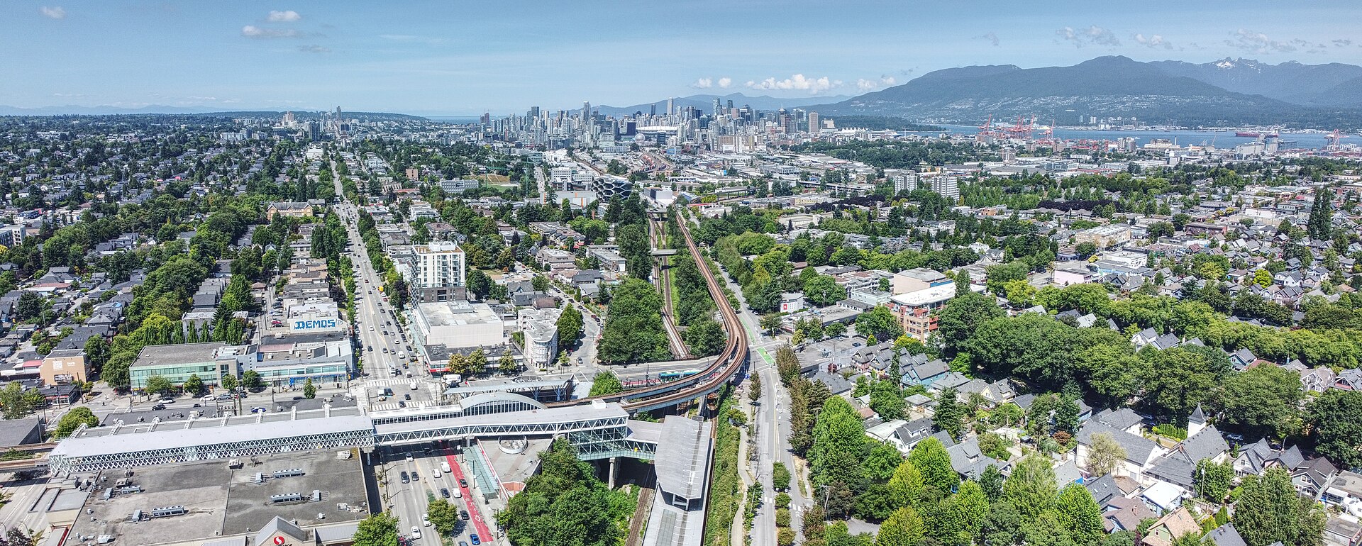
Commercial–Broadway, Vancouver (2025), Kensington-Cedar Cottage You checked the neighborhood.Now check an address ! Photo: Northwest, CC BY 4.0 · Wikimedia Commons

For C$40.00 a CrimesLog™ Home Report provides: (where available)

  • Nearest 6 Pre-school Nurseries to Address
  • Nearest 6 Primary Schools to Address
  • Nearest 6 Secondary/High Schools to Address
  • Nearest College and University to Address
  • Nearest to Address Medical Clinics, Hospitals and Pharmacies
  • Nearest 2 Police Station details to Address

The Home Report also provides

  • The CrimesLog™ Home Score is a proprietary Home Safety Measure capturing crime frequency, severity, recency and proximity to Address from police crime reporting point
  • A map indicating police anonymized crime reporting points around Address
  • Crime category trendlines for Address neighborhood
  • List of Reported Crime Incidents around Address radius
  • Downloadable PDF report — A Permanent Copy to Keep and Share to aid your Property Research
  • Our crimes database of almost 60 million records is UPDATED EVERY MONTH from US, UK, CA police sources
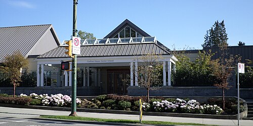
Crofton House School, Vancouver, BC, Kerrisdale
Kerrisdale · Crofton House School, Vancouver, BC
Photo: kennethaw88, CC BY 4.0 · Wikimedia Commons
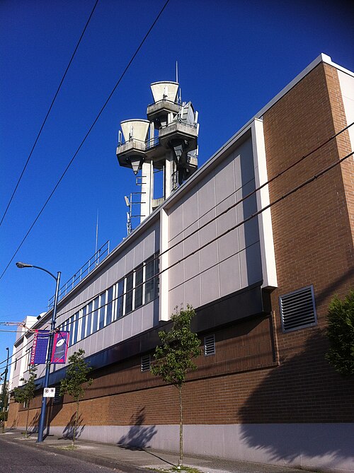
Killarney, Vancouver, BC, Canada, Killarney
Killarney · Killarney, Vancouver, BC, Canada
Photo: bynyalcin, CC BY 3.0 · Wikimedia Commons
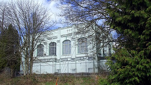
Sperling Annex (Historic BC Electric Substation), Arbutus Ridge
Arbutus Ridge · Sperling Annex (Historic BC Electric Substation)
Photo: Kiwibirdman, CC BY 3.0 · Wikimedia Commons
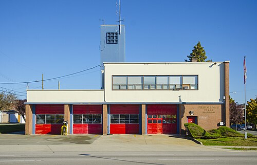
Firehall No. 17 (1954) - 7070 Knight Street, Victoria-Fraserview
Victoria-Fraserview · Firehall No. 17 (1954) - 7070 Knight Street
Photo: Heritage Vancouver Society, CC BY 2.0 · Wikimedia Commons
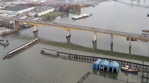
Oak St Bridge and Fraser River, Vancouver, Marpole
Marpole · Oak St Bridge and Fraser River, Vancouver
Photo: Robert Linsdell from St. Andrews, Canada, CC BY 2.0 · Wikimedia Commons
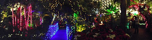
Lights Under The Dome, Riley Park
Riley Park · Lights Under The Dome
Photo: Kiwibirdman, CC BY 3.0 · Wikimedia Commons
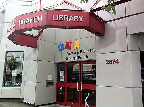
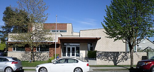
Vancouver Public Library Hastings Branch, Hastings-Sunrise
Hastings-Sunrise · Vancouver Public Library Hastings Branch
Photo: Richard Eriksson from Toronto, Canada, CC BY 2.0 · Wikimedia Commons
King David School, Vancouver, BC, Oakridge
Oakridge · King David School, Vancouver, BC
Photo: kennethaw88, CC BY 4.0 · Wikimedia Commons

How neighborhoods moved each quarter

2022

Whole-area crime rate 11.6 to 13.7 per 1,000 (high: Q3 2022).

Big moves (4+ places in a quarter): moved up Kerrisdale 5th→1st (Q3) moved up Oakridge 11th→7th (Q3) moved up West Point Grey 5th→1st (Q4)

2023

Whole-area crime rate 12.6 to 14.7 per 1,000 (high: Q3 2023).

Big moves (4+ places in a quarter): moved up Victoria-Fraserview 6th→2nd (Q1) moved down West Point Grey 1st→5th (Q1) moved up Arbutus Ridge 7th→2nd (Q2) moved down Dunbar-Southlands 1st→5th (Q2) moved up Oakridge 9th→4th (Q3) moved up Marpole 13th→7th (Q3) moved down Kerrisdale 4th→8th (Q3) moved down Kensington-Cedar Cottage 8th→13th (Q3) moved up West Point Grey 6th→1st (Q4) moved up Riley Park 12th→5th (Q4) moved down Killarney 2nd→6th (Q4) moved down Oakridge 4th→10th (Q4) moved down Marpole 7th→15th (Q4)

2024

Whole-area crime rate 11.6 to 13.1 per 1,000 (high: Q3 2024).

Big moves (4+ places in a quarter): moved up Killarney 6th→2nd (Q1) moved up Oakridge 10th→4th (Q1) moved down Arbutus Ridge 3rd→7th (Q1) moved down West Point Grey 1st→8th (Q1) moved down Shaughnessy 11th→15th (Q1) moved down Riley Park 6th→11th (Q2) moved up Riley Park 10th→6th (Q4) moved down Kerrisdale 6th→12th (Q4) moved down Shaughnessy 11th→15th (Q4)

2025

Whole-area crime rate 11.0 to 12.6 per 1,000 (high: Q3 2025).

Big moves (4+ places in a quarter): moved up Shaughnessy 15th→6th (Q1) moved up Kerrisdale 12th→7th (Q1) moved down Riley Park 6th→11th (Q1) moved down Marpole 10th→14th (Q1) moved up Arbutus Ridge 5th→1st (Q2) moved down West Point Grey 2nd→6th (Q2) moved up Oakridge 12th→8th (Q2) moved up Marpole 14th→10th (Q2) moved down Hastings-Sunrise 8th→13th (Q2) moved up Oakridge 8th→2nd (Q3) moved down Shaughnessy 7th→13th (Q3) moved up Shaughnessy 13th→6th (Q4) moved down Oakridge 2nd→11th (Q4) moved down Marpole 9th→13th (Q4) moved down Kensington-Cedar Cottage 8th→14th (Q4)

2026

Whole-area crime rate 12.0 to 12.1 per 1,000 (high: Q2 2026). 2 quarters so far.

Big moves (4+ places in a quarter): moved up Oakridge 11th→6th (Q1) moved down Hastings-Sunrise 10th→14th (Q1) moved up Kerrisdale 7th→1st (Q2) moved up Marpole 13th→6th (Q2) moved up Hastings-Sunrise 14th→8th (Q2) moved down West Point Grey 5th→10th (Q2) moved down Kitsilano 8th→12th (Q2) moved down Shaughnessy 9th→13th (Q2)

Reported Safety Incidents

In Q2 2026: property incidents were 54% (4,360), vehicle crimes were 18% (1,477), public order incidents were 17% (1,378) and violent incidents were 10% (792).

Recorded crime here is grouped into violent crime, property crime (burglary and theft), vehicle crime and public order offences, so you can compare how safe each neighborhood is for the kind of crime that matters to you.

Places we left out, and places to read with care

Left out: Burrard. They have almost no residents: their crimes are against visitors, so a rate per resident says little about living there.

The 22 neighborhoods on the map

Vancouver is made of 22 neighborhoods compared here, each in its own colour on the map. They are the local areas of the City of Vancouver: 662,248 residents between them.

  • Arbutus Ridge
  • Downtown
  • Dunbar-Southlands
  • Fairview
  • Grandview-Woodland
  • Hastings-Sunrise
  • Kensington-Cedar Cottage
  • Kerrisdale
  • Killarney
  • Kitsilano
  • Marpole
  • Mount Pleasant
  • Oakridge
  • Renfrew-Collingwood
  • Riley Park
  • Shaughnessy
  • South Cambie
  • Strathcona
  • Sunset
  • Victoria-Fraserview
  • West End
  • West Point Grey

All 22 neighborhoods, Q2 2026

Crimes per 1,000 residents, Q2 2026, lowest first. The last two columns compare with Q1 2022.
#NeighborhoodResidentsAllViolentPropertyVehiclePublic orderRate vs Q1 2022Places gained
1Kerrisdale14,1053.20.12.00.80.3down43%up4
2Killarney32,1673.50.51.41.00.7down27%up2
3Arbutus Ridge15,0834.00.22.00.90.9down36%up6
4Dunbar-Southlands21,1174.10.61.91.20.5up38%down3
5Victoria-Fraserview31,0954.50.31.21.61.4down4%down2
6Marpole28,1825.80.43.41.40.6down29%up6
7Riley Park23,6826.00.53.31.40.8down14%up4
8Hastings-Sunrise36,0726.30.63.11.41.2up9%down1
9Oakridge14,0716.30.63.51.11.1up4%down1
10West Point Grey13,4296.50.23.22.40.7up44%down8
11Kensington-Cedar Cottage50,7546.80.53.12.01.2up6%down1
12Kitsilano43,9387.00.44.80.90.8up23%down6
13Shaughnessy8,0347.60.84.21.70.9down27%up3
14Sunset37,1867.90.34.11.81.6down10%down1
15South Cambie9,8468.40.45.91.40.7down5%down1
16Fairview33,96911.70.68.01.51.7down5%up1
17Renfrew-Collingwood53,07812.21.08.31.51.4up23%down2
18Mount Pleasant37,09113.51.08.72.01.8down9%up1
19West End47,61813.91.88.12.02.1down2%down1
20Grandview-Woodland28,11914.82.17.72.52.5down2%–
21Downtown69,82935.73.618.36.87.0down1%–
22Strathcona13,78346.89.119.96.811.0up9%–

Photographs

67 photographs of the 22 neighborhoods run along the reel; click one to see it full size. Each is credited here and under the large view.

All 67 photographs and their credits
  1. Kerrisdale · Crofton House School, Vancouver, BC. Photo: kennethaw88, CC BY 4.0 · Wikimedia Commons
  2. Killarney · Killarney, Vancouver, BC, Canada. Photo: bynyalcin, CC BY 3.0 · Wikimedia Commons
  3. Arbutus Ridge · Sperling Annex (Historic BC Electric Substation). Photo: Kiwibirdman, CC BY 3.0 · Wikimedia Commons
  4. Victoria-Fraserview · Firehall No. 17 (1954) - 7070 Knight Street. Photo: Heritage Vancouver Society, CC BY 2.0 · Wikimedia Commons
  5. Marpole · Oak St Bridge and Fraser River, Vancouver. Photo: Robert Linsdell from St. Andrews, Canada, CC BY 2.0 · Wikimedia Commons
  6. Riley Park · Lights Under The Dome. Photo: Kiwibirdman, CC BY 3.0 · Wikimedia Commons
  7. Hastings-Sunrise · Vancouver Public Library Hastings Branch. Photo: Richard Eriksson from Toronto, Canada, CC BY 2.0 · Wikimedia Commons
  8. Oakridge · King David School, Vancouver, BC. Photo: kennethaw88, CC BY 4.0 · Wikimedia Commons
  9. West Point Grey · Brock House Society Heritage Building on Jericho Beach in Vancouver, Canada. Photo: Buster Laroux, CC0 · Wikimedia Commons
  10. Kensington-Cedar Cottage · Commercial–Broadway, Vancouver (2025). Photo: Northwest, CC BY 4.0 · Wikimedia Commons
  11. Kitsilano · Museum of Vancouver Back. Photo: Jeff Hitchcock, CC BY 2.0 · Wikimedia Commons
  12. Shaughnessy · Sperling Annex (Historic BC Electric Substation). Photo: Kiwibirdman, CC BY 3.0 · Wikimedia Commons
  13. South Cambie · 5255 Heather Street. Photo: Jeff Hitchcock from Seattle, WA, USA, CC BY 2.0 · Wikimedia Commons
  14. Fairview · Design School. Photo: Francisco Anzola, CC BY 2.0 · Wikimedia Commons
  15. Mount Pleasant · Vancouver City Hall. Photo: popejon2 from Paddington, Australia, CC BY 2.0 · Wikimedia Commons
  16. West End · Robson Street (Between Jervis & Bute). Photo: Jeff Hitchcock from Seattle, WA, USA, CC BY 2.0 · Wikimedia Commons
  17. Grandview-Woodland · Commercial–Broadway (2025) Westside. Photo: Northwest, CC BY 4.0 · Wikimedia Commons
  18. Downtown · 130 Carrall Street. Photo: Jeff Hitchcock from Seattle, WA, USA, CC BY 2.0 · Wikimedia Commons
  19. Strathcona · Alexander Street & Gore Avenue. Photo: Jeff Hitchcock from Seattle, WA, USA, CC BY 2.0 · Wikimedia Commons
  20. Kerrisdale · Casa Mia. Photo: Jeff Hitchcock, CC BY 3.0 · Wikimedia Commons
  21. Victoria-Fraserview · Vancouver Public Library Fraserview Branch. Photo: Richard Eriksson from Toronto, Canada, CC BY 2.0 · Wikimedia Commons
  22. Marpole · Telus World of Science Building (Jennifer Morrow) - Flickr. Photo: Jennifer Morrow from San Francisco, CC BY 2.0 · Wikimedia Commons
  23. Riley Park · BC Liquor Store - 28th & Main Exterior. Photo: Roland Tanglao, CC BY 2.0 · Wikimedia Commons
  24. West Point Grey · Mountain View from Spanish Banks. Photo: Ruth Hartnup from Vancouver, Canada, CC BY 2.0 · Wikimedia Commons
  25. Kensington-Cedar Cottage · Commercial–Broadway (2025). Photo: Northwest, CC BY 4.0 · Wikimedia Commons
  26. Kitsilano · That Green Building by the Burrard Bridge. Photo: popejon2 from Paddington, Australia, CC BY 2.0 · Wikimedia Commons
  27. South Cambie · Around Vancouver, British Columbia. Photo: Robert Linsdell from St. Andrews, Canada, CC BY 2.0 · Wikimedia Commons
  28. Fairview · Broadway–City Hall Station (2026-02). Photo: Northwest, CC BY 4.0 · Wikimedia Commons
  29. Mount Pleasant · Festive City Hall. Photo: Ruth Hartnup from Vancouver, Canada, CC BY 2.0 · Wikimedia Commons
  30. West End · Davie Street & Bute Street 2018. Photo: Jeff Hitchcock from Seattle, WA, USA, CC BY 2.0 · Wikimedia Commons
  31. Grandview-Woodland · Grandview-Woodland, Vancouver, BC, Canada. Photo: bynyalcin, CC BY 3.0 · Wikimedia Commons
  32. Downtown · Canada Place & Burrard Street. Photo: Jeff Hitchcock from Seattle, WA, USA, CC BY 2.0 · Wikimedia Commons
  33. Strathcona · Gore Avenue (Between Alexander & Powell). Photo: Jeff Hitchcock from Seattle, WA, USA, CC BY 2.0 · Wikimedia Commons
  34. Kerrisdale · Vancouver Night. Photo: Frank Zhong, CC BY 3.0 · Wikimedia Commons
  35. Marpole · Marine Gateway Retail 2017. Photo: Daylen, CC0 · Wikimedia Commons
  36. Riley Park · Fairchild Group Headquarters, Vancouver, BC. Photo: kennethaw88, CC BY 4.0 · Wikimedia Commons
  37. West Point Grey · Spanish Banks View Downtown. Photo: Akos Kokai, CC BY 2.0 · Wikimedia Commons
  38. Kitsilano · Museum of Vancouver. Photo: popejon2 from Paddington, Australia, CC BY 2.0 · Wikimedia Commons
  39. South Cambie · St. Vincent's Hospital Honoria Conway-Heather. Photo: Jeff Hitchcock from Seattle, WA, USA, CC BY 2.0 · Wikimedia Commons
  40. Fairview · Spiral Stairs (The Waterfall Building). Photo: Kiwibirdman, CC BY 3.0 · Wikimedia Commons
  41. Mount Pleasant · Unity of Culture Mural on the Vancouver Aboriginal Child & Family Services Society Building. Photo: Ruth Hartnup from Vancouver, Canada, CC BY 2.0 · Wikimedia Commons
  42. West End · Sunset Beach. Photo: Francisco Anzola, CC BY 2.0 · Wikimedia Commons
  43. Grandview-Woodland · Lonsdale Quay, Vancouver. Photo: Robert Linsdell from St. Andrews, Canada, CC BY 2.0 · Wikimedia Commons
  44. Downtown · Canada Place & Burrard Street. Photo: Jeff Hitchcock from Seattle, WA, USA, CC BY 2.0 · Wikimedia Commons
  45. Strathcona · Alexander Street & Gore Avenue. Photo: Jeff Hitchcock from Seattle, WA, USA, CC BY 2.0 · Wikimedia Commons
  46. Riley Park · Nat Bailey Stadium. Photo: popejon2 from Paddington, Australia, CC BY 2.0 · Wikimedia Commons
  47. Kitsilano · Museum of Vancouver - Flickr - Reg Natarajan. Photo: Reg Natarajan from Vancouver, Bogotá, CC BY 2.0 · Wikimedia Commons
  48. South Cambie · St. Vincent's Hospital Honoria Conway-Heather. Photo: Jeff Hitchcock from Seattle, WA, USA, CC BY 2.0 · Wikimedia Commons
  49. Fairview · Beehives in Pine Street Community Garden. Photo: Ruth Hartnup from Vancouver, Canada, CC BY 2.0 · Wikimedia Commons
  50. Mount Pleasant · City Hall. Photo: Kenny Louie from Vancouver, Canada, CC BY 2.0 · Wikimedia Commons
  51. West End · The Palisades Alberni Street. Photo: Jeff Hitchcock, CC BY 2.0 · Wikimedia Commons
  52. Grandview-Woodland · Vancouver. Photo: Andrew Harvey, CC BY 3.0 · Wikimedia Commons
  53. Downtown · 1 West Cordova Street. Photo: Jeff Hitchcock from Seattle, WA, USA, CC BY 2.0 · Wikimedia Commons
  54. Strathcona · Pacific Central Station, Vancouver, BC. Photo: David Wilson, CC BY 2.0 · Wikimedia Commons
  55. Riley Park · Published on Main. Photo: Mx. Granger, CC0 · Wikimedia Commons
  56. Kitsilano · Senakw (2026). Photo: Northwest, CC BY 4.0 · Wikimedia Commons
  57. Fairview · Fairview Vancouver Kindergarden May 2012. Photo: bynyalcin, CC BY 3.0 · Wikimedia Commons
  58. Mount Pleasant · Community Garden at City Hall. Photo: Ruth Hartnup from Vancouver, Canada, CC BY 2.0 · Wikimedia Commons
  59. West End · Christmas Eve 2010, St. Andrew's Wesley Church, Vancouver. Photo: Reg Natarajan from Vancouver, Bogotá, CC BY 2.0 · Wikimedia Commons
  60. Grandview-Woodland · Downtown Vancouver. Photo: Aditya Chinchure, CC0 · Wikimedia Commons
  61. Downtown · False Creek, Vancouver. Photo: Reg Natarajan from Vancouver, Bogotá, CC BY 2.0 · Wikimedia Commons
  62. Kitsilano · Sailboats Off the Vancouver Yacht Club. Photo: Roy Luck, CC BY 2.0 · Wikimedia Commons
  63. Fairview · Infer Nothing, or Whatever You Want. I Just Liked the Old Sign, Wires, and Bricks.. Photo: cogdogblog, CC BY 2.0 · Wikimedia Commons
  64. West End · A-Maze Ing -Laughter.English Bay Vancouver.. Photo: Bernard Spragg. NZ from Christchurch, New Zealand, CC0 · Wikimedia Commons
  65. Grandview-Woodland · COSCO Vancouver (Ship, 2004) 001. Photo: Caelie_Frampton from Vancouver, BC, Canada, CC BY 2.0 · Wikimedia Commons
  66. Downtown · Granville Street, Vancouver 2010. Photo: popejon2 from Paddington, Australia, CC BY 2.0 · Wikimedia Commons
  67. Kitsilano · City of Vancouver Archives 3. Photo: Mx. Granger, CC0 · Wikimedia Commons

Sources and notes

CrimesLog sources crime incident data originated and published by the Vancouver Police Department (VPD) through the City of Vancouver GeoDASH Open Data Portal under the Open Data Licence – Vancouver.

Contains information licensed under the Open Government Licence – Canada. Source: Statistics Canada, 2021 Census of Population.

First-place medal: 1st Place Medal emoji icon by Icons8.

Local areas defined by the City of Vancouver (Open Government Licence – Vancouver); boundaries from Statistics Canada, 2021 Census cartographic boundary files (Statistics Canada Open Licence); simplified by CrimesLog. Basemap: © OpenStreetMap contributors. The photographs are credited under each picture.

Rates are recorded crimes per 1,000 residents, quarter by quarter; where a neighborhood has fewer than 100 residents the rate would be worked out on 100 (those places are left out of the race). A count of recorded crime is not a verdict on any neighborhood.