Baltimore, Maryland · Neighborhood crime trends

Baltimore Eastern District

19 neighborhoods - a quarterly race to the lowest crime rate.

Crime Trends: Neighborhoods compared - each quarter from Q1 2022

Baltimore as a whole averaged 22.7 crimes for every 1,000 residents per quarter in Q2 2026, while Eastern District averaged 34.9 (leaving out 2 places with almost no residents), hence it is generally less safe when all crimes are considered.

How do the 19 neighborhoods of Eastern District compare? In Q2 2026 the police recorded 1,241 crimes across them, 34.9 for every 1,000 residents. That is 16.7% above a year earlier and 48.6% above Q1 2022, the first quarter we track.

Penn-Fallsway has the lowest rate of the everyday neighborhoods (9.9 per 1,000), followed by Berea (27.0) and Barclay (31.3). Broadway East has the highest (38.3).

Use the RACE CHARTS below to watch all 19 BALTIMORE EASTERN DISTRICT NEIGHBORHOODs race across 18 quarter periods from Q1 2022 to Q2 2026 - one crime category at a time or all together. The race chart can be used to compare average crime rates by category against Baltimore's average.

Neighborhood boundaries are defined by Baltimore City (Open Baltimore) and simplified by CrimesLog.
Lowest rate (everyday)
lowest ratePenn-Fallsway
9.9 crimes per 1,000 residents, Q2 2026
Highest rate
upBroadway East
38.3 per 1,000, Q2 2026
Whole area, Q2 2026
34.9 per 1,000
up 16.7% above a year earlier · up 48.6% above Q1 2022
Compared
19 neighborhoods
35,561 residents · 18 quarters

Baltimore Eastern District neighborhood quarterly crime race

Press ▶︎ to watch Q1 2022 to Q2 2026. Tick one crime category or several; hover a bar for the neighborhood. Property crimes includes burglaries and thefts.

Crime categories
Indicated: crimes rate per 1000 residents per quarterAll · safest at the top · square-root scale · Q1 2022 to Q2 202601510255010017.9Barclay15.5Berea21.3Biddle Street23.7Broadway East41.3CARE12.5Darley Park53.7Dunbar-Broadway59.9East Baltimore Midway23.4Gay Street26.9Greenmount West23.7Johnston Square16.0Madison-Eastend20.9Middle East23.1Milton-Montford18.1Oldtown21.9Oliver113Orangeville3.1Penn-Fallsway62.1South Clifton ParkBaltimore Q2 2026 average all crimes (22.7)Numbers are crimes per 1,000 residents per quarter. Zero-crime quarters show 0 and rank safest. Not included, no residents: Greenmount Cemetery; Orangeville Industrial Area.
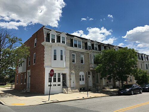
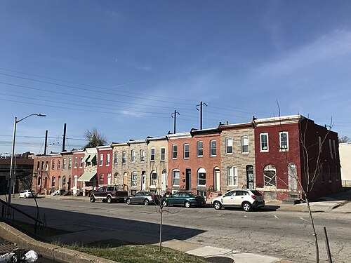
Rowhouses, 1500 Block of N. Patterson Park Avenue (East Side), Baltimore, MD 21213, Berea You checked the neighborhood.Now check an address ! Photo: Baltimore Heritage, CC0 · Flickr

For $34.00 a CrimesLog™ Home Report provides: (where available)

  • Nearest 6 Pre-school Nurseries to Address
  • Nearest 6 Primary Schools to Address
  • Nearest 6 Secondary/High Schools to Address
  • Nearest College and University to Address
  • Nearest to Address Medical Clinics, Hospitals and Pharmacies
  • Nearest 2 Police Station details to Address

The Home Report also provides

  • The CrimesLog™ Home Score is a proprietary Home Safety Measure capturing crime frequency, severity, recency and proximity to Address from police crime reporting point
  • A map indicating police anonymized crime reporting points around Address
  • Crime category trendlines for Address neighborhood
  • List of Reported Crime Incidents around Address radius
  • Downloadable PDF report — A Permanent Copy to Keep and Share to aid your Property Research
  • Our crimes database of almost 60 million records is UPDATED EVERY MONTH from US, UK, CA police sources
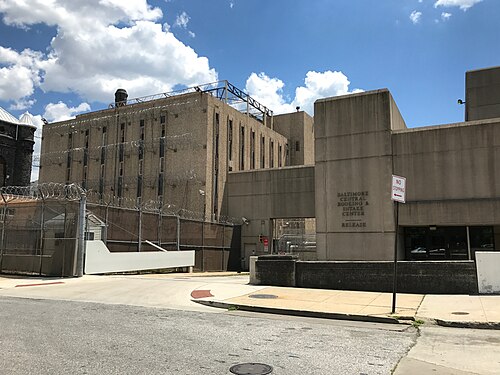
Baltimore Central Booking & Intake Center (Eager Street Release Gate), 300 E. Madison Street, Baltimore, MD 21202 (35223, Penn-Fallsway
Penn-Fallsway · Baltimore Central Booking & Intake Center (Eager Street Release Gate), 300 E. Madison Street, Baltimore, MD 21202 (35223
Photo: Baltimore Heritage from Baltimore, MD, USA, CC0 · Wikimedia Commons
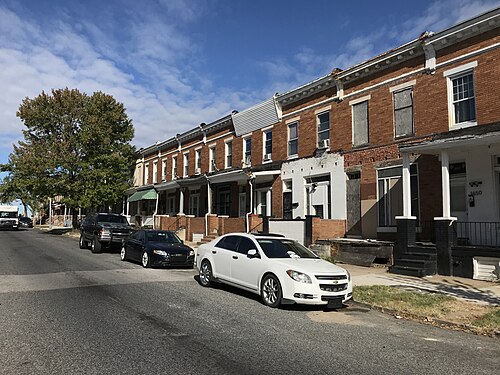
Rowhouses, 1600 Block of E. 25th Street, Baltimore, MD 21218, Darley Park
Darley Park · Rowhouses, 1600 Block of E. 25th Street, Baltimore, MD 21218
Photo: Baltimore Heritage from Baltimore, MD, USA, CC0 · Wikimedia Commons
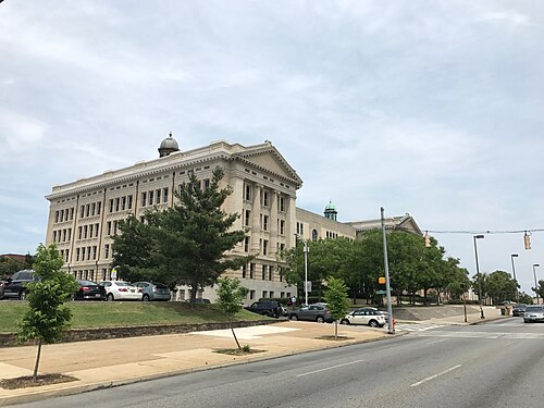
Baltimore City Public Schools District Office, 200 E. North Avenue, Baltimore, MD 21202, Greenmount West
Greenmount West · Baltimore City Public Schools District Office, 200 E. North Avenue, Baltimore, MD 21202
Photo: Baltimore Heritage from Baltimore, MD, USA, CC0 · Wikimedia Commons
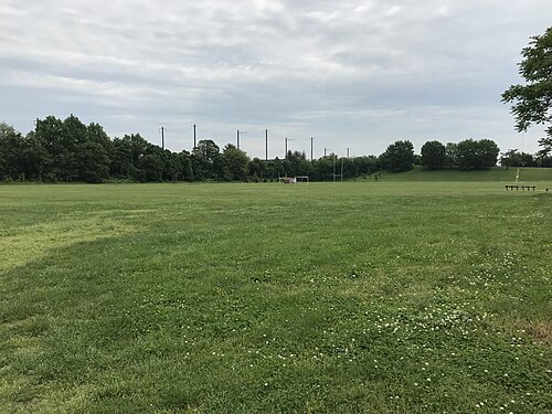
N. Curley Street Entrance, Frank C. Bocek Park, Edison Highway and E. Madison Street, Baltimore, MD 21205, Madison-Eastend
Madison-Eastend · N. Curley Street Entrance, Frank C. Bocek Park, Edison Highway and E. Madison Street, Baltimore, MD 21205
Photo: Baltimore Heritage from Baltimore, MD, USA, CC0 · Wikimedia Commons
Milton-Preston Peace Park (2017), 2500 E. Preston Street, Baltimore, MD 21213, Berea
Berea · Milton-Preston Peace Park (2017), 2500 E. Preston Street, Baltimore, MD 21213
Photo: Baltimore Heritage from Baltimore, MD, USA, CC0 · Wikimedia Commons
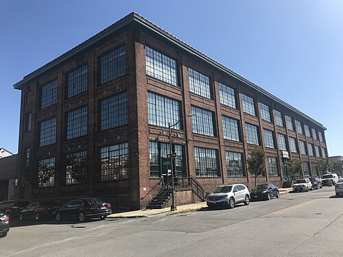
Former L. Greif & Brothers Clothing Factory (C. 1912), 901 N. Milton Avenue, Baltimore, MD 21205, Milton-Montford
Milton-Montford · Former L. Greif & Brothers Clothing Factory (C. 1912), 901 N. Milton Avenue, Baltimore, MD 21205
Photo: Baltimore Heritage from Baltimore, MD, USA, CC0 · Wikimedia Commons
2200 Block of Barclay Street (East Side), Baltimore, MD 21218, Barclay
Barclay · 2200 Block of Barclay Street (East Side), Baltimore, MD 21218
Photo: Baltimore Heritage from Baltimore, MD, USA, CC0 · Wikimedia Commons
Rowhouses, 1000 Block of N. Patterson Park Avenue (West Side), Baltimore, MD 21205, Biddle Street
Biddle Street · Rowhouses, 1000 Block of N. Patterson Park Avenue (West Side), Baltimore, MD 21205
Photo: Baltimore Heritage from Baltimore, MD, USA, CC0 · Wikimedia Commons

How neighborhoods moved each quarter

2022

Whole-area crime rate 23.5 to 34.2 per 1,000 (high: Q3 2022).

Big moves (4+ places in a quarter): moved up Gay Street 11th→5th (Q2) moved up Broadway East 13th→9th (Q2) moved down Barclay 5th→10th (Q2) moved down Biddle Street 8th→14th (Q2) moved down Milton-Montford 10th→15th (Q2) moved up Biddle Street 14th→2nd (Q3) moved up Greenmount West 11th→6th (Q3) moved down Madison-Eastend 3rd→8th (Q3) moved down Gay Street 5th→11th (Q3) moved down Oliver 8th→12th (Q3) moved down Broadway East 9th→14th (Q3) moved up Barclay 7th→2nd (Q4) moved up Broadway East 14th→10th (Q4) moved down Biddle Street 2nd→11th (Q4) moved down Johnston Square 10th→14th (Q4)

2023

Whole-area crime rate 31.9 to 36.2 per 1,000 (high: Q3 2023).

Big moves (4+ places in a quarter): moved down Middle East 6th→12th (Q1) moved down Biddle Street 11th→16th (Q1) moved up Madison-Eastend 7th→2nd (Q2) moved up Milton-Montford 14th→5th (Q2) moved down Greenmount West 6th→11th (Q2) moved up Biddle Street 16th→12th (Q2) moved down Barclay 3rd→14th (Q2) moved down Johnston Square 11th→16th (Q2) moved up Biddle Street 12th→5th (Q3) moved up Barclay 14th→8th (Q3) moved down Gay Street 9th→13th (Q3) moved down CARE 10th→14th (Q3) moved up Oliver 11th→7th (Q4) moved down Oldtown 7th→11th (Q4)

2024

Whole-area crime rate 29.4 to 33.4 per 1,000 (high: Q3 2024).

Big moves (4+ places in a quarter): moved up Barclay 9th→4th (Q1) moved up Greenmount West 12th→7th (Q1) moved down Biddle Street 5th→10th (Q1) moved up Johnston Square 16th→12th (Q1) moved down Middle East 10th→14th (Q1) moved up Biddle Street 10th→6th (Q2) moved down Milton-Montford 6th→11th (Q2) moved up Biddle Street 6th→2nd (Q3) moved up Milton-Montford 11th→6th (Q3) moved up Middle East 16th→10th (Q3) moved up Barclay 7th→2nd (Q4) moved up Greenmount West 11th→6th (Q4) moved up CARE 12th→8th (Q4) moved down Biddle Street 2nd→9th (Q4) moved down Milton-Montford 6th→10th (Q4) moved down Middle East 10th→14th (Q4)

2025

Whole-area crime rate 28.6 to 33.3 per 1,000 (high: Q3 2025).

Big moves (4+ places in a quarter): moved up Biddle Street 9th→3rd (Q1) moved up Oldtown 11th→6th (Q1) moved up Oliver 13th→8th (Q1) moved down Madison-Eastend 3rd→10th (Q1) moved down Broadway East 7th→11th (Q1) moved down Greenmount West 6th→12th (Q1) moved down CARE 8th→14th (Q1) moved up Gay Street 9th→5th (Q2) moved up Broadway East 11th→6th (Q2) moved up Greenmount West 12th→8th (Q2) moved up CARE 14th→10th (Q2) moved down Biddle Street 3rd→11th (Q2) moved down Oldtown 6th→12th (Q2) moved down Oliver 8th→13th (Q2) moved up Greenmount West 8th→4th (Q3) moved up Biddle Street 11th→6th (Q3) moved up Oliver 13th→9th (Q3) moved up Johnston Square 15th→10th (Q3) moved down Gay Street 5th→13th (Q3) moved down Milton-Montford 9th→14th (Q3) moved down South Clifton Park 14th→18th (Q3) moved up Milton-Montford 14th→9th (Q4) moved down Johnston Square 10th→14th (Q4) moved up Orangeville 19th→15th (Q4) moved down CARE 12th→18th (Q4)

2026

Whole-area crime rate 29.4 to 34.9 per 1,000 (high: Q2 2026). 2 quarters so far.

Big moves (4+ places in a quarter): moved up Madison-Eastend 8th→4th (Q1) moved up Oliver 12th→8th (Q1) moved up Johnston Square 14th→9th (Q1) moved down Broadway East 6th→14th (Q1) moved down Orangeville 15th→19th (Q1) moved up Milton-Montford 12th→6th (Q2) moved down Biddle Street 2nd→8th (Q2) moved down East Baltimore Midway 11th→15th (Q2)

Reported Safety Incidents

In Q2 2026: property incidents were 45% (553), violent incidents were 35% (437), vehicle crimes were 20% (247) and public order incidents were 0% (4).

Recorded crime here is grouped into violent crime, property crime (burglary and theft), vehicle crime and public order offences, so you can compare how safe each neighborhood is for the kind of crime that matters to you.

Places we left out, and places to read with care

Left out: Greenmount Cemetery; Orangeville Industrial Area. They have almost no residents: their crimes are against visitors, so a rate per resident says little about living there.

Orangeville (169.0 per 1,000 from 24 crimes among 142 residents), South Clifton Park (75.4 per 1,000 from 34 crimes among 451 residents), Biddle Street (31.4 per 1,000 from 28 crimes among 891 residents), Milton-Montford (27.7 per 1,000 from 30 crimes among 1,083 residents), Dunbar-Broadway (50.0 per 1,000 from 55 crimes among 1,099 residents), Darley Park (16.6 per 1,000 from 20 crimes among 1,201 residents), CARE (54.2 per 1,000 from 67 crimes among 1,236 residents), Johnston Square (36.9 per 1,000 from 56 crimes among 1,518 residents), Greenmount West (21.3 per 1,000 from 34 crimes among 1,598 residents), Middle East (62.0 per 1,000 from 110 crimes among 1,773 residents), East Baltimore Midway (52.9 per 1,000 from 99 crimes among 1,871 residents), Gay Street (47.3 per 1,000 from 91 crimes among 1,926 residents), Madison-Eastend (24.2 per 1,000 from 50 crimes among 2,067 residents) and Oldtown (32.4 per 1,000 from 88 crimes among 2,714 residents) are places with few residents (under 3,000): a rate on so few people says little about living there, so they are not named as the lowest or highest.

The 19 neighborhoods on the map

Eastern District is made of 19 neighborhoods compared here, each in its own colour on the map. They are the Neighborhood Statistical Areas of Baltimore City (Open Baltimore), grouped into police districts by CrimesLog: 35,561 residents between them.

  • Barclay
  • Berea
  • Biddle Street
  • Broadway East
  • CARE
  • Darley Park
  • Dunbar-Broadway
  • East Baltimore Midway
  • Gay Street
  • Greenmount West
  • Johnston Square
  • Madison-Eastend
  • Middle East
  • Milton-Montford
  • Oldtown
  • Oliver
  • Orangeville
  • Penn-Fallsway
  • South Clifton Park

All 19 neighborhoods, Q2 2026

Crimes per 1,000 residents, Q2 2026, lowest first. The last two columns compare with Q1 2022.
#NeighborhoodResidentsAllViolentPropertyVehiclePublic orderRate vs Q1 2022Places gained
1Penn-Fallsway2,9349.92.75.12.00.0up222%–
2Darley Park †1,20116.65.89.21.70.0up33%–
3Greenmount West †1,59821.36.36.97.50.6down21%up11
4Madison-Eastend †2,06724.211.17.35.30.5up51%–
5Berea3,55327.010.411.35.30.0up75%down2
6Milton-Montford †1,08327.76.514.86.50.0up20%up4
7Barclay2,74431.38.413.89.10.0up75%down2
8Biddle Street †89131.414.612.34.50.0up47%–
9Oldtown †2,71432.416.910.35.20.0up80%down3
10Oliver3,47334.012.113.08.90.0up55%down1
11Johnston Square †1,51836.911.915.29.90.0up56%up1
12Broadway East3,28738.314.314.69.40.0up62%up1
13Gay Street †1,92647.313.527.06.80.0up102%down2
14Dunbar-Broadway †1,09950.028.216.44.50.9down7%up2
15East Baltimore Midway †1,87152.923.523.55.90.0down12%up2
16CARE †1,23654.217.024.312.90.0up31%down1
17Middle East †1,77362.07.945.18.50.6up197%down10
18South Clifton Park †45175.426.628.820.00.0up21%–
19Orangeville †142169.056.3105.67.00.0up50%–

† Orangeville, South Clifton Park, Biddle Street, Milton-Montford, Dunbar-Broadway, Darley Park, CARE, Johnston Square, Greenmount West, Middle East, East Baltimore Midway, Gay Street, Madison-Eastend and Oldtown are places with few residents. A rate on a very small number of residents or crimes is not comparable with the others.

Photographs

117 photographs of the 19 neighborhoods run along the reel; click one to see it full size. Each is credited here and under the large view.

All 117 photographs and their credits
  1. Penn-Fallsway · Baltimore Central Booking & Intake Center (Eager Street Release Gate), 300 E. Madison Street, Baltimore, MD 21202 (35223. Photo: Baltimore Heritage from Baltimore, MD, USA, CC0 · Wikimedia Commons
  2. Darley Park · Rowhouses, 1600 Block of E. 25th Street, Baltimore, MD 21218. Photo: Baltimore Heritage from Baltimore, MD, USA, CC0 · Wikimedia Commons
  3. Greenmount West · Baltimore City Public Schools District Office, 200 E. North Avenue, Baltimore, MD 21202. Photo: Baltimore Heritage from Baltimore, MD, USA, CC0 · Wikimedia Commons
  4. Madison-Eastend · N. Curley Street Entrance, Frank C. Bocek Park, Edison Highway and E. Madison Street, Baltimore, MD 21205. Photo: Baltimore Heritage from Baltimore, MD, USA, CC0 · Wikimedia Commons
  5. Berea · Milton-Preston Peace Park (2017), 2500 E. Preston Street, Baltimore, MD 21213. Photo: Baltimore Heritage from Baltimore, MD, USA, CC0 · Wikimedia Commons
  6. Milton-Montford · Former L. Greif & Brothers Clothing Factory (C. 1912), 901 N. Milton Avenue, Baltimore, MD 21205. Photo: Baltimore Heritage from Baltimore, MD, USA, CC0 · Wikimedia Commons
  7. Barclay · 2200 Block of Barclay Street (East Side), Baltimore, MD 21218. Photo: Baltimore Heritage from Baltimore, MD, USA, CC0 · Wikimedia Commons
  8. Biddle Street · Rowhouses, 1000 Block of N. Patterson Park Avenue (West Side), Baltimore, MD 21205. Photo: Baltimore Heritage from Baltimore, MD, USA, CC0 · Wikimedia Commons
  9. Oldtown · Rowhouses, 934–936 N. Central Avenue, Baltimore, MD 21202. Photo: Baltimore Heritage from Baltimore, MD, USA, CC0 · Wikimedia Commons
  10. Oliver · Storefront of Vacant Cornerstore Commercial Building, 1640 N. Broadway, Baltimore, MD 21213. Photo: Baltimore Heritage from Baltimore, MD, USA, CC0 · Wikimedia Commons
  11. Johnston Square · Commercial Buildings, 1200 Block of Greenmount Avenue (East Side), Baltimore, MD 21202. Photo: Baltimore Heritage from Baltimore, MD, USA, CC0 · Wikimedia Commons
  12. Broadway East · Rowhouses, 1419–1429 N. Milton Avenue, Baltimore, MD 21213. Photo: Baltimore Heritage from Baltimore, MD, USA, CC0 · Wikimedia Commons
  13. Gay Street · Madison Square Park View Southeast from N. Eden Street Between E. Chase and E. Eager Streets, Baltimore, MD 21213 (49149. Photo: Baltimore Heritage from Baltimore, MD, USA, CC0 · Wikimedia Commons
  14. Dunbar-Broadway · William H. Welch Medical Library (1929), Johns Hopkins University School of Medicine, 1900 E. Monument Street, Baltimore. Photo: Baltimore Heritage from Baltimore, MD, USA, CC0 · Wikimedia Commons
  15. East Baltimore Midway · Brick Paved Section of Robb Street in Baltimore. Photo: Elliott R. Plack, CC0 · Wikimedia Commons
  16. CARE · Rowhouses, 2100 Block of Orleans Street (North Side), Baltimore, MD 21224. Photo: Baltimore Heritage from Baltimore, MD, USA, CC0 · Wikimedia Commons
  17. Middle East · Pre-Clinical Teaching Building (PCTB) (1981), Johns Hopkins Medical Campus, 725 N. Wolfe Street Baltimore, MD 21205 (489. Photo: Baltimore Heritage from Baltimore, MD, USA, CC0 · Wikimedia Commons
  18. South Clifton Park · Columbus School Apartments Former Public School No. 99 (1891), 2000 E. North Avenue, Baltimore, MD 21213. Photo: Baltimore Heritage from Baltimore, MD, USA, CC0 · Wikimedia Commons
  19. Greenmount Cemetery · Vacant Rowhouses, 1000 Block of E. North Avenue (North Side), Baltimore, MD 21202. Photo: Baltimore Heritage from Baltimore, MD, USA, CC0 · Wikimedia Commons
  20. Penn-Fallsway · Baltimore City Youth Detention Center (YDC) (2017; Penza Bailey Architects), 926 Greenmount Avenue, Baltimore, MD 21202. Photo: Baltimore Heritage from Baltimore, MD, USA, CC0 · Wikimedia Commons
  21. Greenmount West · Former Guilford Apartments, 231-233 E. North Avenue, Baltimore, MD 21202. Photo: Baltimore Heritage from Baltimore, MD, USA, CC0 · Wikimedia Commons
  22. Berea · Rowhouse/church with Collapsing Sidewall Surrounded by Fence, E. Preston Street and N. Milton Avenue (Southeast Corner), Baltimore, MD 21213. Photo: Baltimore Heritage, CC0 · Flickr
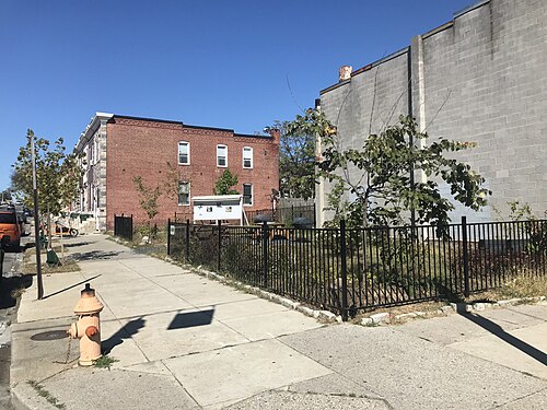
  23. Milton-Montford · Archway, Community Open Space Rain Garden, E. Eager Street and N. Milton Avenue (Southwest Corner), Baltimore, MD 21205. Photo: Baltimore Heritage from Baltimore, MD, USA, CC0 · Wikimedia Commons
  24. Barclay · Calvert Street Park, N. Calvert Street and E. 23rd Street (Southeast Corner), Baltimore, MD 21218. Photo: Baltimore Heritage from Baltimore, MD, USA, CC0 · Wikimedia Commons
  25. Biddle Street · Vacant Former New Baptist Church, 1840 E. Biddle Street, Baltimore, MD 21213. Photo: Baltimore Heritage, CC0 · Flickr
  26. Oldtown · Waters Towers (1977), 1400 E. Madison Street, Baltimore, MD 21205. Photo: Baltimore Heritage from Baltimore, MD, USA, CC0 · Wikimedia Commons
  27. Oliver · Eastside District Court Former Sears Store (1938), 1400 E. North Avenue, Baltimore, MD 21213. Photo: Baltimore Heritage from Baltimore, MD, USA, CC0 · Wikimedia Commons
  28. Johnston Square · Commercial Builldings, 1201 Greenmount Avenue, Baltimore, MD 21202. Photo: Baltimore Heritage from Baltimore, MD, USA, CC0 · Wikimedia Commons
  29. Broadway East · Rowhouse Church with Collapsing Sidewall Surrounded by Fence, E. Preston Street and N. Milton Avenue (Southeast Corner). Photo: Baltimore Heritage from Baltimore, MD, USA, CC0 · Wikimedia Commons
  30. Gay Street · Detail of Upper Levels, I Love This Corner Deli Grandpa's Food Market, 1000 N. Broadway, Baltimore, MD 21205 (4896552441. Photo: Baltimore Heritage from Baltimore, MD, USA, CC0 · Wikimedia Commons
  31. Dunbar-Broadway · Pre-Clinical Teaching Building (PCTB) (1981), Johns Hopkins Medical Campus, 725 N. Wolfe Street Baltimore, MD 21205 (489. Photo: Baltimore Heritage from Baltimore, MD, USA, CC0 · Wikimedia Commons
  32. East Baltimore Midway · Cecil Elementary School-School No. 7, 2000 Cecil Avenue, Baltimore, MD 21218. Photo: Baltimore Heritage from Baltimore, MD, USA, CC0 · Wikimedia Commons
  33. CARE · Former Friedens Evangelical Lutheran Church, 219 N. Chester Street, Baltimore, MD 21231. Photo: Baltimore Heritage from Baltimore, MD, USA, CC0 · Wikimedia Commons
  34. Middle East · Antoine's Razor Cutz Barber Salon, 2014 E. Madison Street, Baltimore, MD 21205. Photo: Baltimore Heritage from Baltimore, MD, USA, CC0 · Wikimedia Commons
  35. Penn-Fallsway · Baltimore City Juvenile Justice Center (2002; RTKL, Architects), 300 N. Gay Street, Baltimore, MD 21202. Photo: Baltimore Heritage from Baltimore, MD, USA, CC0 · Wikimedia Commons
  36. Greenmount West · Baltimore City Public Schools District Office, 200 E. North Avenue Baltimore, MD 21202. Photo: Baltimore Heritage from Baltimore, MD, USA, CC0 · Wikimedia Commons
  37. Berea · Berea Temple Seventh Day Adventist Church/Former Baltimore Hebrew Congregation Synagogue (1890; Charles L. Carson, Architect), 1901 Madison. Photo: Baltimore Heritage, CC0 · Flickr
  38. Milton-Montford · Rowhouses, 741–747 N. Milton Avenue, Baltimore, MD 21205. Photo: Baltimore Heritage from Baltimore, MD, USA, CC0 · Wikimedia Commons
  39. Barclay · First Floor Entrance, Commercial Building, 111 E. 23rd Street, Baltimore, MD 21218. Photo: Baltimore Heritage from Baltimore, MD, USA, CC0 · Wikimedia Commons
  40. Biddle Street · Rowhouses, 600-612 E. Biddle Street, Baltimore, MD 21218. Photo: Baltimore Heritage, CC0 · Flickr
  41. Oldtown · Latrobe Homes, 900 E. Madison Street, Baltimore, MD 21202. Photo: Baltimore Heritage from Baltimore, MD, USA, CC0 · Wikimedia Commons
  42. Oliver · New Cornerstone Baptist Church, 1530 E. Preston Street, Baltimore, MD 21213. Photo: Baltimore Heritage, CC0 · Flickr
  43. Johnston Square · Former Post Office Garage Building, 439-441 E. Preston Street, Baltimore, MD 21202. Photo: Baltimore Heritage from Baltimore, MD, USA, CC0 · Wikimedia Commons
  44. Broadway East · Rowhouses, 2400–2418 E. Preston Street, Baltimore, MD 21213. Photo: Baltimore Heritage from Baltimore, MD, USA, CC0 · Wikimedia Commons
  45. Gay Street · View of Median on N. Broadway Between E. Monument and E. Madison Streets, Baltimore, MD 21205. Photo: Baltimore Heritage from Baltimore, MD, USA, CC0 · Wikimedia Commons
  46. Dunbar-Broadway · St. Philip's Lutheran Church (1958, Frederic Moehle & Rev. Francis B. Smith), 501 N. Caroline Street, Baltimore, MD 2120. Photo: Baltimore Heritage from Baltimore, MD, USA, CC0 · Wikimedia Commons
  47. East Baltimore Midway · Cecil Elementary School-School No. 7, 2000 Cecil Avenue, Baltimore, MD 21218. Photo: Baltimore Heritage from Baltimore, MD, USA, CC0 · Wikimedia Commons
  48. CARE · Former Friedens Evangelical Lutheran Church, 219 N. Chester Street, Baltimore, MD 21231. Photo: Baltimore Heritage from Baltimore, MD, USA, CC0 · Wikimedia Commons
  49. Middle East · Rehabilitated Rowhouses, 722-724 N. Patterson Park Avenue, Baltimore, MD 21205. Photo: Baltimore Heritage from Baltimore, MD, USA, CC0 · Wikimedia Commons
  50. Penn-Fallsway · Holiday Inn Express Hotel Former Old Town National Bank (1924), 221 N. Gay Street, Baltimore, MD 21202. Photo: Baltimore Heritage from Baltimore, MD, USA, CC0 · Wikimedia Commons
  51. Greenmount West · Boarded Guilford Avenue Entrance, Former Guilford Apartments, 231-233 E. North Avenue, Baltimore, MD 21202. Photo: Baltimore Heritage from Baltimore, MD, USA, CC0 · Wikimedia Commons
  52. Berea · Rowhouses, 1500 Block of N. Patterson Park Avenue (East Side), Baltimore, MD 21213. Photo: Baltimore Heritage, CC0 · Flickr
  53. Milton-Montford · Rowhouses, 843–847 N. Milton Avenue, Baltimore, MD 21205. Photo: Baltimore Heritage from Baltimore, MD, USA, CC0 · Wikimedia Commons
  54. Barclay · First Philadelphia Baptist Church, 2120 Greenmount Avenue, Baltimore, MD 21218. Photo: Baltimore Heritage from Baltimore, MD, USA, CC0 · Wikimedia Commons
  55. Biddle Street · House/apartment Building, 104 E. Biddle Street, Baltimore, MD 21202. Photo: Baltimore Heritage, CC0 · Flickr
  56. Oldtown · Latrobe Homes, 900 E. Madison Street, Baltimore, MD 21202. Photo: Baltimore Heritage from Baltimore, MD, USA, CC0 · Wikimedia Commons
  57. Johnston Square · Forrest Street Park, 1100 Forrest Street, Baltimore, MD 21202. Photo: Baltimore Heritage from Baltimore, MD, USA, CC0 · Wikimedia Commons
  58. Broadway East · F&J Grocery & Snack Shop II, 2444 E. Preston Street, Baltimore MD 21213. Photo: Baltimore Heritage from Baltimore, MD, USA, CC0 · Wikimedia Commons
  59. Gay Street · Rowhouses, 1000 Block of N. Caroline Street (East Side), Baltimore, MD 21205. Photo: Baltimore Heritage from Baltimore, MD, USA, CC0 · Wikimedia Commons
  60. Dunbar-Broadway · Vernion T. Williams Educational Building, First Baptist Church, 525 N. Caroline Street, Baltimore, MD 21205 (35037313735. Photo: Baltimore Heritage from Baltimore, MD, USA, CC0 · Wikimedia Commons
  61. East Baltimore Midway · Homewood House - Oliver Cromwell School - Public School No. 74, 2200 Homewood Avenue, Baltimore, MD 21218. Photo: Baltimore Heritage from Baltimore, MD, USA, CC0 · Wikimedia Commons
  62. CARE · Apostolic Towers Senior Housing, 201 N. Washington Street, Baltimore, MD 21231. Photo: Baltimore Heritage from Baltimore, MD, USA, CC0 · Wikimedia Commons
  63. Middle East · Baltimore CIty Healthy Start Middle East, 610 N. Chester Street Baltimore, MD 21205. Photo: Baltimore Heritage, CC0 · Flickr
  64. Greenmount West · Former Rite Aid Pharmacy, 423 E. North Avenue, Baltimore, MD 21202. Photo: Baltimore Heritage from Baltimore, MD, USA, CC0 · Wikimedia Commons
  65. Berea · Rowhouses, 1500 Block of N. Patterson Park Avenue (East Side), Baltimore, MD 21213. Photo: Baltimore Heritage, CC0 · Flickr
  66. Barclay · Cornerstone, Ebenezer Baptist Church, 306 E. 23rd Street, Baltimore, MD 21218. Photo: Baltimore Heritage from Baltimore, MD, USA, CC0 · Wikimedia Commons
  67. Biddle Street · The Varsity on Biddle, 30 W. Biddle Street, Baltimore, MD 21201. Photo: Baltimore Heritage, CC0 · Flickr
  68. Oldtown · Institute of Notre Dame, 901 Aisquith Street, Baltimore, MD 21202. Photo: Baltimore Heritage from Baltimore, MD, USA, CC0 · Wikimedia Commons
  69. Johnston Square · Basketball Courts in Johnston Square Park, E. Biddle Street and Valley Street, Baltimore, MD 21202. Photo: Baltimore Heritage, CC0 · Flickr
  70. Broadway East · Former Eastern High Service Pumping Station-Development Site for the Baltimore Food Hub, E. Oliver Street and N. Wolfe S. Photo: Baltimore Heritage from Baltimore, MD, USA, CC0 · Wikimedia Commons
  71. Gay Street · Former Religious School Building, Sought Out Redeemed Church Of Lord Jesus, 1214 N. Broadway, Baltimore, MD 21213. Photo: Baltimore Heritage, CC0 · Wikimedia Commons
  72. Dunbar-Broadway · First Baptist Church (1880), 525 N. Caroline Street, Baltimore, MD 21205. Photo: Baltimore Heritage from Baltimore, MD, USA, CC0 · Wikimedia Commons
  73. East Baltimore Midway · Homewood House - Oliver Cromwell School - Public School No. 74, 2200 Homewood Avenue, Baltimore, MD 21218. Photo: Baltimore Heritage from Baltimore, MD, USA, CC0 · Wikimedia Commons
  74. CARE · Rowhouses, 2000 Block of Orleans Street (North Side), Baltimore, MD 21231. Photo: Baltimore Heritage from Baltimore, MD, USA, CC0 · Wikimedia Commons
  75. Greenmount West · City Arts 2 (2016; Hord Coplan Macht, Architects), 1700 Greenmount Avenue, Baltimore, MD 21218. Photo: Baltimore Heritage from Baltimore, MD, USA, CC0 · Wikimedia Commons
  76. Berea · Milton-Preston Peace Park (2017), 2500 E. Preston Street, Baltimore, MD 21213. Photo: Baltimore Heritage, CC0 · Flickr
  77. Barclay · 2500 Block of Guilford Avenue (East Side), Baltimore, MD 21218. Photo: Baltimore Heritage from Baltimore, MD, USA, CC0 · Wikimedia Commons
  78. Biddle Street · Fallsway Fountain Monument (1915; Hans Schuler, Sculptor; Theodore Wells Pietsch, Architect), Guilford Avenue and E. Biddle Street, Baltimor. Photo: Baltimore Heritage, CC0 · Flickr
  79. Oldtown · Waters Avenue African Methodist Episcopal Church, 417 Aisquith Street, Baltimore, MD 21202. Photo: Baltimore Heritage from Baltimore, MD, USA, CC0 · Wikimedia Commons
  80. Broadway East · First John Tabernacle Baptist Church, 1801 E. Preston Street, Baltimore, MD 21213. Photo: Baltimore Heritage from Baltimore, MD, USA, CC0 · Wikimedia Commons
  81. Gay Street · Grace Memorial Baptist Church, 1100 N. Eden Street, Baltimore, MD 21213. Photo: Baltimore Heritage from Baltimore, MD, USA, CC0 · Wikimedia Commons
  82. Dunbar-Broadway · St. Philip's Lutheran Church (1958, Frederic Moehle & Rev. Francis B. Smith), 501 N. Caroline Street, Baltimore, MD 2120. Photo: Baltimore Heritage from Baltimore, MD, USA, CC0 · Wikimedia Commons
  83. East Baltimore Midway · Cecil Elementary School-School No. 7, 2000 Cecil Avenue, Baltimore, MD 21218. Photo: Baltimore Heritage from Baltimore, MD, USA, CC0 · Wikimedia Commons
  84. CARE · Entrance on E. Fayette Street, Eastside Medical Center at Apostolic Towers Senior Housing, 201 N. Washington Street, Bal. Photo: Baltimore Heritage from Baltimore, MD, USA, CC0 · Wikimedia Commons
  85. Greenmount West · Baltimore Montessori Public Charter School, 1600 Guilford Avenue, Baltimore, MD 21202. Photo: Baltimore Heritage from Baltimore, MD, USA, CC0 · Wikimedia Commons
  86. Berea · Rowhouses, 1419–1429 N. Milton Avenue, Baltimore, MD 21213. Photo: Baltimore Heritage, CC0 · Flickr
  87. Barclay · A Plus Grocery, 2454 Barclay Street, Baltimore, MD 21218. Photo: Baltimore Heritage from Baltimore, MD, USA, CC0 · Wikimedia Commons
  88. Biddle Street · 'Bee Kind' Community Art Grant Mural (2019; Renz Balagtas, Artist), 924 E. Biddle Street, Baltimore, MD 21202. Photo: Baltimore Heritage, CC0 · Flickr
  89. Oldtown · Monument East (1976, Conklin and Rossant), 633 Aisquith Street, Baltimore, MD 21202. Photo: Baltimore Heritage from Baltimore, MD, USA, CC0 · Wikimedia Commons
  90. Broadway East · Detail of Carved Face, Marble-Fronted Rowhouse, 1714 E. Oliver Street, Baltimore, MD 21213. Photo: Baltimore Heritage from Baltimore, MD, USA, CC0 · Wikimedia Commons
  91. Gay Street · Open Space Behind Sought Out Redeemed Church Of Lord Jesus, 1214 N. Broadway, Baltimore, MD 21213. Photo: Baltimore Heritage, CC0 · Wikimedia Commons
  92. Dunbar-Broadway · St. Philip's Lutheran Church (1958, Frederic Moehle & Rev. Francis B. Smith), 501 N. Caroline Street, Baltimore, MD 2120. Photo: Baltimore Heritage from Baltimore, MD, USA, CC0 · Wikimedia Commons
  93. East Baltimore Midway · Cecil Elementary School-School No. 7, 2000 Cecil Avenue, Baltimore, MD 21218. Photo: Baltimore Heritage from Baltimore, MD, USA, CC0 · Wikimedia Commons
  94. CARE · Sign, Apostolic Towers Senior Housing, 201 N. Washington Street, Baltimore, MD 21231. Photo: Baltimore Heritage from Baltimore, MD, USA, CC0 · Wikimedia Commons
  95. Greenmount West · AREA 405 Albion Brewery (1848) C.M. Kemp Company (1904), 405 E. Oliver Street, Baltimore, MD 21202. Photo: Baltimore Heritage from Baltimore, MD, USA, CC0 · Wikimedia Commons
  96. Berea · Plaque, Fort Worthington Elementary/Middle School (2017; Grimm + Parker Architects), 2710 E. Hoffman Street, Baltimore, MD 21213. Photo: Baltimore Heritage, CC0 · Flickr
  97. Barclay · Barclay Food Market, 2701 Barclay Street, Baltimore, MD 21218. Photo: Baltimore Heritage, CC0 · Flickr
  98. Biddle Street · The Ivy Hotel, 205 E. Biddle Street, Baltimore, MD 21202. Photo: Baltimore Heritage, CC0 · Flickr
  99. Oldtown · Sign, Oldtown Fire Station (1974; Dalton, Dalton, Little, and Newport, Architects), 1100 Hillen Street, Baltimore, MD 21. Photo: Baltimore Heritage from Baltimore, MD, USA, CC0 · Wikimedia Commons
  100. Broadway East · Entrance, Marble-Fronted Rowhouse, 1714 E. Oliver Street, Baltimore, MD 21213. Photo: Baltimore Heritage from Baltimore, MD, USA, CC0 · Wikimedia Commons
  101. Gay Street · Open Space Behind Sought Out Redeemed Church Of Lord Jesus, 1214 N. Broadway, Baltimore, MD 21213. Photo: Baltimore Heritage, CC0 · Wikimedia Commons
  102. Dunbar-Broadway · Charles Carroll of Carrollton Elementary-Middle School-Sojourner-Douglass College, 200 N. Central Avenue, Baltimore, MD. Photo: Baltimore Heritage from Baltimore, MD, USA, CC0 · Wikimedia Commons
  103. East Baltimore Midway · North Barclay Green Apartments (2015; Marks, Thomas Architects), 2026 Greenmount Avenue, Baltimore, MD 21218 (4899835798. Photo: Baltimore Heritage from Baltimore, MD, USA, CC0 · Wikimedia Commons
  104. CARE · Entrance, Tench Tilghman Elementary Middle School School No. 13 (1977), 600 N. Patterson Park Avenue, Baltimore, MD 2120. Photo: Baltimore Heritage from Baltimore, MD, USA, CC0 · Wikimedia Commons
  105. Greenmount West · Barclay Park, Barclay Street Between E. Lanvale Street and E. Lafayette Avenue (East Side), Baltimore, MD 21202 (2748460. Photo: Baltimore Heritage from Baltimore, MD, USA, CC0 · Wikimedia Commons
  106. Barclay · Open Walls Baltimore Mural (2012; JAZ, Muralist), Barclay Street and E. Oliver Street (Northeast Corner), Baltimore, MD 21202. Photo: Baltimore Heritage, CC0 · Flickr
  107. Biddle Street · Fallsway Fountain Monument (1915; Hans Schuler, Sculptor; Theodore Wells Pietsch, Architect), Guilford Avenue and E. Biddle Street, Baltimor. Photo: Baltimore Heritage, CC0 · Flickr
  108. Broadway East · Entrance, Israel Baptist Church (2005), 1200 N. Washington Street, Baltimore, MD 21213. Photo: Baltimore Heritage from Baltimore, MD, USA, CC0 · Wikimedia Commons
  109. Gay Street · Hampton House Former Johns Hopkins Hospital Nurses Home, 624 N. Broadway, Baltimore, MD 21205. Photo: Baltimore Heritage from Baltimore, MD, USA, CC0 · Wikimedia Commons
  110. Dunbar-Broadway · Paul Laurence Dunbar High School, 1400 Orleans Street, Baltimore, MD 21205. Photo: Baltimore Heritage from Baltimore, MD, USA, CC0 · Wikimedia Commons
  111. CARE · Johns-hopkins-hospital. Photo: Baltimore Heritage from Baltimore, MD, USA, CC0 · Wikimedia Commons
  112. Barclay · Ebenezer Baptist Church, 2301 Guilford Avenue, Baltimore, MD 21218. Photo: Baltimore Heritage, CC0 · Flickr
  113. Gay Street · Entrance, Former Clifton Savings Bank, 1101 N. Gay Street, Baltimore, MD 21213. Photo: Baltimore Heritage from Baltimore, MD, USA, CC0 · Wikimedia Commons
  114. Dunbar-Broadway · Charles Carroll of Carrollton Elementary-Middle School-Sojourner-Douglass College, 200 N. Central Avenue, Baltimore, MD. Photo: Baltimore Heritage from Baltimore, MD, USA, CC0 · Wikimedia Commons
  115. Barclay · Mt. Moriah Church of God & Christ (1924), 3123 Barclay Street, Baltimore, MD 21218. Photo: Baltimore Heritage, CC0 · Flickr
  116. Dunbar-Broadway · Charles Carroll of Carrollton Elementary-Middle School-Sojourner-Douglass College, 200 N. Central Avenue, Baltimore, MD. Photo: Baltimore Heritage from Baltimore, MD, USA, CC0 · Wikimedia Commons
  117. Barclay · Saint Matthew's New Life United Methodist Church, 416 E. 23rd Street, Baltimore, MD 21218. Photo: Baltimore Heritage, CC0 · Flickr

Sources and notes

CrimesLog sources crime incident data published by the Baltimore Police Department (BPD) through the City of Baltimore Open Data Hub, containing public sector information made available under the City of Baltimore Open Data Terms of Service.

Population: U.S. Census Bureau, American Community Survey 5-year estimates (public domain).

First-place medal: 1st Place Medal emoji icon by Icons8.

Neighborhood boundaries are the Neighborhood Statistical Areas defined by Baltimore City (Open Baltimore), grouped into police districts by CrimesLog and simplified by CrimesLog. The photographs are credited under each picture.

Rates are recorded crimes per 1,000 residents, quarter by quarter; where a neighborhood has fewer than 100 residents the rate would be worked out on 100 (those places are left out of the race). A count of recorded crime is not a verdict on any neighborhood.