Bradford, West Yorkshire · Neighbourhood crime trends

Bradford Halifax

10 neighbourhoods - a quarterly race to the lowest crime rate.

Crime Trends: Neighbourhoods compared - each quarter from Q1 2023

Bradford as a whole averaged 41.9 crimes for every 1,000 residents per quarter in Q2 2026, while Halifax averaged 18.5 (leaving out 3 places with almost no residents), hence it is generally safer when all crimes are considered.

How do the 10 neighbourhoods of Halifax compare? In Q2 2026 the police recorded 277 crimes across them, 18.5 for every 1,000 residents. That is 12.3% below a year earlier and 33.1% below Q1 2023, the first quarter we track.

Catherine Slack has the lowest rate of the everyday neighbourhoods (7.4 per 1,000), followed by Mountain (8.1) and Hill Top (13.0). Queensbury has the highest (27.9).

Use the RACE CHARTS below to watch all 10 BRADFORD HALIFAX NEIGHBOURHOODs race across 14 quarter periods from Q1 2023 to Q2 2026 - one crime category at a time or all together. The race chart can be used to compare average crime rates by category against Bradford's average.

Neighbourhood areas derived by CrimesLog from rail station locations (NaPTAN, Department for Transport) and OS Open Names. Contains OS data © Crown copyright and database right 2024; contains public sector information licensed under the Open Government Licence v3.0.
Lowest rate (everyday)
lowest rateCatherine Slack
7.4 crimes per 1,000 residents, Q2 2026
Highest rate
upQueensbury
27.9 per 1,000, Q2 2026
Whole area, Q2 2026
18.5 per 1,000
down 12.3% below a year earlier · down 33.1% below Q1 2023
Compared
10 neighbourhoods
14,994 residents · 14 quarters

Bradford Halifax neighbourhood quarterly crime race

Press ▶︎ to watch Q1 2023 to Q2 2026. Tick one crime category or several; hover a bar for the neighbourhood. Property crimes includes burglaries and thefts.

Crime categories
Indicated: crimes rate per 1000 residents per quarterAll · safest at the top · square-root scale · Q1 2023 to Q2 202601510255025.3Catherine Slack53.5Clayton24.9Clayton Heights3.8Denholme Clough16.7Hill Top14.0Mountain26.3Old Dolphin38.5Queensbury24.7The Shay10.4Town EndBradford Q2 2026 average all crimes (41.9)Numbers are crimes per 1,000 residents per quarter. Zero-crime quarters show 0 and rank safest. Not included, no residents: Keelham; Sun Side; West Scholes.
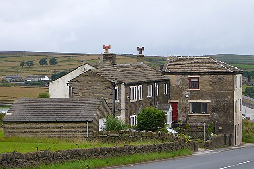
Houses in Brighouse and Denholme Gate Road, Queensbury, The Shay You checked the neighbourhood.Now check an address ! Photo: Tim Green from Bradford, CC BY 2.0 · Wikimedia Commons

For £24.99 a CrimesLog™ Home Report provides: (where available)

  • Nearest 6 Pre-school Nurseries to Address
  • Nearest 6 Primary Schools to Address
  • Nearest 6 Secondary/High Schools to Address
  • Nearest College and University to Address
  • Nearest to Address GP Practice/Health Centres, Hospitals and Pharmacies
  • Nearest 2 Police Station details to Address

The Home Report also provides

  • The CrimesLog™ Home Score is a proprietary Home Safety Measure capturing crime frequency, severity, recency and proximity to Address from police crime reporting point
  • A map indicating police anonymised crime reporting points around Address
  • Crime category trendlines for Address neighbourhood
  • List of Reported Crime Incidents around Address radius
  • Downloadable PDF report — A Permanent Copy to Keep and Share to aid your Property Research
  • Our crimes database of almost 60 million records is UPDATED EVERY MONTH from US, UK, CA police sources
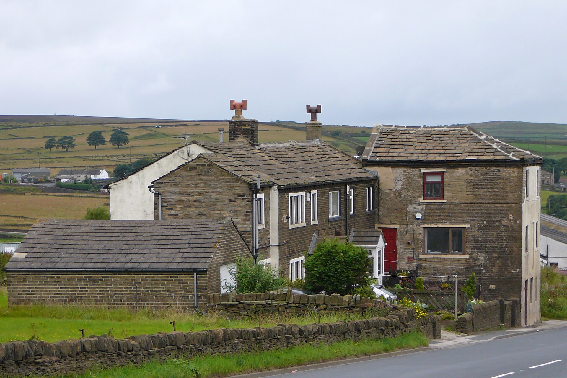
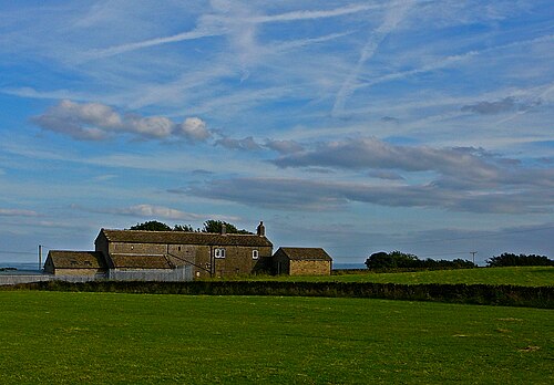
View from Clayton Town End, Old Dolphin
Old Dolphin · View from Clayton Town End
Photo: Tim Green from Bradford, CC BY 2.0 · Wikimedia Commons
Houses in Brighouse and Denholme Gate Road, Queensbury, The Shay
The Shay · Houses in Brighouse and Denholme Gate Road, Queensbury
Photo: Tim Green from Bradford, CC BY 2.0 · Wikimedia Commons
View Towards Manningham Mills from Hanging Falls, Old Dolphin
Old Dolphin · View Towards Manningham Mills from Hanging Falls
Photo: Tim Green from Bradford, CC BY 2.0 · Wikimedia Commons
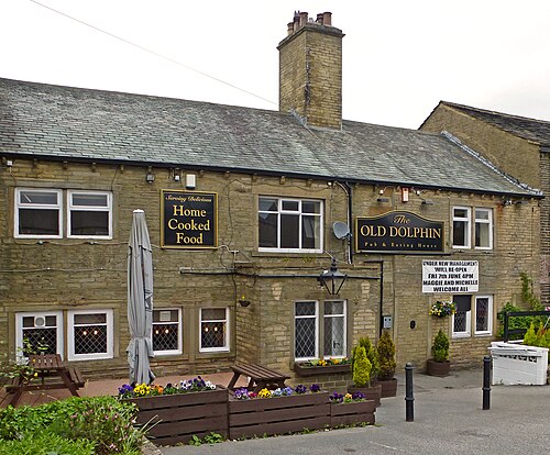
Old Dolphin, Highgate Road, Queensbury, Old Dolphin
Old Dolphin · Old Dolphin, Highgate Road, Queensbury
Photo: Tim Green from Bradford, CC BY 2.0 · Wikimedia Commons
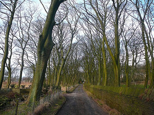
Avenue, Old Harrowins, Queensbury, Old Dolphin
Old Dolphin · Avenue, Old Harrowins, Queensbury
Photo: Tim Green from Bradford, CC BY 2.0 · Wikimedia Commons
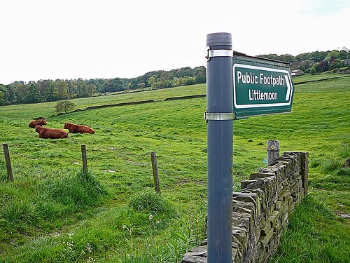
Footpath, New House Lane, Old Dolphin
Old Dolphin · Footpath, New House Lane
Photo: Tim Green from Bradford, CC BY 2.0 · Wikimedia Commons
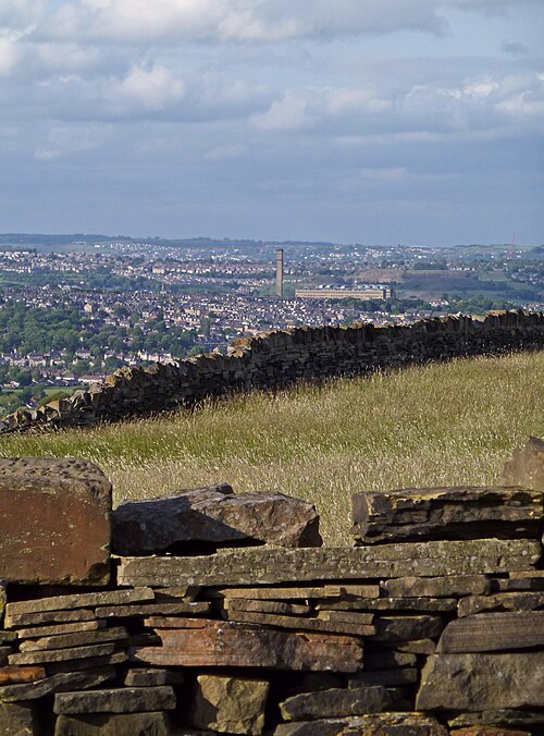
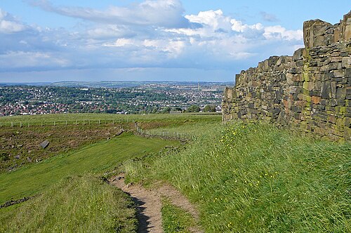
View Towards Manningham Mill, Old Dolphin
Old Dolphin · View Towards Manningham Mill
Photo: Tim Green from Bradford, CC BY 2.0 · Wikimedia Commons
Stott Hall Farm, Old Dolphin
Old Dolphin · Stott Hall Farm
Photo: Tim Green from Bradford, CC BY 2.0 · Wikimedia Commons

How neighbourhoods moved each quarter

2023

Whole-area crime rate 19.2 to 27.6 per 1,000 (high: Q1 2023).

Big moves (4+ places in a quarter): moved down The Shay 4th→8th (Q3)

2024

Whole-area crime rate 15.8 to 21.2 per 1,000 (high: Q3 2024).

Big moves (4+ places in a quarter): moved up The Shay 7th→3rd (Q1) moved down Hill Top 2nd→6th (Q1) moved up Clayton 7th→2nd (Q4)

2025

Whole-area crime rate 17.3 to 21.1 per 1,000 (high: Q2 2025).

Big moves (4+ places in a quarter): moved down Clayton 2nd→8th (Q1) moved up Clayton 8th→4th (Q2) moved down Catherine Slack 6th→10th (Q2) moved down Clayton 4th→9th (Q3) moved up The Shay 7th→2nd (Q4) moved down Old Dolphin 6th→10th (Q4)

2026

Whole-area crime rate 17.6 to 18.5 per 1,000 (high: Q2 2026). 2 quarters so far.

Big moves (4+ places in a quarter): moved up Denholme Clough 5th→1st (Q1) moved down The Shay 2nd→8th (Q1) moved up Catherine Slack 7th→2nd (Q2)

Reported Safety Incidents

In Q2 2026: violent incidents were 44% (123), public order incidents were 25% (70), property incidents were 24% (66) and vehicle crimes were 6% (18).

Recorded crime here is grouped into violent crime, property crime (burglary and theft), vehicle crime and public order offences, so you can compare how safe each neighbourhood is for the kind of crime that matters to you.

Places we left out, and places to read with care

Left out: Keelham; Sun Side; West Scholes. They have almost no residents: their crimes are against visitors, so a rate per resident says little about living there.

The Shay (21.6 per 1,000 from 7 crimes among 324 residents), Town End (2.6 per 1,000 from 1 crime among 386 residents), Clayton (21.9 per 1,000 from 9 crimes among 411 residents), Denholme Clough (7.6 per 1,000 from 4 crimes among 525 residents) and Old Dolphin (21.5 per 1,000 from 18 crimes among 838 residents) are places with few residents (under 3,000): a rate on so few people says little about living there, so they are not named as the lowest or highest.

The 10 neighbourhoods on the map

Halifax is made of 10 neighbourhoods compared here, each in its own colour on the map. They are neighbourhood areas derived by CrimesLog from rail station locations and OS Open Names: 14,994 residents between them.

  • Catherine Slack
  • Clayton
  • Clayton Heights
  • Denholme Clough
  • Hill Top
  • Mountain
  • Old Dolphin
  • Queensbury
  • The Shay
  • Town End

All 10 neighbourhoods, Q2 2026

Crimes per 1,000 residents, Q2 2026, lowest first. The last two columns compare with Q1 2023.
#NeighbourhoodResidentsAllViolentPropertyVehiclePublic orderRate vs Q1 2023Places gained
1Town End †3862.60.02.60.00.0down75%up1
2Catherine Slack9487.41.12.10.04.2down71%up5
3Denholme Clough †5257.63.80.03.80.0up100%down2
4Mountain1,8528.14.30.01.62.2down42%down1
5Hill Top2,15113.03.74.70.04.7down22%down1
6Clayton Heights1,56713.48.33.20.01.9down46%–
7Old Dolphin †83821.57.24.82.47.2down18%up1
8The Shay †32421.612.33.10.06.2down13%down3
9Clayton †41121.94.92.44.99.7down59%up1
10Queensbury5,99227.913.27.01.56.2down28%down1

† The Shay, Town End, Clayton, Denholme Clough and Old Dolphin are places with few residents. A rate on a very small number of residents or crimes is not comparable with the others.

Photographs

128 photographs of the 10 neighbourhoods run along the reel; click one to see it full size. Each is credited here and under the large view.

All 128 photographs and their credits
  1. Old Dolphin · View from Clayton Town End. Photo: Tim Green from Bradford, CC BY 2.0 · Wikimedia Commons
  2. The Shay · Houses in Brighouse and Denholme Gate Road, Queensbury. Photo: Tim Green from Bradford, CC BY 2.0 · Wikimedia Commons
  3. Old Dolphin · View Towards Manningham Mills from Hanging Falls. Photo: Tim Green from Bradford, CC BY 2.0 · Wikimedia Commons
  4. Old Dolphin · Old Dolphin, Highgate Road, Queensbury. Photo: Tim Green from Bradford, CC BY 2.0 · Wikimedia Commons
  5. Old Dolphin · Avenue, Old Harrowins, Queensbury. Photo: Tim Green from Bradford, CC BY 2.0 · Wikimedia Commons
  6. Old Dolphin · Footpath, New House Lane. Photo: Tim Green from Bradford, CC BY 2.0 · Wikimedia Commons
  7. Old Dolphin · View Towards Manningham Mill. Photo: Tim Green from Bradford, CC BY 2.0 · Wikimedia Commons
  8. Old Dolphin · Stott Hall Farm. Photo: Tim Green from Bradford, CC BY 2.0 · Wikimedia Commons
  9. Old Dolphin · Avenue in Littlemoor Park, Queensbury, May 2008. Photo: Tim Green from Bradford, CC BY 2.0 · Wikimedia Commons
  10. Town End · Manningham Mills from Clayton Town End. Photo: Tim Green from Bradford, CC BY 2.0 · Wikimedia Commons
  11. Denholme Clough · Denholme Church. Photo: Tim Green from Bradford, CC BY 2.0 · Wikimedia Commons
  12. Hill Top · Egypt Road, Thornton. Photo: Tim Green from Bradford, CC BY 2.0 · Wikimedia Commons
  13. Clayton Heights · Nab End. Photo: Tim Green from Bradford, CC BY 2.0 · Wikimedia Commons
  14. Clayton · Clayton CofE First School (Former). Photo: Tim Green from Bradford, CC BY 2.0 · Wikimedia Commons
  15. Baildon · Baildon Methodist Church. Photo: Tim Green, CC BY 2.0 · Wikimedia Commons
  16. Burley-in-Wharfedale · Pool, Bleach Mill, Menston. Photo: Tim Green from Bradford, CC BY 2.0 · Wikimedia Commons
  17. Bingley · Bingley Catholic Church December 2025 Cf 1. Photo: Secretlondon, CC BY 4.0 · Wikimedia Commons
  18. Crossflatts · The Acorn, Eldwick (25th September 2010). Photo: Flickr user:Tim Green aka atouch, CC BY 2.0 · Wikimedia Commons
  19. Harecroft · Station Hotel. Photo: Tim Green from Bradford, UK, CC BY 2.0 · Wikimedia Commons
  20. Thornton · Thornton Church. Photo: Tim Green from Bradford, CC BY 2.0 · Wikimedia Commons
  21. Wilsden · New Inn, Wilsden. Photo: Flickr user:Tim Green aka atouch, CC BY 2.0 · Wikimedia Commons
  22. Cackleshaw · Oakworth Railway Station. Photo: Thomas's Pics, CC BY 2.0 · Wikimedia Commons
  23. Cullingworth · Stained Glass Window in Cullingworth Church. Photo: Tim Green from Bradford, CC BY 2.0 · Wikimedia Commons
  24. Denholme · Denholme Church and Dean Brow Farm. Photo: Tim Green from Bradford, CC BY 2.0 · Wikimedia Commons
  25. Flappit Spring · The Flappit, Keighley. Photo: Tim Green from Bradford, CC BY 2.0 · Wikimedia Commons
  26. Haworth · Brontë Parsonage Museum, Church St, Haworth. Photo: Robert Linsdell from St. Andrews, Canada, CC BY 2.0 · Wikimedia Commons
  27. Keighley · Damems Station. Photo: Tim Green from Bradford, CC BY 2.0 · Wikimedia Commons
  28. Lees · Chimney of Ebor Mill. Photo: Tim Green from Bradford, CC BY 2.0 · Wikimedia Commons
  29. Lumb Foot · Sladen Bridge. Photo: Tim Green from Bradford, CC BY 2.0 · Wikimedia Commons
  30. Oakworth · Drone View of Houses (Unsplash). Photo: Richard Horne richardhorne, CC0 · Wikimedia Commons
  31. Oxenhope · Churns at Oxenhope Station. Photo: Tim Green, CC BY 2.0 · Wikimedia Commons
  32. Ryecroft · Goit Stock Mill Chimney. Photo: Tim Green from Bradford, CC BY 2.0 · Wikimedia Commons
  33. Bradford Forster Square · Entrance to Cartwright Hall. Photo: Green Giant, CC BY 4.0 · Wikimedia Commons
  34. Bradford Interchange · Bolling Hall Ghost Room. Photo: Michael D Beckwith from England, CC0 · Wikimedia Commons
  35. Horton Bank · Great Horton Road, Bradford. Photo: Tim Green from Bradford, CC BY 2.0 · Wikimedia Commons
  36. Horton Bank Top · Horton Bank Country Park, Queesnbury. Photo: Tim Green, CC BY 2.0 · Wikimedia Commons
  37. Low Moor · Black Horse Hotel in Cleckheaton Road, Low Moor, Bradford. Photo: Tim Green from Bradford, CC BY 2.0 · Wikimedia Commons
  38. Tong · St Bartholomew. Photo: Peter Broster, CC BY 2.0 · Wikimedia Commons
  39. Saltaire · Congregational Church, Saltaire - Interior. Photo: Tim Green from Bradford, CC BY 2.0 · Wikimedia Commons
  40. Shipley · Cartwright Hall. Photo: Tim Green from Bradford, CC BY 2.0 · Wikimedia Commons
  41. Town End · Barn, Town End, Clayton. Photo: Tim Green from Bradford, CC BY 2.0 · Wikimedia Commons
  42. Denholme Clough · St Paul, Denholme. Photo: Tim Green from Bradford, CC BY 2.0 · Wikimedia Commons
  43. Hill Top · Duke of York, Allerton, Bradford. Photo: Tim Green from Bradford, UK, CC BY 2.0 · Wikimedia Commons
  44. Clayton Heights · Highgate Mills, Clayton Heights. Photo: Tim Green from Bradford, CC BY 2.0 · Wikimedia Commons
  45. Clayton · Royal Hotel. Photo: Tim Green from Bradford, CC BY 2.0 · Wikimedia Commons
  46. Baildon · Buck Mill Bridge 4. Photo: Tim Green from Bradford, CC BY 2.0 · Wikimedia Commons
  47. Burley-in-Wharfedale · The Hermit, Burley Woodhead. Photo: Tim Green from Bradford, CC BY 2.0 · Wikimedia Commons
  48. Bingley · Bingley Catholic Church December 2025 Cf 2. Photo: Secretlondon, CC BY 4.0 · Wikimedia Commons
  49. Crossflatts · Bethel Chapel, East Morton. Photo: Tim Green from Bradford, CC BY 2.0 · Wikimedia Commons
  50. Harecroft · Hallas Mill. Photo: Tim Green from Bradford, CC BY 2.0 · Wikimedia Commons
  51. Thornton · Thornton Church. Photo: Tim Green from Bradford, CC BY 2.0 · Wikimedia Commons
  52. Cackleshaw · A Traditional Wooden Station Nameboard, 2013. Photo: Roger Carvell, CC BY 3.0 · Wikimedia Commons
  53. Cullingworth · Cullingworth Church, from Catstones End. Photo: Tim Green from Bradford, CC BY 2.0 · Wikimedia Commons
  54. Haworth · Bronte Parsonage Museum. Photo: Jay Sands, CC BY 3.0 · Wikimedia Commons
  55. Keighley · Barn at East Riddlesden Hall, Keighley. Photo: Tim Green from Bradford, CC BY 2.0 · Wikimedia Commons
  56. Bradford Forster Square · Bright Building, University of Bradford. Photo: Tim Green, CC BY 2.0 · Wikimedia Commons
  57. Bradford Interchange · Bolling Hall Housebody. Photo: Michael D Beckwith, CC0 · Wikimedia Commons
  58. Horton Bank · Lister's Mill, from Hollingwood Lane. Photo: Tim Green from Bradford, CC BY 2.0 · Wikimedia Commons
  59. Horton Bank Top · View from Horton Bank Country Park. Photo: Tim Green from Bradford, CC BY 2.0 · Wikimedia Commons
  60. Low Moor · Holy Trinity, Low Moor 2. Photo: Tim Green from Bradford, CC BY 2.0 · Wikimedia Commons
  61. Saltaire · Congregational (United Reformed) Church, Saltaire. Photo: Tim Green from Bradford, CC BY 2.0 · Wikimedia Commons
  62. Shipley · Canal Bridge, Shipley. Photo: Tim Green from Bradford, CC BY 2.0 · Wikimedia Commons
  63. Town End · St James, Thornton. Photo: Tim Green from Bradford, CC BY 2.0 · Wikimedia Commons
  64. Denholme Clough · Cross and Spire. Photo: Tim Green from Bradford, CC BY 2.0 · Wikimedia Commons
  65. Hill Top · Rock and Heifer. Photo: Tim Green from Bradford, CC BY 2.0 · Wikimedia Commons
  66. Clayton · Chrisharben Park Lodge, Clayton. Photo: Tim Green from Bradford, CC BY 2.0 · Wikimedia Commons
  67. Baildon · House on the Moor. Photo: Tim Green from Bradford, CC BY 2.0 · Wikimedia Commons
  68. Bingley · All Saints, Bingley Flickr 16 August 2023. Photo: Tim Green, CC BY 2.0 · Wikimedia Commons
  69. Thornton · Bell Chapel, Thornton. Photo: Tim Green, CC BY 2.0 · Wikimedia Commons
  70. Cackleshaw · Oakworth Railway Station-3189338134. Photo: jay-jerry, CC BY 2.0 · Wikimedia Commons
  71. Cullingworth · Cullingworth. Photo: Tim Green from Bradford, CC BY 2.0 · Wikimedia Commons
  72. Haworth · British Railways Standard Class 4 No. 75078 at Haworth Station - July 2023. Photo: Alan King, Public domain · Wikimedia Commons
  73. Keighley · Barn, East Riddlesden Hall. Photo: Tim Green from Bradford, CC BY 2.0 · Wikimedia Commons
  74. Bradford Forster Square · Cape Street. Photo: Tim Green from Bradford, CC BY 2.0 · Wikimedia Commons
  75. Bradford Interchange · Bolling Hall Georgian Drawing Room. Photo: Michael D Beckwith from England, CC0 · Wikimedia Commons
  76. Horton Bank · The Monkey, Great Horton. Photo: Tim Green from Bradford, CC BY 2.0 · Wikimedia Commons
  77. Horton Bank Top · Horton Bank Country Park. Photo: Tim Green, CC BY 2.0 · Wikimedia Commons
  78. Low Moor · Corner Stores. Photo: Tim Green from Bradford, CC BY 2.0 · Wikimedia Commons
  79. Saltaire · Boathouse, Saltaire. Photo: Tim Green from Bradford, CC BY 2.0 · Wikimedia Commons
  80. Shipley · Cartwright Hall. Photo: Tim Green from Bradford, CC BY 2.0 · Wikimedia Commons
  81. Denholme Clough · St Paul's, Denholme - North Side. Photo: Tim Green from Bradford, CC BY 2.0 · Wikimedia Commons
  82. Baildon · Baildon Parish Church. Photo: Tim Green from Bradford, CC BY 2.0 · Wikimedia Commons
  83. Thornton · Bell Chapel, Thornton. Photo: Tim Green from Bradford, CC BY 2.0 · Wikimedia Commons
  84. Cackleshaw · Oakworth Level Crossing. Photo: Thomas's Pics, CC BY 2.0 · Wikimedia Commons
  85. Cullingworth · Cullingworth Sundial. Photo: Tim Green from Bradford, CC BY 2.0 · Wikimedia Commons
  86. Haworth · Church St, Haworth. Photo: Robert Linsdell from St. Andrews, Canada, CC BY 2.0 · Wikimedia Commons
  87. Keighley · Cliffe Castle Music Room. Photo: Michael D Beckwith from England, CC0 · Wikimedia Commons
  88. Bradford Forster Square · Abingdon Street, Manningham. Photo: Tim Green from Bradford, CC BY 2.0 · Wikimedia Commons
  89. Horton Bank Top · Manningham Mills, from the Horton Bank Country Park. Photo: Tim Green from Bradford, CC BY 2.0 · Wikimedia Commons
  90. Saltaire · Back Alley at Saltaire. Photo: Alison Christine from North Yorkshire, UK, CC BY 2.0 · Wikimedia Commons
  91. Shipley · Cartwright Hall, Lister Park. Photo: Tim Green from Bradford, CC BY 2.0 · Wikimedia Commons
  92. Denholme Clough · St Paul's Denholme 2. Photo: Tim Green from Bradford, CC BY 2.0 · Wikimedia Commons
  93. Baildon · Baildon Parish Church. Photo: Tim Green from Bradford, CC BY 2.0 · Wikimedia Commons
  94. Thornton · Long Lane, Allerton, Bradford. Photo: Tim Green from Bradford, CC BY 2.0 · Wikimedia Commons
  95. Cullingworth · Cullingworth. Photo: Tim Green from Bradford, CC BY 2.0 · Wikimedia Commons
  96. Haworth · North Street, Haworth. Photo: Tim Green from Bradford, CC BY 2.0 · Wikimedia Commons
  97. Keighley · Cliffe Castle Great Drawing Room. Photo: Michael D Beckwith from England, CC0 · Wikimedia Commons
  98. Bradford Forster Square · Chimney, Westholme Street, Bradford. Photo: Tim Green from Bradford, CC BY 2.0 · Wikimedia Commons
  99. Horton Bank Top · Bank Top Mill, Beacon Road, Bradford. Photo: Tim Green from Bradford, CC BY 2.0 · Wikimedia Commons
  100. Saltaire · Bell and Chimneys in Saltaire. Photo: Tim Green from Bradford, CC BY 2.0 · Wikimedia Commons
  101. Shipley · Crag Road Methodist Chapel, Shipley. Photo: Tim Green from Bradford, CC BY 2.0 · Wikimedia Commons
  102. Baildon · Buck Mill Bridge. Photo: Tim Green from Bradford, CC BY 2.0 · Wikimedia Commons
  103. Haworth · Brontë Parsonage Museum, Church St, Haworth. Photo: Robert Linsdell from St. Andrews, Canada, CC BY 2.0 · Wikimedia Commons
  104. Bradford Forster Square · Drinking Fountain at Peel Park. Photo: Tim Green from Bradford, CC BY 2.0 · Wikimedia Commons
  105. Horton Bank Top · Arch 2. Photo: Tim Green from Bradford, CC BY 2.0 · Wikimedia Commons
  106. Saltaire · Ancient and Modern. Photo: Tim Green from Bradford, CC BY 2.0 · Wikimedia Commons
  107. Shipley · Cartwright Hall. Photo: Tim Green from Bradford, CC BY 2.0 · Wikimedia Commons
  108. Baildon · Baildon Bank. Photo: Tim Green from Bradford, CC BY 2.0 · Wikimedia Commons
  109. Haworth · 43924 - Pulling Into Howarth Station. Photo: puffin11uk, CC0 · Wikimedia Commons
  110. Bradford Forster Square · Bradford Town Hall. Photo: Tim Green from Bradford, CC BY 2.0 · Wikimedia Commons
  111. Horton Bank Top · Horton Bank Top, Bradford. Photo: Tim Green from Bradford, CC BY 2.0 · Wikimedia Commons
  112. Saltaire · Hirst Mill Flickr 12 July 2024. Photo: Tim Green, CC BY 2.0 · Wikimedia Commons
  113. Shipley · Heaton Mount. Photo: Tim Green from Bradford, CC BY 2.0 · Wikimedia Commons
  114. Baildon · Baildon Bank. Photo: Tim Green from Bradford, CC BY 2.0 · Wikimedia Commons
  115. Haworth · Arrival, Haworth Station. Photo: Tim Green from Bradford, CC BY 2.0 · Wikimedia Commons
  116. Bradford Forster Square · Cloudy Campus. Photo: Tim Green from Bradford, UK, CC BY 2.0 · Wikimedia Commons
  117. Horton Bank Top · Arch 3 Bw. Photo: Tim Green from Bradford, CC BY 2.0 · Wikimedia Commons
  118. Shipley · Manningham Mills, from Heaton. Photo: Tim Green from Bradford, CC BY 2.0 · Wikimedia Commons
  119. Haworth · Eyes Right. Photo: ARG_Flickr, CC BY 2.0 · Wikimedia Commons
  120. Bradford Forster Square · Cartwright Hall April 2014. Photo: Green Giant, CC BY 4.0 · Wikimedia Commons
  121. Horton Bank Top · Head, Bank Top Mill. Photo: Tim Green from Bradford, CC BY 2.0 · Wikimedia Commons
  122. Shipley · Converted Mill at Shipley. Photo: Tim Green from Bradford, CC BY 2.0 · Wikimedia Commons
  123. Haworth · Ginnel in Haworth. Photo: Tim Green from Bradford, CC BY 2.0 · Wikimedia Commons
  124. Bradford Forster Square · Cartwright Hall Flickr 24 September 2022. Photo: Tim Green, CC BY 2.0 · Wikimedia Commons
  125. Shipley · Erected by the Baptists. Photo: Tim Green from Bradford, CC BY 2.0 · Wikimedia Commons
  126. Bradford Forster Square · Cartwright Hall Flickr 9 May 2024. Photo: Tim Green, CC BY 2.0 · Wikimedia Commons
  127. Bradford Forster Square · Cartwright Hall Flickr 7 April 2024. Photo: Tim Green, CC BY 2.0 · Wikimedia Commons
  128. Bradford Forster Square · Cartwright Hall Flickr 21 September 2023. Photo: Tim Green, CC BY 2.0 · Wikimedia Commons

Sources and notes

CrimesLog sources crime incident data as published by the UK Home Office through their national data portal at data.police.uk and licensed under their Open Government Licence v3.0. Reported crime incidents originate from individual Territorial Police Forces of England, Wales and Northern Ireland

Contains ONS data © Crown copyright and database right. Contains NISRA data © Crown copyright. Licensed under the Open Government Licence v3.0.

First-place medal: 1st Place Medal emoji icon by Icons8.

Neighbourhood areas derived by CrimesLog from rail station locations (NaPTAN, Department for Transport) and OS Open Names. Contains OS data © Crown copyright and database right 2024; contains public sector information licensed under the Open Government Licence v3.0. The photographs are credited under each picture.

Rates are recorded crimes per 1,000 residents, quarter by quarter; where a neighbourhood has fewer than 100 residents the rate would be worked out on 100 (those places are left out of the race). A count of recorded crime is not a verdict on any neighbourhood.