Cleveland, Ohio · Neighborhood crime trends

Cleveland North East

10 neighborhoods - a quarterly race to the lowest crime rate.

Crime Trends: Neighborhoods compared - each quarter from Q1 2022

Cleveland as a whole averaged 47.3 crimes for every 1,000 residents per quarter in Q2 2026, while north east Cleveland averaged 57.1, hence it is generally less safe when all crimes are considered.

How do the 10 neighborhoods of north east Cleveland compare? In Q2 2026 the police recorded 5,520 crimes across them, 57.1 for every 1,000 residents. That is 0.1% below a year earlier and 20.4% above Q1 2022, the first quarter we track.

University has the lowest rate of the everyday neighborhoods (17.8 per 1,000), followed by North Shore Collinwood (39.5) and Glenville (55.2). Goodrich-Kirtland Pk has the highest (85.8).

Use the RACE CHARTS below to watch all 10 CLEVELAND NORTH EAST NEIGHBORHOODs race across 18 quarter periods from Q1 2022 to Q2 2026 - one crime category at a time or all together. The race chart can be used to compare average crime rates by category against Cleveland's average.

Neighborhood boundaries are defined by ClevelandGIS and simplified by CrimesLog.
Lowest rate (everyday)
lowest rateUniversity
17.8 crimes per 1,000 residents, Q2 2026
Highest rate
upGoodrich-Kirtland Pk
85.8 per 1,000, Q2 2026
Whole area, Q2 2026
57.1 per 1,000
down 0.1% below a year earlier · up 20.4% above Q1 2022
Compared
10 neighborhoods
96,708 residents · 18 quarters

Cleveland North East neighborhood quarterly crime race

Press ▶︎ to watch Q1 2022 to Q2 2026. Tick one crime category or several; hover a bar for the neighborhood. Property crimes includes burglaries and thefts.

Crime categories
Indicated: crimes rate per 1000 residents per quarterAll · safest at the top · square-root scale · Q1 2022 to Q2 202601510255053.9Collinwood-Nottingham73.0Downtown38.9Euclid-Green67.3Fairfax44.4Glenville59.1Goodrich-Kirtland Pk47.2Hough33.1North Shore Collinwood54.6St.Clair-Superior18.0UniversityCleveland Q2 2026 average all crimes (47.3)Numbers are crimes per 1,000 residents per quarter. Zero-crime quarters show 0 and rank safest.
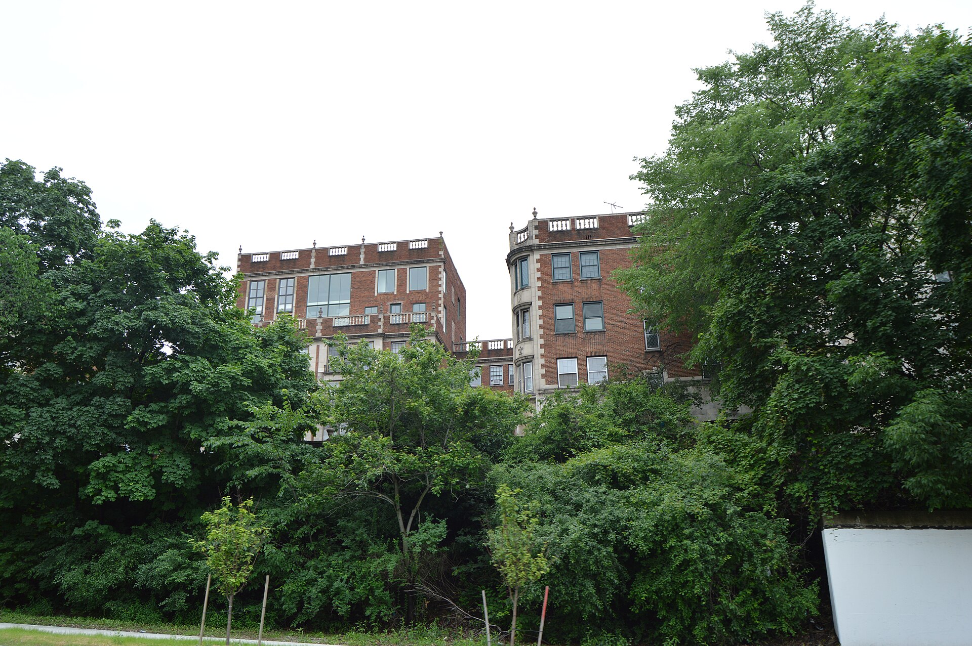
Cedar Glen Apartments from Below, University You checked the neighborhood.Now check an address ! Photo: Nyttend, Public domain · Wikimedia Commons

For $34.00 a CrimesLog™ Home Report provides: (where available)

  • Nearest 6 Pre-school Nurseries to Address
  • Nearest 6 Primary Schools to Address
  • Nearest 6 Secondary/High Schools to Address
  • Nearest College and University to Address
  • Nearest to Address Medical Clinics, Hospitals and Pharmacies
  • Nearest 2 Police Station details to Address

The Home Report also provides

  • The CrimesLog™ Home Score is a proprietary Home Safety Measure capturing crime frequency, severity, recency and proximity to Address from police crime reporting point
  • A map indicating police anonymized crime reporting points around Address
  • Crime category trendlines for Address neighborhood
  • List of Reported Crime Incidents around Address radius
  • Downloadable PDF report — A Permanent Copy to Keep and Share to aid your Property Research
  • Our crimes database of almost 60 million records is UPDATED EVERY MONTH from US, UK, CA police sources
Cedar Glen Apartments from Below, University
University · Cedar Glen Apartments from Below
Photo: Nyttend, Public domain · Wikimedia Commons
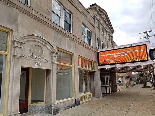
Cleveland - LaSalle Theatre (OHPTC), North Shore Collinwood
North Shore Collinwood · Cleveland - LaSalle Theatre (OHPTC)
Photo: Ohio Redevelopment Projects - ODSA, CC BY 2.0 · Wikimedia Commons
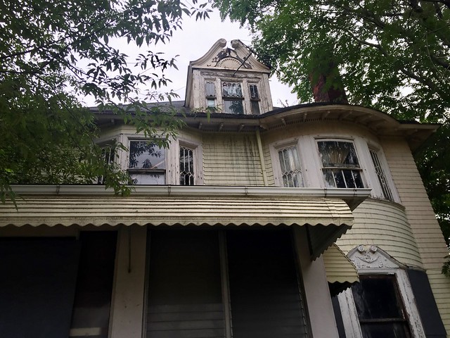
East 84th Street, Hough, Cleveland, OH, Hough
Hough · East 84th Street, Hough, Cleveland, OH
Photo: w_lemay, CC0 · Flickr
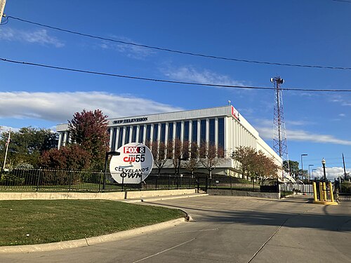
WJW WBNX Studios, St.Clair-Superior
St.Clair-Superior · WJW WBNX Studios
Photo: Nathan Obral, CC0 · Wikimedia Commons
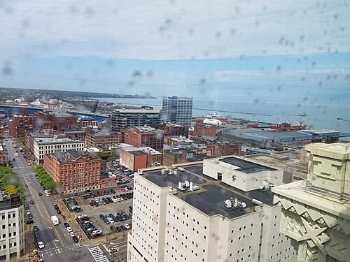
Cleveland - Standard Building (OHPTC), Downtown
Downtown · Cleveland - Standard Building (OHPTC)
Photo: Ohio Redevelopment Projects - ODSA, CC BY 2.0 · Wikimedia Commons
Euclid Avenue, Midtown, Cleveland, OH, Goodrich-Kirtland Pk
Goodrich-Kirtland Pk · Euclid Avenue, Midtown, Cleveland, OH
Photo: Warren LeMay from Cincinnati, OH, United States, CC0 · Wikimedia Commons
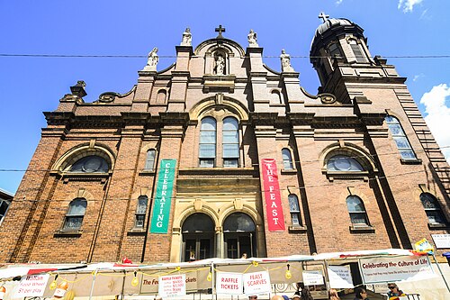
Feast of the Assumption in Little Italy Cleveland, University
University · Feast of the Assumption in Little Italy Cleveland
Photo: Erik Drost, CC BY 2.0 · Wikimedia Commons
Cleveland - LaSalle Theatre (OHPTC), North Shore Collinwood
North Shore Collinwood · Cleveland - LaSalle Theatre (OHPTC)
Photo: Ohio Redevelopment Projects - ODSA, CC BY 2.0 · Wikimedia Commons

How neighborhoods moved each quarter

2022

Whole-area crime rate 47.4 to 61.8 per 1,000 (high: Q4 2022).

Big moves (4+ places in a quarter): moved up Goodrich-Kirtland Pk 8th→4th (Q2)

2023

Whole-area crime rate 55.5 to 67.5 per 1,000 (high: Q2 2023).

No neighborhood moved more than three places in a quarter.

2024

Whole-area crime rate 55.6 to 65.9 per 1,000 (high: Q3 2024).

No neighborhood moved more than three places in a quarter.

2025

Whole-area crime rate 45.4 to 57.1 per 1,000 (high: Q2 2025).

No neighborhood moved more than three places in a quarter.

2026

Whole-area crime rate 45.8 to 57.1 per 1,000 (high: Q2 2026). 2 quarters so far.

No neighborhood moved more than three places in a quarter.

Reported Safety Incidents

In Q2 2026: property incidents were 33% (1,801), violent incidents were 29% (1,583), vehicle crimes were 10% (559) and public order incidents were 6% (354).

Recorded crime here is grouped into violent crime, property crime (burglary and theft), vehicle crime and public order offences, so you can compare how safe each neighborhood is for the kind of crime that matters to you.

Read category comparisons with care. A category that jumps while the total hardly moves looks like a change in how offences are classified, not in what happened: Q4 2022: vehicle up 69% while the total moved 4%; Q4 2025: public order down 29% while the total moved 1%. The whole-area rate is the steadier guide.

Places we left out, and places to read with care

No place is left out: every neighborhood in this race has residents to count.

The 10 neighborhoods on the map

North East is made of 10 neighborhoods compared here, each in its own colour on the map. They are the neighborhoods of the City of Cleveland (ClevelandGIS), grouped into areas of the city by CrimesLog: 96,708 residents between them.

  • Collinwood-Nottingham
  • Downtown
  • Euclid-Green
  • Fairfax
  • Glenville
  • Goodrich-Kirtland Pk
  • Hough
  • North Shore Collinwood
  • St.Clair-Superior
  • University

All 10 neighborhoods, Q2 2026

Crimes per 1,000 residents, Q2 2026, lowest first. The last two columns compare with Q1 2022.
#NeighborhoodResidentsAllViolentPropertyVehiclePublic orderRate vs Q1 2022Places gained
1University8,95617.87.02.32.50.5down1%–
2North Shore Collinwood15,61039.512.013.83.52.0up19%–
3Glenville20,79755.217.618.55.54.8up24%up1
4Hough9,41560.216.320.96.93.7up28%up1
5Euclid-Green5,24260.315.616.88.83.8up55%down2
6Collinwood-Nottingham9,10470.018.821.48.04.0up30%–
7St.Clair-Superior4,74371.521.525.15.73.4up31%–
8Downtown14,02473.216.725.76.34.5up0%up2
9Fairfax5,11376.925.826.27.65.3up14%–
10Goodrich-Kirtland Pk3,70485.824.822.98.15.9up45%down2

Photographs

171 photographs of the 10 neighborhoods run along the reel; click one to see it full size. Each is credited here and under the large view.

All 171 photographs and their credits
  1. University · Cedar Glen Apartments from Below. Photo: Nyttend, Public domain · Wikimedia Commons
  2. North Shore Collinwood · Cleveland - LaSalle Theatre (OHPTC). Photo: Ohio Redevelopment Projects - ODSA, CC BY 2.0 · Wikimedia Commons
  3. Hough · East 84th Street, Hough, Cleveland, OH. Photo: w_lemay, CC0 · Flickr
  4. St.Clair-Superior · WJW WBNX Studios. Photo: Nathan Obral, CC0 · Wikimedia Commons
  5. Downtown · Cleveland - Standard Building (OHPTC). Photo: Ohio Redevelopment Projects - ODSA, CC BY 2.0 · Wikimedia Commons
  6. Goodrich-Kirtland Pk · Euclid Avenue, Midtown, Cleveland, OH. Photo: Warren LeMay from Cincinnati, OH, United States, CC0 · Wikimedia Commons
  7. University · Feast of the Assumption in Little Italy Cleveland. Photo: Erik Drost, CC BY 2.0 · Wikimedia Commons
  8. North Shore Collinwood · Cleveland - LaSalle Theatre (OHPTC). Photo: Ohio Redevelopment Projects - ODSA, CC BY 2.0 · Wikimedia Commons
  9. Hough · Newton Avenue Historic District, Hough, Cleveland, OH. Photo: w_lemay, CC0 · Flickr
  10. Downtown · Cleveland - Standard Building (OHPTC). Photo: Ohio Redevelopment Projects - ODSA, CC BY 2.0 · Wikimedia Commons
  11. Goodrich-Kirtland Pk · Cleveland, Central, 2018 - Old Statue, Euclid Avenue, Midtown, Cleveland, OH. Photo: Warren LeMay from Cincinnati, OH, United States, CC0 · Wikimedia Commons
  12. University · Linsalata Alumni Center, Case Western Reserve University, Cleveland, OH. Photo: w_lemay, CC0 · Flickr
  13. Hough · East 89th Street Historic District, Hough, Cleveland, OH. Photo: w_lemay, CC0 · Flickr
  14. Downtown · University Hall, Cleveland State University. Photo: Nyttend, Public domain · Wikimedia Commons
  15. University · Morley Building, Case Western Reserve University, Cleveland, OH. Photo: w_lemay, CC0 · Flickr
  16. Hough · Newton Avenue, Hough, Cleveland, OH. Photo: w_lemay, CC0 · Flickr
  17. Downtown · Downtown Church. Photo: matthew.devalle, CC BY 2.0 · Flickr
  18. Hough · Newton Avenue, Hough, Cleveland, OH. Photo: w_lemay, CC0 · Flickr
  19. Downtown · Downtown Cleveland. Photo: Slideshow Bruce, CC BY 2.0 · Flickr
  20. Downtown · Downtown Cleveland. Photo: airbus777, CC BY 2.0 · Flickr
  21. Downtown · Part of the New Downtown Cleveland Hilton. Photo: KalinaSoftware, CC BY 2.0 · Flickr
  22. Downtown · Downtown Cleveland Panorama. Photo: jonridinger, CC BY 2.0 · Flickr
  23. Downtown · Downtown Cleveland from Columbus Road Lift Bridge. Photo: roy.luck, CC BY 2.0 · Flickr
  24. Downtown · Downtown Cleveland and Lift Bridges. Photo: roy.luck, CC BY 2.0 · Flickr
  25. University · Allosaurus in Cleveland Natural History Museum. Photo: Erik Drost, CC BY 4.0 · Wikimedia Commons
  26. Glenville · Public Library Carnegie Superior Branch. Photo: Nyttend, Public domain · Wikimedia Commons
  27. Hough · Hough Avenue Reformed Church. Photo: Ronrodjr, CC0 · Wikimedia Commons
  28. Downtown · East 4th Street. Photo: Erik Drost, CC BY 2.0 · Wikimedia Commons
  29. Fairfax · Euclid Avenue Aldi. Photo: Nyttend, Public domain · Wikimedia Commons
  30. Goodrich-Kirtland Pk · Cleveland, Central, 2018 - Cleveland First United Methodist Church, Midtown, Cleveland, OH. Photo: Warren LeMay from Cincinnati, OH, United States, CC0 · Wikimedia Commons
  31. Broadway-Slavic Village · Harvard School Front. Photo: Nyttend, Public domain · Wikimedia Commons
  32. Buckeye-Shaker Square · Fairhill Road Village Single House. Photo: Nyttend, Public domain · Wikimedia Commons
  33. Buckeye-Woodhill · St Elizabeth of Hungary Rectory, Buckeye Road. Photo: Nyttend, Public domain · Wikimedia Commons
  34. Central · Jacob Goldsmith House Site. Photo: Nyttend, Public domain · Wikimedia Commons
  35. Cuyahoga Valley · Historic U.S. Coast Guard Station in Cleveland. Photo: Erik Drost, CC BY 2.0 · Wikimedia Commons
  36. Union-Miles · Miles Park Library. Photo: Nyttend, Public domain · Wikimedia Commons
  37. Edgewater · Rock & Roll Hall of Fame. Photo: Erik Drost, CC BY 2.0 · Wikimedia Commons
  38. Kamm's · CTS Rapid Transit Sign (8404469408) (2). Photo: David Wilson from Oak Park, Illinois, USA, CC BY 2.0 · Wikimedia Commons
  39. Bellaire-Puritas · Rockport Branch Library. Photo: Packer1028, CC0 · Wikimedia Commons
  40. Hopkins · Hopkins Towers. Photo: Mark Turnauckas, CC BY 2.0 · Flickr
  41. Jefferson · Thomas Jefferson. Photo: eekim, CC BY 2.0 · Flickr
  42. Brooklyn Centre · Daisy at West 32nd in Cleveland. Photo: Nyttend, Public domain · Wikimedia Commons
  43. Clark-Fulton · Hilliard Apartment Building Site. Photo: Nyttend, Public domain · Wikimedia Commons
  44. Detroit Shoreway · St Stephen Church, West Side Cleveland. Photo: Nyttend, Public domain · Wikimedia Commons
  45. Ohio City · West Side Magyar Baptist Church, Cleveland. Photo: Ronrodjr, CC0 · Wikimedia Commons
  46. Tremont · Saint Michael's School, 3146 Scranton Road, Cleveland, OH 44109. Photo: Ronrodjr, CC0 · Wikimedia Commons
  47. University · First Church of Christ, Scientist, of Cleveland. Photo: Nyttend, Public domain · Wikimedia Commons
  48. Glenville · 99th Near Hampden in Cleveland. Photo: Nyttend, Public domain · Wikimedia Commons
  49. Hough · Newton Avenue in Cleveland. Photo: Nyttend, Public domain · Wikimedia Commons
  50. Downtown · Full Moon Over Terminal Tower. Photo: Erik Drost, CC BY 2.0 · Wikimedia Commons
  51. Fairfax · Euclid Avenue 8400 Block. Photo: Nyttend, Public domain · Wikimedia Commons
  52. Goodrich-Kirtland Pk · Cleveland, Central, 2018 - Euclid Avenue, Midtown, Cleveland, OH. Photo: Warren LeMay from Cincinnati, OH, United States, CC0 · Wikimedia Commons
  53. Broadway-Slavic Village · St Stanislaus School, Cleveland. Photo: Nyttend, Public domain · Wikimedia Commons
  54. Buckeye-Shaker Square · Moreland Theater Front. Photo: Nyttend, Public domain · Wikimedia Commons
  55. Buckeye-Woodhill · St Elizabeth of Hungary Parish Hall on Buckeye Road. Photo: Nyttend, Public domain · Wikimedia Commons
  56. Central · St. John's AME Church in Cleveland. Photo: Nyttend, Public domain · Wikimedia Commons
  57. Cuyahoga Valley · Historic U.S. Coast Guard Station in Cleveland. Photo: Erik Drost, CC BY 2.0 · Wikimedia Commons
  58. Edgewater · Cleveland Skyline from Edgewater Beach House. Photo: James E. Walker Jr., CC BY 2.0 · Flickr
  59. Bellaire-Puritas · Crossburn Park. Photo: Packer1028, CC0 · Wikimedia Commons
  60. Hopkins · Cleveland Hopkins Concourse D (Closed). Photo: airbus777, CC BY 2.0 · Flickr
  61. Detroit Shoreway · University Circle Cherry Blossoms. Photo: Erik Drost, CC BY 2.0 · Wikimedia Commons
  62. Ohio City · Rocket Mortgage FieldHouse and Progressive Field. Photo: Erik Drost, CC BY 2.0 · Wikimedia Commons
  63. Tremont · Mega Church. Photo: Ronrodjr, CC0 · Wikimedia Commons
  64. University · Cleveland Museum of Art. Photo: Erik Drost, CC BY 2.0 · Wikimedia Commons
  65. Glenville · University Circle. Photo: Erik Drost, CC BY 2.0 · Wikimedia Commons
  66. Hough · East 89th Street Historic District. Photo: User:Nyttend, Public domain · Wikimedia Commons
  67. Downtown · Cleveland Playhouse Square. Photo: Erik Drost, CC BY 2.0 · Wikimedia Commons
  68. Fairfax · Charles Schweinfurth House from Chester. Photo: Nyttend, Public domain · Wikimedia Commons
  69. Goodrich-Kirtland Pk · Cleveland, Central, 2018 - Agora Theatre and Ballroom, Euclid Avenue, Midtown, Cleveland, OH. Photo: Warren LeMay from Cincinnati, OH, United States, CC0 · Wikimedia Commons
  70. Broadway-Slavic Village · Bohemian National Hall. Photo: Nyttend, Public domain · Wikimedia Commons
  71. Buckeye-Shaker Square · Shaker Square Cinemas. Photo: Packer1028, CC0 · Wikimedia Commons
  72. Buckeye-Woodhill · Weizer Building Site, 8935 Buckeye Road. Photo: Nyttend, Public domain · Wikimedia Commons
  73. Central · Cleveland, Central, 2018 - Phillip Gaensslen House, Prospect Avenue Historic District, Midtown, Cleveland, OH (283260553. Photo: Warren LeMay from Cincinnati, OH, United States, CC0 · Wikimedia Commons
  74. Cuyahoga Valley · Cleveland Bridge. Photo: Erik Drost, CC BY 2.0 · Wikimedia Commons
  75. Edgewater · Beauty Unknown. Photo: mitch_peanut, CC BY 2.0 · Flickr
  76. Bellaire-Puritas · Gilmore Park, Cuyahoga County. Photo: Packer1028, CC0 · Wikimedia Commons
  77. Hopkins · . Photo: Pat Kilkenny, CC BY 2.0 · Flickr
  78. Detroit Shoreway · University Circle Cherry Blossoms. Photo: Erik Drost, CC BY 2.0 · Wikimedia Commons
  79. Ohio City · Forest City Bank Building. Photo: Nyttend, Public domain · Wikimedia Commons
  80. Tremont · Cleveland Public Library South Branch, Scranton Road, Cleveland, OH. Photo: Ronrodjr, CC0 · Wikimedia Commons
  81. University · Downtown Cleveland - James A. Garfield Monument. Photo: Erik Drost, CC BY 2.0 · Wikimedia Commons
  82. Glenville · East 98th Street, Glenville, Cleveland, OH. Photo: w_lemay, CC0 · Flickr
  83. Hough · 1872 E. 89th St., Cleveland. Photo: User:Nyttend, Public domain · Wikimedia Commons
  84. Downtown · Cleveland - Standard Building (OHPTC). Photo: Ohio Redevelopment Projects - ODSA, CC BY 2.0 · Wikimedia Commons
  85. Fairfax · Henry P. White House. Photo: Nyttend, Public domain · Wikimedia Commons
  86. Goodrich-Kirtland Pk · Cleveland, Central, 2018 - Euclid Avenue, Midtown, Cleveland, OH. Photo: Warren LeMay from Cincinnati, OH, United States, CC0 · Wikimedia Commons
  87. Broadway-Slavic Village · Waterman Service Building, Front from North. Photo: Nyttend, Public domain · Wikimedia Commons
  88. Central · Cleveland, Central, 2018 - Gifford House, Prospect Avenue Historic District, Midtown, Cleveland, OH. Photo: Warren LeMay from Cincinnati, OH, United States, CC0 · Wikimedia Commons
  89. Cuyahoga Valley · Cleveland Bridge. Photo: Erik Drost, CC BY 2.0 · Wikimedia Commons
  90. Edgewater · Cleveland from Edgewater Pier. Photo: RuggyBearLA, CC BY 2.0 · Flickr
  91. Detroit Shoreway · University Circle Cherry Blossoms. Photo: Erik Drost, CC BY 2.0 · Wikimedia Commons
  92. Ohio City · Miller Block on Lorain Avenue. Photo: Nyttend, Public domain · Wikimedia Commons
  93. Tremont · Cleveland Metroparks Towpath Trail. Photo: Erik Drost, CC BY 2.0 · Wikimedia Commons
  94. University · Art Museum and Lagoon. Photo: Erik Drost, CC BY 2.0 · Wikimedia Commons
  95. Glenville · East 98th Street, Glenville, Cleveland, OH. Photo: w_lemay, CC0 · Flickr
  96. Hough · East 84th Street, Hough, Cleveland, OH. Photo: w_lemay, CC0 · Flickr
  97. Downtown · Cleveland - Standard Building (OHPTC). Photo: Ohio Redevelopment Projects - ODSA, CC BY 2.0 · Wikimedia Commons
  98. Fairfax · First Church of Christ, Scientist, Fairfax, Cleveland, OH. Photo: w_lemay, CC0 · Flickr
  99. Goodrich-Kirtland Pk · Euclid Avenue, Midtown, Cleveland, OH. Photo: Warren LeMay from Cincinnati, OH, United States, CC0 · Wikimedia Commons
  100. Broadway-Slavic Village · Cataract Falls. Photo: Erik Drost, CC BY 2.0 · Wikimedia Commons
  101. Central · Cleveland, Central, 2018 - Zion Lutheran Church, Midtown, Cleveland, OH. Photo: Warren LeMay from Cincinnati, OH, United States, CC0 · Wikimedia Commons
  102. Cuyahoga Valley · Cleveland Bridge. Photo: Erik Drost, CC BY 2.0 · Wikimedia Commons
  103. Edgewater · Cleveland from Edgewater Pier. Photo: RuggyBearLA, CC BY 2.0 · Flickr
  104. Detroit Shoreway · Franklin West of 64th, West Side Cleveland. Photo: Nyttend, Public domain · Wikimedia Commons
  105. Ohio City · Hubbard Cooke Building. Photo: Ohio Office of Redevelopment from Columbus, Ohio, USA, CC BY 2.0 · Wikimedia Commons
  106. Tremont · Holmden Avenue, Scranton South Side. Photo: Nyttend, Public domain · Wikimedia Commons
  107. University · Cleveland Museum of Art. Photo: Erik Drost, CC BY 2.0 · Wikimedia Commons
  108. Glenville · East Boulevard Historic District, Glenville, Cleveland, OH. Photo: w_lemay, CC0 · Flickr
  109. Hough · East 93rd Street, Hough, Cleveland, OH. Photo: w_lemay, CC0 · Flickr
  110. Downtown · Ernst & Young Building. Photo: Erik Drost, CC BY 2.0 · Wikimedia Commons
  111. Fairfax · Calvary Presbyterian Church, Fairfax, Cleveland, OH. Photo: w_lemay, CC0 · Flickr
  112. Goodrich-Kirtland Pk · Payne Avenue, Asiatown, Goodrich-Kirtland Park, Cleveland, OH. Photo: Warren LeMay from Cincinnati, OH, United States, CC0 · Wikimedia Commons
  113. Broadway-Slavic Village · Forest City Brewery Site in Cleveland. Photo: Nyttend, Public domain · Wikimedia Commons
  114. Central · Cleveland, Central, 2018 - McBride Mansion, Prospect Avenue Historic District, Midtown, Cleveland, OH. Photo: Warren LeMay from Cincinnati, OH, United States, CC0 · Wikimedia Commons
  115. Cuyahoga Valley · Main Avenue Bridge. Photo: Erik Drost, CC BY 2.0 · Wikimedia Commons
  116. Edgewater · Rock & Roll Hall of Fame. Photo: Erik Drost, CC BY 2.0 · Wikimedia Commons
  117. Detroit Shoreway · Cleveland-Capitol Theatre (OHPTC). Photo: Ohio Redevelopment Projects - ODSA from Columbus, Ohio, USA, CC BY 2.0 · Wikimedia Commons
  118. Ohio City · Cleveland - Belden-Seymour House (OHPTC). Photo: Ohio Redevelopment Projects - ODSA, CC BY 2.0 · Wikimedia Commons
  119. Tremont · St. Theodosius Orthodox Church. Photo: Erik Drost, CC BY 2.0 · Wikimedia Commons
  120. University · Cleveland Museum of Art. Photo: Erik Drost, CC BY 2.0 · Wikimedia Commons
  121. Glenville · East Boulevard Historic District, Glenville, Cleveland, OH. Photo: w_lemay, CC0 · Flickr
  122. Hough · Newton Avenue Historic District, Hough, Cleveland, OH. Photo: w_lemay, CC0 · Flickr
  123. Downtown · Key Tower. Photo: Erik Drost, CC BY 2.0 · Wikimedia Commons
  124. Fairfax · Old St. Agnes Catholic Church Tower, Euclid Avenue, Fairfax, Cleveland, OH. Photo: w_lemay, CC0 · Flickr
  125. Central · Cleveland, Central, 2018 - George Merwin House, Prospect Avenue Historic District, Midtown, Cleveland, OH. Photo: Warren LeMay from Cincinnati, OH, United States, CC0 · Wikimedia Commons
  126. Cuyahoga Valley · Terminal Tower and the Moon. Photo: Erik Drost, CC BY 2.0 · Wikimedia Commons
  127. Edgewater · Edgewater Park. Photo: Erik Drost, CC BY 2.0 · Wikimedia Commons
  128. Ohio City · Carnegie West Branch Library. Photo: Packer1028, CC0 · Wikimedia Commons
  129. Tremont · Czechoslovak Baptist Church. Photo: Ronrodjr, CC0 · Wikimedia Commons
  130. University · Cleveland Museum of Art. Photo: Erik Drost, CC BY 2.0 · Wikimedia Commons
  131. Glenville · East Boulevard Historic District, Glenville, Cleveland, OH. Photo: w_lemay, CC0 · Flickr
  132. Hough · Newton Avenue Historic District, Hough, Cleveland, OH. Photo: w_lemay, CC0 · Flickr
  133. Downtown · Downtown Cleveland from Columbus Road Lift Bridge. Photo: roy.luck, CC BY 2.0 · Flickr
  134. Fairfax · First Church of Christ, Scientist, Fairfax, Cleveland, OH. Photo: w_lemay, CC0 · Flickr
  135. Cuyahoga Valley · Cleveland Bridges in the Flats. Photo: Erik Drost, CC BY 2.0 · Wikimedia Commons
  136. Edgewater · Edgewater Park. Photo: Erik Drost, CC BY 2.0 · Wikimedia Commons
  137. Ohio City · FirstEnergy Stadium. Photo: Erik Drost, CC BY 2.0 · Wikimedia Commons
  138. Tremont · A Christmas Story House - 2. Photo: APK, CC BY 4.0 · Wikimedia Commons
  139. University · Cleveland Museum of Art, Wade Park Lagoon, and Night Passing the Earth to Day. Photo: Erik Drost, CC BY 2.0 · Wikimedia Commons
  140. Glenville · Lee Avenue, Glenville, Cleveland, OH. Photo: w_lemay, CC0 · Flickr
  141. Hough · East 97th Street, Hough, Cleveland, OH. Photo: w_lemay, CC0 · Flickr
  142. Downtown · Downtown Cleveland. Photo: Brad.L.Owens, CC BY 2.0 · Flickr
  143. Fairfax · Euclid Avenue Temple, Fairfax, Cleveland, OH. Photo: w_lemay, CC0 · Flickr
  144. Cuyahoga Valley · Bridge in the Cleveland Flats. Photo: Erik Drost, CC BY 2.0 · Wikimedia Commons
  145. Edgewater · Cleveland Sign at Edgewater Park. Photo: Erik Drost, CC BY 2.0 · Wikimedia Commons
  146. Ohio City · Franklin East of 44th, West Side Cleveland. Photo: Nyttend, Public domain · Wikimedia Commons
  147. Tremont · St. Matthew's, Cleveland. Photo: Ronrodjr, CC0 · Wikimedia Commons
  148. University · Cherry Blossoms at Wade Park Lagoon. Photo: Erik Drost, CC BY 2.0 · Wikimedia Commons
  149. Glenville · Herrick Road, Glenville, Cleveland, OH. Photo: w_lemay, CC0 · Flickr
  150. Cuyahoga Valley · Cleveland Metroparks Towpath Trail. Photo: Erik Drost, CC BY 2.0 · Wikimedia Commons
  151. Edgewater · Cleveland from Edgewater Pier. Photo: RuggyBearLA, CC BY 2.0 · Flickr
  152. Ohio City · West Side Market, Ohio City, Cleveland, OH. Photo: w_lemay, CC0 · Flickr
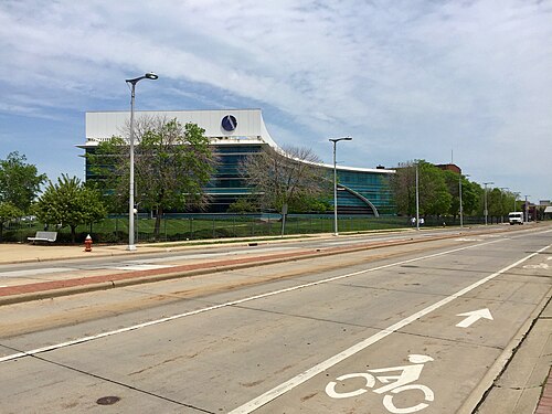
  153. University · Mandel School of Applied Social Sciences Building. Photo: Packer1028, CC0 · Wikimedia Commons
  154. Glenville · Herrick Road, Glenville, Cleveland, OH. Photo: w_lemay, CC0 · Flickr
  155. Cuyahoga Valley · Key Tower. Photo: Erik Drost, CC BY 2.0 · Wikimedia Commons
  156. University · Kelvin Smith Library, Case Western Reserve University, Cleveland, Ohio 110/365 #Project365 #365 #Cwru #Library #Spiral #Cleveland #Ohio. Photo: Scott McLeod, CC BY 2.0 · Flickr
  157. Glenville · Maury Avenue, Glenville, Cleveland, OH. Photo: w_lemay, CC0 · Flickr
  158. Cuyahoga Valley · Cleveland-Cuyahoga Valley Industrial Center (JRS). Photo: Ohio Redevelopment Projects - ODSA, CC BY 2.0 · Flickr
  159. University · Centenary Building Is the Oldest Structure on Lee University's Cleveland TN Campus. Photo: Harrison Keely, CC BY 4.0 · Wikimedia Commons
  160. Glenville · Wade Park Avenue, Glenville, Cleveland, OH. Photo: w_lemay, CC0 · Flickr
  161. Cuyahoga Valley · Whiskey Island to the Flats Bridge Construction. Photo: Erik Drost, CC BY 2.0 · Wikimedia Commons
  162. University · Cleveland History Center. Photo: Erik Drost, CC BY 2.0 · Wikimedia Commons
  163. Glenville · Wade Park Avenue, Glenville, Cleveland, OH. Photo: w_lemay, CC0 · Flickr
  164. Cuyahoga Valley · Cleveland Veterans Memorial Bridge. Photo: Erik Drost, CC BY 2.0 · Wikimedia Commons
  165. University · Kent Hale Smith Engineering and Science Building, Case Western Reserve University, Cleveland, Ohio #Casewestern #Cwru #Cleveland #Ohio 201/3. Photo: Scott McLeod, CC BY 2.0 · Flickr
  166. Glenville · Wade Park Avenue, Glenville, Cleveland, OH. Photo: w_lemay, CC0 · Flickr
  167. University · Linsalata Alumni Center, Case Western Reserve University, Cleveland, OH. Photo: w_lemay, CC0 · Flickr
  168. Glenville · Empire Avenue, Glenville, Cleveland, OH. Photo: w_lemay, CC0 · Flickr
  169. University · Amasa Stone Chapel, Case Western Reserve University, Cleveland, OH. Photo: w_lemay, CC0 · Flickr
  170. University · A.W. Smith Building, Case Western Reserve University, Cleveland, OH. Photo: w_lemay, CC0 · Flickr
  171. University · Sears Building, Case Western Reserve University, Cleveland, OH. Photo: w_lemay, CC0 · Flickr

Sources and notes

CrimesLog sources crime incident data published by the Cleveland Division of Police through the City of Cleveland ArcGIS Open Data service, containing public sector information made available by the City of Cleveland, Ohio.

Population: U.S. Census Bureau, American Community Survey 5-year estimates (public domain).

First-place medal: 1st Place Medal emoji icon by Icons8.

Neighborhood boundaries are defined by ClevelandGIS, grouped into areas of the city and simplified by CrimesLog. The photographs are credited under each picture.

Rates are recorded crimes per 1,000 residents, quarter by quarter; where a neighborhood has fewer than 100 residents the rate would be worked out on 100 (those places are left out of the race). A count of recorded crime is not a verdict on any neighborhood.