Baltimore, Maryland · Neighborhood crime trends

Baltimore Southeastern District

30 neighborhoods - a quarterly race to the lowest crime rate.

Crime Trends: Neighborhoods compared - each quarter from Q1 2022

Baltimore as a whole averaged 22.7 crimes for every 1,000 residents per quarter in Q2 2026, while Southeastern District averaged 32.5 (leaving out 3 places with almost no residents), hence it is generally less safe when all crimes are considered.

How do the 30 neighborhoods of Southeastern District compare? In Q2 2026 the police recorded 2,001 crimes across them, 32.5 for every 1,000 residents. That is 0.5% below a year earlier and 60.0% above Q1 2022, the first quarter we track.

Canton has the lowest rate of the everyday neighborhoods (19.8 per 1,000), followed by Greektown (20.7) and Upper Fells Point (23.8). Fells Point has the highest (37.4).

Use the RACE CHARTS below to watch all 30 BALTIMORE SOUTHEASTERN DISTRICT NEIGHBORHOODs race across 18 quarter periods from Q1 2022 to Q2 2026 - one crime category at a time or all together. The race chart can be used to compare average crime rates by category against Baltimore's average.

Neighborhood boundaries are defined by Baltimore City (Open Baltimore) and simplified by CrimesLog.
Lowest rate (everyday)
lowest rateCanton
19.8 crimes per 1,000 residents, Q2 2026
Highest rate
upFells Point
37.4 per 1,000, Q2 2026
Whole area, Q2 2026
32.5 per 1,000
down 0.5% below a year earlier · up 60.0% above Q1 2022
Compared
30 neighborhoods
61,636 residents · 18 quarters

Baltimore Southeastern District neighborhood quarterly crime race

Press ▶︎ to watch Q1 2022 to Q2 2026. Tick one crime category or several; hover a bar for the neighborhood. Property crimes includes burglaries and thefts.

Crime categories
Indicated: crimes rate per 1000 residents per quarterAll · safest at the top · square-root scale · Q1 2022 to Q2 202605255010025050022.4Baltimore Highlands13.1Bayview18.1Brewers Hill14.5Broening Manor8.2Butchers Hill10.6Canton214Canton Industrial Area14.7Eastwood46.6Ellwood Park/Monument27.0Fells Point12.7Graceland Park13.8Greektown19.8Harbor East16.4Harbor Point26.6Highlandtown26.6Holabird Industrial Park29.9Jonestown62.0Kresson10.3Little Italy32.2McElderry Park8.1Medford25.2O'Donnell Heights18.9Patterson Park Neighborhood20.2Patterson Place9.6Perkins50.3Pleasant View Gardens625Pulaski Industrial Area5.9Saint Helena11.3Upper Fells Point25.4Washington HillBaltimore Q2 2026 average all crimes (22.7)Numbers are crimes per 1,000 residents per quarter. Zero-crime quarters show 0 and rank safest. Not included, no residents: Dundalk Marine Terminal; Hopkins Bayview; PattersonPark.
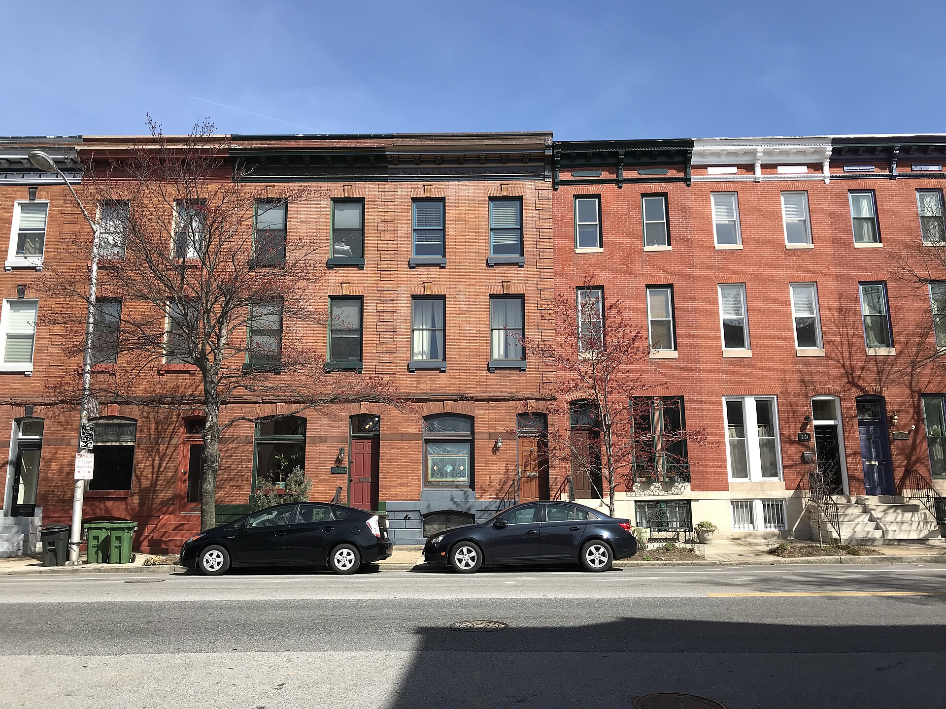
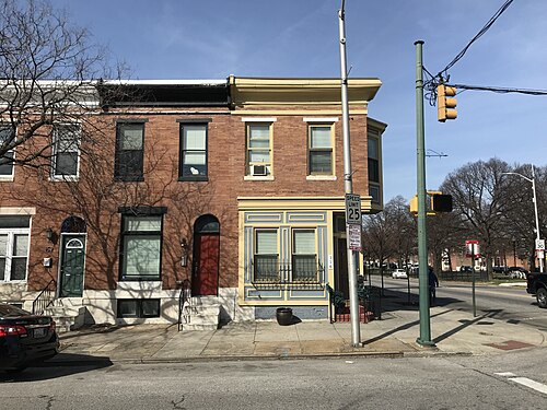
Rowhouses, 2126-2134 E. Baltimore Street, Baltimore, MD 21231, Butchers Hill You checked the neighborhood.Now check an address ! Photo: Baltimore Heritage from Baltimore, MD, USA, CC0 · Wikimedia Commons

For $34.00 a CrimesLog™ Home Report provides: (where available)

  • Nearest 6 Pre-school Nurseries to Address
  • Nearest 6 Primary Schools to Address
  • Nearest 6 Secondary/High Schools to Address
  • Nearest College and University to Address
  • Nearest to Address Medical Clinics, Hospitals and Pharmacies
  • Nearest 2 Police Station details to Address

The Home Report also provides

  • The CrimesLog™ Home Score is a proprietary Home Safety Measure capturing crime frequency, severity, recency and proximity to Address from police crime reporting point
  • A map indicating police anonymized crime reporting points around Address
  • Crime category trendlines for Address neighborhood
  • List of Reported Crime Incidents around Address radius
  • Downloadable PDF report — A Permanent Copy to Keep and Share to aid your Property Research
  • Our crimes database of almost 60 million records is UPDATED EVERY MONTH from US, UK, CA police sources
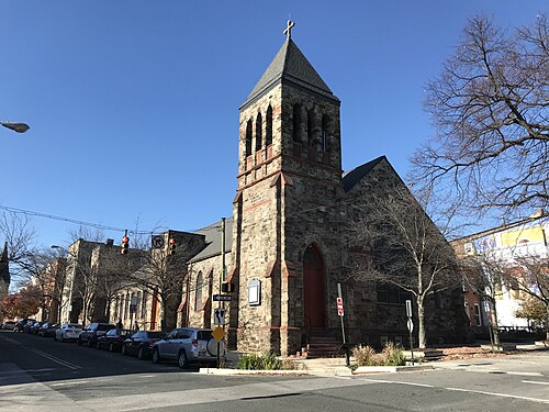
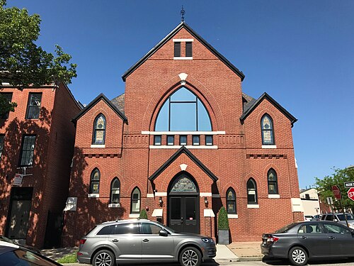
St. Andrew Orthodox Church, 2028 E. Lombard Street Baltimore, MD 21231, Butchers Hill
Butchers Hill · St. Andrew Orthodox Church, 2028 E. Lombard Street Baltimore, MD 21231
Photo: Baltimore Heritage from Baltimore, MD, USA, CC0 · Wikimedia Commons
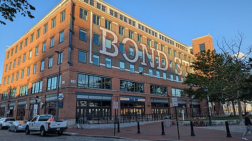
Bond Street Wharf, Harbor Point
Harbor Point · Bond Street Wharf
Photo: Eden, Janine and Jim from New York City, CC BY 2.0 · Wikimedia Commons
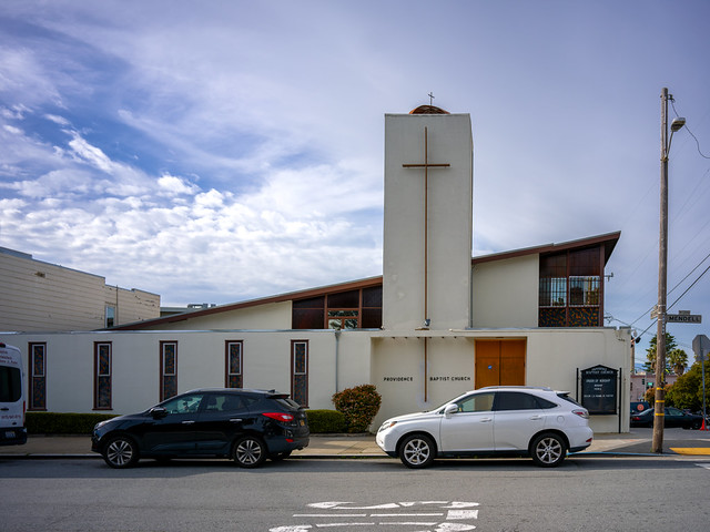
Providence Baptist Church, Bayview
Bayview · Providence Baptist Church
Photo: dalecruse, CC BY 2.0 · Flickr
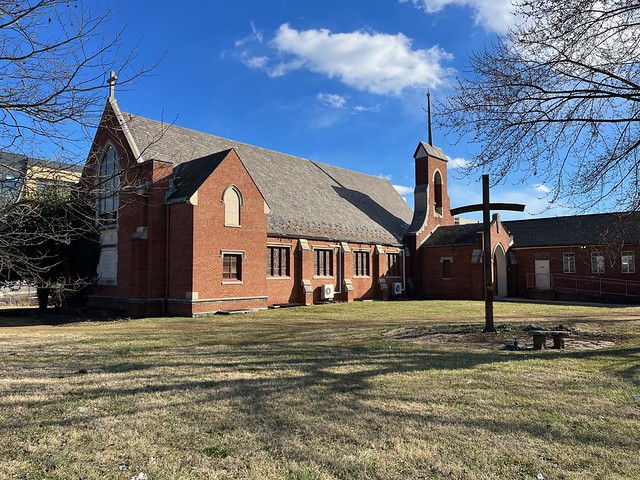
Former Canton Methodist Episcopal Church (1883–1884; Charles L. Carson, Architect), 1000 S. Ellwood Avenue, Baltimore, M, Canton
Canton · Former Canton Methodist Episcopal Church (1883–1884; Charles L. Carson, Architect), 1000 S. Ellwood Avenue, Baltimore, M
Photo: Baltimore Heritage from Baltimore, MD, USA, CC0 · Wikimedia Commons
Destiny Christian Church/Former Luther Memorial Lutheran Church (1931; 1956, Addition), 5401 Eastern Avenue, Baltimore, MD 21224, Greektown
Greektown · Destiny Christian Church/Former Luther Memorial Lutheran Church (1931; 1956, Addition), 5401 Eastern Avenue, Baltimore, MD 21224
Photo: Baltimore Heritage, CC0 · Flickr
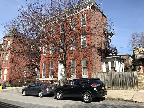
Rowhouse, 2218 E. Pratt Street, Baltimore, MD 21231, Upper Fells Point
Upper Fells Point · Rowhouse, 2218 E. Pratt Street, Baltimore, MD 21231
Photo: Baltimore Heritage from Baltimore, MD, USA, CC0 · Wikimedia Commons
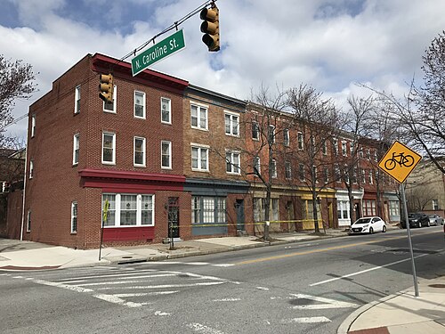
Commercial Rowhouse Group, 1500 Block of E. Baltimore Street, Baltimore, MD 21231, Washington Hill
Washington Hill · Commercial Rowhouse Group, 1500 Block of E. Baltimore Street, Baltimore, MD 21231
Photo: Baltimore Heritage from Baltimore, MD, USA, CC0 · Wikimedia Commons
Rowhouses, 154-156 N. Linwood Avenue, Baltimore, MD 21224, Patterson Park Neighborhood
Patterson Park Neighborhood · Rowhouses, 154-156 N. Linwood Avenue, Baltimore, MD 21224
Photo: Baltimore Heritage from Baltimore, MD, USA, CC0 · Wikimedia Commons

How neighborhoods moved each quarter

2022

Whole-area crime rate 20.3 to 31.3 per 1,000 (high: Q3 2022).

Big moves (4+ places in a quarter): moved down Medford 2nd→6th (Q2) moved down Butchers Hill 3rd→7th (Q2) moved up Holabird Industrial Park 21st→11th (Q2) moved down Bayview 9th→14th (Q2) moved up Pleasant View Gardens 27th→21st (Q2) moved down Harbor East 16th→23rd (Q2) moved down O'Donnell Heights 19th→24th (Q2) moved up Eastwood 10th→1st (Q3) moved up Medford 6th→2nd (Q3) moved up Greektown 9th→5th (Q3) moved up Broening Manor 12th→7th (Q3) moved up Bayview 14th→8th (Q3) moved up Harbor East 23rd→11th (Q3) moved up O'Donnell Heights 24th→12th (Q3) moved down Upper Fells Point 4th→14th (Q3) moved down Perkins 2nd→18th (Q3) moved down Holabird Industrial Park 11th→19th (Q3) moved down Pleasant View Gardens 21st→27th (Q3) moved up Brewers Hill 13th→7th (Q4) moved up Holabird Industrial Park 19th→8th (Q4) moved up Upper Fells Point 14th→10th (Q4) moved up Baltimore Highlands 17th→13th (Q4) moved up Patterson Park Neighborhood 21st→15th (Q4) moved up Highlandtown 22nd→16th (Q4) moved down Little Italy 4th→18th (Q4) moved down Harbor Point 15th→19th (Q4) moved down O'Donnell Heights 12th→20th (Q4) moved down Washington Hill 20th→24th (Q4) moved down Patterson Place 16th→25th (Q4)

2023

Whole-area crime rate 29.0 to 39.4 per 1,000 (high: Q3 2023).

Big moves (4+ places in a quarter): moved up Butchers Hill 11th→6th (Q1) moved up Little Italy 18th→10th (Q1) moved up Harbor Point 19th→11th (Q1) moved up Jonestown 23rd→14th (Q1) moved up Fells Point 21st→15th (Q1) moved down Holabird Industrial Park 8th→16th (Q1) moved up Washington Hill 24th→18th (Q1) moved down Patterson Park Neighborhood 15th→19th (Q1) moved up Patterson Place 25th→20th (Q1) moved down Harbor East 14th→21st (Q1) moved down Highlandtown 16th→23rd (Q1) moved down Baltimore Highlands 13th→24th (Q1) moved up Bayview 12th→5th (Q2) moved up Holabird Industrial Park 16th→9th (Q2) moved up Perkins 17th→13th (Q2) moved down Upper Fells Point 7th→14th (Q2) moved up O'Donnell Heights 22nd→15th (Q2) moved up Baltimore Highlands 24th→16th (Q2) moved down Harbor Point 11th→17th (Q2) moved up McElderry Park 25th→19th (Q2) moved down Jonestown 14th→20th (Q2) moved down Fells Point 15th→25th (Q2) moved up Harbor Point 17th→4th (Q3) moved up Broening Manor 11th→5th (Q3) moved up O'Donnell Heights 15th→6th (Q3) moved up Perkins 13th→7th (Q3) moved up McElderry Park 19th→14th (Q3) moved down Eastwood 3rd→16th (Q3) moved up Patterson Park Neighborhood 22nd→18th (Q3) moved up Ellwood Park/Monument 26th→19th (Q3) moved up Fells Point 25th→20th (Q3) moved down Little Italy 7th→21st (Q3) moved down Jonestown 20th→25th (Q3) moved down Holabird Industrial Park 9th→28th (Q3) moved up Bayview 8th→4th (Q4) moved down Broening Manor 5th→9th (Q4) moved up Eastwood 16th→11th (Q4) moved down O'Donnell Heights 6th→12th (Q4) moved up Patterson Place 24th→14th (Q4) moved down Brewers Hill 12th→18th (Q4) moved down Baltimore Highlands 13th→20th (Q4) moved down Washington Hill 17th→22nd (Q4)

2024

Whole-area crime rate 26.9 to 34.3 per 1,000 (high: Q3 2024).

Big moves (4+ places in a quarter): moved up Perkins 6th→1st (Q1) moved up Eastwood 11th→4th (Q1) moved down Harbor Point 2nd→6th (Q1) moved up Upper Fells Point 13th→9th (Q1) moved down Greektown 5th→11th (Q1) moved down Bayview 4th→12th (Q1) moved up Brewers Hill 18th→14th (Q1) moved up Baltimore Highlands 20th→16th (Q1) moved down O'Donnell Heights 12th→17th (Q1) moved up Highlandtown 24th→18th (Q1) moved up Jonestown 23rd→19th (Q1) moved down McElderry Park 15th→21st (Q1) moved down Patterson Place 14th→25th (Q1) moved up O'Donnell Heights 17th→5th (Q2) moved up Greektown 11th→6th (Q2) moved down Butchers Hill 5th→10th (Q2) moved up Little Italy 20th→12th (Q2) moved down Harbor Point 6th→14th (Q2) moved up Patterson Place 25th→18th (Q2) moved down Fells Point 15th→19th (Q2) moved down Baltimore Highlands 16th→22nd (Q2) moved up Butchers Hill 10th→5th (Q3) moved up Upper Fells Point 11th→6th (Q3) moved up Harbor Point 14th→9th (Q3) moved down Eastwood 4th→11th (Q3) moved down O'Donnell Heights 5th→13th (Q3) moved up Fells Point 19th→14th (Q3) moved up Washington Hill 24th→16th (Q3) moved down Broening Manor 9th→17th (Q3) moved up Baltimore Highlands 22nd→18th (Q3) moved up Ellwood Park/Monument 23rd→19th (Q3) moved down Highlandtown 17th→22nd (Q3) moved down Patterson Park Neighborhood 16th→24th (Q3) moved up O'Donnell Heights 13th→8th (Q4) moved up Little Italy 15th→11th (Q4) moved up Broening Manor 17th→12th (Q4) moved down Perkins 1st→14th (Q4) moved down Fells Point 14th→19th (Q4) moved down Ellwood Park/Monument 19th→25th (Q4)

2025

Whole-area crime rate 26.6 to 32.6 per 1,000 (high: Q2 2025).

Big moves (4+ places in a quarter): moved up Holabird Industrial Park 28th→2nd (Q1) moved up Graceland Park 9th→3rd (Q1) moved down Upper Fells Point 4th→11th (Q1) moved up Washington Hill 16th→12th (Q1) moved down O'Donnell Heights 8th→13th (Q1) moved down Little Italy 11th→17th (Q1) moved down Jonestown 18th→22nd (Q1) moved down Brewers Hill 15th→24th (Q1) moved down Kresson 24th→28th (Q1) moved up Bayview 10th→6th (Q2) moved up Upper Fells Point 11th→7th (Q2) moved up O'Donnell Heights 13th→9th (Q2) moved up Perkins 14th→10th (Q2) moved up Little Italy 17th→13th (Q2) moved up Jonestown 22nd→14th (Q2) moved up Patterson Place 20th→15th (Q2) moved up Brewers Hill 24th→16th (Q2) moved up Patterson Park Neighborhood 21st→17th (Q2) moved up Highlandtown 23rd→18th (Q2) moved down Eastwood 15th→19th (Q2) moved down Harbor Point 6th→20th (Q2) moved down Baltimore Highlands 16th→22nd (Q2) moved down Fells Point 18th→23rd (Q2) moved down Holabird Industrial Park 2nd→24th (Q2) moved up Greektown 8th→3rd (Q3) moved up Harbor Point 20th→7th (Q3) moved down Butchers Hill 4th→8th (Q3) moved up Holabird Industrial Park 24th→9th (Q3) moved up Eastwood 19th→14th (Q3) moved up Baltimore Highlands 22nd→15th (Q3) moved down Little Italy 13th→18th (Q3) moved down Patterson Place 15th→24th (Q3) moved down Perkins 10th→28th (Q3) moved up O'Donnell Heights 11th→6th (Q4) moved down Bayview 6th→10th (Q4) moved up Little Italy 18th→12th (Q4) moved down Holabird Industrial Park 9th→14th (Q4) moved up Fells Point 21st→16th (Q4) moved up Pleasant View Gardens 25th→18th (Q4) moved down Baltimore Highlands 15th→24th (Q4) moved down Jonestown 16th→25th (Q4)

2026

Whole-area crime rate 27.4 to 32.5 per 1,000 (high: Q2 2026). 2 quarters so far.

Big moves (4+ places in a quarter): moved up Upper Fells Point 11th→6th (Q1) moved down Greektown 3rd→7th (Q1) moved up Patterson Place 22nd→14th (Q1) moved up Baltimore Highlands 24th→17th (Q1) moved up Jonestown 25th→20th (Q1) moved down Highlandtown 17th→21st (Q1) moved up Harbor East 27th→22nd (Q1) moved down Eastwood 15th→23rd (Q1) moved down Pleasant View Gardens 18th→24th (Q1) moved down Brewers Hill 20th→25th (Q1) moved up Butchers Hill 8th→3rd (Q2) moved up Bayview 10th→5th (Q2) moved up Eastwood 23rd→6th (Q2) moved down Graceland Park 3rd→9th (Q2) moved down Upper Fells Point 6th→10th (Q2) moved up Washington Hill 16th→12th (Q2) moved down O'Donnell Heights 5th→13th (Q2) moved up Patterson Park Neighborhood 19th→14th (Q2) moved down Little Italy 11th→16th (Q2) moved down Fells Point 13th→17th (Q2) moved up Pleasant View Gardens 24th→18th (Q2) moved down Holabird Industrial Park 15th→26th (Q2)

Reported Safety Incidents

In Q2 2026: property incidents were 55% (1,103), vehicle crimes were 25% (500), violent incidents were 20% (395) and public order incidents were 0% (3).

Recorded crime here is grouped into violent crime, property crime (burglary and theft), vehicle crime and public order offences, so you can compare how safe each neighborhood is for the kind of crime that matters to you.

Places we left out, and places to read with care

Left out: Dundalk Marine Terminal; Hopkins Bayview; Patterson Park. They have almost no residents: their crimes are against visitors, so a rate per resident says little about living there.

Holabird Industrial Park (70.8 per 1,000 from 8 crimes among 113 residents), Pulaski Industrial Area (765.6 per 1,000 from 98 crimes among 128 residents), Canton Industrial Area (548.8 per 1,000 from 118 crimes among 215 residents), Harbor Point (13.1 per 1,000 from 4 crimes among 305 residents), Perkins (76.4 per 1,000 from 24 crimes among 314 residents), Kresson (112.7 per 1,000 from 40 crimes among 355 residents), Eastwood (19.6 per 1,000 from 8 crimes among 409 residents), Pleasant View Gardens (39.4 per 1,000 from 18 crimes among 457 residents), Patterson Place (28.5 per 1,000 from 24 crimes among 842 residents), Little Italy (32.1 per 1,000 from 28 crimes among 872 residents), O'Donnell Heights (26.3 per 1,000 from 24 crimes among 913 residents), Jonestown (44.9 per 1,000 from 51 crimes among 1,137 residents), Saint Helena (5.0 per 1,000 from 6 crimes among 1,188 residents), Harbor East (50.2 per 1,000 from 71 crimes among 1,415 residents), Broening Manor (25.6 per 1,000 from 46 crimes among 1,796 residents), Ellwood Park/Monument (54.4 per 1,000 from 112 crimes among 2,058 residents), Medford (7.1 per 1,000 from 15 crimes among 2,100 residents), Butchers Hill (11.0 per 1,000 from 24 crimes among 2,189 residents), Graceland Park (20.8 per 1,000 from 46 crimes among 2,211 residents), Bayview (17.6 per 1,000 from 39 crimes among 2,222 residents), Brewers Hill (50.2 per 1,000 from 114 crimes among 2,272 residents), Washington Hill (25.8 per 1,000 from 59 crimes among 2,288 residents), Highlandtown (45.2 per 1,000 from 114 crimes among 2,523 residents), Baltimore Highlands (44.0 per 1,000 from 112 crimes among 2,547 residents) and McElderry Park (41.9 per 1,000 from 121 crimes among 2,885 residents) are places with few residents (under 3,000): a rate on so few people says little about living there, so they are not named as the lowest or highest.

The 30 neighborhoods on the map

Southeastern District is made of 30 neighborhoods compared here, each in its own colour on the map. They are the Neighborhood Statistical Areas of Baltimore City (Open Baltimore), grouped into police districts by CrimesLog: 61,636 residents between them.

  • Baltimore Highlands
  • Bayview
  • Brewers Hill
  • Broening Manor
  • Butchers Hill
  • Canton
  • Canton Industrial Area
  • Eastwood
  • Ellwood Park/Monument
  • Fells Point
  • Graceland Park
  • Greektown
  • Harbor East
  • Harbor Point
  • Highlandtown
  • Holabird Industrial Park
  • Jonestown
  • Kresson
  • Little Italy
  • McElderry Park
  • Medford
  • O'Donnell Heights
  • Patterson Park Neighborhood
  • Patterson Place
  • Perkins
  • Pleasant View Gardens
  • Pulaski Industrial Area
  • Saint Helena
  • Upper Fells Point
  • Washington Hill

All 30 neighborhoods, Q2 2026

Crimes per 1,000 residents, Q2 2026, lowest first. The last two columns compare with Q1 2022.
#NeighborhoodResidentsAllViolentPropertyVehiclePublic orderRate vs Q1 2022Places gained
1Saint Helena †1,1885.00.83.40.80.0down14%–
2Medford †2,1007.11.42.92.40.5down12%–
3Butchers Hill †2,18911.00.05.55.50.0up33%–
4Harbor Point †30513.13.39.80.00.0down20%up9
5Bayview †2,22217.65.05.47.20.0up34%up4
6Eastwood †40919.69.82.47.30.0up33%up6
7Canton11,86219.81.511.46.90.0up87%down1
8Greektown4,35520.76.07.17.60.0up50%up2
9Graceland Park †2,21120.88.66.85.40.0up64%down1
10Upper Fells Point3,18923.81.612.59.70.0up111%down3
11Broening Manor †1,79625.66.113.46.10.0up77%–
12Washington Hill †2,28825.85.714.45.70.0up2%up8
13O'Donnell Heights †91326.38.813.14.40.0up4%up6
14Patterson Park Neighborhood4,43328.23.414.710.20.0up49%up1
15Patterson Place †84228.54.813.110.70.0up41%up2
16Little Italy †87232.13.420.68.00.0up211%down11
17Fells Point4,04337.49.920.86.40.3up39%up6
18Pleasant View Gardens †45739.417.519.72.20.0down22%up9
19McElderry Park †2,88541.915.616.69.40.3up30%up6
20Baltimore Highlands †2,54744.012.225.56.30.0up96%down2
21Jonestown †1,13744.916.720.27.90.0up50%up3
22Highlandtown †2,52345.27.524.613.10.0up70%–
23Brewers Hill †2,27250.23.534.811.90.0up178%down9
24Harbor East †1,41550.26.442.41.40.0up154%down8
25Ellwood Park/Monument †2,05854.417.023.813.60.0up17%up1
26Holabird Industrial Park †11370.826.635.48.80.0up167%down5
27Perkins †31476.415.944.615.90.0up700%down23
28Kresson †355112.711.395.85.60.0up82%–
29Canton Industrial Area †215548.841.9409.397.70.0up157%–
30Pulaski Industrial Area †128765.6140.6484.4140.60.0up23%–

† Holabird Industrial Park, Pulaski Industrial Area, Canton Industrial Area, Harbor Point, Perkins, Kresson, Eastwood, Pleasant View Gardens, Patterson Place, Little Italy, O'Donnell Heights, Jonestown, Saint Helena, Harbor East, Broening Manor, Ellwood Park/Monument, Medford, Butchers Hill, Graceland Park, Bayview, Brewers Hill, Washington Hill, Highlandtown, Baltimore Highlands and McElderry Park are places with few residents. A rate on a very small number of residents or crimes is not comparable with the others.

Photographs

145 photographs of the 30 neighborhoods run along the reel; click one to see it full size. Each is credited here and under the large view.

All 145 photographs and their credits
  1. Butchers Hill · St. Andrew Orthodox Church, 2028 E. Lombard Street Baltimore, MD 21231. Photo: Baltimore Heritage from Baltimore, MD, USA, CC0 · Wikimedia Commons
  2. Harbor Point · Bond Street Wharf. Photo: Eden, Janine and Jim from New York City, CC BY 2.0 · Wikimedia Commons
  3. Bayview · Providence Baptist Church. Photo: dalecruse, CC BY 2.0 · Flickr
  4. Canton · Former Canton Methodist Episcopal Church (1883–1884; Charles L. Carson, Architect), 1000 S. Ellwood Avenue, Baltimore, M. Photo: Baltimore Heritage from Baltimore, MD, USA, CC0 · Wikimedia Commons
  5. Greektown · Destiny Christian Church/Former Luther Memorial Lutheran Church (1931; 1956, Addition), 5401 Eastern Avenue, Baltimore, MD 21224. Photo: Baltimore Heritage, CC0 · Flickr
  6. Upper Fells Point · Rowhouse, 2218 E. Pratt Street, Baltimore, MD 21231. Photo: Baltimore Heritage from Baltimore, MD, USA, CC0 · Wikimedia Commons
  7. Washington Hill · Commercial Rowhouse Group, 1500 Block of E. Baltimore Street, Baltimore, MD 21231. Photo: Baltimore Heritage from Baltimore, MD, USA, CC0 · Wikimedia Commons
  8. Patterson Park Neighborhood · Rowhouses, 154-156 N. Linwood Avenue, Baltimore, MD 21224. Photo: Baltimore Heritage from Baltimore, MD, USA, CC0 · Wikimedia Commons
  9. Patterson Place · Rowhouses, 2304-2310 E. Fairmount Avenue, Baltimore, MD 21224. Photo: Baltimore Heritage from Baltimore, MD, USA, CC0 · Wikimedia Commons
  10. Little Italy · Former Stratford University Building, 210 S. Central Avenue, Baltimore, MD 21202. Photo: Baltimore Heritage from Baltimore, MD, USA, CC0 · Wikimedia Commons
  11. Fells Point · Factory Building. Photo: Eden, Janine and Jim from New York City, CC BY 2.0 · Wikimedia Commons
  12. Pleasant View Gardens · Eastern Female High School (1869), 249 Aisquith Street, Baltimore, MD 21202. Photo: Baltimore Heritage from Baltimore, MD, USA, CC0 · Wikimedia Commons
  13. McElderry Park · Detached House, 610 N. Linwood Avenue, Baltimore, MD 21205. Photo: Baltimore Heritage from Baltimore, MD, USA, CC0 · Wikimedia Commons
  14. Baltimore Highlands · Baltimore Highlands Mural (2015; Bridget Cimino, Artist), 3601 Roberts Place, Baltimore, MD 21224. Photo: Baltimore Heritage, CC0 · Flickr
  15. Jonestown · Former Presbyterian Eye, Ear & Throat Charity Hospital, 1017 E. Baltimore Street, Baltimore, MD 21202. Photo: Baltimore Heritage from Baltimore, MD, USA, CC0 · Wikimedia Commons
  16. Highlandtown · Abbott Memorial Presbyterian Church (1882), 3426 Bank Street, Baltimore, MD 21224 01. Photo: Baltimore Heritage, CC0 · Wikimedia Commons
  17. Harbor East · Exelon Building (2016; Beatty, Harvey, Coco Architects Elkus Manfredi Architects), 1310 Point Street, Baltimore, MD 2123. Photo: Baltimore Heritage from Baltimore, MD, USA, CC0 · Wikimedia Commons
  18. Ellwood Park/Monument · Gateway Park, Orleans Street and Pulaski Highway, Balimore, MD 21224. Photo: Baltimore Heritage from Baltimore, MD, USA, CC0 · Wikimedia Commons
  19. Perkins · Rowhouse Group, 300 Block of S. Bethel Street, Baltimore, MD 21231. Photo: Baltimore Heritage from Baltimore, MD, USA, CC0 · Wikimedia Commons
  20. Patterson Park · "White House," Patterson Park, Baltimore, MD. Photo: Baltimore Heritage from Baltimore, MD, USA, CC0 · Wikimedia Commons
  21. Butchers Hill · Parish House, St. Andrew Orthodox Church, 2028 E. Lombard Street Baltimore, MD 21231. Photo: Baltimore Heritage from Baltimore, MD, USA, CC0 · Wikimedia Commons
  22. Bayview · NIH Biomedical Research Center in Baltimore. Photo: National Institutes of Health (NIH), CC0 · Flickr
  23. Canton · .St Michael's Ukranian Catholic Church. Photo: sneakerdog, CC BY 2.0 · Flickr
  24. Greektown · 'Pegasus' (2020; Dominic Terlizzi, Sculptor), Eastern Avenue and S. Lehigh Street, Baltimore, MD 21224. Photo: Baltimore Heritage, CC0 · Flickr
  25. Upper Fells Point · St. Michael the Archangel Roman Catholic Church, 1900-1920 E. Lombard Street, Baltimore, MD. Photo: Baltimore Heritage from Baltimore, MD, USA, CC0 · Wikimedia Commons
  26. Washington Hill · First Apostolic Faith Church, 27 S. Caroline Street, Baltimore, MD 21231. Photo: Baltimore Heritage from Baltimore, MD, USA, CC0 · Wikimedia Commons
  27. Patterson Park Neighborhood · Breath of God Lutheran Church Former St. Paul's Evangelical Lutheran Church (1924), 141 S. Clinton Street, Baltimore, MD. Photo: Baltimore Heritage from Baltimore, MD, USA, CC0 · Wikimedia Commons
  28. Patterson Place · Rowhouses, 10-14 N. Montford Avenue, Baltimore, MD 21224. Photo: Baltimore Heritage from Baltimore, MD, USA, CC0 · Wikimedia Commons
  29. Little Italy · Former Stratford University Building, 210 S. Central Avenue, Baltimore, MD 21202. Photo: Baltimore Heritage from Baltimore, MD, USA, CC0 · Wikimedia Commons
  30. Fells Point · South Entrance to South Pavilion, Broadway Market, S. Broadway, Baltimore, MD. Photo: Baltimore Heritage from Baltimore, MD, USA, CC0 · Wikimedia Commons
  31. Pleasant View Gardens · Townhouses at Pleasant View Gardens, 200 Block of Aisquith Street (West Side), Baltimore, MD 21202. Photo: Baltimore Heritage from Baltimore, MD, USA, CC0 · Wikimedia Commons
  32. McElderry Park · Rowhouses, 500-516 N. Glover Street, Baltimore, MD 21205. Photo: Baltimore Heritage from Baltimore, MD, USA, CC0 · Wikimedia Commons
  33. Baltimore Highlands · Baltimore Highlands Mural (2015; Bridget Cimino, Artist), 3601 Roberts Place, Baltimore, MD 21224. Photo: Baltimore Heritage, CC0 · Flickr
  34. Jonestown · Levy Building-Jewish Educational Alliance (1913), 1216 E. Baltimore Street, Baltimore, MD 21202. Photo: Baltimore Heritage from Baltimore, MD, USA, CC0 · Wikimedia Commons
  35. Highlandtown · Breath of God Lutheran Church Former St. Paul's Evangelical Lutheran Church (1924; 1950), 141 S. Clinton Street, Baltimo. Photo: Baltimore Heritage from Baltimore, MD, USA, CC0 · Wikimedia Commons
  36. Harbor East · Harbor East Geodetic Disk. Photo: Elliott R. Plack, CC0 · Wikimedia Commons
  37. Ellwood Park/Monument · Garages Painted with Mural, Gateway Park, Orleans Street and Pulaski Highway, Balimore, MD 21224. Photo: Baltimore Heritage from Baltimore, MD, USA, CC0 · Wikimedia Commons
  38. Perkins · Perkins Square Gazebo (1871), Perkins Spring Square Park, Murphy Lane and Myrtle Avenue, Baltimore, MD 21201. Photo: Baltimore Heritage, CC0 · Flickr
  39. Patterson Park · Rowhouses, 6-10 S. Patterson Park Avenue, Baltimore, MD 21231. Photo: Baltimore Heritage from Baltimore, MD, USA, CC0 · Wikimedia Commons
  40. Butchers Hill · Patterson Park Avenue Entrance, 2229 E. Lombard Street, Baltimore, MD 21231. Photo: Baltimore Heritage from Baltimore, MD, USA, CC0 · Wikimedia Commons
  41. Bayview · Park Entrance with Gate on E. Pratt Street, Joseph Lee Playfields, 6200 E. Pratt Street, Baltimore, MD 21223. Photo: Baltimore Heritage, CC0 · Flickr
  42. Canton · The Baltimore Montessori, 1001 S. Potomac Street, Baltimore, MD 21224. Photo: Baltimore Heritage, CC0 · Flickr
  43. Greektown · 'Pegasus' (2020; Dominic Terlizzi, Sculptor), Eastern Avenue and S. Lehigh Street, Baltimore, MD 21224. Photo: Baltimore Heritage, CC0 · Flickr
  44. Upper Fells Point · Rowhouses, S. Ann Street, Baltimore, MD. Photo: Baltimore Heritage from Baltimore, MD, USA, CC0 · Wikimedia Commons
  45. Washington Hill · St. Michael the Archangel Roman Catholic Church, 1900-1920 E. Lombard Street, Baltimore, MD. Photo: Baltimore Heritage from Baltimore, MD, USA, CC0 · Wikimedia Commons
  46. Patterson Park Neighborhood · Rowhouses, 2908-2916 E. Pratt Street, Baltimore, MD 21224. Photo: Baltimore Heritage from Baltimore, MD, USA, CC0 · Wikimedia Commons
  47. Patterson Place · Rowhouses, 2-36 N. Montford Avenue, Baltimore, MD 21224. Photo: Baltimore Heritage from Baltimore, MD, USA, CC0 · Wikimedia Commons
  48. Little Italy · Christopher Columbus Statue, Baltimore. Photo: SeeMidTN.com (aka Brent), CC BY 2.0 · Flickr
  49. Fells Point · Commercial Buildings, S. Broadway, Baltimore, MD. Photo: Baltimore Heritage from Baltimore, MD, USA, CC0 · Wikimedia Commons
  50. Pleasant View Gardens · Entrance Sign, Pleasant View Gardens Townhomes, Aisquith Street and New Hope Circle, Baltimore, MD 21202. Photo: Baltimore Heritage from Baltimore, MD, USA, CC0 · Wikimedia Commons
  51. McElderry Park · Rowhouses, 600 Block of N. Milton Street (West Side), Baltimore, MD 21205. Photo: Baltimore Heritage from Baltimore, MD, USA, CC0 · Wikimedia Commons
  52. Jonestown · Levy Building-Jewish Educational Alliance (1913), 1216 E. Baltimore Street, Baltimore, MD 21202. Photo: Baltimore Heritage from Baltimore, MD, USA, CC0 · Wikimedia Commons
  53. Highlandtown · Abbott Memorial Presbyterian Church (1882), 3426 Bank Street, Baltimore, MD 21224. Photo: Baltimore Heritage, CC0 · Wikimedia Commons
  54. Harbor East · Harbor East. Photo: sidewalk flying, CC BY 2.0 · Flickr
  55. Ellwood Park/Monument · Rowhouses, 532–540 N. Linwood Avenue, Baltimore, MD 21205. Photo: Baltimore Heritage from Baltimore, MD, USA, CC0 · Wikimedia Commons
  56. Perkins · Perkins Square Gazebo (1871), Perkins Spring Square Park, Murphy Lane and Myrtle Avenue, Baltimore, MD 21201. Photo: Baltimore Heritage, CC0 · Flickr
  57. Patterson Park · Rowhouse, 2300 E. Baltimore Street, Baltimore, MD 21224. Photo: Baltimore Heritage from Baltimore, MD, USA, CC0 · Wikimedia Commons
  58. Butchers Hill · Rowhouses, 2126-2134 E. Baltimore Street, Baltimore, MD 21231. Photo: Baltimore Heritage from Baltimore, MD, USA, CC0 · Wikimedia Commons
  59. Bayview · Playground and Park Path, Joseph Lee Park/Playfields, 6200 E. Pratt Street, Baltimore, MD 21223. Photo: Baltimore Heritage, CC0 · Flickr
  60. Canton · Baltimore Harbor East. Photo: bethcoll, CC BY 2.0 · Flickr
  61. Greektown · Umbra Street Park, 700 Block of Umbra Street (East of Alley), Baltimore, MD 21224. Photo: Baltimore Heritage, CC0 · Flickr
  62. Upper Fells Point · Detached Rowhouse with Sideyard, 2214 E. Pratt Street, Baltimore, MD 21231. Photo: Baltimore Heritage from Baltimore, MD, USA, CC0 · Wikimedia Commons
  63. Patterson Park Neighborhood · Rowhouses, 2900-2906 E. Pratt Street, Baltimore, MD 21224. Photo: Baltimore Heritage from Baltimore, MD, USA, CC0 · Wikimedia Commons
  64. Patterson Place · Rear, Cornerstone Full Gospel Church Former Martin Luther Lutheran Church, 401 N. Patterson Park Avenue, Baltimore, MD 2. Photo: Baltimore Heritage from Baltimore, MD, USA, CC0 · Wikimedia Commons
  65. Little Italy · Little Italy Door. Photo: Ananda La Vita, CC BY 2.0 · Flickr
  66. Fells Point · Commercial Buildings, S. Broadway, Baltimore, MD. Photo: Baltimore Heritage from Baltimore, MD, USA, CC0 · Wikimedia Commons
  67. Pleasant View Gardens · Eastern Female High School (1869), 249 Aisquith Street, Baltimore, MD 21202. Photo: Baltimore Heritage from Baltimore, MD, USA, CC0 · Wikimedia Commons
  68. McElderry Park · Rowhouses, 500 Block of N. Milton Street (West Side), Baltimore, MD 21205. Photo: Baltimore Heritage from Baltimore, MD, USA, CC0 · Wikimedia Commons
  69. Jonestown · B'nai Israel Synagogue, 27 Lloyd Street, Baltimore, MD. Photo: Baltimore Heritage, CC0 · Wikimedia Commons
  70. Highlandtown · Breath of God Lutheran Church Former St. Paul's Evangelical Lutheran Church (1924), 141 S. Clinton Street, Baltimore, MD. Photo: Baltimore Heritage from Baltimore, MD, USA, CC0 · Wikimedia Commons
  71. Ellwood Park/Monument · Rowhouses, 2902–2908 Pulaski Highway, Baltimore, MD 21224. Photo: Baltimore Heritage from Baltimore, MD, USA, CC0 · Wikimedia Commons
  72. Perkins · Perkins Square Gazebo (1871), Perkins Spring Square Park, Murphy Lane and Myrtle Avenue, Baltimore, MD 21201. Photo: Baltimore Heritage, CC0 · Flickr
  73. Patterson Park · Rowhouses, E. Baltimore Street and N. Patterson Park Avenue (Northwest Corner), Baltimore, MD 21231. Photo: Baltimore Heritage from Baltimore, MD, USA, CC0 · Wikimedia Commons
  74. Butchers Hill · Rowhouses, 100 Block of S. Collington Avenue (West Side), Baltimore, MD 21231. Photo: Baltimore Heritage from Baltimore, MD, USA, CC0 · Wikimedia Commons
  75. Bayview · Path on West Side of Park Facing North, Joseph Lee Park/Playfields, 6200 E. Pratt Street, Baltimore, MD 21223. Photo: Baltimore Heritage, CC0 · Flickr
  76. Canton · On the Road. Photo: Vox Efx, CC BY 2.0 · Flickr
  77. Greektown · Umbra Street Park, 700 Block of Umbra Street (East of Alley), Baltimore, MD 21224. Photo: Baltimore Heritage, CC0 · Flickr
  78. Patterson Park Neighborhood · Rowhouses, 100 Block of N. Lakewood Avenue (West Side), Baltimore, MD 21224. Photo: Baltimore Heritage from Baltimore, MD, USA, CC0 · Wikimedia Commons
  79. Patterson Place · Rowhouses, 100-134 N. Bradford Street, Baltimore, MD 21224. Photo: Baltimore Heritage from Baltimore, MD, USA, CC0 · Wikimedia Commons
  80. Little Italy · One Way in Baltimore's Little Italy. Photo: pasa47, CC BY 2.0 · Flickr
  81. Fells Point · Office Building, 1716 Aliceanna Street, Baltimore, MD 21231. Photo: Baltimore Heritage from Baltimore, MD, USA, CC0 · Wikimedia Commons
  82. Pleasant View Gardens · Townhouses at Pleasant View Gardens, 200 Block of Aisquith Street (West Side), Baltimore, MD 21202. Photo: Baltimore Heritage, CC0 · Flickr
  83. McElderry Park · McElderry Park Community Association, 611 N. Montford Avenue, Baltimore, MD 21205. Photo: Baltimore Heritage from Baltimore, MD, USA, CC0 · Wikimedia Commons
  84. Jonestown · Baltimore Post Office (1971), 900 E. Fayette Street, Baltimore, MD 21233. Photo: Baltimore Heritage from Baltimore, MD, USA, CC0 · Wikimedia Commons
  85. Highlandtown · USPS Southeast Finance Station, 340 S. Highland Avenue, Baltimore, MD 21281. Photo: Baltimore Heritage, CC0 · Flickr
  86. Ellwood Park/Monument · Banner Neighborhoods Former Church, 2911 Pulaski Highway, Baltimore, MD 21224. Photo: Baltimore Heritage from Baltimore, MD, USA, CC0 · Wikimedia Commons
  87. Perkins · Detail of Support Column, Perkins Square Gazebo (1871), Perkins Spring Square Park, Murphy Lane and Myrtle Avenue, Baltimore, MD 21201. Photo: Baltimore Heritage, CC0 · Flickr
  88. Patterson Park · Fountain, Patterson Park Near E. Lombard Street and S. Patterson Park Avenue, Baltimore, MD 21231. Photo: Baltimore Heritage from Baltimore, MD, USA, CC0 · Wikimedia Commons
  89. Butchers Hill · Rowhouses, 26-14 S. Collington Avenue, Baltimore, MD 21231. Photo: Baltimore Heritage from Baltimore, MD, USA, CC0 · Wikimedia Commons
  90. Bayview · Basketball Court, Joseph Lee Park/Playfields, 6200 E. Pratt Street, Baltimore, MD 21223. Photo: Baltimore Heritage, CC0 · Flickr
  91. Canton · File:O'Donnell Square Canton Baltimore.jpg. Photo: Julie M. Kichline, CC0 · Wikimedia Commons
  92. Patterson Park Neighborhood · Rowhouses, 16-22 N. Lakewood Avenue, Baltimore, MD 21224. Photo: Baltimore Heritage from Baltimore, MD, USA, CC0 · Wikimedia Commons
  93. Patterson Place · Orleans Liquors, 401 N. Montford Avenue, Baltimore, MD 21224. Photo: Baltimore Heritage from Baltimore, MD, USA, CC0 · Wikimedia Commons
  94. Fells Point · Commercial Building, 1718 Aliceanna Street, Baltimore, MD 21231. Photo: Baltimore Heritage from Baltimore, MD, USA, CC0 · Wikimedia Commons
  95. McElderry Park · McElderry Park Community Association, 611 N. Montford Avenue, Baltimore, MD 21205. Photo: Baltimore Heritage from Baltimore, MD, USA, CC0 · Wikimedia Commons
  96. Jonestown · McKim School Baltimore. Photo: Smallbones, CC0 · Wikimedia Commons
  97. Highlandtown · Abbott Chapel/Abbott Memorial Presbyterian Church (1882), 3426 Bank Street, Baltimore, MD 21224. Photo: Baltimore Heritage, CC0 · Flickr
  98. Ellwood Park/Monument · Dynamic Deliverance Cathedral, 630 N. Linwood Avenue Baltimore, MD 21205. Photo: Baltimore Heritage from Baltimore, MD, USA, CC0 · Wikimedia Commons
  99. Patterson Park · Detail, Patterson Park Pagoda, Patterson Park Near E. Pratt Street and S. Patterson Park Avenue, Baltimore, MD 21231 (40. Photo: Baltimore Heritage from Baltimore, MD, USA, CC0 · Wikimedia Commons
  100. Butchers Hill · Butcher's Hill Rain Garden, E. Lombard Street and S. Chester Street (Northwest Corner), Baltimore, MD 21231 (41452771275. Photo: Baltimore Heritage from Baltimore, MD, USA, CC0 · Wikimedia Commons
  101. Bayview · Park Entrance on E. Pratt Street, Joseph Lee Playfields, 6200 E. Pratt Street, Baltimore, MD 21223. Photo: Baltimore Heritage, CC0 · Flickr
  102. Canton · Dnipro Ukrainian Club, 3101 O'Donnell Street, Baltimore, MD 21224. Photo: Baltimore Heritage, CC0 · Flickr
  103. Patterson Park Neighborhood · Rowhouses, 2600 Block of E. Baltimore Street (North Side), Baltimore, MD 21224. Photo: Baltimore Heritage from Baltimore, MD, USA, CC0 · Wikimedia Commons
  104. Fells Point · Office Building, 1716 Aliceanna Street, Baltimore, MD 21231. Photo: Baltimore Heritage from Baltimore, MD, USA, CC0 · Wikimedia Commons
  105. McElderry Park · Rowhouses, 100 Block of N. Lakewood Avenue (West Side), Baltimore, MD 21224. Photo: Baltimore Heritage from Baltimore, MD, USA, CC0 · Wikimedia Commons
  106. Jonestown · Hendler Creamery Company, 1100 E. Baltimore Street. Photo: Baltimore Heritage, CC BY 2.0 · Wikimedia Commons
  107. Highlandtown · Entrance, Abbott Chapel/Abbott Memorial Presbyterian Church (1882), 3426 Bank Street, Baltimore, MD 21224. Photo: Baltimore Heritage, CC0 · Flickr
  108. Ellwood Park/Monument · The Prince of Peace Baptist Church Former Calvary Presbyterian Church (1914), 600 N. Linwood Avenue, Baltimore, MD 21205. Photo: Baltimore Heritage from Baltimore, MD, USA, CC0 · Wikimedia Commons
  109. Patterson Park · East Side, Patterson Park Pagoda, Patterson Park Near E. Pratt Street and S. Patterson Park Avenue, Baltimore, MD 21231. Photo: Baltimore Heritage from Baltimore, MD, USA, CC0 · Wikimedia Commons
  110. Butchers Hill · Butcher's Hill Rain Garden, E. Lombard Street and S. Chester Street (Northwest Corner), Baltimore, MD 21231 (41452769625. Photo: Baltimore Heritage from Baltimore, MD, USA, CC0 · Wikimedia Commons
  111. Bayview · Field House, Joseph Lee Park/Playfields, 6200 E. Pratt Street, Baltimore, MD 21223. Photo: Baltimore Heritage, CC0 · Flickr
  112. Canton · Rowhouses and Cycletrack, 600 Block of S. Potomac Street, Baltimore, MD 21224. Photo: Baltimore Heritage, CC0 · Flickr
  113. Patterson Park Neighborhood · Patterson Park Public Charter School Former St. Elizabeth of Hungary School (1926; Francis E. Tormey, Architec), 27 N. L. Photo: Baltimore Heritage from Baltimore, MD, USA, CC0 · Wikimedia Commons
  114. Fells Point · Commercial Building, 1718 Aliceanna Street, Baltimore, MD 21231. Photo: Baltimore Heritage from Baltimore, MD, USA, CC0 · Wikimedia Commons
  115. McElderry Park · View East from N. Kenwood Avenue, Library Square Park, 158 N. Linwood Street Baltimore, MD 21224. Photo: Baltimore Heritage from Baltimore, MD, USA, CC0 · Wikimedia Commons
  116. Jonestown · B'nai Israel Synagogue, 27 Lloyd Street, Baltimore, MD. Photo: Baltimore Heritage, CC0 · Wikimedia Commons
  117. Highlandtown · Plaque, Frank Zappa Bust (2010; Konstantinas Bogdanas, Sculptor), Southeast Anchor Branch, Enoch Pratt Free Library, 3601 Eastern Avenue, Ba. Photo: Baltimore Heritage, CC0 · Flickr
  118. Ellwood Park/Monument · Rowhouses, 200 Block of N. Linwood Avenue (West Side), Baltimore, MD 21224. Photo: Baltimore Heritage from Baltimore, MD, USA, CC0 · Wikimedia Commons
  119. Patterson Park · Bmore Licks, 2437 Eastern Avenue, Baltimore, MD 21224. Photo: Baltimore Heritage from Baltimore, MD, USA, CC0 · Wikimedia Commons
  120. Butchers Hill · Rowhouses, Lombard Street, Baltimore, MD. Photo: Baltimore Heritage from Baltimore, MD, USA, CC0 · Wikimedia Commons
  121. Bayview · Field House, Joseph Lee Park/Playfields, 6200 E. Pratt Street, Baltimore, MD 21223. Photo: Baltimore Heritage, CC0 · Flickr
  122. Canton · Commercial/office Building (Athlon Wealth Investors), 3201 Elliott Street, Baltimore, MD 21224. Photo: Baltimore Heritage, CC0 · Flickr
  123. Patterson Park Neighborhood · Rowhouses, N. Kenwood Avenue and E. Fairmount Avenue (Southwest Corner), Baltimore, MD 21224. Photo: Baltimore Heritage from Baltimore, MD, USA, CC0 · Wikimedia Commons
  124. Fells Point · Saint Patrick's Roman Catholic Church, 317 S. Broadway, Baltimore, Maryland 21231. Photo: Baltimore Heritage from Baltimore, MD, USA, CC0 · Wikimedia Commons
  125. Jonestown · Baltimore Passage (2006; David Hess, Sculptor), Albemarle Square, E. Lombard Street Median Between Albermarle Street and S. High Street, Bal. Photo: Baltimore Heritage, CC0 · Flickr
  126. Highlandtown · Plaque, Frank Zappa Bust (2010; Konstantinas Bogdanas, Sculptor), Southeast Anchor Branch, Enoch Pratt Free Library, 3601 Eastern Avenue, Ba. Photo: Baltimore Heritage, CC0 · Flickr
  127. Ellwood Park/Monument · Patterson Park Branch (1910), Enoch Pratt Free Library, 158 N. Linwood Avenue, Baltimore, MD 21224. Photo: Baltimore Heritage from Baltimore, MD, USA, CC0 · Wikimedia Commons
  128. Patterson Park · Former Highlandtown Middle School 101 Ellwood Modern Apartments (1934; Wyatt and Nolting, Architects), 101 S. Ellwood Avenue. Photo: Baltimore Heritage from Baltimore, MD, USA, CC0 · Wikimedia Commons
  129. Butchers Hill · Lombard Street Entrance, St. Andrew Orthodox Church, 2028 E. Lombard Street Baltimore, MD 21231. Photo: Baltimore Heritage from Baltimore, MD, USA, CC0 · Wikimedia Commons
  130. Bayview · Community Message Board, Joseph Lee Park/Playfields, 6200 E. Pratt Street, Baltimore, MD 21223. Photo: Baltimore Heritage, CC0 · Flickr
  131. Fells Point · Rowhouses, 1600 Block of Portugal Street, Baltimore, MD 21231. Photo: Baltimore Heritage from Baltimore, MD, USA, CC0 · Wikimedia Commons
  132. Highlandtown · The New Light Church/Highland Methodist Church (1908), 200 S. Highland Avenue, Baltimore, MD 21224. Photo: Baltimore Heritage, CC0 · Flickr
  133. Ellwood Park/Monument · Patterson Park Branch (1910), Enoch Pratt Free Library, 158 N. Linwood Avenue, Baltimore, MD 21224. Photo: Baltimore Heritage from Baltimore, MD, USA, CC0 · Wikimedia Commons
  134. Patterson Park · Rowhouses from Patterson Park, E. Baltimore Street and N. Port Street (Northwest Corner), Baltimore, MD 21224 (466870183. Photo: Baltimore Heritage from Baltimore, MD, USA, CC0 · Wikimedia Commons
  135. Butchers Hill · Two-story Porch and Rowhouse Sidewall, 136 S. Patterson Park Avenue, Baltimore, MD 21231. Photo: Baltimore Heritage from Baltimore, MD, USA, CC0 · Wikimedia Commons
  136. Fells Point · Alley Houses, 411-417 Griffin Court, Baltimore, MD 21231. Photo: Baltimore Heritage from Baltimore, MD, USA, CC0 · Wikimedia Commons
  137. Highlandtown · Super Clean Laundromat Express, 3728 Bank Street, Baltimore, MD 21224. Photo: Baltimore Heritage, CC0 · Flickr
  138. Patterson Park · Rowhouses on E. Baltimore Street Between N. Luzerne and Glover Streets from Patterson Park, 2601 E. Baltimore Street, Ba. Photo: Baltimore Heritage from Baltimore, MD, USA, CC0 · Wikimedia Commons
  139. Butchers Hill · Rowhouses, 2100 Block of E. Baltimore Street (North Side), Baltimore, MD 21231. Photo: Baltimore Heritage from Baltimore, MD, USA, CC0 · Wikimedia Commons
  140. Fells Point · Commercial Buildings, 433-435 S. Broadway, Baltimore, MD 21231. Photo: Baltimore Heritage from Baltimore, MD, USA, CC0 · Wikimedia Commons
  141. Patterson Park · Rowhouses, 2700 Block of E. Baltimore Street (North Side), Baltimore, MD 21224. Photo: Baltimore Heritage from Baltimore, MD, USA, CC0 · Wikimedia Commons
  142. Butchers Hill · Entrance, 2208 E. Pratt Street, Baltimore, MD 21231. Photo: Baltimore Heritage from Baltimore, MD, USA, CC0 · Wikimedia Commons
  143. Butchers Hill · BG Mansion 2 Baltimore. Photo: Smallbones, CC0 · Wikimedia Commons
  144. Butchers Hill · BG Mansion 1 Baltimore. Photo: Smallbones, CC0 · Wikimedia Commons
  145. Butchers Hill · Stratford University, Baltimore Campus. Photo: Smallbones, CC0 · Wikimedia Commons

Sources and notes

CrimesLog sources crime incident data published by the Baltimore Police Department (BPD) through the City of Baltimore Open Data Hub, containing public sector information made available under the City of Baltimore Open Data Terms of Service.

Population: U.S. Census Bureau, American Community Survey 5-year estimates (public domain).

First-place medal: 1st Place Medal emoji icon by Icons8.

Neighborhood boundaries are the Neighborhood Statistical Areas defined by Baltimore City (Open Baltimore), grouped into police districts by CrimesLog and simplified by CrimesLog. The photographs are credited under each picture.

Rates are recorded crimes per 1,000 residents, quarter by quarter; where a neighborhood has fewer than 100 residents the rate would be worked out on 100 (those places are left out of the race). A count of recorded crime is not a verdict on any neighborhood.