Leeds, West Yorkshire · Neighbourhood crime trends

Leeds Yeadon

10 neighbourhoods - a quarterly race to the lowest crime rate.

Crime Trends: Neighbourhoods compared - each quarter from Q1 2023

Leeds as a whole averaged 40.2 crimes for every 1,000 residents per quarter in Q2 2026, while Yeadon averaged 19.4 (leaving out 4 places with almost no residents), hence it is generally safer when all crimes are considered.

How do the 10 neighbourhoods of Yeadon compare? In Q2 2026 the police recorded 981 crimes across them, 19.4 for every 1,000 residents. That is 10.0% above a year earlier and 8.2% above Q1 2023, the first quarter we track.

Bramhope has the lowest rate of the everyday neighbourhoods (6.2 per 1,000), followed by Horsforth (13.8) and Apperley Bridge (18.0). Rufford Park has the highest (56.0).

Use the RACE CHARTS below to watch all 10 LEEDS YEADON NEIGHBOURHOODs race across 14 quarter periods from Q1 2023 to Q2 2026 - one crime category at a time or all together. The race chart can be used to compare average crime rates by category against Leeds's average.

Neighbourhood areas derived by CrimesLog from rail station locations (NaPTAN, Department for Transport) and OS Open Names. Contains OS data © Crown copyright and database right 2024; contains public sector information licensed under the Open Government Licence v3.0.
Lowest rate (everyday)
lowest rateBramhope
6.2 crimes per 1,000 residents, Q2 2026
Highest rate
upRufford Park
56.0 per 1,000, Q2 2026
Whole area, Q2 2026
19.4 per 1,000
up 10.0% above a year earlier · up 8.2% above Q1 2023
Compared
10 neighbourhoods
50,495 residents · 14 quarters

Leeds Yeadon neighbourhood quarterly crime race

Press ▶︎ to watch Q1 2023 to Q2 2026. Tick one crime category or several; hover a bar for the neighbourhood. Property crimes includes burglaries and thefts.

Crime categories
Indicated: crimes rate per 1000 residents per quarterAll · safest at the top · square-root scale · Q1 2023 to Q2 2026015102517.3Apperley Bridge10.8Bramhope3.8Castley23.0East Carlton23.0Guiseley17.6Horsforth11.9Old Bramhope1.7Pool-in-Wharfedale5.8Rotherford40.1Rufford ParkLeeds Q2 2026 average all crimes (40.2)Numbers are crimes per 1,000 residents per quarter. Zero-crime quarters show 0 and rank safest. Not included, no residents: Holt Park; Moor Side; Pool Bank; Weeton.
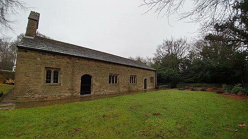
Stable, Granary Range, Cottage And Attached Archway East Of Moseley Farmhouse, Horsforth You checked the neighbourhood.Now check an address ! Photo: Simon Cobb, CC0 · Wikimedia Commons

For £24.99 a CrimesLog™ Home Report provides: (where available)

  • Nearest 6 Pre-school Nurseries to Address
  • Nearest 6 Primary Schools to Address
  • Nearest 6 Secondary/High Schools to Address
  • Nearest College and University to Address
  • Nearest to Address GP Practice/Health Centres, Hospitals and Pharmacies
  • Nearest 2 Police Station details to Address

The Home Report also provides

  • The CrimesLog™ Home Score is a proprietary Home Safety Measure capturing crime frequency, severity, recency and proximity to Address from police crime reporting point
  • A map indicating police anonymised crime reporting points around Address
  • Crime category trendlines for Address neighbourhood
  • List of Reported Crime Incidents around Address radius
  • Downloadable PDF report — A Permanent Copy to Keep and Share to aid your Property Research
  • Our crimes database of almost 60 million records is UPDATED EVERY MONTH from US, UK, CA police sources
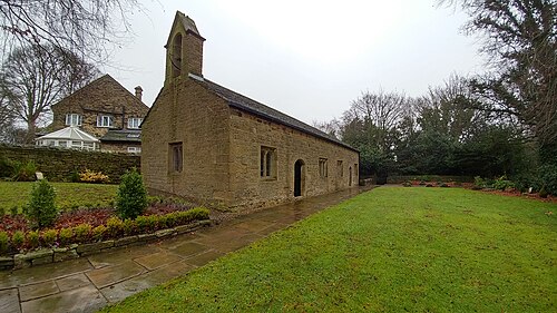
Bramhope 09-01-2018 11-48-57, Bramhope
Bramhope · Bramhope 09-01-2018 11-48-57
Photo: Mark Stevenson, CC BY 2.0 · Wikimedia Commons
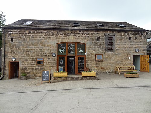
Barn On North Side Of Yard, East Of Moseley Farmhouse, Horsforth
Horsforth · Barn On North Side Of Yard, East Of Moseley Farmhouse
Photo: Simon Cobb, CC0 · Wikimedia Commons
CalverleyHouses1, Apperley Bridge
Apperley Bridge · CalverleyHouses1
Photo: Chemical Engineer, Public domain · Wikimedia Commons
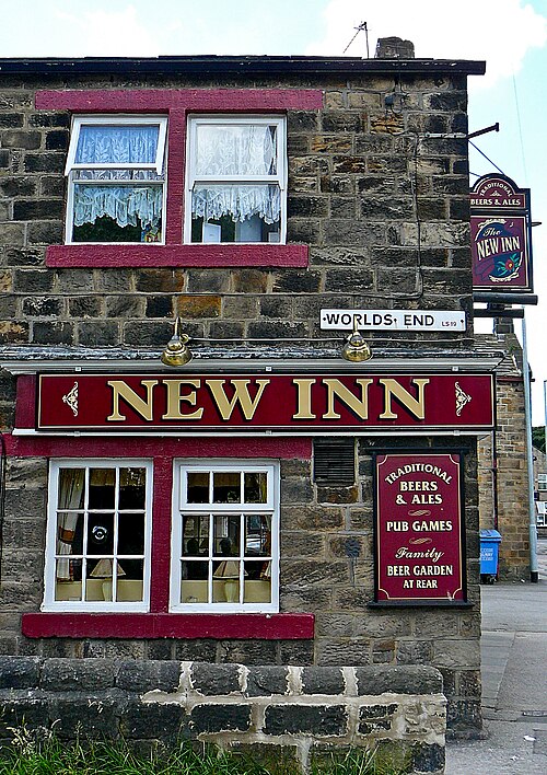
It's Not the End of the World, Guiseley
Guiseley · It's Not the End of the World
Photo: Tim Green from Bradford, UK, CC BY 2.0 · Wikimedia Commons
Bramhope 09-01-2018 11-47-12, Bramhope
Bramhope · Bramhope 09-01-2018 11-47-12
Photo: Mark Stevenson, CC BY 2.0 · Wikimedia Commons
Barn To South West Of Crag House, Horsforth
Horsforth · Barn To South West Of Crag House
Photo: Simon Cobb, CC0 · Wikimedia Commons
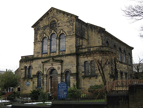
CalverleyMethodist, Apperley Bridge
Apperley Bridge · CalverleyMethodist
Photo: Chemical Engineer, Public domain · Wikimedia Commons
Bramhope 09-01-2018 11-46-42, Bramhope
Bramhope · Bramhope 09-01-2018 11-46-42
Photo: Mark Stevenson, CC BY 2.0 · Wikimedia Commons

How neighbourhoods moved each quarter

2023

Whole-area crime rate 17.1 to 20.0 per 1,000 (high: Q2 2023).

Big moves (4+ places in a quarter): moved up Castley 5th→1st (Q3) moved down Rotherford 1st→5th (Q3)

2024

Whole-area crime rate 16.6 to 21.8 per 1,000 (high: Q3 2024).

Big moves (4+ places in a quarter): moved up Old Bramhope 5th→1st (Q3)

2025

Whole-area crime rate 17.7 to 19.6 per 1,000 (high: Q3 2025).

Big moves (4+ places in a quarter): moved down Rotherford 1st→5th (Q3)

2026

Whole-area crime rate 15.9 to 19.4 per 1,000 (high: Q2 2026). 2 quarters so far.

No neighbourhood moved more than three places in a quarter.

Reported Safety Incidents

In Q2 2026: violent incidents were 38% (373), property incidents were 31% (304), public order incidents were 25% (243) and vehicle crimes were 6% (61).

Recorded crime here is grouped into violent crime, property crime (burglary and theft), vehicle crime and public order offences, so you can compare how safe each neighbourhood is for the kind of crime that matters to you.

Places we left out, and places to read with care

Left out: Holt Park; Moor Side; Pool Bank; Weeton. They have almost no residents: their crimes are against visitors, so a rate per resident says little about living there.

East Carlton (11.5 per 1,000 from 2 crimes among 174 residents), Castley (3.8 per 1,000 from 1 crime among 261 residents), Rotherford (3.8 per 1,000 from 2 crimes among 522 residents), Pool-in-Wharfedale (1.7 per 1,000 from 1 crime among 584 residents) and Old Bramhope (6.6 per 1,000 from 5 crimes among 753 residents) are places with few residents (under 3,000): a rate on so few people says little about living there, so they are not named as the lowest or highest.

The 10 neighbourhoods on the map

Yeadon is made of 10 neighbourhoods compared here, each in its own colour on the map. They are neighbourhood areas derived by CrimesLog from rail station locations and OS Open Names: 50,495 residents between them.

  • Apperley Bridge
  • Bramhope
  • Castley
  • East Carlton
  • Guiseley
  • Horsforth
  • Old Bramhope
  • Pool-in-Wharfedale
  • Rotherford
  • Rufford Park

All 10 neighbourhoods, Q2 2026

Crimes per 1,000 residents, Q2 2026, lowest first. The last two columns compare with Q1 2023.
#NeighbourhoodResidentsAllViolentPropertyVehiclePublic orderRate vs Q1 2023Places gained
1Pool-in-Wharfedale †5841.70.00.00.01.7down0%–
2Rotherford †5223.83.80.00.00.0down33%up1
3Castley †2613.80.03.80.00.0down0%down1
4Bramhope4,1806.21.91.90.02.4down42%–
5Old Bramhope †7536.62.72.71.30.0down44%–
6East Carlton †17411.50.00.05.85.8down50%up2
7Horsforth17,47013.86.52.90.63.8down21%–
8Apperley Bridge15,48218.07.04.41.45.2up4%down2
9Guiseley10,24736.812.315.92.26.3up60%–
10Rufford Park82256.015.814.63.621.9up39%–

† East Carlton, Castley, Rotherford, Pool-in-Wharfedale and Old Bramhope are places with few residents. A rate on a very small number of residents or crimes is not comparable with the others.

Photographs

164 photographs of the 10 neighbourhoods run along the reel; click one to see it full size. Each is credited here and under the large view.

All 164 photographs and their credits
  1. Bramhope · Bramhope 09-01-2018 11-48-57. Photo: Mark Stevenson, CC BY 2.0 · Wikimedia Commons
  2. Horsforth · Barn On North Side Of Yard, East Of Moseley Farmhouse. Photo: Simon Cobb, CC0 · Wikimedia Commons
  3. Apperley Bridge · CalverleyHouses1. Photo: Chemical Engineer, Public domain · Wikimedia Commons
  4. Guiseley · It's Not the End of the World. Photo: Tim Green from Bradford, UK, CC BY 2.0 · Wikimedia Commons
  5. Bramhope · Bramhope 09-01-2018 11-47-12. Photo: Mark Stevenson, CC BY 2.0 · Wikimedia Commons
  6. Horsforth · Barn To South West Of Crag House. Photo: Simon Cobb, CC0 · Wikimedia Commons
  7. Apperley Bridge · CalverleyMethodist. Photo: Chemical Engineer, Public domain · Wikimedia Commons
  8. Bramhope · Bramhope 09-01-2018 11-46-42. Photo: Mark Stevenson, CC BY 2.0 · Wikimedia Commons
  9. Horsforth · Cart Sheds And Outbuildings On South And East Sides Of Yard, East Of Moseley Farmhouse. Photo: Simon Cobb, CC0 · Wikimedia Commons
  10. Horsforth · Moseley Farmhouse. Photo: Simon Cobb, CC0 · Wikimedia Commons
  11. Horsforth · Crag House. Photo: Simon Cobb, CC0 · Wikimedia Commons
  12. Horsforth · Bridge Over Railway Cutting At Se 241 406. Photo: Simon Cobb, CC0 · Wikimedia Commons
  13. Horsforth · Owlet Farmhouse. Photo: Simon Cobb, CC0 · Wikimedia Commons
  14. Horsforth · Lane End Farmhouse. Photo: Simon Cobb, CC0 · Wikimedia Commons
  15. Horsforth · Stable, Granary Range, Cottage And Attached Archway East Of Moseley Farmhouse. Photo: Simon Cobb, CC0 · Wikimedia Commons
  16. Horsforth · Church Lane House Lodge, Adel. Photo: Tim Green, CC BY 2.0 · Wikimedia Commons
  17. Ledsham · Church Ledsham. Photo: Mark Stevenson, CC BY 2.0 · Wikimedia Commons
  18. Micklefield · Church Ledsham. Photo: Mark Stevenson, CC BY 2.0 · Wikimedia Commons
  19. Aberford · Aberford House. Photo: Tim Green from Bradford, CC BY 2.0 · Wikimedia Commons
  20. Cross Gates · View Over Swarcliffe Leeds (JANUARY.2nd.2000). Photo: CT Photography (UK), CC BY 2.0 · Wikimedia Commons
  21. Garforth · GarforthCC2009. Photo: Chemical Engineer, Public domain · Wikimedia Commons
  22. Woodend · Church St John the Evangelist's, Oulton, Leeds. Photo: Mark Stevenson, CC BY 2.0 · Wikimedia Commons
  23. Black Gates · Blackgates House. Photo: Mark Stevenson, CC BY 2.0 · Wikimedia Commons
  24. Cottingley · Farnley Wood. Photo: Mark Stevenson, CC BY 2.0 · Wikimedia Commons
  25. Morley · Haircut 2000, 2 Queen Street, Morley. Photo: Tim Green from Bradford, UK, CC BY 2.0 · Wikimedia Commons
  26. Adel · The Tudors And Victoria House Adel Mill. Photo: Simon Cobb, CC0 · Wikimedia Commons
  27. Alwoodley · EtzChaimLS17. Photo: Chemical Engineer, Public domain · Wikimedia Commons
  28. Alwoodley Park · CarrManor01. Photo: Chemical Engineer, Public domain · Wikimedia Commons
  29. Chapel Allerton · Church St Matthew, Leeds. Photo: Mark Stevenson, CC BY 2.0 · Wikimedia Commons
  30. Lidgett Park · Moor Allerton School. Photo: Simon Cobb, CC0 · Wikimedia Commons
  31. Meanwood · Meanwood Towers, Leeds. Photo: Mark Stevenson, CC BY 2.0 · Wikimedia Commons
  32. Monkswood · Cobble Hall. Photo: Simon Cobb, CC0 · Wikimedia Commons
  33. Moor Allerton · PennyFun. Photo: Chemical Engineer, Public domain · Wikimedia Commons
  34. Moortown · Immaculate Heart Of Mary, Harrogate Road, Leeds. Photo: Mark Stevenson, CC BY 2.0 · Wikimedia Commons
  35. Park Villas · Gate Piers, Gates And Railings To Roundhay Park. Photo: Simon Cobb, CC0 · Wikimedia Commons
  36. Roundhay · Boundary Wall To St Johns School And Almshouses. Photo: Simon Cobb, CC0 · Wikimedia Commons
  37. Shadwell · Shadwell88VHall. Photo: Chemical Engineer, Public domain · Wikimedia Commons
  38. Kirkstall Forge · Broad Lane, Leeds. Photo: Mark Stevenson, CC BY 2.0 · Wikimedia Commons
  39. New Farnley · Cupola of the Old Church, Old Farnley, Leeds. Photo: Tim Green from Bradford, CC BY 2.0 · Wikimedia Commons
  40. New Pudsey · Clifton Road, Leeds. Photo: Mark Stevenson, CC BY 2.0 · Wikimedia Commons
  41. Outwood · Lofthouse Methodist Church Plaque. Photo: Tony Hisgett from Birmingham, UK, CC BY 2.0 · Wikimedia Commons
  42. Woodlesford · Church St John the Evangelist's, Oulton, Leeds. Photo: Mark Stevenson, CC BY 2.0 · Wikimedia Commons
  43. Burley Park · Boundary Wall With Gate Piers And Gates To Spring Hill And Elmfield. Photo: Simon Cobb, CC0 · Wikimedia Commons
  44. Gipton · Gipton's Finest. Photo: Mikey, CC BY 2.0 · Wikimedia Commons
  45. Gipton Wood · Former Council Houses. Photo: Mikey, CC BY 2.0 · Wikimedia Commons
  46. Gledhow · Gledhow Lodge. Photo: Simon Cobb, CC0 · Wikimedia Commons
  47. Harehills Corner · GiptonSpa02. Photo: Chemical Engineer, Public domain · Wikimedia Commons
  48. Headingley · Coach House And Stables To Oxley Hall. Photo: Simon Cobb, CC0 · Wikimedia Commons
  49. Hollin Park · Grove House East And Grove House West, Grove House Court. Photo: Simon Cobb, CC0 · Wikimedia Commons
  50. Lady Wood · Oakwood Library 1. Photo: Chemical Engineer, Public domain · Wikimedia Commons
  51. Leeds · Cromer Road. Photo: Simon Cobb, CC0 · Wikimedia Commons
  52. Oakwood · Oakwood Hall 2010. Photo: Chemical Engineer, Public domain · Wikimedia Commons
  53. Woodhouse Hill · Ebor Cottage, Middleton Road, Leeds. Photo: Mark Stevenson, CC BY 2.0 · Wikimedia Commons
  54. Bardsey · All Hallows, Bardsey 3. Photo: Tim Green from Bradford, CC BY 2.0 · Wikimedia Commons
  55. Bramham · All Saints Church Bramham. Photo: Mark Stevenson, CC BY 2.0 · Wikimedia Commons
  56. Clifford · St Luke Church. Photo: Jay Sands, CC BY 3.0 · Wikimedia Commons
  57. East Keswick · Methodist Church, East Keswick. Photo: Tim Green from Bradford, CC BY 2.0 · Wikimedia Commons
  58. Horsforth · BraggHouseBodington. Photo: Chemical Engineer, Public domain · Wikimedia Commons
  59. Aberford · Aberford. Photo: Tim Green from Bradford, CC BY 2.0 · Wikimedia Commons
  60. Cross Gates · DSCF3195. Photo: John Seb Barber from Leeds, UK, CC BY 2.0 · Wikimedia Commons
  61. Woodend · Church St John the Evangelist's, Oulton, Leeds. Photo: Mark Stevenson, CC BY 2.0 · Wikimedia Commons
  62. Cottingley · Feb 2015 - Sun Setting on Elland Road. Photo: Gareth Williams, CC BY 2.0 · Wikimedia Commons
  63. Adel · Adel Church. Photo: Jay Sands, CC BY 3.0 · Wikimedia Commons
  64. Chapel Allerton · Church St Matthew, Leeds. Photo: Mark Stevenson, CC BY 2.0 · Wikimedia Commons
  65. Meanwood · Bywater Farmhouse. Photo: Simon Cobb, CC0 · Wikimedia Commons
  66. Monkswood · Range Of Farm Buildings To East Of Cobble Hall. Photo: Simon Cobb, CC0 · Wikimedia Commons
  67. Moortown · Immaculate Heart Of Mary, Harrogate Road, Leeds. Photo: Mark Stevenson, CC BY 2.0 · Wikimedia Commons
  68. Park Villas · Mansion Cottage Approximately 10 Metres West Of Roundhay Park Stables. Photo: Simon Cobb, CC0 · Wikimedia Commons
  69. Roundhay · Church Stream Cottage. Photo: Simon Cobb, CC0 · Wikimedia Commons
  70. Shadwell · Shadwell72Library. Photo: Chemical Engineer, Public domain · Wikimedia Commons
  71. Kirkstall Forge · Broad Lane, Leeds. Photo: Mark Stevenson, CC BY 2.0 · Wikimedia Commons
  72. New Pudsey · Church Stanningley St Thomas. Photo: Mark Stevenson, CC BY 2.0 · Wikimedia Commons
  73. Outwood · Lofthouse Methodist Church. Photo: Tony Hisgett from Birmingham, UK, CC BY 2.0 · Wikimedia Commons
  74. Woodlesford · Bridge Farm Hotel, Swillington. Photo: Tim Green from Bradford, UK, CC BY 2.0 · Wikimedia Commons
  75. Burley Park · 63, Victoria Road. Photo: Simon Cobb, CC0 · Wikimedia Commons
  76. Gipton · The Fairway Gipton. Photo: Chemical Engineer, Public domain · Wikimedia Commons
  77. Gledhow · Gledhow Manor. Photo: Simon Cobb, CC0 · Wikimedia Commons
  78. Headingley · MeanwoodHall02. Photo: Chemical Engineer, Public domain · Wikimedia Commons
  79. Hollin Park · Hollin Park Road. Photo: Chemical Engineer, Public domain · Wikimedia Commons
  80. Lady Wood · Roundhay Methodist. Photo: Chemical Engineer, Public domain · Wikimedia Commons
  81. Leeds · 39 Hunslet Road. Photo: Simon Cobb, CC0 · Wikimedia Commons
  82. Bardsey · All Hallows, Bardsey 2. Photo: Tim Green from Bradford, CC BY 2.0 · Wikimedia Commons
  83. Bramham · All Saints Church Bramham. Photo: Mark Stevenson, CC BY 2.0 · Wikimedia Commons
  84. Clifford · View of St Edward King and Confessor Catholic Church. from St Luke Church. Photo: Jay Sands, CC BY 3.0 · Wikimedia Commons
  85. Horsforth · Spennithorne Drive, Leeds. Photo: Mark Stevenson, CC BY 2.0 · Wikimedia Commons
  86. Cross Gates · Cross Gates Railway Station November 2023. Photo: Pacer142, CC0 · Wikimedia Commons
  87. Adel · Adel Church. Photo: Jay Sands, CC BY 3.0 · Wikimedia Commons
  88. Chapel Allerton · 150-170, Harrogate Road. Photo: Simon Cobb, CC0 · Wikimedia Commons
  89. Meanwood · Carr Manor Cottages. Photo: Simon Cobb, CC0 · Wikimedia Commons
  90. Monkswood · Pair Of Cottages Immediately North East Of Cobble Hall. Photo: Simon Cobb, CC0 · Wikimedia Commons
  91. Moortown · Immaculate Heart Of Mary, Harrogate Road, Leeds. Photo: Mark Stevenson, CC BY 2.0 · Wikimedia Commons
  92. Park Villas · Coach House And Stables To Roundhay Park. Photo: Simon Cobb, CC0 · Wikimedia Commons
  93. Roundhay · Elmet Hall. Photo: Simon Cobb, CC0 · Wikimedia Commons
  94. Shadwell · Shadwell12StPaul. Photo: Chemical Engineer, Public domain · Wikimedia Commons
  95. Kirkstall Forge · Baptist Church, With Chapel Cottage Attached. Photo: Simon Cobb, CC0 · Wikimedia Commons
  96. New Pudsey · Canal Road, Rodley, Leeds. Photo: Mark Stevenson, CC BY 2.0 · Wikimedia Commons
  97. Burley Park · 1 And 1A, Providence Avenue. Photo: Simon Cobb, CC0 · Wikimedia Commons
  98. Headingley · Abbey House Museum. Photo: Tim Green, CC BY 2.0 · Wikimedia Commons
  99. Leeds · Calverly Building Leeds April 2025. Photo: Valienne, CC BY 4.0 · Wikimedia Commons
  100. Bardsey · All Hallows, Bardsey 1. Photo: Tim Green from Bradford, CC BY 2.0 · Wikimedia Commons
  101. Bramham · All Saints Church Bramham. Photo: Mark Stevenson, CC BY 2.0 · Wikimedia Commons
  102. Clifford · St Edward King and Confessor Catholic Church, Clifford. Photo: Mark Stevenson, CC BY 2.0 · Wikimedia Commons
  103. Horsforth · BodingtonReception. Photo: Chemical Engineer, Public domain · Wikimedia Commons
  104. Cross Gates · Temple Newsam Hall - Panoramio - PJMarriott (3). Photo: PJMarriott, CC BY 3.0 · Wikimedia Commons
  105. Adel · Adel Church, South Doorway. Photo: Jay Sands, CC BY 3.0 · Wikimedia Commons
  106. Chapel Allerton · 210, Harrogate Road. Photo: Simon Cobb, CC0 · Wikimedia Commons
  107. Meanwood · Carr Manor. Photo: Simon Cobb, CC0 · Wikimedia Commons
  108. Moortown · Roman Catholic Church of the Immaculate Heart of Mary, Harrogate Road, Leeds. Photo: Mark Stevenson, CC BY 2.0 · Wikimedia Commons
  109. Park Villas · DeerParkLeeds. Photo: Chemical Engineer, Public domain · Wikimedia Commons
  110. Roundhay · Roundhay Church. Photo: Tim Green from Bradford, CC BY 2.0 · Wikimedia Commons
  111. Kirkstall Forge · 261, Upper Town Street. Photo: Simon Cobb, CC0 · Wikimedia Commons
  112. New Pudsey · Clifton Road, Leeds. Photo: Mark Stevenson, CC BY 2.0 · Wikimedia Commons
  113. Burley Park · Alder Hill Cottages. Photo: Simon Cobb, CC0 · Wikimedia Commons
  114. Headingley · MeanwoodHall01. Photo: Chemical Engineer, Public domain · Wikimedia Commons
  115. Leeds · Albion House (1). Photo: Simon Cobb, CC0 · Wikimedia Commons
  116. Bardsey · Lychgate, Bardsey. Photo: Tim Green from Bradford, CC BY 2.0 · Wikimedia Commons
  117. Horsforth · 79,81 And 83, Town Street. Photo: Simon Cobb, CC0 · Wikimedia Commons
  118. Cross Gates · Leeds, UK. Photo: ianpudsey, CC BY 3.0 · Wikimedia Commons
  119. Adel · Stair And Low Fold Cottage Adel Mill. Photo: Simon Cobb, CC0 · Wikimedia Commons
  120. Chapel Allerton · Church St Matthew, Leeds. Photo: Mark Stevenson, CC BY 2.0 · Wikimedia Commons
  121. Moortown · Roman Catholic Church of the Immaculate Heart of Mary, Harrogate Road, Leeds. Photo: Mark Stevenson, CC BY 2.0 · Wikimedia Commons
  122. Park Villas · Shadwell Grange. Photo: Chemical Engineer, Public domain · Wikimedia Commons
  123. Roundhay · Avenue, Roundhay Park. Photo: Tim Green from Bradford, CC BY 2.0 · Wikimedia Commons
  124. Kirkstall Forge · 257, Upper Town Street. Photo: Simon Cobb, CC0 · Wikimedia Commons
  125. New Pudsey · Cape Mills, Coal Hill Lane, Farsley, Leeds. Photo: Mark Stevenson, CC BY 2.0 · Wikimedia Commons
  126. Burley Park · Charles Thackrah Building. Photo: Rachael Unsworth / Leeds City Walking Tours, CC BY 4.0 · Wikimedia Commons
  127. Headingley · Cottage Road Cinema, Headingley. Photo: Tim Green from Bradford, CC BY 2.0 · Wikimedia Commons
  128. Leeds · Boundary Wall Of Marshall Mills With Workshop And Railings. Photo: Simon Cobb, CC0 · Wikimedia Commons
  129. Bardsey · Lychgate and Cottages, Bardsey. Photo: Tim Green from Bradford, CC BY 2.0 · Wikimedia Commons
  130. Horsforth · 123-135, Town Street. Photo: Simon Cobb, CC0 · Wikimedia Commons
  131. Cross Gates · CricketersArms2009. Photo: Chemical Engineer, Public domain · Wikimedia Commons
  132. Adel · Swallow Millrace And Mistal Cottage Adel Mill. Photo: Simon Cobb, CC0 · Wikimedia Commons
  133. Chapel Allerton · 198 And 200, Harrogate Road. Photo: Simon Cobb, CC0 · Wikimedia Commons
  134. Kirkstall Forge · Bramley Station. Photo: Ian Kirk (Zath Ras) Camera location53° 48′ 19.3″ N, 1° 38′ 13.96″ W View this and other nearby images on: OpenStreetMap , CC BY 2.5 · Wikimedia Commons
  135. New Pudsey · Bagley Lane, Farsley. Photo: Tim Green from Bradford, CC BY 2.0 · Wikimedia Commons
  136. Burley Park · 27 And 29, Victoria Road. Photo: Simon Cobb, CC0 · Wikimedia Commons
  137. Headingley · Armley House. Photo: Tim Green from Bradford, CC BY 2.0 · Wikimedia Commons
  138. Leeds · 1A, Cavendish Road. Photo: Simon Cobb, CC0 · Wikimedia Commons
  139. Horsforth · Clayton House (1). Photo: Simon Cobb, CC0 · Wikimedia Commons
  140. Cross Gates · Cold, Cold Lies the Clay. Photo: Tim Green from Bradford, CC BY 2.0 · Wikimedia Commons
  141. Chapel Allerton · 204 And 206, Harrogate Road. Photo: Simon Cobb, CC0 · Wikimedia Commons
  142. New Pudsey · Clouds Over Calverley. Photo: Tim Green from Bradford, CC BY 2.0 · Wikimedia Commons
  143. Burley Park · Athlone Street, Armley, Leeds. Photo: Mark Stevenson, CC BY 2.0 · Wikimedia Commons
  144. Headingley · Cottage Road Cinema, Headingley. Photo: Tim Green from Bradford, CC BY 2.0 · Wikimedia Commons
  145. Leeds · 37 And 39, Hunslet Road. Photo: Simon Cobb, CC0 · Wikimedia Commons
  146. Horsforth · 6, Hall Lane. Photo: Simon Cobb, CC0 · Wikimedia Commons
  147. Cross Gates · Coldcotes Circus, Gipton. Photo: Mikey, CC BY 2.0 · Wikimedia Commons
  148. Chapel Allerton · ChapelAllertonMethChurch. Photo: Chemical Engineer, Public domain · Wikimedia Commons
  149. New Pudsey · Angel. Photo: Tim Green from Bradford, CC BY 2.0 · Wikimedia Commons
  150. Burley Park · Devonshire Hall, Cumberland Road, Leeds. Photo: Mark Stevenson, CC BY 2.0 · Wikimedia Commons
  151. Headingley · Fulton Place, Leeds. Photo: Mark Stevenson, CC BY 2.0 · Wikimedia Commons
  152. Leeds · 18 Crown Point Road. Photo: Simon Cobb, CC0 · Wikimedia Commons
  153. Horsforth · 4, Hall Lane. Photo: Simon Cobb, CC0 · Wikimedia Commons
  154. Cross Gates · Epiphany Gipton. Photo: Chemical Engineer, Public domain · Wikimedia Commons
  155. Chapel Allerton · 212, Harrogate Road. Photo: Simon Cobb, CC0 · Wikimedia Commons
  156. Burley Park · Coach House Stables And Boundary Wall With Garden House To Rear Of Spring Hill. Photo: Simon Cobb, CC0 · Wikimedia Commons
  157. Headingley · Woodlea Drive, Leeds. Photo: Mark Stevenson, CC BY 2.0 · Wikimedia Commons
  158. Leeds · Atlas House. Photo: Simon Cobb, CC0 · Wikimedia Commons
  159. Horsforth · Croft House. Photo: Simon Cobb, CC0 · Wikimedia Commons
  160. Burley Park · Alexander Memorial Approximately 14 Metres South Of Church Of St Mark. Photo: Simon Cobb, CC0 · Wikimedia Commons
  161. Leeds · BrownHillAveLS9. Photo: Chemical Engineer, Public domain · Wikimedia Commons
  162. Horsforth · Cards Etc., Town Street, Horsforth. Photo: Tim Green from Bradford, UK, CC BY 2.0 · Wikimedia Commons
  163. Horsforth · Houses in Calverley Lane, Horsforth. Photo: Tim Green from Bradford, CC BY 2.0 · Wikimedia Commons
  164. Horsforth · 2,6 And 8, Bachelor Lane. Photo: Simon Cobb, CC0 · Wikimedia Commons

Sources and notes

CrimesLog sources crime incident data as published by the UK Home Office through their national data portal at data.police.uk and licensed under their Open Government Licence v3.0. Reported crime incidents originate from individual Territorial Police Forces of England, Wales and Northern Ireland

Contains ONS data © Crown copyright and database right. Contains NISRA data © Crown copyright. Licensed under the Open Government Licence v3.0.

First-place medal: 1st Place Medal emoji icon by Icons8.

Neighbourhood areas derived by CrimesLog from rail station locations (NaPTAN, Department for Transport) and OS Open Names. Contains OS data © Crown copyright and database right 2024; contains public sector information licensed under the Open Government Licence v3.0. The photographs are credited under each picture.

Rates are recorded crimes per 1,000 residents, quarter by quarter; where a neighbourhood has fewer than 100 residents the rate would be worked out on 100 (those places are left out of the race). A count of recorded crime is not a verdict on any neighbourhood.