Chicago · Neighborhood crime trends

Chicago Far North Side

12 neighborhoods - a quarterly race to the lowest crime rate.

Crime Trends: Neighborhoods compared - each quarter from Q1 2022

Chicago as a whole averaged 22.3 crimes for every 1,000 residents per quarter in Q2 2026, while the far north side of Chicago averaged 12.4, hence it is generally safer when all crimes are considered.

How do the 12 neighborhoods of the far north side of Chicago compare? In Q2 2026 the police recorded 5,717 crimes across them, 12.4 for every 1,000 residents. That is 6.0% below a year earlier and 15.5% above Q1 2022, the first quarter we track.

Edison Park has the lowest rate of the everyday neighborhoods (2.9 per 1,000), followed by Forest Glen (5.4) and Norwood Park (6.2). Uptown has the highest (19.7).

Use the RACE CHARTS below to watch all 12 CHICAGO FAR NORTH SIDE NEIGHBORHOODs race across 18 quarter periods from Q1 2022 to Q2 2026 - one crime category at a time or all together. The race chart can be used to compare average crime rates by category against Chicago's average.

Neighborhood boundaries are defined by City of Chicago, community areas (Chicago Data Portal).
Lowest rate (everyday)
lowest rateEdison Park
2.9 crimes per 1,000 residents, Q2 2026
Highest rate
upUptown
19.7 per 1,000, Q2 2026
Whole area, Q2 2026
12.4 per 1,000
down 6.0% below a year earlier · up 15.5% above Q1 2022
Compared
12 neighborhoods
461,460 residents · 18 quarters

Chicago Far North Side neighborhood quarterly crime race

Press ▶︎ to watch Q1 2022 to Q2 2026. Tick one crime category or several; hover a bar for the neighborhood. Property crimes includes burglaries and thefts.

Crime categories
Indicated: crimes rate per 1000 residents per quarterAll · safest at the top · square-root scale · Q1 2022 to Q2 202601510259.5Albany Park10.8Edgewater5.8Edison Park5.5Forest Glen7.6Jefferson Park9.0Lincoln Square11.6North Park6.2Norwood Park26.8O'Hare14.8Rogers Park13.3Uptown9.9West RidgeChicago Q2 2026 average all crimes (22.3)Numbers are crimes per 1,000 residents per quarter. Zero-crime quarters show 0 and rank safest.
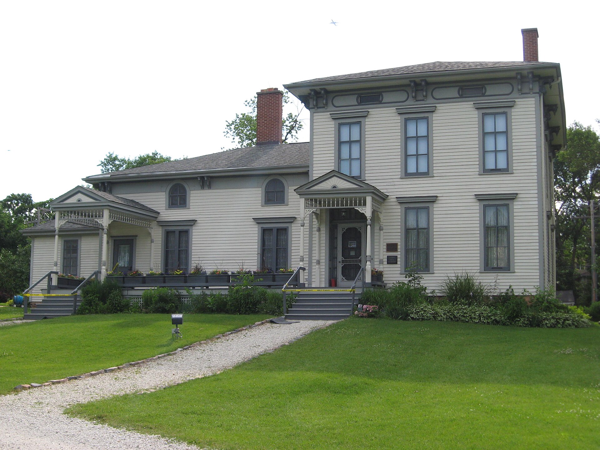
Noble-Seymour-Crippen House (Norwood Park Historical Society), Norwood Park You checked the neighborhood.Now check an address ! Photo: Zol87 from Chicago, IL, USA, CC BY 3.0 · Wikimedia Commons

For $34.00 a CrimesLog™ Home Report provides: (where available)

  • Nearest 6 Pre-school Nurseries to Address
  • Nearest 6 Primary Schools to Address
  • Nearest 6 Secondary/High Schools to Address
  • Nearest College and University to Address
  • Nearest to Address Medical Clinics, Hospitals and Pharmacies
  • Nearest 2 Police Station details to Address

The Home Report also provides

  • The CrimesLog™ Home Score is a proprietary Home Safety Measure capturing crime frequency, severity, recency and proximity to Address from police crime reporting point
  • A map indicating police anonymized crime reporting points around Address
  • Crime category trendlines for Address neighborhood
  • List of Reported Crime Incidents around Address radius
  • Downloadable PDF report — A Permanent Copy to Keep and Share to aid your Property Research
  • Our crimes database of almost 60 million records is UPDATED EVERY MONTH from US, UK, CA police sources
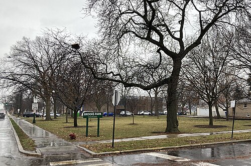
Brooks Park, Chicago, IL, Edison Park
Edison Park · Brooks Park, Chicago, IL
Photo: Nick Number, CC BY 4.0 · Wikimedia Commons
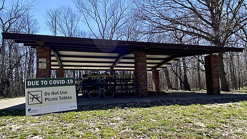
Cook County Forest Preserves Edgebrook Woods Picnic During COVID19, Forest Glen
Forest Glen · Cook County Forest Preserves Edgebrook Woods Picnic During COVID19
Photo: Raed Mansour from Chicago, USA, CC BY 2.0 · Wikimedia Commons
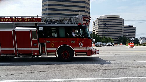
Engine No. 9, Norwood Park
Norwood Park · Engine No. 9
Photo: Michel Curi, CC BY 2.0 · Wikimedia Commons
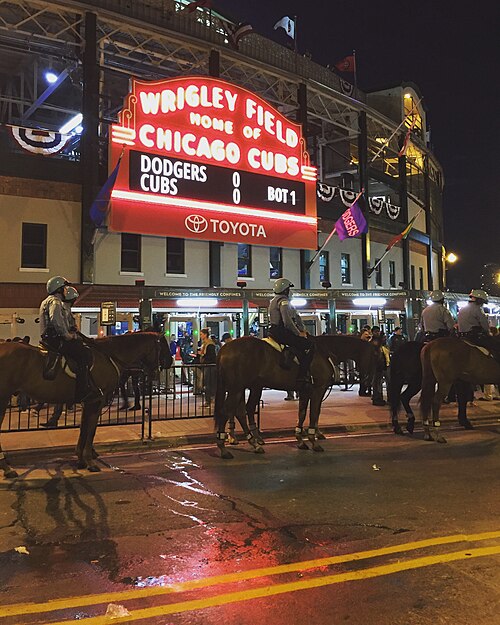
2016 NLCS Game 1, West Ridge
West Ridge · 2016 NLCS Game 1
Photo: Ryan Dickey from Evanston, IL / Chicago, United States, CC BY 2.0 · Wikimedia Commons
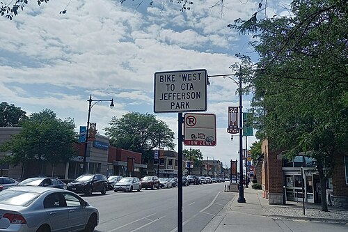
"Bike West to CTA Jefferson Park" Sign - Chicago, IL - August 2025, Albany Park
Albany Park · "Bike West to CTA Jefferson Park" Sign - Chicago, IL - August 2025
Photo: AlphaBeta135, CC BY 4.0 · Wikimedia Commons
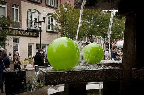
Balls in the Lincoln Square Fountain, Lincoln Square
Lincoln Square · Balls in the Lincoln Square Fountain
Photo: vxla, CC BY 2.0 · Wikimedia Commons
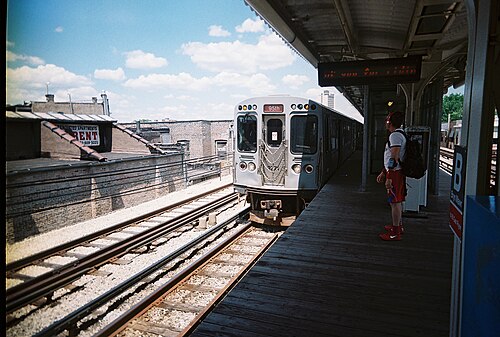
Bryn Mawr CTA, Edgewater
Edgewater · Bryn Mawr CTA
Photo: Kiwithing from Chicago, IL, USA, CC BY 2.0 · Wikimedia Commons
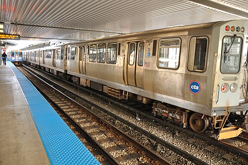
CTA 5000-Series Meets 2600-Series, Rogers Park
Rogers Park · CTA 5000-Series Meets 2600-Series
Photo: vxla from Chicago, US, CC BY 2.0 · Wikimedia Commons

How neighborhoods moved each quarter

2022

Whole-area crime rate 10.7 to 14.7 per 1,000 (high: Q3 2022).

No neighborhood moved more than three places in a quarter.

2023

Whole-area crime rate 13.5 to 16.1 per 1,000 (high: Q3 2023).

No neighborhood moved more than three places in a quarter.

2024

Whole-area crime rate 13.3 to 15.1 per 1,000 (high: Q3 2024).

No neighborhood moved more than three places in a quarter.

2025

Whole-area crime rate 12.2 to 14.2 per 1,000 (high: Q3 2025).

No neighborhood moved more than three places in a quarter.

2026

Whole-area crime rate 11.1 to 12.4 per 1,000 (high: Q2 2026). 2 quarters so far.

No neighborhood moved more than three places in a quarter.

Reported Safety Incidents

In Q2 2026: property incidents were 54% (3,111), violent incidents were 30% (1,703), vehicle crimes were 5% (258) and public order incidents were 4% (247).

Recorded crime here is grouped into violent crime, property crime (burglary and theft), vehicle crime and public order offences, so you can compare how safe each neighborhood is for the kind of crime that matters to you.

Places we left out, and places to read with care

No place is left out: every neighborhood in this race has residents to count.

O'Hare is the home of O'Hare International Airport, where recorded crimes include those at the airport itself, so a rate per resident says little about living there (26.4 per 1,000 from 380 crimes among 14,394 residents), so it is not named as the lowest or highest.

The 12 neighborhoods on the map

Far North Side is made of 12 neighborhoods compared here, each in its own colour on the map. They are the City of Chicago’s official community areas, grouped into eight sides of the city by CrimesLog: 461,460 residents between them.

  • Albany Park
  • Edgewater
  • Edison Park
  • Forest Glen
  • Jefferson Park
  • Lincoln Square
  • North Park
  • Norwood Park
  • O'Hare
  • Rogers Park
  • Uptown
  • West Ridge

All 12 neighborhoods, Q2 2026

Crimes per 1,000 residents, Q2 2026, lowest first. The last two columns compare with Q1 2022.
#NeighborhoodResidentsAllViolentPropertyVehiclePublic orderRate vs Q1 2022Places gained
1Edison Park11,5202.90.61.70.10.1down51%up1
2Forest Glen19,9015.41.52.50.60.1down2%down1
3Norwood Park39,9516.21.93.50.20.1down0%–
4Jefferson Park26,6498.32.44.20.50.3up8%–
5West Ridge78,37310.03.14.80.60.4up1%up2
6North Park18,35610.13.35.70.20.2down13%up3
7Albany Park45,53812.23.56.50.70.7up28%down1
8Lincoln Square41,65112.52.98.10.60.2up39%down3
9Edgewater54,94213.14.17.40.70.4up22%down1
10Rogers Park53,84115.96.07.10.50.9up8%up1
11Uptown56,34419.75.312.20.80.5up47%down1
12O'Hare †14,39426.46.214.00.83.9down2%–

† O'Hare is the home of O'Hare International Airport, where recorded crimes include those at the airport itself, so a rate per resident says little about living there. A rate on a very small number of residents or crimes is not comparable with the others.

Photographs

68 photographs of the 12 neighborhoods run along the reel; click one to see it full size. Each is credited here and under the large view.

All 68 photographs and their credits
  1. Edison Park · Brooks Park, Chicago, IL. Photo: Nick Number, CC BY 4.0 · Wikimedia Commons
  2. Forest Glen · Cook County Forest Preserves Edgebrook Woods Picnic During COVID19. Photo: Raed Mansour from Chicago, USA, CC BY 2.0 · Wikimedia Commons
  3. Norwood Park · Engine No. 9. Photo: Michel Curi, CC BY 2.0 · Wikimedia Commons
  4. West Ridge · 2016 NLCS Game 1. Photo: Ryan Dickey from Evanston, IL / Chicago, United States, CC BY 2.0 · Wikimedia Commons
  5. Albany Park · "Bike West to CTA Jefferson Park" Sign - Chicago, IL - August 2025. Photo: AlphaBeta135, CC BY 4.0 · Wikimedia Commons
  6. Lincoln Square · Balls in the Lincoln Square Fountain. Photo: vxla, CC BY 2.0 · Wikimedia Commons
  7. Edgewater · Bryn Mawr CTA. Photo: Kiwithing from Chicago, IL, USA, CC BY 2.0 · Wikimedia Commons
  8. Rogers Park · CTA 5000-Series Meets 2600-Series. Photo: vxla from Chicago, US, CC BY 2.0 · Wikimedia Commons
  9. Uptown · City Seal on Bus Shelter. Photo: Eric Fischer, CC BY 2.0 · Wikimedia Commons
  10. O'Hare · Blue to O'Hare. Photo: Michel Curi, CC BY 2.0 · Wikimedia Commons
  11. Edison Park · Overhead View of Chicago at Sunset. Photo: Gcjune19, CC BY 4.0 · Wikimedia Commons
  12. Forest Glen · Chicago Public Library Edgebrook Branch. Photo: Nick Number, CC BY 4.0 · Wikimedia Commons
  13. Norwood Park · Norwood Park. Photo: Smallbones, Public domain · Wikimedia Commons
  14. West Ridge · 1940s? Courtyard. Photo: Payton Chung from DCA, USA, CC BY 2.0 · Wikimedia Commons
  15. Albany Park · David Fireproof Storage Warehouse. Photo: Eric Fischer, CC BY 2.0 · Wikimedia Commons
  16. Lincoln Square · Roald Amundsen High School West Side, Chicago, IL. Photo: Nick Number, CC BY 4.0 · Wikimedia Commons
  17. Edgewater · Bryn Mawr CTA Station East View (November 2024). Photo: AlphaBeta135, CC BY 4.0 · Wikimedia Commons
  18. Rogers Park · Leather Archives & Museum - Interior. Photo: OiYoiYoink, CC0 · Wikimedia Commons
  19. Uptown · Big Tree in Front Yard. Photo: Eric Fischer, CC BY 2.0 · Wikimedia Commons
  20. O'Hare · Air Choice One C208B Grand Caravan, N91AC, MSN 5296 (08 2016), as 3E 2905 Chicago (ORD) - Burlington (BRL), Flight Time. Photo: Charles from Port Chester, New York, CC BY 2.0 · Wikimedia Commons
  21. Forest Glen · Caldwell Avenue and Tonty Avenue, Wildwood, Chicago, IL. Photo: Nick Number, CC BY 4.0 · Wikimedia Commons
  22. Norwood Park · Noble-Seymour-Crippen House (Norwood Park Historical Society). Photo: Zol87 from Chicago, IL, USA, CC BY 3.0 · Wikimedia Commons
  23. West Ridge · Casa Bonita. Photo: Payton Chung from DCA, USA, CC BY 2.0 · Wikimedia Commons
  24. Albany Park · New Building Next to Kedzie Station Entrance. Photo: Eric Fischer, CC BY 2.0 · Wikimedia Commons
  25. Lincoln Square · Saint Matthias Church, Chicago, 1913 (NBY 826). Photo: Sloan, Percy H. (Percy Haydn), 1867-, Public domain · Wikimedia Commons
  26. Edgewater · Bryn Mawr Station Stage A (July 2023). Photo: AlphaBeta135, CC BY 4.0 · Wikimedia Commons
  27. Rogers Park · W Sheridan Road. Photo: Jaysin Trevino from Evanston, IL, US, CC BY 2.0 · Wikimedia Commons
  28. Uptown · Building with Deep Balconies and Side Entrance. Photo: Eric Fischer, CC BY 2.0 · Wikimedia Commons
  29. O'Hare · American Airlines A321-231, N133AN, MSN 6482 (03 2015), as AA 2611 Chicago (ORD) - Los Angeles (LAX), Flight Time 3 44 (. Photo: Charles from Port Chester, New York, CC BY 2.0 · Wikimedia Commons
  30. Forest Glen · Caldwell Preserves Entrance at Caldwell Avenue and Tonty Avenue, Wildwood, Chicago, IL. Photo: Nick Number, CC BY 4.0 · Wikimedia Commons
  31. Norwood Park · O. J. Simpson Hotel. Photo: Stephen Hogan from Chicago, United States, CC BY 2.0 · Wikimedia Commons
  32. West Ridge · DeWitt Clinton Elementary School, Chicago. Photo: Nick Number, CC BY 4.0 · Wikimedia Commons
  33. Albany Park · Empty CTA Brown Line Francisco Station. Photo: Raed Mansour, CC BY 2.0 · Wikimedia Commons
  34. Lincoln Square · Metra Over Montrose Avenue. Photo: vxla from Chicago, US, CC BY 2.0 · Wikimedia Commons
  35. Edgewater · Bryn Mawr Station Stage B (July 2023). Photo: AlphaBeta135, CC BY 4.0 · Wikimedia Commons
  36. Rogers Park · Lakeside Loyola University. Photo: Bohao Zhao, CC BY 3.0 · Wikimedia Commons
  37. Uptown · Hutchinson Street District Historic Marker, Evening. Photo: Marker by Commission on Chicago Historical and Architectural landmarks, photograph by Dan Leonard, Public domain · Wikimedia Commons
  38. O'Hare · Aer Lingus A330-302, EI-GAJ, Named St. Carthage, MSN 1791 (05 2017), as EI 122 Chicago (ORD) - Dublin (DUB), Flight Time. Photo: Charles from Port Chester, New York, CC BY 2.0 · Wikimedia Commons
  39. Forest Glen · St. Mary of the Woods Catholic Church, Chicago, IL. Photo: Nick Number, CC BY 4.0 · Wikimedia Commons
  40. West Ridge · New Building on Devon. Photo: Steve Browne & John Verkleir from Chicago, United States, CC BY 2.0 · Wikimedia Commons
  41. Albany Park · Mayfair Branch Library, Chicago, IL. Photo: Nick Number, CC BY 4.0 · Wikimedia Commons
  42. Lincoln Square · Krause Music Store - 01. Photo: dwhartwig, CC BY 2.0 · Wikimedia Commons
  43. Edgewater · Edgewater Presbyterian Church Chicago Emil Zettler Sculpture 2. Photo: Gerald Farinas, CC BY 4.0 · Wikimedia Commons
  44. Rogers Park · Purple Hotel Brick, Allen Dorfman Assassination. Photo: Stephen Hogan from Chicago, United States, CC BY 2.0 · Wikimedia Commons
  45. Uptown · Matching the Existing Setback Nicely on the Other Side of the Street. Photo: Eric Fischer, CC BY 2.0 · Wikimedia Commons
  46. O'Hare · Aer Lingus A330-302, EI-GAJ, Named St. Carthage, MSN 1791 (05 2017), as EI 122 Chicago (ORD) - Dublin (DUB), Flight Time. Photo: Charles from Port Chester, New York, CC BY 2.0 · Wikimedia Commons
  47. Forest Glen · North Branch Trail at Central Avenue. Photo: AlphaBeta135, CC BY 4.0 · Wikimedia Commons
  48. West Ridge · This Is the Building That Houses a Lovely Dive Bar, Casey's Corner. Photo: Steve Browne & John Verkleir from Chicago, United States, CC BY 2.0 · Wikimedia Commons
  49. Albany Park · Murder of Patsy Ricciardi, Outfit Porn King. Photo: Stephen Hogan, CC BY 2.0 · Wikimedia Commons
  50. Lincoln Square · Krause Music Store. Photo: dwhartwig, CC BY 2.0 · Wikimedia Commons
  51. Edgewater · Edgewater Presbyterian Church Chicago Emil Zettler Sculpture 1. Photo: Gerald Farinas, CC BY 4.0 · Wikimedia Commons
  52. Uptown · Walt Disney Magnet School. Photo: Eric Fischer, CC BY 2.0 · Wikimedia Commons
  53. O'Hare · Hilton Hotel at Chicago O'Hare International Airport. Photo: Wouter Kiel, CC BY 2.0 · Wikimedia Commons
  54. West Ridge · Saint Hilary School, Chicago. Photo: Nick Number, CC BY 4.0 · Wikimedia Commons
  55. Albany Park · Lady of Mercy. Photo: CGAphoto from Chicago, USA, CC BY 2.0 · Wikimedia Commons
  56. Lincoln Square · Lawrence Avenue West at Ravenswood Avenue - Chicago, IL - August 2025. Photo: AlphaBeta135, CC BY 4.0 · Wikimedia Commons
  57. Edgewater · Helen C Peirce School of International Studies. Photo: Bairdwarp, CC0 · Wikimedia Commons
  58. Uptown · Looking Down the Street. Photo: Eric Fischer, CC BY 2.0 · Wikimedia Commons
  59. West Ridge · Budlong Woods Branch Library, Chicago. Photo: Nick Number, CC BY 4.0 · Wikimedia Commons
  60. Edgewater · Edgewater Presbyterian Church Chicago Hand Sculpted Chancel Cross. Photo: Gerald Farinas, CC BY 4.0 · Wikimedia Commons
  61. Uptown · Looking Down the Street. Photo: Eric Fischer, CC BY 2.0 · Wikimedia Commons
  62. Edgewater · Ebenezer Lutheran Church, Chicago (45). Photo: erikccooper, CC BY 2.0 · Wikimedia Commons
  63. Uptown · Assembly Hall. Photo: Eric Fischer, CC BY 2.0 · Wikimedia Commons
  64. Edgewater · Ridge Avenue at Broadway and Bryn Mawr Avenue - Chicago, IL - June 2025. Photo: AlphaBeta135, CC BY 4.0 · Wikimedia Commons
  65. Uptown · Building That Meets the Street Badly. Photo: Eric Fischer, CC BY 2.0 · Wikimedia Commons
  66. Edgewater · CTA Berwyn Station House (June 2025). Photo: AlphaBeta135, CC BY 4.0 · Wikimedia Commons
  67. Uptown · Looking Down the Street. Photo: Eric Fischer, CC BY 2.0 · Wikimedia Commons
  68. Uptown · Long Commemorative Street Name Frank & Marjorie Alschuler Way. Photo: Eric Fischer, CC BY 2.0 · Wikimedia Commons

Sources and notes

CrimesLog sources crime incident data published by the Chicago Police Department (CPD) through the City of Chicago Open Data Portal, providing public sector information released under the City of Chicago Terms of Use.

Population: U.S. Census Bureau, American Community Survey 5-year estimates (public domain).

First-place medal: 1st Place Medal emoji icon by Icons8.

Neighborhood boundaries are defined by City of Chicago, community areas (Chicago Data Portal), provided as is, grouped into eight sides of the city by CrimesLog and simplified by CrimesLog. The photographs are credited under each picture.

Rates are recorded crimes per 1,000 residents, quarter by quarter; where a neighborhood has fewer than 100 residents the rate would be worked out on 100 (those places are left out of the race). A count of recorded crime is not a verdict on any neighborhood.