Cincinnati, Ohio · Neighborhood crime trends

Cincinnati West

25 neighborhoods - a quarterly race to the lowest crime rate.

Crime Trends: Neighborhoods compared - each quarter from Q1 2022

Cincinnati as a whole averaged 20.3 crimes for every 1,000 residents per quarter in Q2 2026, while west Cincinnati averaged 22.8, hence it is generally less safe when all crimes are considered.

How do the 25 neighborhoods of west Cincinnati compare? In Q2 2026 the police recorded 3,834 crimes across them, 22.8 for every 1,000 residents. That is 6.1% below a year earlier and 43.5% above Q1 2022, the first quarter we track.

College Hill has the lowest rate of the everyday neighborhoods (12.4 per 1,000), followed by West Price Hill (13.2) and Clifton (16.1). Downtown has the highest (70.3).

Use the RACE CHARTS below to watch all 25 CINCINNATI WEST NEIGHBORHOODs race across 18 quarter periods from Q1 2022 to Q2 2026 - one crime category at a time or all together. The race chart can be used to compare average crime rates by category against Cincinnati's average.

Neighborhood boundaries are defined by CAGIS / City of Cincinnati and simplified by CrimesLog.
Lowest rate (everyday)
lowest rateCollege Hill
12.4 crimes per 1,000 residents, Q2 2026
Highest rate
upDowntown
70.3 per 1,000, Q2 2026
Whole area, Q2 2026
22.8 per 1,000
down 6.1% below a year earlier · up 43.5% above Q1 2022
Compared
25 neighborhoods
168,182 residents · 18 quarters

Cincinnati West neighborhood quarterly crime race

Press ▶︎ to watch Q1 2022 to Q2 2026. Tick one crime category or several; hover a bar for the neighborhood. Property crimes includes burglaries and thefts.

Crime categories
Indicated: crimes rate per 1000 residents per quarterAll · safest at the top · square-root scale · Q1 2022 to Q2 202601510255010053.4Camp Washington11.2Clifton10.2College Hill9.2CUF31.7Downtown18.3East Price Hill11.3East Westwood20.3English Woods25.5Lower Price Hill14.4Millvale10.1Mt. Airy20.6North Fairmount9.6Northside43.9Over-the-Rhine173Queensgate11.2Riverside9.2Sayler Park22.7Sedamsville14.6South Cumminsville17.3South Fairmount17.5Spring Grove Village26.4Villages at Roll Hill20.8West End12.3West Price Hill14.9WestwoodCincinnati Q2 2026 average all crimes (20.3)Numbers are crimes per 1,000 residents per quarter. Zero-crime quarters show 0 and rank safest.
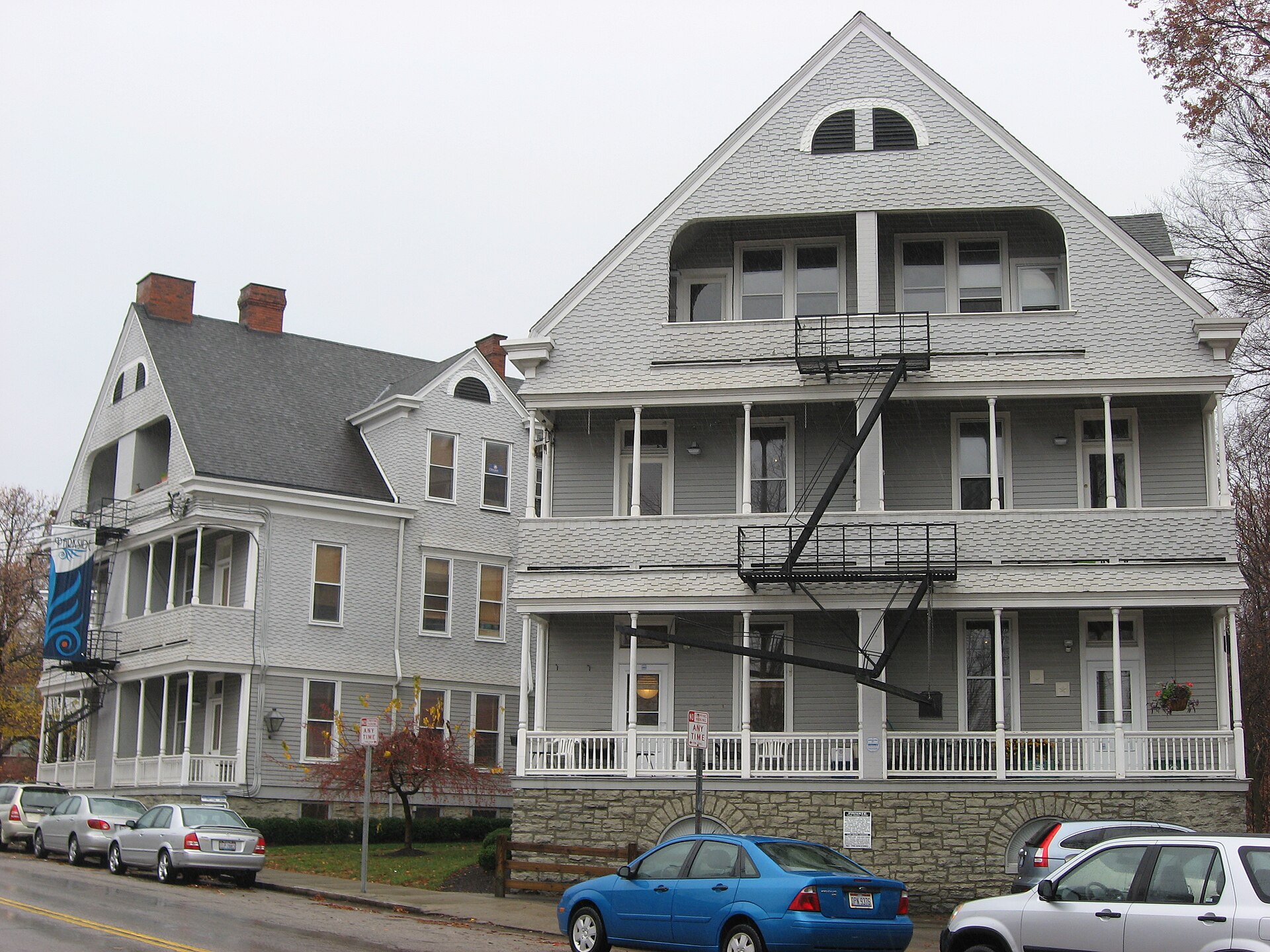
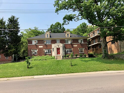
Parkside Apartments in Cincinnati, CUF You checked the neighborhood.Now check an address ! Photo: Nyttend, Public domain · Wikimedia Commons

For $34.00 a CrimesLog™ Home Report provides: (where available)

  • Nearest 6 Pre-school Nurseries to Address
  • Nearest 6 Primary Schools to Address
  • Nearest 6 Secondary/High Schools to Address
  • Nearest College and University to Address
  • Nearest to Address Medical Clinics, Hospitals and Pharmacies
  • Nearest 2 Police Station details to Address

The Home Report also provides

  • The CrimesLog™ Home Score is a proprietary Home Safety Measure capturing crime frequency, severity, recency and proximity to Address from police crime reporting point
  • A map indicating police anonymized crime reporting points around Address
  • Crime category trendlines for Address neighborhood
  • List of Reported Crime Incidents around Address radius
  • Downloadable PDF report — A Permanent Copy to Keep and Share to aid your Property Research
  • Our crimes database of almost 60 million records is UPDATED EVERY MONTH from US, UK, CA police sources
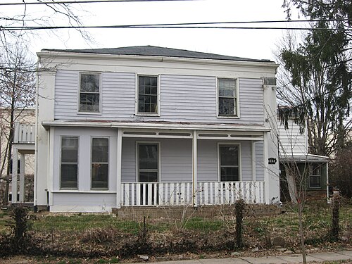
Samuel and Sally Wilson House, College Hill
College Hill · Samuel and Sally Wilson House
Photo: Nyttend, Public domain · Wikimedia Commons
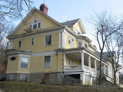
Daniel Thew Wright House, Riverside
Riverside · Daniel Thew Wright House
Photo: Nyttend, Public domain · Wikimedia Commons
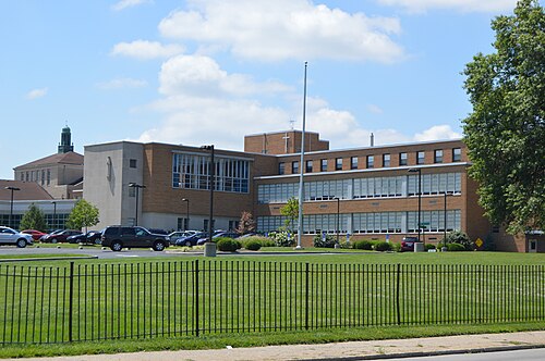
Seton HS from Northeast, West Price Hill
West Price Hill · Seton HS from Northeast
Photo: Nyttend, Public domain · Wikimedia Commons
Lafayette Avenue, Clifton, Cincinnati, OH, Clifton
Clifton · Lafayette Avenue, Clifton, Cincinnati, OH
Photo: Warren LeMay from Cullowhee, NC, United States, CC0 · Wikimedia Commons
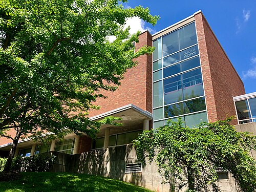
Alms Memorial Hall, DAAP, University of Cincinnati, CUF, Cincinnati, OH, CUF
CUF · Alms Memorial Hall, DAAP, University of Cincinnati, CUF, Cincinnati, OH
Photo: w_lemay, CC0 · Wikimedia Commons
Kirby Road School, Northside
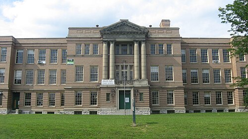
Northside · Kirby Road School
Photo: Nyttend, Public domain · Wikimedia Commons
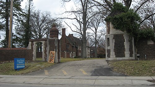
Pinecroft, Powel Crosley Mansion, Mt. Airy
Mt. Airy · Pinecroft, Powel Crosley Mansion
Photo: Nyttend, Public domain · Wikimedia Commons
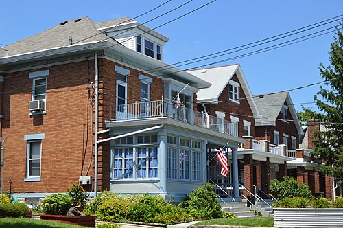
Purcell Avenue, Cincinnati, 700 Block, East Price Hill
East Price Hill · Purcell Avenue, Cincinnati, 700 Block
Photo: Nyttend, Public domain · Wikimedia Commons

How neighborhoods moved each quarter

2022

Whole-area crime rate 15.9 to 21.0 per 1,000 (high: Q3 2022).

Big moves (4+ places in a quarter): moved down CUF 1st→5th (Q2) moved up Sedamsville 19th→11th (Q2) moved down South Cumminsville 11th→16th (Q2) moved down South Fairmount 13th→19th (Q2) moved up East Westwood 9th→2nd (Q3) moved down Northside 1st→6th (Q3) moved down Mt. Airy 4th→9th (Q3) moved up Lower Price Hill 17th→12th (Q3) moved down Sedamsville 11th→18th (Q3) moved down Spring Grove Village 12th→19th (Q3) moved up Riverside 10th→5th (Q4) moved up South Cumminsville 13th→9th (Q4) moved down Millvale 8th→14th (Q4) moved up West End 21st→16th (Q4) moved down English Woods 14th→20th (Q4) moved down Villages at Roll Hill 16th→22nd (Q4)

2023

Whole-area crime rate 19.0 to 23.8 per 1,000 (high: Q3 2023).

Big moves (4+ places in a quarter): moved up Clifton 8th→2nd (Q1) moved up Sedamsville 15th→5th (Q1) moved down East Westwood 2nd→8th (Q1) moved down Northside 6th→10th (Q1) moved down West Price Hill 7th→13th (Q1) moved down Lower Price Hill 12th→16th (Q1) moved up Northside 10th→4th (Q2) moved down Clifton 2nd→6th (Q2) moved up Millvale 12th→7th (Q2) moved up English Woods 19th→8th (Q2) moved down Sedamsville 5th→13th (Q2) moved down South Cumminsville 6th→14th (Q2) moved up Villages at Roll Hill 21st→16th (Q2) moved down Spring Grove Village 15th→21st (Q2) moved up South Cumminsville 14th→3rd (Q3) moved down CUF 2nd→6th (Q3) moved up Mt. Airy 11th→7th (Q3) moved down Millvale 7th→11th (Q3) moved up Lower Price Hill 18th→12th (Q3) moved up South Fairmount 20th→14th (Q3) moved down Sedamsville 13th→18th (Q3) moved down English Woods 8th→21st (Q3) moved up Northside 5th→1st (Q4) moved up CUF 6th→2nd (Q4) moved up Clifton 9th→5th (Q4) moved up Westwood 13th→8th (Q4) moved down South Cumminsville 3rd→11th (Q4) moved down Riverside 8th→13th (Q4) moved up Spring Grove Village 20th→15th (Q4) moved down North Fairmount 16th→20th (Q4) moved down South Fairmount 14th→21st (Q4)

2024

Whole-area crime rate 17.0 to 25.0 per 1,000 (high: Q3 2024).

Big moves (4+ places in a quarter): moved up South Cumminsville 11th→5th (Q1) moved up Sedamsville 16th→7th (Q1) moved up South Fairmount 21st→17th (Q1) moved down Spring Grove Village 15th→20th (Q1) moved up Mt. Airy 9th→5th (Q2) moved up Riverside 14th→6th (Q2) moved up South Fairmount 17th→13th (Q2) moved down Sedamsville 7th→14th (Q2) moved down Lower Price Hill 13th→24th (Q2) moved up Sedamsville 14th→4th (Q3) moved up West Price Hill 11th→7th (Q3) moved down Northside 4th→8th (Q3) moved down South Cumminsville 7th→11th (Q3) moved down Mt. Airy 5th→13th (Q3) moved up Lower Price Hill 24th→15th (Q3) moved down North Fairmount 16th→20th (Q3) moved down Downtown 20th→24th (Q3) moved up Villages at Roll Hill 18th→6th (Q4) moved down Sedamsville 4th→9th (Q4) moved down East Price Hill 10th→14th (Q4) moved down Lower Price Hill 15th→20th (Q4)

2025

Whole-area crime rate 18.8 to 24.3 per 1,000 (high: Q2 2025).

Big moves (4+ places in a quarter): moved up South Fairmount 16th→4th (Q1) moved up Mt. Airy 11th→5th (Q1) moved down Riverside 3rd→8th (Q1) moved up English Woods 21st→15th (Q1) moved up Lower Price Hill 20th→16th (Q1) moved down Villages at Roll Hill 6th→19th (Q1) moved up South Cumminsville 7th→3rd (Q2) moved up Riverside 8th→4th (Q2) moved up West Price Hill 11th→6th (Q2) moved up East Price Hill 14th→7th (Q2) moved up Westwood 13th→9th (Q2) moved up Millvale 18th→11th (Q2) moved down Northside 3rd→13th (Q2) moved down South Fairmount 4th→16th (Q2) moved up CUF 12th→3rd (Q3) moved up East Westwood 15th→4th (Q3) moved up South Fairmount 16th→5th (Q3) moved up Northside 13th→7th (Q3) moved down South Cumminsville 3rd→8th (Q3) moved up English Woods 14th→10th (Q3) moved down East Price Hill 7th→11th (Q3) moved down Clifton 8th→12th (Q3) moved down Westwood 9th→13th (Q3) moved down Mt. Airy 5th→14th (Q3) moved up Villages at Roll Hill 20th→15th (Q3) moved down Millvale 11th→18th (Q3) moved down Sedamsville 10th→20th (Q3) moved up Clifton 12th→6th (Q4) moved up Mt. Airy 14th→8th (Q4) moved down East Westwood 4th→9th (Q4) moved up Sedamsville 20th→11th (Q4) moved down South Cumminsville 8th→13th (Q4) moved down South Fairmount 5th→14th (Q4) moved down English Woods 10th→16th (Q4)

2026

Whole-area crime rate 18.3 to 22.8 per 1,000 (high: Q2 2026). 2 quarters so far.

Big moves (4+ places in a quarter): moved up South Cumminsville 13th→6th (Q1) moved down CUF 3rd→7th (Q1) moved up English Woods 16th→12th (Q1) moved down West Price Hill 7th→13th (Q1) moved down East Westwood 9th→15th (Q1) moved down Sedamsville 11th→20th (Q1) moved up West Price Hill 13th→4th (Q2) moved down Northside 5th→9th (Q2) moved up East Westwood 15th→11th (Q2) moved up Villages at Roll Hill 19th→15th (Q2) moved up Sedamsville 20th→16th (Q2) moved down South Fairmount 11th→20th (Q2) moved down Lower Price Hill 17th→21st (Q2)

Reported Safety Incidents

In Q2 2026: property incidents were 28% (1,070), vehicle crimes were 22% (846), violent incidents were 6% (214) and public order incidents were 0% (0).

Recorded crime here is grouped into violent crime, property crime (burglary and theft), vehicle crime and public order offences, so you can compare how safe each neighborhood is for the kind of crime that matters to you.

Places we left out, and places to read with care

No place is left out: every neighborhood in this race has residents to count.

Queensgate (233.1 per 1,000 from 62 crimes among 266 residents), English Woods (21.8 per 1,000 from 14 crimes among 641 residents), Sedamsville (31.7 per 1,000 from 21 crimes among 662 residents), Lower Price Hill (39.8 per 1,000 from 39 crimes among 979 residents), Camp Washington (84.9 per 1,000 from 97 crimes among 1,143 residents), South Cumminsville (18.5 per 1,000 from 24 crimes among 1,299 residents), North Fairmount (27.7 per 1,000 from 43 crimes among 1,552 residents), Spring Grove Village (33.1 per 1,000 from 66 crimes among 1,996 residents), Villages at Roll Hill (31.0 per 1,000 from 68 crimes among 2,196 residents), South Fairmount (36.2 per 1,000 from 84 crimes among 2,319 residents), Riverside (12.5 per 1,000 from 29 crimes among 2,322 residents), Millvale (34.7 per 1,000 from 82 crimes among 2,361 residents), Sayler Park (7.0 per 1,000 from 19 crimes among 2,713 residents) and East Westwood (20.1 per 1,000 from 57 crimes among 2,838 residents) are places with few residents (under 3,000): a rate on so few people says little about living there, so they are not named as the lowest or highest.

The 25 neighborhoods on the map

West is made of 25 neighborhoods compared here, each in its own colour on the map. They are the Statistical Neighborhood Approximations of the City of Cincinnati (CAGIS), grouped into areas of the city by CrimesLog: 168,182 residents between them.

  • Camp Washington
  • Clifton
  • College Hill
  • CUF
  • Downtown
  • East Price Hill
  • East Westwood
  • English Woods
  • Lower Price Hill
  • Millvale
  • Mt. Airy
  • North Fairmount
  • Northside
  • Over-the-Rhine
  • Queensgate
  • Riverside
  • Sayler Park
  • Sedamsville
  • South Cumminsville
  • South Fairmount
  • Spring Grove Village
  • Villages at Roll Hill
  • West End
  • West Price Hill
  • Westwood

All 25 neighborhoods, Q2 2026

Crimes per 1,000 residents, Q2 2026, lowest first. The last two columns compare with Q1 2022.
#NeighborhoodResidentsAllViolentPropertyVehiclePublic orderRate vs Q1 2022Places gained
1Sayler Park †2,7137.00.01.52.20.0down24%up1
2College Hill14,85812.40.52.63.00.0up21%up3
3Riverside †2,32212.50.02.11.30.0up12%up3
4West Price Hill17,82113.20.73.22.40.0up7%up5
5Clifton8,02816.10.54.74.60.0up43%up2
6CUF18,28216.10.83.96.50.0up75%down5
7Westwood33,71718.30.87.42.90.0up22%up5
8South Cumminsville †1,29918.52.34.63.90.0up26%up3
9Northside8,55019.10.94.06.50.0up99%down6
10Mt. Airy8,06219.62.04.33.00.0up95%down6
11East Westwood †2,83820.12.17.02.80.0up78%down3
12East Price Hill16,28620.61.06.14.40.0up12%up3
13English Woods †64121.83.17.80.00.0up8%up3
14North Fairmount †1,55227.72.64.55.80.0up34%up3
15Villages at Roll Hill †2,19631.05.56.82.30.0up17%up6
16Sedamsville †66231.71.510.610.60.0up40%up3
17Spring Grove Village †1,99633.13.09.54.50.0up89%down3
18Millvale †2,36134.73.83.43.80.0up141%down8
19West End6,68235.33.07.94.30.0up70%down1
20South Fairmount †2,31936.22.615.54.30.0up110%down7
21Lower Price Hill †97939.85.16.18.20.0up56%down1
22Over-the-Rhine6,29152.92.910.317.00.0up21%up1
23Downtown6,31870.31.719.318.50.0up122%down1
24Camp Washington †1,14384.93.543.711.40.0up59%–
25Queensgate †266233.13.879.037.60.0up35%–

† Queensgate, English Woods, Sedamsville, Lower Price Hill, Camp Washington, South Cumminsville, North Fairmount, Spring Grove Village, Villages at Roll Hill, South Fairmount, Riverside, Millvale, Sayler Park and East Westwood are places with few residents. A rate on a very small number of residents or crimes is not comparable with the others.

Photographs

97 photographs of the 25 neighborhoods run along the reel; click one to see it full size. Each is credited here and under the large view.

All 97 photographs and their credits
  1. College Hill · Samuel and Sally Wilson House. Photo: Nyttend, Public domain · Wikimedia Commons
  2. Riverside · Daniel Thew Wright House. Photo: Nyttend, Public domain · Wikimedia Commons
  3. West Price Hill · Seton HS from Northeast. Photo: Nyttend, Public domain · Wikimedia Commons
  4. Clifton · Lafayette Avenue, Clifton, Cincinnati, OH. Photo: Warren LeMay from Cullowhee, NC, United States, CC0 · Wikimedia Commons
  5. CUF · Alms Memorial Hall, DAAP, University of Cincinnati, CUF, Cincinnati, OH. Photo: w_lemay, CC0 · Wikimedia Commons
  6. Northside · Kirby Road School. Photo: Nyttend, Public domain · Wikimedia Commons
  7. Mt. Airy · Pinecroft, Powel Crosley Mansion. Photo: Nyttend, Public domain · Wikimedia Commons
  8. East Price Hill · Purcell Avenue, Cincinnati, 700 Block. Photo: Nyttend, Public domain · Wikimedia Commons
  9. North Fairmount · Beekman Street, North Fairmount, Cincinnati, OH. Photo: Warren LeMay from Cincinnati, OH, United States, CC0 · Wikimedia Commons
  10. Sedamsville · Houses on Delhi in Sedamsville. Photo: Nyttend, Public domain · Wikimedia Commons
  11. Spring Grove Village · Winton Place Methodist Episcopal Church Front. Photo: Nyttend, Public domain · Wikimedia Commons
  12. West End · Taft Information Technology High School. Photo: Mx. Granger, CC0 · Wikimedia Commons
  13. South Fairmount · Old St. Bonaventura Catholic School, South Fairmount, Cincinnati, OH. Photo: Warren LeMay from Cincinnati, OH, United States, CC0 · Wikimedia Commons
  14. Lower Price Hill · Church Street, Lower Price Hill, Cincinnati, OH. Photo: Warren LeMay from Cincinnati, OH, United States, CC0 · Wikimedia Commons
  15. Over-the-Rhine · Cincinnati Music Hall at Night (PXL 20230307 002348966). Photo: Hayden Schiff, CC BY 4.0 · Wikimedia Commons
  16. Downtown · Carew Tower at Race - Out, Cincinnati, United States (Unsplash). Photo: Jordan Andrews exit, CC0 · Wikimedia Commons
  17. Camp Washington · Marshall Avenue, Camp Washington, Cincinnati, OH. Photo: Warren LeMay from Cullowhee, NC, United States, CC0 · Wikimedia Commons
  18. Queensgate · Longworth Hall, Queensgate, Cincinnati, OH. Photo: Warren LeMay from Cullowhee, NC, United States, CC0 · Wikimedia Commons
  19. College Hill · Old College Hill Town Hall, College Hill, Cincinnati, OH. Photo: w_lemay, CC0 · Flickr
  20. Riverside · Cincinnati - Taylor-Southgate Bridge & Coliseum Reflected. Photo: David Paul Ohmer, CC BY 2.0 · Flickr
  21. Clifton · Ludlow Avenue, Clifton, Cincinnati, OH. Photo: Warren LeMay from Cullowhee, NC, United States, CC0 · Wikimedia Commons
  22. CUF · DAA Building, DAAP, University of Cincinnati, CUF, Cincinnati, OH. Photo: w_lemay, CC0 · Wikimedia Commons
  23. Northside · White Castle, Northside, Cincinnati. Photo: Jere Keys from New York City, USA, CC BY 2.0 · Wikimedia Commons
  24. East Price Hill · Eighth and Considine, Mission Revival House. Photo: Nyttend, Public domain · Wikimedia Commons
  25. North Fairmount · Dempsey Street, North Fairmount, Cincinnati, OH. Photo: Warren LeMay from Cincinnati, OH, United States, CC0 · Wikimedia Commons
  26. Sedamsville · Sedam Street, Sedamsville, Cincinnati, OH. Photo: w_lemay, CC0 · Flickr
  27. Spring Grove Village · Epworth Free Methodist Fellowship Church, Spring Grove Village, Cincinnati, OH. Photo: w_lemay, CC0 · Flickr
  28. West End · General Andrew Hickenlooper House, West End, Cincinnati, OH. Photo: Warren LeMay from Cullowhee, NC, United States, CC0 · Wikimedia Commons
  29. South Fairmount · St. Francis Hospital Grotto, South Fairmount, Cincinnati, OH. Photo: Warren LeMay from Cincinnati, OH, United States, CC0 · Wikimedia Commons
  30. Lower Price Hill · 8th Street, Lower Price Hill, Cincinnati, OH. Photo: Warren LeMay from Cincinnati, OH, United States, CC0 · Wikimedia Commons
  31. Over-the-Rhine · Cincinnati - Cincinnati Union Terminal (OHPTC). Photo: Ohio Redevelopment Projects - ODSA, CC BY 2.0 · Wikimedia Commons
  32. Downtown · Cincinnati Public Library Reopening. Photo: Hayden Schiff, CC BY 4.0 · Wikimedia Commons
  33. Camp Washington · Massachusetts Avenue, Camp Washington, Cincinnati, OH. Photo: Warren LeMay from Cullowhee, NC, United States, CC0 · Wikimedia Commons
  34. Queensgate · Cincinnati - Cincinnati Union Terminal (OHPTC). Photo: Ohio Redevelopment Projects - ODSA, CC BY 2.0 · Wikimedia Commons
  35. College Hill · Cincinnati Fire Department Station 51, College Hill, Cincinnati, OH. Photo: w_lemay, CC0 · Flickr
  36. Clifton · The Clifton House Bed and Breakfast, Clifton, Cincinnati, OH. Photo: Warren LeMay from Cullowhee, NC, United States, CC0 · Wikimedia Commons
  37. CUF · Bishop Street Snow, Corryville, Cincinnati, OH. Photo: Warren LeMay from Cincinnati, OH, United States, CC0 · Wikimedia Commons
  38. Northside · St. Pius X Church in Cincinnati, Southwestern Angle Closeup. Photo: Nyttend, Public domain · Wikimedia Commons
  39. East Price Hill · Plymouth Congregational Church, Former Location. Photo: Nyttend, Public domain · Wikimedia Commons
  40. North Fairmount · Pulte Street, North Fairmount, Cincinnati, OH. Photo: Warren LeMay from Cincinnati, OH, United States, CC0 · Wikimedia Commons
  41. Spring Grove Village · Matthew Church of Christ, Spring Grove Village, Cincinnati, OH. Photo: w_lemay, CC0 · Flickr
  42. West End · Cincinnati - Film Center Building (OHPTC). Photo: Ohio Redevelopment Projects - ODSA, CC BY 2.0 · Wikimedia Commons
  43. South Fairmount · St. Francis Hospital in Cincinnati. Photo: Nyttend, Public domain · Wikimedia Commons
  44. Lower Price Hill · Storrs at State in Lower Price Hill. Photo: Nyttend, Public domain · Wikimedia Commons
  45. Over-the-Rhine · Cincinnati Music Hall, Over-the-Rhine, Cincinnati, OH. Photo: Warren LeMay from Cincinnati, OH, United States, CC0 · Wikimedia Commons
  46. Downtown · Datestone, Times-Star Building, Cincinnati, OH. Photo: w_lemay, CC0 · Wikimedia Commons
  47. Camp Washington · Sacred Heart Catholic Parish Church, Camp Washington, Cincinnati, OH. Photo: Warren LeMay from Cullowhee, NC, United States, CC0 · Wikimedia Commons
  48. Queensgate · Harriett Beecher Stowe School, Queensgate, Cincinnati, OH. Photo: Warren LeMay from Cullowhee, NC, United States, CC0 · Wikimedia Commons
  49. College Hill · Old College Hill Town Hall, College Hill, Cincinnati, OH. Photo: w_lemay, CC0 · Flickr
  50. Clifton · Bishop Street and Jefferson Avenue, Corryville, Cincinnati, OH. Photo: Warren LeMay from Covington, KY, United States, CC0 · Wikimedia Commons
  51. CUF · Parkside Apartments in Cincinnati. Photo: Nyttend, Public domain · Wikimedia Commons
  52. Northside · St. Patrick's Church Clergy House, Northside, Cincinnati, OH. Photo: w_lemay, CC0 · Flickr
  53. East Price Hill · Cincinnati Price Hill Carnegie Library. Photo: Nyttend, Public domain · Wikimedia Commons
  54. West End · Wetterer House, West End, Cincinnati, OH. Photo: Warren LeMay from Cullowhee, NC, United States, CC0 · Wikimedia Commons
  55. Lower Price Hill · St. Michael the Archangel Church, Lower Price Hill, Cincinnati, OH. Photo: Warren LeMay from Cincinnati, OH, United States, CC0 · Wikimedia Commons
  56. Over-the-Rhine · 14th Street and Republic Street, Over-the-Rhine, Cincinnati, OH. Photo: Warren LeMay from Cincinnati, OH, United States, CC0 · Wikimedia Commons
  57. Downtown · Times-Star Building, Cincinnati, OH. Photo: w_lemay, CC0 · Wikimedia Commons
  58. Camp Washington · Elam Street, Camp Washington, Cincinnati, OH. Photo: Warren LeMay from Cullowhee, NC, United States, CC0 · Wikimedia Commons
  59. College Hill · Consolation Baptist Church, College Hill, Cincinnati, OH. Photo: w_lemay, CC0 · Flickr
  60. Clifton · Stenton House, Clifton, Cincinnati, OH. Photo: Warren LeMay from Cullowhee, NC, United States, CC0 · Wikimedia Commons
  61. CUF · Fairview Public School Front. Photo: Nyttend, Public domain · Wikimedia Commons
  62. East Price Hill · Beech Avenue Houses in Cincinnati. Photo: Nyttend, Public domain · Wikimedia Commons
  63. Over-the-Rhine · 13th Street, Over-the-Rhine, Cincinnati, OH. Photo: Warren LeMay from Cincinnati, OH, United States, CC0 · Wikimedia Commons
  64. Downtown · Hamilton County Courthouse, Cincinnati, OH. Photo: Warren LeMay from Chicago, IL, United States, CC0 · Wikimedia Commons
  65. Camp Washington · Colerain Avenue, Camp Washington, Cincinnati, OH. Photo: Warren LeMay from Cullowhee, NC, United States, CC0 · Wikimedia Commons
  66. College Hill · Future Site of College Hill Station, College Hill, Cincinnati, OH. Photo: w_lemay, CC0 · Flickr
  67. Clifton · Ludlow Avenue, Clifton, Cincinnati, OH. Photo: Warren LeMay from Cullowhee, NC, United States, CC0 · Wikimedia Commons
  68. CUF · Fairview Public School Front and Western Side. Photo: Nyttend, Public domain · Wikimedia Commons
  69. East Price Hill · CCU Drive and Campus from Glenway. Photo: Nyttend, Public domain · Wikimedia Commons
  70. Over-the-Rhine · 13th Street and Republic Street, Over-the-Rhine, Cincinnati, OH. Photo: Warren LeMay from Cincinnati, OH, United States, CC0 · Wikimedia Commons
  71. Downtown · Cincinnati-Union Trust Building (OHPTC). Photo: Ohio Redevelopment Projects - ODSA, CC BY 2.0 · Wikimedia Commons
  72. Camp Washington · Food Market Sign, Colerain Avenue, Camp Washington, Cincinnati, OH. Photo: Warren LeMay from Cullowhee, NC, United States, CC0 · Wikimedia Commons
  73. College Hill · Cincinnati Fire Department Station 51, College Hill, Cincinnati, OH. Photo: w_lemay, CC0 · Flickr
  74. Clifton · Jefferson Avenue, Clifton, Cincinnati, OH. Photo: Warren LeMay from Cincinnati, OH, United States, CC0 · Wikimedia Commons
  75. CUF · Melbourne Flats in Cincinnati. Photo: Nyttend, Public domain · Wikimedia Commons
  76. East Price Hill · St. Peter's Lick Run Historic District. Photo: Nyttend, Public domain · Wikimedia Commons
  77. Downtown · Alms & Doepke Building, Over-the-Rhine, Cincinnati, OH. Photo: Warren LeMay from Cincinnati, OH, United States, CC0 · Wikimedia Commons
  78. Camp Washington · Colerain Avenue, Camp Washington, Cincinnati, OH. Photo: Warren LeMay from Cullowhee, NC, United States, CC0 · Wikimedia Commons
  79. College Hill · Brighton Bank Building, College Hill, Cincinnati, OH. Photo: w_lemay, CC0 · Flickr
  80. Clifton · Bishop Street, Clifton, Cincinnati, OH. Photo: Warren LeMay from Cincinnati, OH, United States, CC0 · Wikimedia Commons
  81. East Price Hill · Holy Family Catholic Church, East Price Hill, Cincinnati, OH. Photo: w_lemay, CC0 · Flickr
  82. Downtown · Church of St. Francis Xavier, Cincinnati, OH. Photo: Warren LeMay from Cincinnati, OH, United States, CC0 · Wikimedia Commons
  83. Camp Washington · American Sign Museum, Camp Washington, Cincinnati, OH. Photo: Warren LeMay from Cullowhee, NC, United States, CC0 · Wikimedia Commons
  84. College Hill · Brighton Bank Building, College Hill, Cincinnati, OH. Photo: w_lemay, CC0 · Flickr
  85. Clifton · Bishop Street, Clifton, Cincinnati, OH. Photo: Warren LeMay from Cincinnati, OH, United States, CC0 · Wikimedia Commons
  86. East Price Hill · Angel Statue, Holy Family Catholic Church, East Price Hill, Cincinnati, OH. Photo: w_lemay, CC0 · Flickr
  87. Downtown · Cincinnati-Cincinnati Enquirer Building (OHPTC). Photo: Ohio Redevelopment Projects - ODSA, CC BY 2.0 · Wikimedia Commons
  88. Camp Washington · Marshall Avenue, Camp Washington, Cincinnati, OH. Photo: Warren LeMay from Cullowhee, NC, United States, CC0 · Wikimedia Commons
  89. Clifton · Bishop Street, Clifton, Cincinnati, OH. Photo: Warren LeMay from Cincinnati, OH, United States, CC0 · Wikimedia Commons
  90. Camp Washington · Sacred Heart Catholic Parish Church, Camp Washington, Cincinnati, OH. Photo: Warren LeMay from Cullowhee, NC, United States, CC0 · Wikimedia Commons
  91. Clifton · Bishop Street, Clifton, Cincinnati, OH. Photo: Warren LeMay from Cincinnati, OH, United States, CC0 · Wikimedia Commons
  92. Camp Washington · Colerain Avenue, Camp Washington, Cincinnati, OH. Photo: Warren LeMay from Cullowhee, NC, United States, CC0 · Wikimedia Commons
  93. Clifton · Wentworth Avenue, Clifton, Cincinnati, OH. Photo: Warren LeMay from Cincinnati, OH, United States, CC0 · Wikimedia Commons
  94. Camp Washington · Elam Street, Camp Washington, Cincinnati, OH. Photo: Warren LeMay from Cullowhee, NC, United States, CC0 · Wikimedia Commons
  95. Clifton · Parkview Manor, Clifton, Cincinnati, OH. Photo: Warren LeMay from Cincinnati, OH, United States, CC0 · Wikimedia Commons
  96. Camp Washington · Cincinnati Gas and Electric Company Building, Camp Washington, Cincinnati, OH. Photo: Warren LeMay from Cullowhee, NC, United States, CC0 · Wikimedia Commons
  97. Clifton · Charles B. Russell House, Clifton, Cincinnati, OH. Photo: Warren LeMay from Cincinnati, OH, United States, CC0 · Wikimedia Commons

Sources and notes

CrimesLog sources crime incident data published by the City of Cincinnati through its Open Data portal under the PDI (Police Data Initiative) Crime Incidents dataset, incorporating information originally reported by the Cincinnati Police Department.

Population: U.S. Census Bureau, American Community Survey 5-year estimates (public domain).

First-place medal: 1st Place Medal emoji icon by Icons8.

Neighborhood boundaries are the Statistical Neighborhood Approximations defined by CAGIS / City of Cincinnati, grouped into areas of the city and simplified by CrimesLog. The photographs are credited under each picture.

Rates are recorded crimes per 1,000 residents, quarter by quarter; where a neighborhood has fewer than 100 residents the rate would be worked out on 100 (those places are left out of the race). A count of recorded crime is not a verdict on any neighborhood.