New York City · Neighborhood crime trends

New York Brooklyn South

25 neighborhoods - a quarterly race to the lowest crime rate.

Crime Trends: Neighborhoods compared - each quarter from Q1 2022

New York as a whole averaged 16.5 crimes for every 1,000 residents per quarter in Q2 2026, while south Brooklyn averaged 11.1 (leaving out 9 places with almost no residents), hence it is generally safer when all crimes are considered.

How do the 25 neighborhoods of south Brooklyn compare? In Q2 2026 the police recorded 13,578 crimes across them, 11.1 for every 1,000 residents. That is 3.5% below a year earlier and 17.1% above Q1 2022, the first quarter we track.

Borough Park has the lowest rate of the everyday neighborhoods (3.9 per 1,000), followed by Mapleton-Midwood (West) (5.7) and Kensington (5.9). Coney Island-Sea Gate has the highest (27.1).

Use the RACE CHARTS below to watch all 25 NEW YORK BROOKLYN SOUTH NEIGHBORHOODs race across 18 quarter periods from Q1 2022 to Q2 2026 - one crime category at a time or all together. The race chart can be used to compare average crime rates by category against New York's average.

Neighborhood boundaries are defined by NYC Department of City Planning, 2020 Neighborhood Tabulation Areas.
Lowest rate (everyday)
lowest rateBorough Park
3.9 crimes per 1,000 residents, Q2 2026
Highest rate
upConey Island-Sea Gate
27.1 per 1,000, Q2 2026
Whole area, Q2 2026
11.1 per 1,000
down 3.5% below a year earlier · up 17.1% above Q1 2022
Compared
25 neighborhoods
1,223,259 residents · 18 quarters

New York Brooklyn South neighborhood quarterly crime race

Press ▶︎ to watch Q1 2022 to Q2 2026. Tick one crime category or several; hover a bar for the neighborhood. Property crimes includes burglaries and thefts.

Crime categories
Indicated: crimes rate per 1000 residents per quarterAll · safest at the top · square-root scale · Q1 2022 to Q2 2026015108.1Bath Beach11.3Bay Ridge7.3Bensonhurst4.2Borough Park11.9Brighton Beach12.2Canarsie15.7Coney Island-Sea Gate7.3Dyker Heights14.7East Flatbush-Erasmus11.3East Flatbush-Farragut12.6Flatbush8.9Flatbush (West)-Ditmas Park-Parkville11.8Flatlands2.0Fort Hamilton7.5Gravesend (East)-Homecrest9.4Gravesend (South)8.4Gravesend (West)7.0Kensington8.5Madison6.6Mapleton-Midwood (West)9.0Marine Park-Mill Basin-Bergen Beach6.2Midwood10.2Sheepshead Bay-Manhattan Beach-Gerritsen Beach10.6Sunset Park (Central)7.5Sunset Park (East)-Borough Park (West)New York Q2 2026 average all crimes (16.5)Numbers are crimes per 1,000 residents per quarter. Zero-crime quarters show 0 and rank safest. Not included, no residents: Barren Island-Floyd Bennett Field; Calvert Vaux Park; Canarsie Park &Pier; Dyker Beach Park; Holy Cross Cemetery; Jamaica Bay (West); Marine Park-Plumb Island; McGuire Fields; Shirley Chisholm State Park.
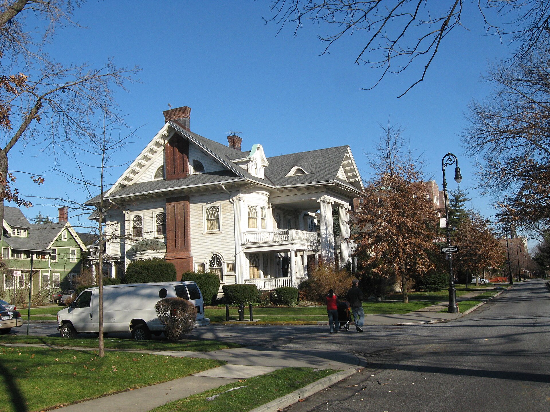
1305 Albemarle Road, Flatbush (West)-Ditmas Park-Parkville You checked the neighborhood.Now check an address ! Photo: Jim.henderson, Public domain · Wikimedia Commons

For $34.00 a CrimesLog™ Home Report provides: (where available)

  • Nearest 6 Pre-school Nurseries to Address
  • Nearest 6 Primary Schools to Address
  • Nearest 6 Secondary/High Schools to Address
  • Nearest College and University to Address
  • Nearest to Address Medical Clinics, Hospitals and Pharmacies
  • Nearest 2 Police Station details to Address

The Home Report also provides

  • The CrimesLog™ Home Score is a proprietary Home Safety Measure capturing crime frequency, severity, recency and proximity to Address from police crime reporting point
  • A map indicating police anonymized crime reporting points around Address
  • Crime category trendlines for Address neighborhood
  • List of Reported Crime Incidents around Address radius
  • Downloadable PDF report — A Permanent Copy to Keep and Share to aid your Property Research
  • Our crimes database of almost 60 million records is UPDATED EVERY MONTH from US, UK, CA police sources
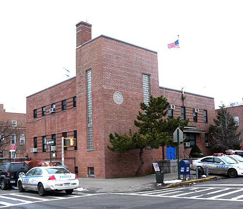
66th Precinct NYPD 16th Avenue 59, Borough Park
Borough Park · 66th Precinct NYPD 16th Avenue 59
Photo: Jim.henderson, CC0 · Wikimedia Commons
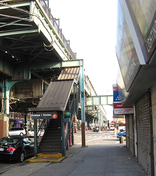
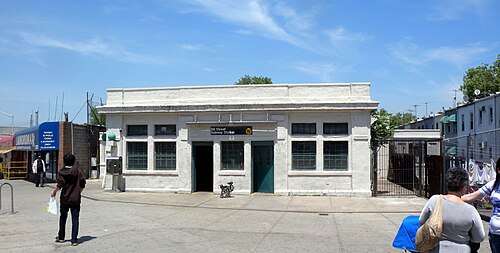
Avenue I F Station, Mapleton-Midwood (West)
Mapleton-Midwood (West) · Avenue I F Station
Photo: Jim.henderson, Public domain · Wikimedia Commons
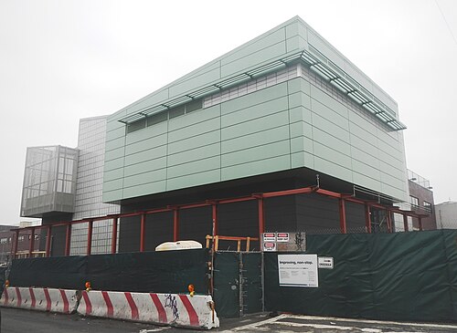
Church Avenue FG Signal House Construction, Kensington
Kensington · Church Avenue FG Signal House Construction
Photo: Jim.henderson, CC0 · Wikimedia Commons
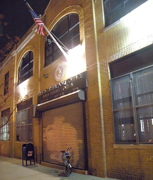
Dyker Heights USPS 11228, Dyker Heights
Dyker Heights · Dyker Heights USPS 11228
Photo: Jim.henderson, CC0 · Wikimedia Commons
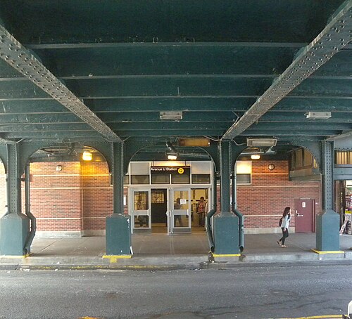
Avenue U Q Station Entry, Madison
Madison · Avenue U Q Station Entry
Photo: Jim.henderson, CC0 · Wikimedia Commons
NYCT 6545, Gravesend (West)
Gravesend (West) · NYCT 6545
Photo: Metropolitan Transportation Authority of the State of New York, CC BY 2.0 · Wikimedia Commons
Hoffman Is Fr Bklyn, Fort Hamilton
Fort Hamilton · Hoffman Is Fr Bklyn
Photo: Jim.henderson, CC0 · Wikimedia Commons
BMT 86st Headhouse, Gravesend (East)-Homecrest
Gravesend (East)-Homecrest · BMT 86st Headhouse
Photo: Jim.henderson, Public domain · Wikimedia Commons

How neighborhoods moved each quarter

2022

Whole-area crime rate 9.5 to 11.4 per 1,000 (high: Q3 2022).

Big moves (4+ places in a quarter): moved up Flatbush (West)-Ditmas Park-Parkville 13th→8th (Q2) moved down Dyker Heights 6th→12th (Q2) moved up Bay Ridge 18th→14th (Q2) moved down Bath Beach 10th→16th (Q2) moved up Bath Beach 16th→12th (Q3) moved up Sheepshead Bay-Manhattan Beach-Gerritsen Beach 18th→14th (Q3) moved down Marine Park-Mill Basin-Bergen Beach 13th→17th (Q3) moved up Dyker Heights 15th→11th (Q4) moved up Brighton Beach 23rd→13th (Q4) moved down Bath Beach 12th→16th (Q4) moved down Sheepshead Bay-Manhattan Beach-Gerritsen Beach 14th→18th (Q4)


2023

Whole-area crime rate 10.4 to 11.1 per 1,000 (high: Q4 2023).

Big moves (4+ places in a quarter): moved up Sheepshead Bay-Manhattan Beach-Gerritsen Beach 18th→13th (Q1) moved down Brighton Beach 13th→19th (Q1) moved down Flatbush (West)-Ditmas Park-Parkville 8th→13th (Q2) moved down Gravesend (West) 10th→16th (Q2) moved up Brighton Beach 20th→16th (Q3) moved down Sunset Park (Central) 14th→19th (Q3) moved down Marine Park-Mill Basin-Bergen Beach 17th→21st (Q3) moved up Gravesend (West) 14th→6th (Q4) moved down Sunset Park (East)-Borough Park (West) 8th→12th (Q4)

2024

Whole-area crime rate 11.0 to 11.9 per 1,000 (high: Q2 2024).

Big moves (4+ places in a quarter): moved up Flatbush (West)-Ditmas Park-Parkville 10th→6th (Q1) moved up Dyker Heights 11th→7th (Q1) moved down Gravesend (West) 6th→12th (Q1) moved down Flatbush (West)-Ditmas Park-Parkville 6th→11th (Q2) moved down Bath Beach 17th→21st (Q2) moved up Gravesend (West) 10th→6th (Q3) moved down East Flatbush-Farragut 19th→23rd (Q3) moved up Bensonhurst 9th→5th (Q4)

2025

Whole-area crime rate 10.9 to 11.6 per 1,000 (high: Q3 2025).

Big moves (4+ places in a quarter): moved up Brighton Beach 17th→10th (Q1) moved up Marine Park-Mill Basin-Bergen Beach 19th→14th (Q1) moved down Bay Ridge 11th→16th (Q1) moved up Bay Ridge 16th→10th (Q2) moved up Sheepshead Bay-Manhattan Beach-Gerritsen Beach 17th→13th (Q2) moved down Brighton Beach 10th→14th (Q2) moved down Gravesend (South) 13th→17th (Q2) moved up Flatbush (West)-Ditmas Park-Parkville 14th→9th (Q4) moved down Bay Ridge 9th→14th (Q4)

2026

Whole-area crime rate 10.4 to 11.1 per 1,000 (high: Q2 2026). 2 quarters so far.

Big moves (4+ places in a quarter): moved up Sunset Park (East)-Borough Park (West) 13th→9th (Q1) moved down Flatbush (West)-Ditmas Park-Parkville 9th→17th (Q1) moved up Madison 12th→5th (Q2) moved down Fort Hamilton 3rd→8th (Q2) moved down Sunset Park (East)-Borough Park (West) 9th→17th (Q2)

Reported Safety Incidents

In Q2 2026: public order incidents were 43% (5,888), property incidents were 22% (2,951), violent incidents were 18% (2,484) and vehicle crimes were 10% (1,382).

Recorded crime here is grouped into violent crime, property crime (burglary and theft), vehicle crime and public order offences, so you can compare how safe each neighborhood is for the kind of crime that matters to you.

Read category comparisons with care. A category that jumps while the total hardly moves looks like a change in how offences are classified, not in what happened: Q1 2026: violent down 46% while the total moved 7%. The whole-area rate is the steadier guide.

Places we left out, and places to read with care

Left out: Barren Island-Floyd Bennett Field; Calvert Vaux Park; Canarsie Park & Pier; Dyker Beach Park; Holy Cross Cemetery; Jamaica Bay (West); Marine Park-Plumb Island; McGuire Fields; Shirley Chisholm State Park. They have almost no residents: their crimes are against visitors, so a rate per resident says little about living there.

Fort Hamilton is an Army base with only about a thousand residents (8.2 per 1,000 from 8 crimes among 980 residents), so it is not named as the lowest or highest.

The 25 neighborhoods on the map

Brooklyn South is made of 25 neighborhoods compared here, each in its own colour on the map. They are the City Planning “Neighborhood Tabulation Areas”: 1,223,259 residents between them.

  • Bath Beach
  • Bay Ridge
  • Bensonhurst
  • Borough Park
  • Brighton Beach
  • Canarsie
  • Coney Island-Sea Gate
  • Dyker Heights
  • East Flatbush-Erasmus
  • East Flatbush-Farragut
  • Flatbush
  • Flatbush (West)-Ditmas Park-Parkville
  • Flatlands
  • Fort Hamilton
  • Gravesend (East)-Homecrest
  • Gravesend (South)
  • Gravesend (West)
  • Kensington
  • Madison
  • Mapleton-Midwood (West)
  • Marine Park-Mill Basin-Bergen Beach
  • Midwood
  • Sheepshead Bay-Manhattan Beach-Gerritsen Beach
  • Sunset Park (Central)
  • Sunset Park (East)-Borough Park (West)

All 25 neighborhoods, Q2 2026

Crimes per 1,000 residents, Q2 2026, lowest first. The last two columns compare with Q1 2022.
#NeighborhoodResidentsAllViolentPropertyVehiclePublic orderRate vs Q1 2022Places gained
1Borough Park89,6733.90.70.90.41.8down8%up1
2Mapleton-Midwood (West)37,5195.71.01.10.62.8down13%up2
3Kensington38,9035.91.41.00.92.4down15%up2
4Dyker Heights39,1487.31.51.31.22.9up1%up2
5Madison38,1977.51.12.20.53.4down11%up7
6Gravesend (West)56,5177.91.71.90.92.9down5%up5
7Midwood49,2918.11.41.70.64.2up30%down4
8Fort Hamilton †9808.22.01.01.03.1up300%down7
9Gravesend (East)-Homecrest50,0328.31.22.10.73.9up11%down1
10Bensonhurst94,4989.11.71.90.84.2up24%down3
11Bay Ridge84,8389.41.51.81.53.8down16%up7
12Sheepshead Bay-Manhattan Beach-Gerritsen Beach64,2449.71.62.60.94.0down4%up4
13Gravesend (South)28,60410.12.02.71.03.7up8%up2
14Marine Park-Mill Basin-Bergen Beach42,83710.31.02.60.65.7up15%–
15Flatbush (West)-Ditmas Park-Parkville39,80310.62.22.11.04.6up20%down2
16Sunset Park (Central)44,49910.72.12.41.24.5up1%up1
17Sunset Park (East)-Borough Park (West)30,22011.42.02.80.85.0up52%down8
18Bath Beach30,17012.73.82.80.74.7up57%down8
19Brighton Beach28,32712.82.33.60.94.9up7%up2
20Flatlands61,58913.42.42.71.36.2up13%–
21East Flatbush-Farragut34,02515.12.62.91.66.8up34%down2
22Canarsie76,74615.62.62.92.36.7up28%–
23Flatbush65,75916.42.72.92.17.4up31%–
24East Flatbush-Erasmus42,37520.04.83.92.17.8up36%–
25Coney Island-Sea Gate54,46527.15.06.81.511.8up72%–

† Fort Hamilton is an Army base with only about a thousand residents. A rate on a very small number of residents or crimes is not comparable with the others.

Photographs

108 photographs of the 25 neighborhoods run along the reel; click one to see it full size. Each is credited here and under the large view.

All 108 photographs and their credits
  1. Borough Park · 66th Precinct NYPD 16th Avenue 59. Photo: Jim.henderson, CC0 · Wikimedia Commons
  2. Mapleton-Midwood (West) · Avenue I F Station. Photo: Jim.henderson, Public domain · Wikimedia Commons
  3. Kensington · Church Avenue FG Signal House Construction. Photo: Jim.henderson, CC0 · Wikimedia Commons
  4. Dyker Heights · Dyker Heights USPS 11228. Photo: Jim.henderson, CC0 · Wikimedia Commons
  5. Madison · Avenue U Q Station Entry. Photo: Jim.henderson, CC0 · Wikimedia Commons
  6. Gravesend (West) · NYCT 6545. Photo: Metropolitan Transportation Authority of the State of New York, CC BY 2.0 · Wikimedia Commons
  7. Fort Hamilton · Hoffman Is Fr Bklyn. Photo: Jim.henderson, CC0 · Wikimedia Commons
  8. Gravesend (East)-Homecrest · BMT 86st Headhouse (BMT = Brooklyn–Manhattan Transit, a New York City subway division). Photo: Jim.henderson, Public domain · Wikimedia Commons
  9. Bensonhurst · Dime Savings 86st 19th Avenue. Photo: Jim.henderson, Public domain · Wikimedia Commons
  10. Bay Ridge · B&T 7621. Photo: Metropolitan Transportation Authority of the State of New York from United States of America, CC BY 2.0 · Wikimedia Commons
  11. Sheepshead Bay-Manhattan Beach-Gerritsen Beach · Bedford Avenue Foot. Photo: Jim.henderson, Public domain · Wikimedia Commons
  12. Gravesend (South) · Bay 50 BMT Station (BMT = Brooklyn–Manhattan Transit, a New York City subway division). Photo: Jim.henderson, Public domain · Wikimedia Commons
  13. Marine Park-Mill Basin-Bergen Beach · Brooklyn, Mill Basin. Photo: adias623, CC BY 2.0 · Wikimedia Commons
  14. Flatbush (West)-Ditmas Park-Parkville · 70 Precinct Lawrence Avenue. Photo: Jim.henderson, CC0 · Wikimedia Commons
  15. Sunset Park (Central) · 8th Avenue N Station. Photo: Jim.henderson, CC0 · Wikimedia Commons
  16. Sunset Park (East)-Borough Park (West) · Catharine of Alexandria Roman Catholic Church Fort Hamilton Parkway 45 St. Photo: Jim.henderson, CC0 · Wikimedia Commons
  17. Bath Beach · Bath Beach USPS 1865 Benson Avenue 11214. Photo: Jim.henderson, CC0 · Wikimedia Commons
  18. Brighton Beach · BMT 100 Nostalgia Ride (BMT = Brooklyn–Manhattan Transit, a New York City subway division). Photo: Metropolitan Transportation Authority of the State of New York, CC BY 2.0 · Wikimedia Commons
  19. Flatlands · BPL Flatlands Avenue P. Photo: Jim.henderson, Public domain · Wikimedia Commons
  20. East Flatbush-Farragut · Straße in New York (21603981523) (2). Photo: dronepicr, CC BY 2.0 · Wikimedia Commons
  21. Canarsie · Bay Ridge Branch Ralph Avenue. Photo: Jim.henderson, Public domain · Wikimedia Commons
  22. Flatbush · Baptist Ch of Redeemer Cortelyou Road. Photo: Jim.henderson, CC0 · Wikimedia Commons
  23. East Flatbush-Erasmus · Downstate MC Lenox Road NYAv. Photo: Jim.henderson, CC0 · Wikimedia Commons
  24. Coney Island-Sea Gate · White Sands Bay53 St. Photo: Jim.henderson, CC0 · Wikimedia Commons
  25. Barren Island-Floyd Bennett Field · Mill Basin Bridge. Photo: Jim.henderson, Public domain · Wikimedia Commons
  26. Calvert Vaux Park · Defunct Barges in CI Creek. Photo: Jim.henderson, CC0 · Wikimedia Commons
  27. Canarsie Park & Pier · Canarsie Pier. Photo: Jim.henderson, Public domain · Wikimedia Commons
  28. McGuire Fields · Mill Basin. Photo: Jim.henderson, Public domain · Wikimedia Commons
  29. Borough Park · 18th Avenue F Station. Photo: Jim.henderson, Public domain · Wikimedia Commons
  30. Kensington · Church Avenue IND Toilets (IND = Independent Subway System, a New York City subway division). Photo: Jim.henderson, Public domain · Wikimedia Commons
  31. Dyker Heights · Dyker Heights Lites 2010. Photo: Jim.henderson, CC0 · Wikimedia Commons
  32. Gravesend (West) · Belt Parkway Bay Cleanup Site 2018. Photo: Wil540 art, CC BY 4.0 · Wikimedia Commons
  33. Fort Hamilton · Dyker Heights, Brooklyn, NY, USA. Photo: Андрей Бобровский, CC BY 3.0 · Wikimedia Commons
  34. Gravesend (East)-Homecrest · Ahi Ezer Congr 1885 Ocean Parkway. Photo: Jim.henderson, CC0 · Wikimedia Commons
  35. Bensonhurst · 79st West End BMT Station (BMT = Brooklyn–Manhattan Transit, a New York City subway division). Photo: Jim.henderson, Public domain · Wikimedia Commons
  36. Bay Ridge · JP Jones Obelisk Park 5BBT. Photo: Jim.henderson, CC0 · Wikimedia Commons
  37. Sheepshead Bay-Manhattan Beach-Gerritsen Beach · Coney Isand WPCF Knapp. Photo: Jim.henderson, CC0 · Wikimedia Commons
  38. Gravesend (South) · Contello Towers. Photo: Jim.henderson, CC0 · Wikimedia Commons
  39. Marine Park-Mill Basin-Bergen Beach · 7700KingsPlaza. Photo: Ondapedia7014, CC0 · Wikimedia Commons
  40. Flatbush (West)-Ditmas Park-Parkville · Argyle Road Beverley Sq West. Photo: Jim.henderson, CC0 · Wikimedia Commons
  41. Sunset Park (Central) · 8th Avenue Stationhouse. Photo: Kidfly182, CC BY 4.0 · Wikimedia Commons
  42. Sunset Park (East)-Borough Park (West) · BMT 36-38 St Yard (BMT = Brooklyn–Manhattan Transit, a New York City subway division). Photo: Jim.henderson, Public domain · Wikimedia Commons
  43. Bath Beach · ISS026-E-17053 - View of New York. Photo: Earth Science and Remote Sensing Unit, Lyndon B. Johnson Space Center, Public domain · Wikimedia Commons
  44. Brighton Beach · BMT 100 Nostalgia Ride (BMT = Brooklyn–Manhattan Transit, a New York City subway division). Photo: Metropolitan Transportation Authority of the State of New York, CC BY 2.0 · Wikimedia Commons
  45. Flatlands · DRC Flatlands Downsun. Photo: Jim.henderson, Public domain · Wikimedia Commons
  46. Canarsie · Canarsie High. Photo: Jim.henderson, Public domain · Wikimedia Commons
  47. Flatbush · Apt Cortelou Road Ocean Avenue. Photo: Jim.henderson, CC0 · Wikimedia Commons
  48. East Flatbush-Erasmus · Univ Hospital Bklyn Lenox. Photo: Jim.henderson, CC0 · Wikimedia Commons
  49. Coney Island-Sea Gate · CI Hospital West. Photo: Jim.henderson, Public domain · Wikimedia Commons
  50. Calvert Vaux Park · Block Institute 376 Bay44 St. Photo: Jim.henderson, CC0 · Wikimedia Commons
  51. Canarsie Park & Pier · Paedegat Basin. Photo: Jim.henderson, Public domain · Wikimedia Commons
  52. Borough Park · 55th St BMT Borough Park Stair (BMT = Brooklyn–Manhattan Transit, a New York City subway division). Photo: Jim.henderson, Public domain · Wikimedia Commons
  53. Kensington · 743 Church Avenue Brooklyn Jan 2026 Lofty Pigeon Books Der Pioneer Bakery. Photo: Wil540 art, CC BY 4.0 · Wikimedia Commons
  54. Dyker Heights · Dyker Heights Christmas Lights December 2025. Photo: CastIronSeasoner, CC BY 4.0 · Wikimedia Commons
  55. Gravesend (West) · 86th Telco Building-Meucci Triangle. Photo: Jim.henderson, Public domain · Wikimedia Commons
  56. Fort Hamilton · Jersey Shore. Photo: Erik Drost, CC BY 2.0 · Wikimedia Commons
  57. Gravesend (East)-Homecrest · Bambi Academy 2937 86 St. Photo: Jim.henderson, CC0 · Wikimedia Commons
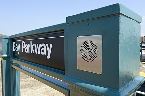
  58. Bensonhurst · Bay Parkway Station from 20th Avenue Station. Photo: Error46146 (talk), CC BY 3.0 · Wikimedia Commons
  59. Bay Ridge · Manhattan as Seen from Verrazano Bridge. Photo: Bekim D., CC BY 3.0 · Wikimedia Commons
  60. Sheepshead Bay-Manhattan Beach-Gerritsen Beach · Channel Allen Avenue Knapp St. Photo: Jim.henderson, CC0 · Wikimedia Commons
  61. Gravesend (South) · Avenue X Culver Station. Photo: Jim.henderson, Public domain · Wikimedia Commons
  62. Marine Park-Mill Basin-Bergen Beach · C40LFB9. Photo: Ondapedia7014, CC0 · Wikimedia Commons
  63. Flatbush (West)-Ditmas Park-Parkville · 203 Marlborough Road Prospect Park South Houses in the Snow Jan 2026 Brooklyn. Photo: Wil540 art, CC BY 4.0 · Wikimedia Commons
  64. Sunset Park (Central) · Brooklyn 47th Street Toward 5th. Photo: Matthew Jording from Brooklyn, NY, USA, CC BY 2.0 · Wikimedia Commons
  65. Sunset Park (East)-Borough Park (West) · Fort Hamilton Parkway BMT Stair to 43 St (BMT = Brooklyn–Manhattan Transit, a New York City subway division). Photo: Jim.henderson, CC0 · Wikimedia Commons
  66. Brighton Beach · BMT 100 Nostalgia Ride (BMT = Brooklyn–Manhattan Transit, a New York City subway division). Photo: Metropolitan Transportation Authority of the State of New York, CC BY 2.0 · Wikimedia Commons
  67. Flatlands · DRC Flatlands Upsun. Photo: Jim.henderson, Public domain · Wikimedia Commons
  68. Canarsie · Canarsie HS. Photo: Jim.henderson, CC0 · Wikimedia Commons
  69. Flatbush · 187 Marlborough Road Prospect Park South House in the Snow Jan 2026 Brooklyn. Photo: Wil540 art, CC BY 4.0 · Wikimedia Commons
  70. East Flatbush-Erasmus · PS 181 New York Avenue. Photo: Jim.henderson, CC0 · Wikimedia Commons
  71. Coney Island-Sea Gate · CI Lady of Solace HS. Photo: Jim.henderson, CC0 · Wikimedia Commons
  72. Borough Park · 37 Bk Factory. Photo: Jim.henderson, Public domain · Wikimedia Commons
  73. Kensington · 733 Church Avenue Brooklyn in the Snow Jan 2026. Photo: Wil540 art, CC BY 4.0 · Wikimedia Commons
  74. Gravesend (West) · 25th Avenue BMT Station (BMT = Brooklyn–Manhattan Transit, a New York City subway division). Photo: Jim.henderson, Public domain · Wikimedia Commons
  75. Fort Hamilton · Army Garrison Fort Hamilton Celebrates 200th Anniversary. Photo: U.S. Army photo by Mark Getman, Public domain · Wikimedia Commons
  76. Bensonhurst · Bay Parkway 83d St BMT Station (BMT = Brooklyn–Manhattan Transit, a New York City subway division). Photo: Jim.henderson, CC0 · Wikimedia Commons
  77. Sheepshead Bay-Manhattan Beach-Gerritsen Beach · Amity School 3867 Shore Parkway Sun. Photo: Jim.henderson, CC BY 3.0 · Wikimedia Commons
  78. Gravesend (South) · CI Yard Entrance. Photo: Jim.henderson, Public domain · Wikimedia Commons
  79. Marine Park-Mill Basin-Bergen Beach · Snow in Mill Basin. Photo: Michael Galpert from new york, CC BY 2.0 · Wikimedia Commons
  80. Flatbush (West)-Ditmas Park-Parkville · 202 Marlborough Road Prospect Park South Houses in the Snow Jan 2026 Brooklyn. Photo: Wil540 art, CC BY 4.0 · Wikimedia Commons
  81. Sunset Park (Central) · Church of Grace to Fujianese 6th Avenue 52 St BR. Photo: Jim.henderson, CC0 · Wikimedia Commons
  82. Brighton Beach · BMT 100 Nostalgia Ride (BMT = Brooklyn–Manhattan Transit, a New York City subway division). Photo: Metropolitan Transportation Authority of the State of New York, CC BY 2.0 · Wikimedia Commons
  83. Coney Island-Sea Gate · Lady of Solace Shrine Church RC CI. Photo: Jim.henderson, CC0 · Wikimedia Commons
  84. Borough Park · Bne Yehuda 16th Avenue BP. Photo: Jim.henderson, CC0 · Wikimedia Commons
  85. Bensonhurst · Bramson ORT 8105 Bay Parkway Bensonhurst. Photo: Jim.henderson, CC0 · Wikimedia Commons
  86. Sheepshead Bay-Manhattan Beach-Gerritsen Beach · Canda Avenue Sheepshead Bay Sun. Photo: Jim.henderson, CC BY 3.0 · Wikimedia Commons
  87. Gravesend (South) · Avenue X CI Yard Lead Tracks. Photo: Jim.henderson, CC0 · Wikimedia Commons
  88. Flatbush (West)-Ditmas Park-Parkville · Albemarle Road & Stratford. Photo: Jim.henderson, Public domain · Wikimedia Commons
  89. Coney Island-Sea Gate · Coney Island Memorial Chapel Snow. Photo: Jim.henderson, CC0 · Wikimedia Commons
  90. Borough Park · Bne Yehuda BP Sign. Photo: Jim.henderson, CC0 · Wikimedia Commons
  91. Bensonhurst · Finbar Roman Catholic Church Benson Avenue B19 St. Photo: Jim.henderson, CC0 · Wikimedia Commons
  92. Sheepshead Bay-Manhattan Beach-Gerritsen Beach · 1786 Sheepshead Bay Road, Brooklyn - New York City - Flickr - Marcela McGreal. Photo: Marcela from New York, NY, USA, CC BY 2.0 · Wikimedia Commons
  93. Gravesend (South) · CI Yard Motor Shop Fr Avenue X Station. Photo: Jim.henderson, CC0 · Wikimedia Commons
  94. Flatbush (West)-Ditmas Park-Parkville · 1305 Albemarle Road. Photo: Jim.henderson, Public domain · Wikimedia Commons
  95. Coney Island-Sea Gate · CI Creek Stillwell. Photo: Jim.henderson, Public domain · Wikimedia Commons
  96. Borough Park · Bnos Yerushalayim D’Chasidei Belz 317 Dahill. Photo: Jim.henderson, CC0 · Wikimedia Commons
  97. Bensonhurst · 20th Avenue 86 St Station. Photo: Jim.henderson, CC0 · Wikimedia Commons
  98. Flatbush (West)-Ditmas Park-Parkville · 1306 Albemarle Road. Photo: Jim.henderson, Public domain · Wikimedia Commons
  99. Borough Park · 13th Avenue,Borough Park. Photo: Robert S from U.S.A., CC0 · Wikimedia Commons
  100. Bensonhurst · Moose Lodge 168 7711 18th Avenue. Photo: Jim.henderson, CC0 · Wikimedia Commons
  101. Borough Park · Fort Hamilton Parkway Platform Seabeach BMT (BMT = Brooklyn–Manhattan Transit, a New York City subway division). Photo: Jim.henderson, Public domain · Wikimedia Commons
  102. Bensonhurst · Brooklyn Studio School 21st Avenue. Photo: Jim.henderson, CC0 · Wikimedia Commons
  103. Bensonhurst · NY & Company 21st Avenue 86 St. Photo: Jim.henderson, CC0 · Wikimedia Commons
  104. Bensonhurst · Bay Parkway West End BMT Western Arch (BMT = Brooklyn–Manhattan Transit, a New York City subway division). Photo: Jim.henderson, CC0 · Wikimedia Commons
  105. Bensonhurst · 71st West End BMT Station (BMT = Brooklyn–Manhattan Transit, a New York City subway division). Photo: Jim.henderson, Public domain · Wikimedia Commons
  106. Bensonhurst · 16th Avenue 71st NYTel. Photo: Jim.henderson, Public domain · Wikimedia Commons
  107. Bensonhurst · DSC01092gemspa. Photo: Alex Lozupone, CC BY 4.0 · Wikimedia Commons
  108. Bensonhurst · Bay Parkway Station House at Dusk September 2025. Photo: 4300streetcar, CC BY 4.0 · Wikimedia Commons

Sources and notes

CrimesLog sources crime incident data published by the New York City Police Department (NYPD) through the NYC Open Data Portal, containing public sector information governed by the NYC Open Data Law (Local Law 11 of 2012) and the NYC.gov Terms of Use.

Population: U.S. Census Bureau, American Community Survey 5-year estimates (public domain).

First-place medal: 1st Place Medal emoji icon by Icons8.

Neighborhood boundaries are defined by NYC Department of City Planning, 2020 Neighborhood Tabulation Areas (NYC Open Data), merged and simplified by CrimesLog. The photographs are credited under each picture.

Rates are recorded crimes per 1,000 residents, quarter by quarter; where a neighborhood has fewer than 100 residents the rate would be worked out on 100 (those places are left out of the race). A count of recorded crime is not a verdict on any neighborhood.