Toronto, Ontario · Neighborhood crime trends

Toronto Etobicoke

22 neighborhoods - a quarterly race to the lowest crime rate.

Crime Trends: Neighborhoods compared - each quarter from Q1 2022

Toronto as a whole averaged 3.3 crimes for every 1,000 residents per quarter in Q2 2026, while Etobicoke averaged 3.5, hence it is generally less safe when all crimes are considered.

How do the 22 neighborhoods of Etobicoke compare? In Q2 2026 the police recorded 1,331 crimes across them, 3.5 for every 1,000 residents. That is 0.8% above a year earlier and 13.1% above Q1 2022, the first quarter we track.

Markland Wood has the lowest rate of the everyday neighborhoods (1.4 per 1,000), followed by Edenbridge-Humber Valley (1.5) and Alderwood (1.7). Mimico-Queensway has the highest (12.1).

Use the RACE CHARTS below to watch all 22 TORONTO ETOBICOKE NEIGHBORHOODs race across 18 quarter periods from Q1 2022 to Q2 2026 - one crime category at a time or all together. The race chart can be used to compare average crime rates by category against Toronto's average.

Neighborhood boundaries are defined by the City of Toronto (Open Government Licence – Toronto) and simplified by CrimesLog.
Lowest rate (everyday)
lowest rateMarkland Wood
1.4 crimes per 1,000 residents, Q2 2026
Highest rate
upMimico-Queensway
12.1 per 1,000, Q2 2026
Whole area, Q2 2026
3.5 per 1,000
up 0.8% above a year earlier · up 13.1% above Q1 2022
Compared
22 neighborhoods
376,237 residents · 18 quarters

Toronto Etobicoke neighborhood quarterly crime race

Press ▶︎ to watch Q1 2022 to Q2 2026. Tick one crime category or several; hover a bar for the neighborhood. Property crimes includes burglaries and thefts.

Crime categories
Indicated: crimes rate per 1000 residents per quarterAll · safest at the top · square-root scale · Q1 2022 to Q2 20260152.5Alderwood1.4Edenbridge-Humber Valley4.0Elms-Old Rexdale1.4Eringate-Centennial-West Deane5.0Etobicoke City Centre2.6Etobicoke West Mall1.8Humber Bay Shores2.2Humber Heights-Westmount2.2Islington2.5Kingsview Village-The Westway1.0Kingsway South1.8Long Branch1.9Markland Wood4.6Mimico-Queensway2.5Mount Olive-Silverstone-Jamestown3.7New Toronto1.0Princess-Rosethorn3.3Rexdale-Kipling2.7Stonegate-Queensway5.6Thistletown-Beaumond Heights7.8West Humber-Clairville2.5Willowridge-Martingrove-RichviewToronto Q2 2026 average all crimes (3.3)Numbers are crimes per 1,000 residents per quarter. Zero-crime quarters show 0 and rank safest.
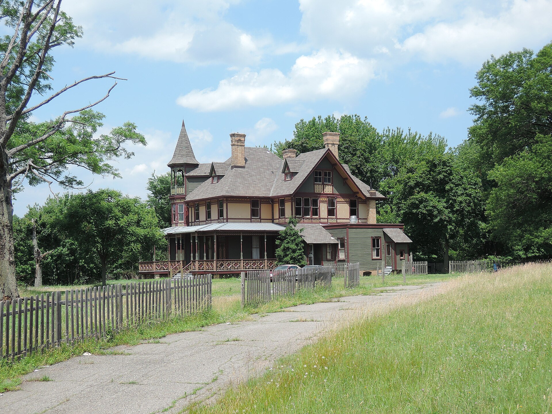
Kreischer House Uncut, Tottenville-Charleston You checked the neighborhood.Now check an address ! Photo: Jim.henderson, CC0 · Wikimedia Commons

For C$40.00 a CrimesLog™ Home Report provides: (where available)

  • Nearest 6 Pre-school Nurseries to Address
  • Nearest 6 Primary Schools to Address
  • Nearest 6 Secondary/High Schools to Address
  • Nearest College and University to Address
  • Nearest to Address Medical Clinics, Hospitals and Pharmacies
  • Nearest 2 Police Station details to Address

The Home Report also provides

  • The CrimesLog™ Home Score is a proprietary Home Safety Measure capturing crime frequency, severity, recency and proximity to Address from police crime reporting point
  • A map indicating police anonymized crime reporting points around Address
  • Crime category trendlines for Address neighborhood
  • List of Reported Crime Incidents around Address radius
  • Downloadable PDF report — A Permanent Copy to Keep and Share to aid your Property Research
  • Our crimes database of almost 60 million records is UPDATED EVERY MONTH from US, UK, CA police sources
A Nice Place, Edenbridge-Humber Valley
Edenbridge-Humber Valley · A Nice Place
Photo: Michael from Calgary, AB, Canada, CC BY 2.0 · Wikimedia Commons
Lights Of December December 1, 2011, Princess-Rosethorn
Princess-Rosethorn · Lights Of December December 1, 2011
Photo: Michael from Calgary, AB, Canada, CC BY 2.0 · Wikimedia Commons
Gulls on the Wing, Marie Curtis Park, Toronto, Long Branch
Long Branch · Gulls on the Wing, Marie Curtis Park, Toronto
Photo: Robert Taylor from Stirling, ON, Canada, CC BY 2.0 · Wikimedia Commons
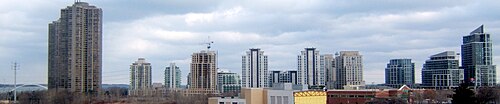
HumberBayTowers, Humber Bay Shores
Humber Bay Shores · HumberBayTowers
Photo: JosephIWMolto, Public domain · Wikimedia Commons
EtobicokeFormerCouncilOffices, Islington
Islington · EtobicokeFormerCouncilOffices
Photo: JosephIWMolto, Public domain · Wikimedia Commons
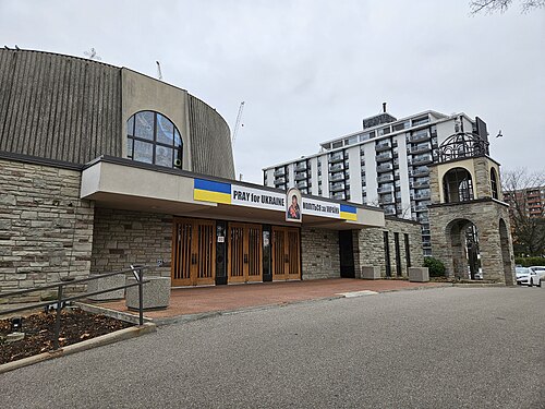
Church of Saint Demetrius, Toronto, Humber Heights-Westmount
Humber Heights-Westmount · Church of Saint Demetrius, Toronto
Photo: Cltjames, CC BY 4.0 · Wikimedia Commons
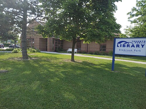
Elmbrook Library Toronto, Eringate-Centennial-West Deane
Eringate-Centennial-West Deane · Elmbrook Library Toronto
Photo: GelvinM, CC0 · Wikimedia Commons
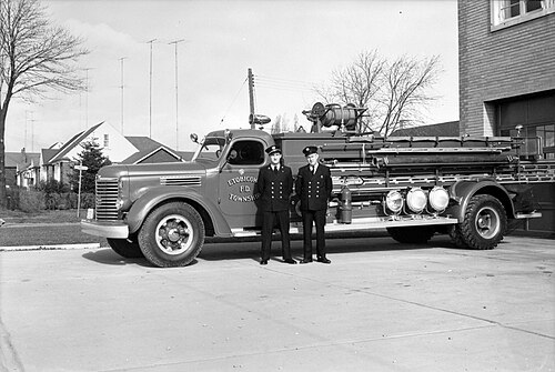
Fire Hall, Etobicoke, Royal York Road, Southeast Corner Tenby St (1954) 02, Stonegate-Queensway
Stonegate-Queensway · Fire Hall, Etobicoke, Royal York Road, Southeast Corner Tenby St (1954) 02
Photo: James Victor Salmon, Public domain · Wikimedia Commons

How neighborhoods moved each quarter

2022

Whole-area crime rate 3.1 to 3.9 per 1,000 (high: Q4 2022).

Big moves (4+ places in a quarter): moved up Humber Heights-Westmount 8th→3rd (Q2) moved up Kingsview Village-The Westway 10th→4th (Q2) moved down Kingsway South 2nd→8th (Q2) moved up Stonegate-Queensway 15th→9th (Q2) moved down Markland Wood 7th→12th (Q2) moved down Long Branch 5th→17th (Q2) moved up Markland Wood 12th→1st (Q3) moved up Etobicoke West Mall 11th→3rd (Q3) moved up Mount Olive-Silverstone-Jamestown 13th→8th (Q3) moved down Humber Heights-Westmount 3rd→9th (Q3) moved up Alderwood 14th→10th (Q3) moved down Kingsview Village-The Westway 4th→13th (Q3) moved down Stonegate-Queensway 9th→15th (Q3) moved up Willowridge-Martingrove-Richview 12th→1st (Q4) moved up Humber Bay Shores 7th→2nd (Q4) moved up Humber Heights-Westmount 9th→5th (Q4) moved up Elms-Old Rexdale 17th→7th (Q4) moved down Edenbridge-Humber Valley 4th→8th (Q4) moved up Stonegate-Queensway 15th→11th (Q4) moved down Islington 6th→12th (Q4) moved down Alderwood 10th→15th (Q4) moved down Princess-Rosethorn 2nd→16th (Q4)


2023

Whole-area crime rate 4.2 to 4.6 per 1,000 (high: Q4 2023).

Big moves (4+ places in a quarter): moved up Alderwood 15th→1st (Q1) moved up Mount Olive-Silverstone-Jamestown 10th→5th (Q1) moved up Kingsview Village-The Westway 14th→7th (Q1) moved down Markland Wood 4th→8th (Q1) moved up Long Branch 13th→9th (Q1) moved down Etobicoke West Mall 3rd→10th (Q1) moved up Princess-Rosethorn 16th→11th (Q1) moved down Elms-Old Rexdale 7th→13th (Q1) moved down Willowridge-Martingrove-Richview 1st→14th (Q1) moved down Stonegate-Queensway 11th→15th (Q1) moved down Kingsway South 9th→16th (Q1) moved up Thistletown-Beaumond Heights 21st→17th (Q1) moved up Etobicoke West Mall 10th→2nd (Q2) moved up Willowridge-Martingrove-Richview 14th→4th (Q2) moved down Humber Bay Shores 3rd→9th (Q2) moved down Edenbridge-Humber Valley 6th→10th (Q2) moved down Humber Heights-Westmount 2nd→11th (Q2) moved up Rexdale-Kipling 19th→13th (Q2) moved down Princess-Rosethorn 11th→15th (Q2) moved up Humber Heights-Westmount 11th→3rd (Q3) moved down Eringate-Centennial-West Deane 1st→6th (Q3) moved up Stonegate-Queensway 16th→7th (Q3) moved down Long Branch 6th→10th (Q3) moved down Alderwood 3rd→12th (Q3) moved down Mount Olive-Silverstone-Jamestown 8th→13th (Q3) moved up Alderwood 12th→1st (Q4) moved up Mount Olive-Silverstone-Jamestown 13th→6th (Q4) moved up Islington 14th→9th (Q4) moved down Etobicoke West Mall 4th→11th (Q4) moved down Edenbridge-Humber Valley 9th→13th (Q4)

2024

Whole-area crime rate 3.9 to 4.2 per 1,000 (high: Q3 2024).

Big moves (4+ places in a quarter): moved up Humber Bay Shores 5th→1st (Q1) moved up Mount Olive-Silverstone-Jamestown 6th→2nd (Q1) moved up Etobicoke West Mall 11th→4th (Q1) moved down Alderwood 1st→6th (Q1) moved down Markland Wood 2nd→7th (Q1) moved down Willowridge-Martingrove-Richview 4th→8th (Q1) moved up Edenbridge-Humber Valley 13th→9th (Q1) moved up Kingsway South 15th→10th (Q1) moved up New Toronto 17th→12th (Q1) moved up Princess-Rosethorn 18th→13th (Q1) moved down Eringate-Centennial-West Deane 7th→14th (Q1) moved down Islington 9th→16th (Q1) moved up Long Branch 15th→1st (Q2) moved up Princess-Rosethorn 13th→2nd (Q2) moved up Edenbridge-Humber Valley 9th→5th (Q2) moved up Eringate-Centennial-West Deane 14th→6th (Q2) moved down Humber Bay Shores 1st→7th (Q2) moved down Etobicoke West Mall 4th→8th (Q2) moved down Mount Olive-Silverstone-Jamestown 2nd→10th (Q2) moved down Humber Heights-Westmount 3rd→11th (Q2) moved down Kingsview Village-The Westway 5th→12th (Q2) moved down Willowridge-Martingrove-Richview 8th→13th (Q2) moved down Stonegate-Queensway 11th→15th (Q2) moved down New Toronto 12th→17th (Q2) moved up Willowridge-Martingrove-Richview 13th→1st (Q3) moved up Stonegate-Queensway 15th→2nd (Q3) moved up Islington 14th→6th (Q3) moved up Kingsview Village-The Westway 12th→7th (Q3) moved down Princess-Rosethorn 2nd→9th (Q3) moved down Alderwood 3rd→12th (Q3) moved down Kingsway South 9th→13th (Q3) moved down Long Branch 1st→14th (Q3) moved down Humber Heights-Westmount 11th→16th (Q3) moved up Princess-Rosethorn 9th→1st (Q4) moved up Humber Bay Shores 8th→2nd (Q4) moved up Etobicoke West Mall 10th→3rd (Q4) moved up Long Branch 14th→6th (Q4) moved down Willowridge-Martingrove-Richview 1st→7th (Q4) moved up Kingsway South 13th→9th (Q4) moved down Markland Wood 3rd→10th (Q4) moved down Stonegate-Queensway 2nd→12th (Q4) moved down Islington 6th→14th (Q4) moved up New Toronto 19th→15th (Q4) moved down Elms-Old Rexdale 15th→19th (Q4)

2025

Whole-area crime rate 3.5 to 3.8 per 1,000 (high: Q3 2025).

Big moves (4+ places in a quarter): moved up Mount Olive-Silverstone-Jamestown 13th→1st (Q1) moved up Kingsway South 9th→3rd (Q1) moved down Princess-Rosethorn 1st→6th (Q1) moved up Humber Heights-Westmount 17th→8th (Q1) moved up Islington 14th→10th (Q1) moved down Willowridge-Martingrove-Richview 7th→11th (Q1) moved down Edenbridge-Humber Valley 4th→12th (Q1) moved down Long Branch 6th→14th (Q1) moved down Stonegate-Queensway 12th→16th (Q1) moved up Humber Bay Shores 5th→1st (Q2) moved up Edenbridge-Humber Valley 12th→3rd (Q2) moved up Long Branch 14th→5th (Q2) moved up Alderwood 13th→8th (Q2) moved down Mount Olive-Silverstone-Jamestown 1st→11th (Q2) moved down Humber Heights-Westmount 8th→12th (Q2) moved down Kingsview Village-The Westway 9th→14th (Q2) moved up Eringate-Centennial-West Deane 7th→1st (Q3) moved up Markland Wood 6th→2nd (Q3) moved up Princess-Rosethorn 9th→3rd (Q3) moved up Stonegate-Queensway 15th→5th (Q3) moved down Humber Bay Shores 1st→6th (Q3) moved down Kingsway South 2nd→12th (Q3) moved down Etobicoke West Mall 4th→13th (Q3) moved up Kingsway South 12th→3rd (Q4) moved up Kingsview Village-The Westway 15th→4th (Q4) moved down Markland Wood 2nd→7th (Q4) moved down Princess-Rosethorn 3rd→8th (Q4) moved down Humber Bay Shores 6th→11th (Q4) moved down Stonegate-Queensway 5th→13th (Q4) moved down Long Branch 8th→14th (Q4)

2026

Whole-area crime rate 3.5 to 3.6 per 1,000 (high: Q1 2026). 2 quarters so far.

Big moves (4+ places in a quarter): moved up Alderwood 9th→1st (Q1) moved up Long Branch 14th→2nd (Q1) moved up Markland Wood 7th→3rd (Q1) moved up Etobicoke West Mall 12th→5th (Q1) moved down Eringate-Centennial-West Deane 2nd→6th (Q1) moved up Stonegate-Queensway 13th→8th (Q1) moved down Kingsway South 3rd→10th (Q1) moved down Willowridge-Martingrove-Richview 5th→12th (Q1) moved down Princess-Rosethorn 8th→13th (Q1) moved down Kingsview Village-The Westway 4th→15th (Q1) moved down New Toronto 15th→20th (Q1) moved up Princess-Rosethorn 13th→4th (Q2) moved up Humber Bay Shores 11th→6th (Q2) moved up Humber Heights-Westmount 14th→8th (Q2) moved down Etobicoke West Mall 5th→10th (Q2) moved down Mount Olive-Silverstone-Jamestown 7th→15th (Q2)

Reported Safety Incidents

In Q2 2026: violent incidents were 54% (717), vehicle crimes were 27% (359), property incidents were 19% (255) and public order incidents were 0% (0).

Recorded crime here is grouped into violent crime, property crime (burglary and theft), vehicle crime and public order offences, so you can compare how safe each neighborhood is for the kind of crime that matters to you.

Places we left out, and places to read with care

No place is left out: every neighborhood in this race has residents to count.

The 22 neighborhoods on the map

Etobicoke is made of 22 neighborhoods compared here, each in its own colour on the map. They are the City of Toronto’s neighborhood areas, grouped into six areas of the city by CrimesLog: 376,237 residents between them.

  • Alderwood
  • Edenbridge-Humber Valley
  • Elms-Old Rexdale
  • Eringate-Centennial-West Deane
  • Etobicoke City Centre
  • Etobicoke West Mall
  • Humber Bay Shores
  • Humber Heights-Westmount
  • Islington
  • Kingsview Village-The Westway
  • Kingsway South
  • Long Branch
  • Markland Wood
  • Mimico-Queensway
  • Mount Olive-Silverstone-Jamestown
  • New Toronto
  • Princess-Rosethorn
  • Rexdale-Kipling
  • Stonegate-Queensway
  • Thistletown-Beaumond Heights
  • West Humber-Clairville
  • Willowridge-Martingrove-Richview

All 22 neighborhoods, Q2 2026

Crimes per 1,000 residents, Q2 2026, lowest first. The last two columns compare with Q1 2022.
#NeighborhoodResidentsAllViolentPropertyVehiclePublic orderRate vs Q1 2022Places gained
1Markland Wood10,5591.40.40.40.70.0down25%up6
2Edenbridge-Humber Valley15,4801.50.30.70.50.0up10%up1
3Alderwood12,5961.70.70.40.60.0down34%up10
4Princess-Rosethorn11,1771.70.40.70.60.0up73%down3
5Long Branch11,4001.81.10.30.40.0up5%–
6Humber Bay Shores22,6331.91.20.50.10.0up5%–
7Islington23,6591.91.00.30.60.0down17%up2
8Humber Heights-Westmount10,4271.91.30.30.40.0down13%–
9Eringate-Centennial-West Deane18,5012.00.60.31.20.0up45%down5
10Etobicoke West Mall12,2182.31.30.50.50.0down13%up4
11Stonegate-Queensway25,7452.31.10.80.50.0down16%up4
12Willowridge-Martingrove-Richview22,4562.31.30.40.70.0down9%–
13Kingsway South8,9352.40.61.20.60.0up133%down11
14Kingsview Village-The Westway22,0263.01.70.50.90.0up24%down4
15Mount Olive-Silverstone-Jamestown32,0693.31.80.80.60.0up35%down4
16Elms-Old Rexdale9,3663.71.60.41.70.0down5%up2
17New Toronto11,5023.82.70.50.60.0up2%–
18Rexdale-Kipling10,3784.63.10.51.10.0up41%down2
19Etobicoke City Centre23,8565.02.51.11.40.0down0%up1
20Thistletown-Beaumond Heights9,3575.83.91.50.40.0up4%up1
21West Humber-Clairville33,6907.02.11.53.40.0down10%up1
22Mimico-Queensway18,20712.110.50.41.20.0up165%down3

Photographs

48 photographs of the 22 neighborhoods run along the reel; click one to see it full size. Each is credited here and under the large view.

All 48 photographs and their credits
  1. Edenbridge-Humber Valley · A Nice Place. Photo: Michael from Calgary, AB, Canada, CC BY 2.0 · Wikimedia Commons
  2. Princess-Rosethorn · Lights Of December December 1, 2011. Photo: Michael from Calgary, AB, Canada, CC BY 2.0 · Wikimedia Commons
  3. Long Branch · Gulls on the Wing, Marie Curtis Park, Toronto. Photo: Robert Taylor from Stirling, ON, Canada, CC BY 2.0 · Wikimedia Commons
  4. Humber Bay Shores · HumberBayTowers. Photo: JosephIWMolto, Public domain · Wikimedia Commons
  5. Islington · EtobicokeFormerCouncilOffices. Photo: JosephIWMolto, Public domain · Wikimedia Commons
  6. Humber Heights-Westmount · Church of Saint Demetrius, Toronto. Photo: Cltjames, CC BY 4.0 · Wikimedia Commons
  7. Eringate-Centennial-West Deane · Elmbrook Library Toronto. Photo: GelvinM, CC0 · Wikimedia Commons
  8. Stonegate-Queensway · Fire Hall, Etobicoke, Royal York Road, Southeast Corner Tenby St (1954) 02. Photo: James Victor Salmon, Public domain · Wikimedia Commons
  9. Kingsway South · Bloor Street Bridge Over the Humber River. Photo: Robert Taylor from Stirling, ON, Canada, CC BY 2.0 · Wikimedia Commons
  10. Kingsview Village-The Westway · Looking Out the Right Window on a Trip from Pearson to Union, 2015 06 06 (225). Photo: booledozer, Public domain · Wikimedia Commons
  11. New Toronto · Whitlam Avenue (Between Twenty Second & Twenty Fourth). Photo: Jeff Hitchcock from Seattle, WA, USA, CC BY 2.0 · Wikimedia Commons
  12. Etobicoke City Centre · Sherway Gardens Mall. Photo: Jeff Hitchcock from Seattle, WA, USA, CC BY 2.0 · Wikimedia Commons
  13. West Humber-Clairville · Looking Out the Left Window on a Trip from Union to Pearson, 2015 06 06 A (631). Photo: booledozer, Public domain · Wikimedia Commons
  14. Mimico-Queensway · Horner Avenue (Between Kipling & Judson). Photo: Jeff Hitchcock from Seattle, WA, USA, CC BY 2.0 · Wikimedia Commons
  15. Long Branch · LongBranchVincentMasseySchool. Photo: JosephIWMolto, Public domain · Wikimedia Commons
  16. Humber Bay Shores · 1987 Toronto Skyline. Photo: Robert Taylor from Stirling, Canada, CC BY 2.0 · Wikimedia Commons
  17. Humber Heights-Westmount · Ukrainian Holodomor Memorial, Toronto. Photo: Carim James, CC0 · Wikimedia Commons
  18. Eringate-Centennial-West Deane · CN Tower Under Construction. Photo: Robert Taylor from Stirling, Canada, CC BY 2.0 · Wikimedia Commons
  19. Stonegate-Queensway · HumberOneOfThreeRemainingOldHouses. Photo: JosephIWMolto, Public domain · Wikimedia Commons
  20. Kingsway South · RoyalYorkTTCStation 01. Photo: G0T0, CC0 · Wikimedia Commons
  21. New Toronto · Humber College G Building. Photo: Jeff Hitchcock from Seattle, WA, USA, CC BY 2.0 · Wikimedia Commons
  22. Etobicoke City Centre · Sherway Gardens Mall. Photo: Jeff Hitchcock from Seattle, WA, USA, CC BY 2.0 · Wikimedia Commons
  23. West Humber-Clairville · HumberCollegeJanuary2024Entrance. Photo: T&TRKFNF2022, CC0 · Wikimedia Commons
  24. Mimico-Queensway · Horner Avenue (Between Kipling & Judson). Photo: Jeff Hitchcock from Seattle, WA, USA, CC BY 2.0 · Wikimedia Commons
  25. Humber Bay Shores · 1988 Toronto Skyline. Photo: Robert Taylor from Stirling, Canada, CC BY 2.0 · Wikimedia Commons
  26. Humber Heights-Westmount · Riverlea Italian Seniors Club. Photo: PvOberstein, CC0 · Wikimedia Commons
  27. Stonegate-Queensway · Humber River Viewed from the Bloor Bridge. Photo: Diego Silvestre, CC BY 2.0 · Wikimedia Commons
  28. Kingsway South · RoyalYorkBusBay. Photo: G0T0, CC0 · Wikimedia Commons
  29. New Toronto · Lake Shore Boulevard West & Islington Avenue. Photo: Jeff Hitchcock from Seattle, WA, USA, CC BY 2.0 · Wikimedia Commons
  30. Etobicoke City Centre · Construction at Sherway Gardens Mall, 2014 04 03 (1). Photo: OldYorkGuy, Public domain · Wikimedia Commons
  31. West Humber-Clairville · Residence Inn by Marriott. Photo: shanhitex, CC BY 3.0 · Wikimedia Commons
  32. Mimico-Queensway · MimicoCentralStFormerMimicoHighSchool. Photo: JosephIWMolto, Public domain · Wikimedia Commons
  33. Stonegate-Queensway · 22 12 2009 Lights of Christmas. Photo: Michael from Calgary, AB, Canada, CC BY 2.0 · Wikimedia Commons
  34. Kingsway South · RoyalYorkTTCStation 02. Photo: G0T0, CC0 · Wikimedia Commons
  35. New Toronto · Humber College G Building. Photo: Jeff Hitchcock from Seattle, WA, USA, CC BY 2.0 · Wikimedia Commons
  36. Etobicoke City Centre · Construction at Sherway Gardens Mall, 2014 04 03 (6). Photo: OldYorkGuy, Public domain · Wikimedia Commons
  37. Mimico-Queensway · StLeosRomanCatholicChurchAnRectoryMimico. Photo: JosephIWMolto, Public domain · Wikimedia Commons
  38. Stonegate-Queensway · MimicoHistoricStockHomeToday. Photo: JosephIWMolto, Public domain · Wikimedia Commons
  39. New Toronto · Humber College J Building. Photo: Jeff Hitchcock from Seattle, WA, USA, CC BY 2.0 · Wikimedia Commons
  40. Etobicoke City Centre · Construction at Sherway Gardens Mall, 2014 04 03 (5). Photo: OldYorkGuy, Public domain · Wikimedia Commons
  41. Mimico-Queensway · MimicoRowHousesAtBendInLakeShoreBlvd. Photo: JosephIWMolto, Public domain · Wikimedia Commons
  42. Stonegate-Queensway · QueenswayBusinesses. Photo: JosephIWMolto, Public domain · Wikimedia Commons
  43. New Toronto · Humber College G Building. Photo: Jeff Hitchcock from Seattle, WA, USA, CC BY 2.0 · Wikimedia Commons
  44. Mimico-Queensway · MimicoStationRdStLeosOldRectory. Photo: JosephIWMolto, Public domain · Wikimedia Commons
  45. New Toronto · Humber College F Building. Photo: Jeff Hitchcock from Seattle, WA, USA, CC BY 2.0 · Wikimedia Commons
  46. Mimico-Queensway · MimicoHouseOverlookingMinnieCreek. Photo: JosephIWMolto, Public domain · Wikimedia Commons
  47. New Toronto · Cumberland House. Photo: Jeff Hitchcock from Seattle, WA, USA, CC BY 2.0 · Wikimedia Commons
  48. Mimico-Queensway · MimicoStanleyAveDr.ForbesGodfreyHouse. Photo: JosephIWMolto, Public domain · Wikimedia Commons

Sources and notes

CrimesLog sources crime incident data originated by the Toronto Police Service (TPS) and published through the City of Toronto Open Data Portal under the Open Data Licence – Toronto.

Contains information licensed under the Open Government Licence – Canada. Source: Statistics Canada, 2021 Census of Population.

First-place medal: 1st Place Medal emoji icon by Icons8.

Neighborhood boundaries are defined by the City of Toronto (Open Government Licence – Toronto), grouped into six areas of the city by CrimesLog and simplified by CrimesLog. The photographs are credited under each picture.

Rates are recorded crimes per 1,000 residents, quarter by quarter; where a neighborhood has fewer than 100 residents the rate would be worked out on 100 (those places are left out of the race). A count of recorded crime is not a verdict on any neighborhood.