Seattle, Washington · Neighborhood crime trends

Seattle Beacon Hill Duwamish

8 neighborhoods - a quarterly race to the lowest crime rate.

Crime Trends: Neighborhoods compared - each quarter from Q1 2022

Seattle as a whole averaged 22.8 crimes for every 1,000 residents per quarter in Q2 2026, while Beacon Hill Duwamish averaged 27.5 (leaving out 1 place with almost no residents), hence it is generally less safe when all crimes are considered.

How do the 8 neighborhoods of Beacon Hill Duwamish compare? In Q2 2026 the police recorded 1,174 crimes across them, 27.5 for every 1,000 residents. That is 0.7% above a year earlier and 27.8% below Q1 2022, the first quarter we track.

Mid-Beacon Hill has the lowest rate of the everyday neighborhoods (8.0 per 1,000), followed by South Beacon Hill (10.6) and Holly Park (11.4). North Beacon Hill has the highest (30.7).

Use the RACE CHARTS below to watch all 8 SEATTLE BEACON HILL DUWAMISH NEIGHBORHOODs race across 18 quarter periods from Q1 2022 to Q2 2026 - one crime category at a time or all together. The race chart can be used to compare average crime rates by category against Seattle's average.

Neighborhood boundaries are defined by the City of Seattle and simplified by CrimesLog.
Lowest rate (everyday)
lowest rateMid-Beacon Hill
8.0 crimes per 1,000 residents, Q2 2026
Highest rate
upNorth Beacon Hill
30.7 per 1,000, Q2 2026
Whole area, Q2 2026
27.5 per 1,000
up 0.7% above a year earlier · down 27.8% below Q1 2022
Compared
8 neighborhoods
42,717 residents · 18 quarters

Seattle Beacon Hill Duwamish neighborhood quarterly crime race

Press ▶︎ to watch Q1 2022 to Q2 2026. Tick one crime category or several; hover a bar for the neighborhood. Property crimes includes burglaries and thefts.

Crime categories
Indicated: crimes rate per 1000 residents per quarterAll · safest at the top · square-root scale · Q1 2022 to Q2 2026052550100250500221Georgetown16.1Holly Park873Industrial District12.8Mid-Beacon Hill32.5North Beacon Hill493SODO11.5South Beacon Hill29.7South ParkSeattle Q2 2026 average all crimes (22.8)Numbers are crimes per 1,000 residents per quarter. Zero-crime quarters show 0 and rank safest. Not included, no residents: Harbor Island.
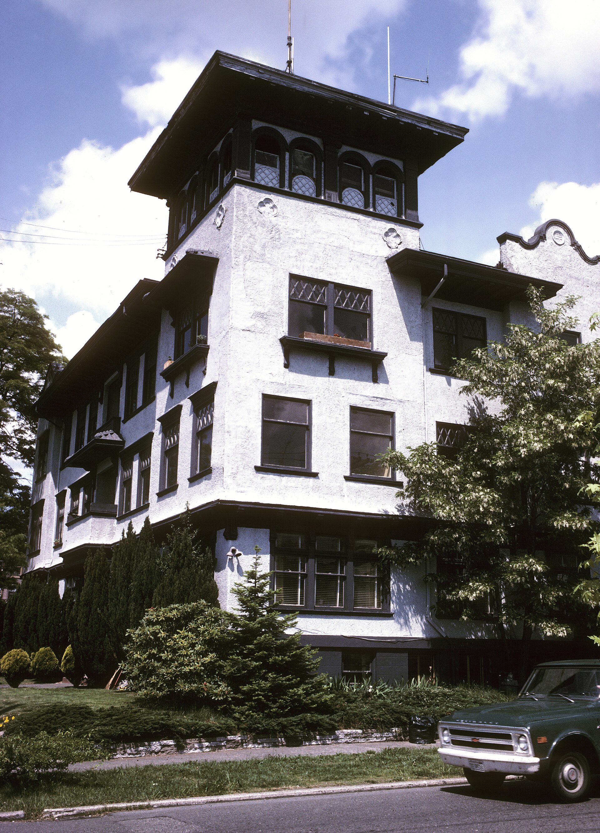
Apartment Building at 302 Malden Avenue E., Capitol Hill, Seattle, Circa 1975, Broadway You checked the neighborhood.Now check an address ! Photo: Seattle Municipal Archives from Seattle, WA, CC BY 2.0 · Wikimedia Commons

For $34.00 a CrimesLog™ Home Report provides: (where available)

  • Nearest 6 Pre-school Nurseries to Address
  • Nearest 6 Primary Schools to Address
  • Nearest 6 Secondary/High Schools to Address
  • Nearest College and University to Address
  • Nearest to Address Medical Clinics, Hospitals and Pharmacies
  • Nearest 2 Police Station details to Address

The Home Report also provides

  • The CrimesLog™ Home Score is a proprietary Home Safety Measure capturing crime frequency, severity, recency and proximity to Address from police crime reporting point
  • A map indicating police anonymized crime reporting points around Address
  • Crime category trendlines for Address neighborhood
  • List of Reported Crime Incidents around Address radius
  • Downloadable PDF report — A Permanent Copy to Keep and Share to aid your Property Research
  • Our crimes database of almost 60 million records is UPDATED EVERY MONTH from US, UK, CA police sources
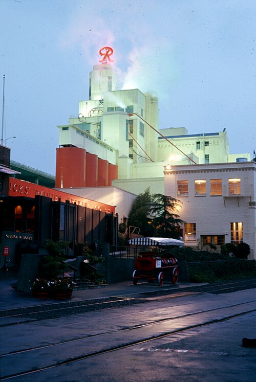
Rainier Brewery Building, Circa 1980, Mid-Beacon Hill
Mid-Beacon Hill · Rainier Brewery Building, Circa 1980
Photo: Seattle Municipal Archives from Seattle, WA, CC BY 2.0 · Wikimedia Commons
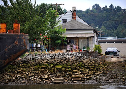
South Park Home, South Park
South Park · South Park Home
Photo: USEPA Environmental-Protection-Agency, Public domain · Wikimedia Commons
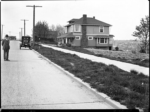
Seattle - 15th Avenue S. Near Massachusetts St., 1927, North Beacon Hill
North Beacon Hill · Seattle - 15th Avenue S. Near Massachusetts St., 1927
Photo: George Chew, CC BY 4.0 · Wikimedia Commons
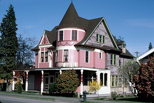
House in Georgetown, Circa 1980, Georgetown
Georgetown · House in Georgetown, Circa 1980
Photo: Seattle Municipal Archives from Seattle, WA, CC BY 2.0 · Wikimedia Commons
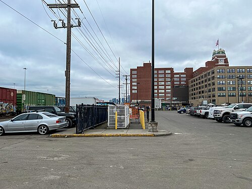
Starbucks Building in Seattle, SODO
SODO · Starbucks Building in Seattle
Photo: Z3lvs, CC0 · Wikimedia Commons
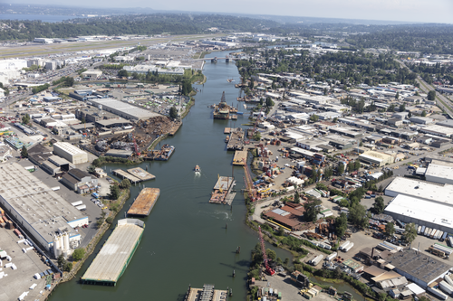
Aerial View of Seattle, Washington, with a Focus on the Duwamish Waterway, Industrial District
Industrial District · Aerial View of Seattle, Washington, with a Focus on the Duwamish Waterway
Photo: Carol M. Highsmith, Public domain · Wikimedia Commons
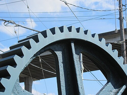
Gear from Old Spokane Street Bridge, Harbor Island
Harbor Island · Gear from Old Spokane Street Bridge
Photo: Robert Ashworth from Bellingham, WA., USA, CC BY 2.0 · Wikimedia Commons
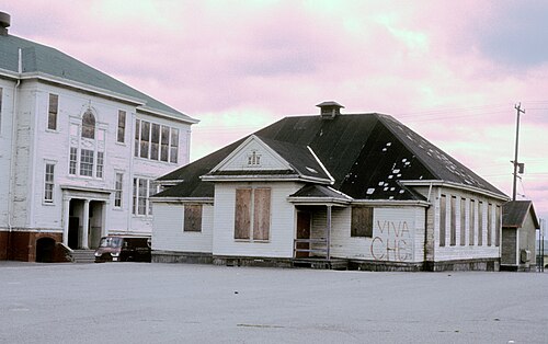
Old Beacon Hill School, Seattle, Circa 1970s, North Beacon Hill
North Beacon Hill · Old Beacon Hill School, Seattle, Circa 1970s
Photo: Seattle Municipal Archives from Seattle, WA, CC BY 2.0 · Wikimedia Commons

How neighborhoods moved each quarter

2022

Whole-area crime rate 38.1 to 43.7 per 1,000 (high: Q3 2022).

No neighborhood moved more than three places in a quarter.

2023

Whole-area crime rate 32.7 to 41.0 per 1,000 (high: Q3 2023).

No neighborhood moved more than three places in a quarter.

2024

Whole-area crime rate 31.9 to 36.8 per 1,000 (high: Q3 2024).

No neighborhood moved more than three places in a quarter.

2025

Whole-area crime rate 24.3 to 28.9 per 1,000 (high: Q3 2025).

No neighborhood moved more than three places in a quarter.

2026

Whole-area crime rate 23.1 to 27.5 per 1,000 (high: Q2 2026). 2 quarters so far.

No neighborhood moved more than three places in a quarter.

Reported Safety Incidents

In Q2 2026: property incidents were 45% (530), vehicle crimes were 34% (401), violent incidents were 10% (119) and public order incidents were 7% (78).

Recorded crime here is grouped into violent crime, property crime (burglary and theft), vehicle crime and public order offences, so you can compare how safe each neighborhood is for the kind of crime that matters to you.

Places we left out, and places to read with care

Left out: Harbor Island. They have almost no residents: their crimes are against visitors, so a rate per resident says little about living there.

Industrial District (591.5 per 1,000 from 84 crimes among 142 residents), SODO (365.5 per 1,000 from 280 crimes among 766 residents) and Georgetown (109.9 per 1,000 from 139 crimes among 1,265 residents) are places with few residents (under 3,000): a rate on so few people says little about living there, so they are not named as the lowest or highest.

The 8 neighborhoods on the map

Beacon Hill Duwamish is made of 8 neighborhoods compared here, each in its own colour on the map. They are the areas of the City of Seattle's Neighborhood Map Atlas, grouped into areas of the city by CrimesLog: 42,717 residents between them.

  • Georgetown
  • Holly Park
  • Industrial District
  • Mid-Beacon Hill
  • North Beacon Hill
  • SODO
  • South Beacon Hill
  • South Park

All 8 neighborhoods, Q2 2026

Crimes per 1,000 residents, Q2 2026, lowest first. The last two columns compare with Q1 2022.
#NeighborhoodResidentsAllViolentPropertyVehiclePublic orderRate vs Q1 2022Places gained
1Mid-Beacon Hill13,3328.00.93.53.10.5down37%up1
2South Beacon Hill5,21210.62.14.23.60.2down8%down1
3Holly Park5,54111.42.25.23.40.2down29%–
4South Park4,10816.32.25.65.81.2down45%–
5North Beacon Hill12,35130.72.214.38.74.0down6%–
6Georgetown †1,265109.94.069.630.04.7down50%–
7SODO †766365.544.4124.0174.913.1down26%–
8Industrial District †142591.563.4359.1126.80.0down32%–

† Industrial District, SODO and Georgetown are places with few residents. A rate on a very small number of residents or crimes is not comparable with the others.

Photographs

176 photographs of the 8 neighborhoods run along the reel; click one to see it full size. Each is credited here and under the large view.

All 176 photographs and their credits
  1. Mid-Beacon Hill · Rainier Brewery Building, Circa 1980. Photo: Seattle Municipal Archives from Seattle, WA, CC BY 2.0 · Wikimedia Commons
  2. South Park · South Park Home. Photo: USEPA Environmental-Protection-Agency, Public domain · Wikimedia Commons
  3. North Beacon Hill · Seattle - 15th Avenue S. Near Massachusetts St., 1927. Photo: George Chew, CC BY 4.0 · Wikimedia Commons
  4. Georgetown · House in Georgetown, Circa 1980. Photo: Seattle Municipal Archives from Seattle, WA, CC BY 2.0 · Wikimedia Commons
  5. SODO · Starbucks Building in Seattle. Photo: Z3lvs, CC0 · Wikimedia Commons
  6. Industrial District · Aerial View of Seattle, Washington, with a Focus on the Duwamish Waterway. Photo: Carol M. Highsmith, Public domain · Wikimedia Commons
  7. Harbor Island · Gear from Old Spokane Street Bridge. Photo: Robert Ashworth from Bellingham, WA., USA, CC BY 2.0 · Wikimedia Commons
  8. North Beacon Hill · Old Beacon Hill School, Seattle, Circa 1970s. Photo: Seattle Municipal Archives from Seattle, WA, CC BY 2.0 · Wikimedia Commons
  9. Georgetown · Hat and Boots Service Station, Circa 1980. Photo: Seattle Municipal Archives from Seattle, WA, CC BY 2.0 · Wikimedia Commons
  10. SODO · Seattle Fire Station 14, 1927. Photo: Seattle Municipal Archives from Seattle, WA, CC BY 2.0 · Wikimedia Commons
  11. Georgetown · Murrow Memorial Bridge 07747. Photo: Walter Siegmund, CC BY 2.5 · Wikimedia Commons
  12. SODO · East Waterway Lander Street Terminal Looking NE, 1914. Photo: Seattle Municipal Archives from Seattle, WA, CC BY 2.0 · Wikimedia Commons
  13. Georgetown · Fantagraphics Georgetown. Photo: Gnisacc, CC BY 4.0 · Wikimedia Commons
  14. SODO · Fire Station ^ 14 - 3224 4th Avenue S. - SODO Ladder 7 Aid 14 Rescue 1 Reserve Rescue Unit Numerous Posts Cables Etc Remov. Photo: Loco Steve, CC BY 3.0 · Wikimedia Commons
  15. Georgetown · Georgetown, Seattle - Airport Way and S. Vale St., Circa 1966. Photo: Seattle Municipal Archives from Seattle, WA, CC BY 4.0 · Wikimedia Commons
  16. Georgetown · Beanie's Tavern, Circa 1979. Photo: Seattle Municipal Archives from Seattle, WA, CC BY 2.0 · Wikimedia Commons
  17. Georgetown · Jules Mae's Restaurant, Georgetown, Seattle, Circa 1980. Photo: Seattle Municipal Archives from Seattle, WA, CC BY 2.0 · Wikimedia Commons
  18. Ballard · Seattle - Adams Elementary School, 1970s. Photo: Seattle Municipal Archives from Seattle, WA, CC BY 2.0 · Wikimedia Commons
  19. Fremont · Seattle - Fremont Avenue Near 43rd Street, 1970s. Photo: Seattle Municipal Archives from Seattle, WA, CC BY 2.0 · Wikimedia Commons
  20. Green Lake · Seattle - Gregg's Green Lake Cycle, 1989. Photo: Seattle Municipal Archives from Seattle, WA, CC BY 4.0 · Wikimedia Commons
  21. Phinney Ridge · Seattle - Twin Teepees Restaurant, Circa 1980. Photo: Seattle Municipal Archives from Seattle, WA, CC BY 2.0 · Wikimedia Commons
  22. Wallingford · Seattle - Interlake School, Circa 1975. Photo: Seattle Municipal Archives from Seattle, WA, CC BY 2.0 · Wikimedia Commons
  23. West Woodland · Mars Hill Church, Ballard Location, Worship Band Stage. Photo: Ruthanne Reid, CC BY 2.0 · Wikimedia Commons
  24. Broadway · View West from Capitol Hill, Circa 1970s - Flickr - Seattle Municipal Archives. Photo: Seattle Municipal Archives from Seattle, WA, CC BY 2.0 · Wikimedia Commons
  25. Eastlake · Seattle - El Cerrito Apartments, Circa 1975. Photo: Seattle Municipal Archives from Seattle, WA, CC BY 2.0 · Wikimedia Commons
  26. Madison Park · Seattle - Apartment Buildings Near Lake Washington, 1970s. Photo: Seattle Municipal Archives from Seattle, WA, CC BY 2.0 · Wikimedia Commons
  27. Montlake · Seattle - House Near 11th Avenue E. & Delmar Dr., 1961. Photo: Seattle Municipal Archives from Seattle, WA, CC BY 2.0 · Wikimedia Commons
  28. Portage Bay · Seattle - Canal Market, 1970s. Photo: Seattle Municipal Archives from Seattle, WA, CC BY 2.0 · Wikimedia Commons
  29. South Lake Union · Fairview Avenue N., 1931. Photo: Seattle Municipal Archives from Seattle, WA, CC BY 4.0 · Wikimedia Commons
  30. Stevens · Seattle - John Street Widening at 21st Avenue E., 1955. Photo: Seattle Municipal Archives from Seattle, WA, CC BY 2.0 · Wikimedia Commons
  31. Westlake · MOHAI. Photo: Kira Picabo, CC BY 3.0 · Wikimedia Commons
  32. Atlantic · Seattle Central Area Home, 1976. Photo: Seattle Municipal Archives from Seattle, WA, CC BY 2.0 · Wikimedia Commons
  33. Leschi · Meredith & Sheets, 2801 Jackson, C1914. Photo: Rob Ketcherside, CC BY 2.0 · Wikimedia Commons
  34. Mann · Seattle - Branding Iron Tavern, Circa 1980. Photo: Sawyer's Inc. via Seattle Municipal Archives from Seattle, WA, CC BY 2.0 · Wikimedia Commons
  35. Minor · Seattle - Damaged Light Pole in Front of Ebenezer Zion A.M.E. Church, Circa 1960. Photo: Seattle Municipal Archives from Seattle, WA, CC BY 2.0 · Wikimedia Commons
  36. North Delridge · West Spokane Bridge, 1929. Photo: Seattle Municipal Archives from Seattle, WA, CC BY 4.0 · Wikimedia Commons
  37. Belltown · Denny Regrade, 2nd Avenue, Seattle C1909. Photo: William Creswell from Seattle, Washington, USA, CC BY 2.0 · Wikimedia Commons
  38. Central Business District · Entrance Hall of Fairmont Olympic Hotel. Photo: Exilexi, CC BY 4.0 · Wikimedia Commons
  39. Denny Triangle · Fall 2007 024 - Flickr - GregTheBusker. Photo: Greg Schechter from San Francisco, USA, CC BY 2.0 · Wikimedia Commons
  40. First Hill · Garrand Hall of Seattle University 芸術と科学のブランチ. Photo: Bohao Zhao, CC BY 3.0 · Wikimedia Commons
  41. Pike-Market · First Avenue, 1968. Photo: Seattle Municipal Archives from Seattle, WA, CC BY 2.0 · Wikimedia Commons
  42. Pioneer Square · Centurylink Field, from Passenger Bridge at King Street Station. Photo: Kira Picabo, CC BY 3.0 · Wikimedia Commons
  43. Yesler Terrace · Looking Down James Street, Seattle, 1963. Photo: W.L. Dahl via Seattle Municipal Archives from Seattle, WA, CC BY 2.0 · Wikimedia Commons
  44. Olympic Hills · Seattle - NE 143rd Street Near 30th Avenue NE, 1959. Photo: Seattle Municipal Archives from Seattle, WA, CC BY 2.0 · Wikimedia Commons
  45. Victory Heights · Seattle - Lake City Way & 125th Street, 1954. Photo: Seattle Municipal Archives from Seattle, WA, CC BY 2.0 · Wikimedia Commons
  46. Ravenna · Microsoft Store University Village, Seattle, WA 23.10.2011. Photo: https://www.flickr.com/photos/justinbaeder/, CC BY 2.0 · Wikimedia Commons
  47. Roosevelt · Roosevelt LINK Platforms. Photo: TraininteriorguyALT, CC BY 4.0 · Wikimedia Commons
  48. University District · Seattle - Candi Lyn Apartments, 1964. Photo: Seattle Municipal Archives from Seattle, WA, CC BY 2.0 · Wikimedia Commons
  49. University of Washington · Communications Building, University of Washington. Photo: Sammi Brie, CC0 · Wikimedia Commons
  50. Greenwood · Seattle - Bob's Holman Road Grocery, 1959. Photo: Seattle Municipal Archives from Seattle, WA, CC BY 2.0 · Wikimedia Commons
  51. Licton Springs · Traffic Calming Cushion on North 92nd Street, Seattle, WA, US. Photo: Lumikeiju, CC0 · Wikimedia Commons
  52. Maple Leaf · Northgate LINK Platforms. Photo: TraininteriorguyALT, CC BY 4.0 · Wikimedia Commons
  53. Pinehurst · Pinehurst LINK Platforms. Photo: TraininteriorguyALT, CC BY 4.0 · Wikimedia Commons
  54. Briarcliff · Aurora Over House in Seattle. Photo: Lianguanlun, CC BY 4.0 · Wikimedia Commons
  55. East Queen Anne · Seattle - 116 Smith St 01. Photo: Joe Mabel, CC BY 3.0 · Wikimedia Commons
  56. Interbay · Seattle Post-Intelligencer Building, Circa 2019. Photo: Seattle Municipal Archives from Seattle, WA, CC BY 2.0 · Wikimedia Commons
  57. Lawton Park · House at West Point at Dusk. Photo: asimov4, CC BY 3.0 · Wikimedia Commons
  58. Lower Queen Anne · Kerry Park (Unsplash). Photo: Zhifei Zhou phoebezzf, CC0 · Wikimedia Commons
  59. North Queen Anne · Seattle - Street Stairway Off 15th Avenue W. and W. Armour St., Circa 2010. Photo: Seattle Municipal Archives from Seattle, WA, CC BY 4.0 · Wikimedia Commons
  60. West Queen Anne · View West Across Smith Cove to Magnolia, 1903. Photo: Seattle Municipal Archives from Seattle, WA, CC BY 2.0 · Wikimedia Commons
  61. Columbia City · Aki Kurose Middle School Academy 2024. Photo: Gnisacc, CC BY 4.0 · Wikimedia Commons
  62. Mount Baker · Seattle - Colman Park, 1936. Photo: Seattle Municipal Archives from Seattle, WA, CC BY 2.0 · Wikimedia Commons
  63. Rainier Beach · Houses at Rainier & Norfolk, 1912. Photo: Seattle Municipal Archives from Seattle, WA, CC BY 2.0 · Wikimedia Commons
  64. Seward Park · Seattle - Angeline Street Stairway, 1963. Photo: Seattle Municipal Archives from Seattle, WA, CC BY 2.0 · Wikimedia Commons
  65. Alki · Alki-marina. Photo: User:Introvert, CC BY 2.5 · Wikimedia Commons
  66. Genesee · 4560 California Avenue, Seattle, 1977. Photo: Seattle Municipal Archives from Seattle, WA, CC BY 2.0 · Wikimedia Commons
  67. North Admiral · West Seattle Barber Shop, Circa 1976. Photo: Seattle Municipal Archives from Seattle, WA, CC BY 2.0 · Wikimedia Commons
  68. Ballard · Seattle Cedar Lumber Company Mill in Ballard, 1915. Photo: Seattle Municipal Archives., CC BY 2.0 · Wikimedia Commons
  69. Fremont · Fremont Public Library. Photo: Simon Cooke from Seattle, USA, CC BY 2.0 · Wikimedia Commons
  70. Green Lake · Seattle - E. Green Lake Way and Ravenna Boulevard, 1963. Photo: Seattle Municipal Archives from Seattle, WA, CC BY 2.0 · Wikimedia Commons
  71. Wallingford · Family on Wallingford Porch, Circa 1979. Photo: Seattle Municipal Archives from Seattle, WA, CC BY 2.0 · Wikimedia Commons
  72. West Woodland · Ballard Duplex, Seattle. Photo: Sightline Housing Solutions Photo Library, CC BY 2.0 · Wikimedia Commons
  73. Broadway · Egan House, Seattle, Circa 1970s. Photo: Seattle Municipal Archives from Seattle, WA, CC BY 2.0 · Wikimedia Commons
  74. Eastlake · L'Amourita Apartments, 1970s. Photo: Seattle Municipal Archives from Seattle, WA, CC BY 2.0 · Wikimedia Commons
  75. Madison Park · Washington Pioneer Hall, 1975. Photo: Seattle Municipal Archives from Seattle, WA, CC BY 2.0 · Wikimedia Commons
  76. Montlake · Seattle - Montlake Playfield, 1938. Photo: Seattle Municipal Archives from Seattle, WA, CC BY 2.0 · Wikimedia Commons
  77. South Lake Union · MOHAI and South Lake Union Park, Circa 2019. Photo: Seattle Municipal Archives from Seattle, WA, CC BY 2.0 · Wikimedia Commons
  78. Stevens · Seattle - Spot Cleaners, Circa 1977. Photo: Seattle Municipal Archives from Seattle, WA, CC BY 2.0 · Wikimedia Commons
  79. Westlake · Westlake, Seattle, WA 98109, USA. Photo: Kira Picabo, CC BY 3.0 · Wikimedia Commons
  80. Atlantic · Seattle - Central District Grocery Store, Circa 1980. Photo: Seattle Municipal Archives from Seattle, WA, CC BY 2.0 · Wikimedia Commons
  81. Leschi · Seattle - Aerial of Leschi, 1968. Photo: Seattle Municipal Archives from Seattle, WA, CC BY 2.0 · Wikimedia Commons
  82. Minor · Seattle, Houses Near 23rd & Yesler, Circa 1980. Photo: Seattle Municipal Archives from Seattle, WA, CC BY 2.0 · Wikimedia Commons
  83. North Delridge · Seattle - SW Spokane Street, 1962. Photo: Seattle Municipal Archives from Seattle, WA, CC BY 2.0 · Wikimedia Commons
  84. Belltown · Belltown, Seattle, WA, USA. Photo: Kira Picabo, CC BY 3.0 · Wikimedia Commons
  85. Central Business District · Firehouse. Photo: Sarah Stierch from Sonoma, CA, USA, CC BY 2.0 · Wikimedia Commons
  86. Denny Triangle · Fall 2007 022 - Flickr - GregTheBusker. Photo: Greg Schechter from San Francisco, USA, CC BY 2.0 · Wikimedia Commons
  87. First Hill · David Lynch at Town Hall. Photo: Aaron, CC BY 2.0 · Wikimedia Commons
  88. Pike-Market · Corner Market Building, Pike Place Market, 1974. Photo: Seattle Municipal Archives from Seattle, WA, CC BY 2.0 · Wikimedia Commons
  89. Pioneer Square · 211 First Avenue S., 1979. Photo: Seattle Municipal Archives from Seattle, WA, CC BY 2.0 · Wikimedia Commons
  90. Yesler Terrace · Cascade PBS, 361 Broadway, Seattle - Center Staircase. Photo: Maiacosis, CC BY 4.0 · Wikimedia Commons
  91. University of Washington · Alberg Pano - Restitch. Photo: derivative work: J.smith (talk) Alberg_pano.jpg: Joe Mabel Alberg_pano_piece_01.jpg: Joe Mabel Alberg_pano_piece_02.jpg:, CC BY 2.5 · Wikimedia Commons
  92. East Queen Anne · Mt. Rainier from 1208 Bigelow Avenue N., Seattle, Washington LCCN93510123. Photo: Miscellaneous Items in High Demand, PPOC, Library of Congress, Public domain · Wikimedia Commons
  93. Interbay · Interbay Stadium Seattle Ballard FC Vs Oakland Jul 19 2024. Photo: Vtgco, CC0 · Wikimedia Commons
  94. Lawton Park · Grey House. Photo: Mr4483, CC BY 4.0 · Wikimedia Commons
  95. Lower Queen Anne · EMP Museum, Seattle, United States (Unsplash). Photo: Sergei Akulich sakulich, CC0 · Wikimedia Commons
  96. North Queen Anne · Seattle - Clean-M-Rite Cleaners, 1970s. Photo: Seattle Municipal Archives from Seattle, WA, CC BY 2.0 · Wikimedia Commons
  97. Columbia City · Columbia Park-Seattle, November 2024. Photo: CiderDog06, CC0 · Wikimedia Commons
  98. Seward Park · Slide Down the Hill XD. Photo: inte the husky, CC BY 3.0 · Wikimedia Commons
  99. Ballard · Ballard Smoke Shop and Pete's Place, Circa 1970s. Photo: Seattle Municipal Archives from Seattle, WA, CC BY 2.0 · Wikimedia Commons
  100. Fremont · Seattle - Antique Store, Circa 1975. Photo: Seattle Municipal Archives from Seattle, WA, CC BY 2.0 · Wikimedia Commons
  101. Wallingford · Aerial of Wallingford, 1975. Photo: Seattle Municipal Archives from Seattle, WA, CC BY 2.0 · Wikimedia Commons
  102. West Woodland · Seattle - Mike's Chili Parlor, Circa 1975. Photo: Seattle Municipal Archives from Seattle, WA, CC BY 2.0 · Wikimedia Commons
  103. Broadway · Bicyclist on Broadway, 2013 - Flickr - Seattle Municipal Archives. Photo: Seattle Municipal Archives from Seattle, WA, CC BY 4.0 · Wikimedia Commons
  104. Eastlake · Seattle - Skipper's Tavern, Circa 1975. Photo: Seattle Municipal Archives from Seattle, WA, CC BY 2.0 · Wikimedia Commons
  105. South Lake Union · Seattle - Houses on Eastlake Avenue E Below I-5, 1970s. Photo: Seattle Municipal Archives from Seattle, WA, CC BY 2.0 · Wikimedia Commons
  106. Stevens · Home of Seattle Mayor John F. Dore, 1937. Photo: Unknown authorUnknown author, Public domain · Wikimedia Commons
  107. Westlake · Westlake, Seattle, WA 98109, USA. Photo: Kira Picabo, CC BY 3.0 · Wikimedia Commons
  108. Atlantic · Aerial of Sick's Stadium, Circa 1972. Photo: Seattle Municipal Archives from Seattle, WA, CC BY 2.0 · Wikimedia Commons
  109. Leschi · Wifi Ice Cream?. Photo: Robert Ashworth from Bellingham, WA., USA, CC BY 2.0 · Wikimedia Commons
  110. Minor · 2016.10.12.103846 Autumn Foliage 14th Avenue Seattle Washington USA. Photo: Hermann Luyken, CC0 · Wikimedia Commons
  111. North Delridge · Highland Games at West Seattle Stadium, 1951. Photo: Seattle Municipal Archives from Seattle, WA, CC BY 4.0 · Wikimedia Commons
  112. Central Business District · 5th Avenue Theater. Photo: Bohao Zhao, CC BY 3.0 · Wikimedia Commons
  113. First Hill · Babeland Exterior, January 2023. Photo: Lethargilistic, CC0 · Wikimedia Commons
  114. Pike-Market · A Tavern at Pike Place Market. Photo: JOHN LLOYD from Concrete, Washington, United States, CC BY 2.0 · Wikimedia Commons
  115. Pioneer Square · Amtrak- King Street Station- Seattle Washington.. Photo: Loco Steve from Bromley , UK, CC BY 2.0 · Wikimedia Commons
  116. Yesler Terrace · Cascade PBS, 361 Broadway, Seattle - Off Staircase. Photo: Maiacosis, CC BY 4.0 · Wikimedia Commons
  117. University of Washington · 1991 Grantland Rice Trophy. Photo: PK-WIKI, CC BY 4.0 · Wikimedia Commons
  118. Lawton Park · Radar at West Point. Photo: asimov4, CC BY 3.0 · Wikimedia Commons
  119. Columbia City · Seattle - Rainier Avenue Near Edmunds Street, Circa 1954. Photo: Seattle Municipal Archives from Seattle, WA, CC BY 2.0 · Wikimedia Commons
  120. Ballard · International Schooner, Circa 1980. Photo: Seattle Municipal Archives from Seattle, WA, CC BY 2.0 · Wikimedia Commons
  121. Fremont · Seattle - Stone Way, Circa 1954. Photo: Seattle Municipal Archives from Seattle, WA, CC BY 4.0 · Wikimedia Commons
  122. Wallingford · Seattle Skyline. Photo: Viktoria Kampbell, CC BY 3.0 · Wikimedia Commons
  123. Broadway · Apartment Building at 302 Malden Avenue E., Capitol Hill, Seattle, Circa 1975. Photo: Seattle Municipal Archives from Seattle, WA, CC BY 2.0 · Wikimedia Commons
  124. South Lake Union · Seattle Victorian Row House on Eastlake Avenue, 1970s. Photo: Seattle Municipal Archives from Seattle, WA, CC BY 2.0 · Wikimedia Commons
  125. Westlake · Seattle - Swedish Club 04. Photo: Joe Mabel, CC BY 3.0 · Wikimedia Commons
  126. Atlantic · Seattle City Light Billboard at Sick's Stadium, 1952. Photo: Seattle Municipal Archives from Seattle, WA, CC BY 2.0 · Wikimedia Commons
  127. Minor · 2016.10.12.104707 Autumn Foliage E Jefferson Street Seattle Washington USA. Photo: Hermann Luyken, CC0 · Wikimedia Commons
  128. Central Business District · In Westlake Mall, 2nd Story. Photo: Kira Picabo, CC BY 3.0 · Wikimedia Commons
  129. First Hill · Dunbar Restaurant at Sorrento Hotel, Circa 1970s. Photo: Seattle Municipal Archives from Seattle, WA, CC BY 2.0 · Wikimedia Commons
  130. Pike-Market · Key Arena. Photo: Dale Cruse from San Francisco, CA, USA, CC BY 2.0 · Wikimedia Commons
  131. Pioneer Square · Clock Tower. Photo: Thomson M, CC BY 3.0 · Wikimedia Commons
  132. Yesler Terrace · I-5 Southbound from Yesler Way, Seattle. Photo: SounderBruce, CC BY 3.0 · Wikimedia Commons
  133. University of Washington · Magnuson HSB I J Wing. Photo: Joshuadfranklin, CC BY 3.0 · Wikimedia Commons
  134. Columbia City · Platform View Columbia City Station View. Photo: Seattledude at English Wikipedia, Public domain · Wikimedia Commons
  135. Ballard · Club Tavern, Ballard, Seattle, Circa 1975. Photo: Seattle Municipal Archives from Seattle, WA, CC BY 2.0 · Wikimedia Commons
  136. Broadway · Broadway and John, 1953. Photo: F. John Albi via Seattle Municipal Archives from Seattle, WA, CC BY 2.0 · Wikimedia Commons
  137. South Lake Union · Arthur Foss, Swiftsure. Photo: Kira Picabo, CC BY 3.0 · Wikimedia Commons
  138. Westlake · Seattle - Swedish Club 03. Photo: Joe Mabel, CC BY 3.0 · Wikimedia Commons
  139. Minor · 2016.10.12.105201 Autumn Foliage E Cherry Street Seattle Washington USA New. Photo: Hermann Luyken, CC0 · Wikimedia Commons
  140. Central Business District · Pike Pine Retail Core, Seattle, WA, USA. Photo: Almondox, CC BY 3.0 · Wikimedia Commons
  141. First Hill · 2016.10.12.110657 Autumn Foliage Seattle University Seattle Washington USA. Photo: Hermann Luyken, CC0 · Wikimedia Commons
  142. Pioneer Square · KING STREET STATION SEATTLE WA. Photo: Loco Steve, CC BY 3.0 · Wikimedia Commons
  143. Yesler Terrace · How Very Ominous.... Photo: Kira Picabo, CC BY 3.0 · Wikimedia Commons
  144. University of Washington · Gowen Plaque. Photo: en:User:Tibetologist, CC BY 3.0 · Wikimedia Commons
  145. Columbia City · Seattle - Columbia City Ale House, 2009. Photo: Seattle Municipal Archives from Seattle, WA, CC BY 4.0 · Wikimedia Commons
  146. Broadway · Seattle Art Museum Entrance Hall, Circa 1938. Photo: Seattle Municipal Archives from Seattle, WA, CC BY 2.0 · Wikimedia Commons
  147. South Lake Union · Seattle - Cascade Cottages, Circa 1975. Photo: Seattle Municipal Archives from Seattle, WA, CC BY 2.0 · Wikimedia Commons
  148. Minor · Church of the Immaculate Conception, Seattle, C1940. Photo: Rob Ketcherside, CC BY 2.0 · Wikimedia Commons
  149. Central Business District · Pike Pine Retail Core, Seattle, WA, USA. Photo: Almondox, CC BY 3.0 · Wikimedia Commons
  150. University of Washington · 1991 MacArthur Bowl Plaque. Photo: PK-WIKI, CC BY 4.0 · Wikimedia Commons
  151. Minor · Seattle - 123 21st Avenue, Circa 1980. Photo: Seattle Municipal Archives from Seattle, WA, CC BY 2.0 · Wikimedia Commons
  152. Central Business District · Pike Pine Retail Core, Seattle, WA, USA. Photo: Almondox, CC BY 3.0 · Wikimedia Commons
  153. University of Washington · Bookshelves Suzzallo Allen Library University of Washington Seattle Washington 2026. Photo: Guywelch2000, CC BY 4.0 · Wikimedia Commons
  154. Minor · Seattle - 517-521 21st Avenue, 1976. Photo: Seattle Municipal Archives from Seattle, WA, CC BY 4.0 · Wikimedia Commons
  155. Central Business District · Gift of the Line. Photo: Scott Thompson, CC BY 3.0 · Wikimedia Commons
  156. University of Washington · University of Washington Red Square Golden Hour Seattle Washington. Photo: Guywelch2000, CC BY 4.0 · Wikimedia Commons
  157. Minor · Seattle 21st & James, Circa 1980. Photo: Seattle Municipal Archives from Seattle, WA, CC BY 2.0 · Wikimedia Commons
  158. University of Washington · Cedrus Libani University of Washington Quad Seattle 2026. Photo: Guywelch2000, CC0 · Wikimedia Commons
  159. University of Washington · Denny Hall UW Seattle South Facade 2026. Photo: Guywelch2000, CC BY 4.0 · Wikimedia Commons
  160. University of Washington · Suzzallo Reading Room University of Washington Restoration Seattle Washington 2026. Photo: Guywelch2000, CC BY 4.0 · Wikimedia Commons
  161. University of Washington · Alberg Pano. Photo: Joe Mabel, CC BY 2.5 · Wikimedia Commons
  162. University of Washington · 2009-0919-HuskyStadium. Photo: Bobak Ha'Eri, CC BY 3.0 · Wikimedia Commons
  163. University of Washington · Husky Stadium - April 7, 2016. Photo: David Schott, CC BY 2.0 · Wikimedia Commons
  164. University of Washington · Suzzallo Library - Thought Inspiration and Mastery. Photo: Guywelch2000, CC0 · Wikimedia Commons
  165. University of Washington · Drumheller Fountain, May 2016. Photo: Travis Wise, CC BY 2.0 · Wikimedia Commons
  166. University of Washington · Drumhellerfountain. Photo: Keng Susumpow, CC BY 2.0 · Wikimedia Commons
  167. University of Washington · UW Tower. Photo: Atomic Taco, Public domain · Wikimedia Commons
  168. University of Washington · Husky Stadium Lake Washington. Photo: Ciar, Public domain · Wikimedia Commons
  169. University of Washington · Suzzallo Library, WSU 01. Photo: Icewedge, Public domain · Wikimedia Commons
  170. University of Washington · University of Washington Old Library. Photo: no photo credit, Public domain · Wikimedia Commons
  171. University of Washington · UW Allen Building 01. Photo: Joe Mabel, CC BY 2.5 · Wikimedia Commons
  172. University of Washington · Alaska Airlines Arena. Photo: ECTran71, CC0 · Wikimedia Commons
  173. University of Washington · Suzzallo Library at UW. Photo: Robert Ashworth from Bellingham, WA., USA, CC BY 2.0 · Wikimedia Commons
  174. University of Washington · Barnett Newman, Broken Obelisk (Designed 1963, Cast 1967), Quadrangle, Suzzallo Library, University of Washington, Seattle, Washington. Photo: Barnett Newman, Public domain · Wikimedia Commons
  175. University of Washington · Mt. Baker and UW Tower. Photo: Andrew Hopkins, CC BY 2.0 · Wikimedia Commons
  176. University of Washington · Flying Lion Shield of The University of Washington, Seattle, USA - Engineering Building Date 1921 - Style Collegiate Gothic. Photo: Wonderlane from Seattle, USA, CC BY 2.0 · Wikimedia Commons

Sources and notes

CrimesLog sources crime incident data published by the Seattle Police Department (SPD) through the City of Seattle Open Data Portal (data.seattle.gov), containing public sector information released under the City of Seattle Open Data Program.

Population: U.S. Census Bureau, American Community Survey 5-year estimates (public domain).

First-place medal: 1st Place Medal emoji icon by Icons8.

Neighborhood boundaries are the Neighborhood Map Atlas areas defined by the City of Seattle, grouped into areas of the city and simplified by CrimesLog. The photographs are credited under each picture.

Rates are recorded crimes per 1,000 residents, quarter by quarter; where a neighborhood has fewer than 100 residents the rate would be worked out on 100 (those places are left out of the race). A count of recorded crime is not a verdict on any neighborhood.