New York City · Neighborhood crime trends

New York Manhattan North

16 neighborhoods - a quarterly race to the lowest crime rate.

Crime Trends: Neighborhoods compared - each quarter from Q1 2022

New York as a whole averaged 16.5 crimes for every 1,000 residents per quarter in Q2 2026, while northern Manhattan averaged 16.7 (leaving out 3 places with almost no residents), hence it is generally about as safe as New York as a whole when all crimes are considered.

How do the 16 neighborhoods of northern Manhattan compare? In Q2 2026 the police recorded 15,296 crimes across them, 16.7 for every 1,000 residents. That is 2.5% below a year earlier and 5.1% above Q1 2022, the first quarter we track.

Upper East Side-Yorkville has the lowest rate of the everyday neighborhoods (5.9 per 1,000), followed by Upper West Side (Central) (10.1) and Morningside Heights (10.2). East Harlem (North) has the highest (30.1).

Use the RACE CHARTS below to watch all 16 NEW YORK MANHATTAN NORTH NEIGHBORHOODs race across 18 quarter periods from Q1 2022 to Q2 2026 - one crime category at a time or all together. The race chart can be used to compare average crime rates by category against New York's average.

Neighborhood boundaries are defined by NYC Department of City Planning, 2020 Neighborhood Tabulation Areas.
Lowest rate (everyday)
lowest rateUpper East Side-Yorkville
5.9 crimes per 1,000 residents, Q2 2026
Highest rate
upEast Harlem (North)
30.1 per 1,000, Q2 2026
Whole area, Q2 2026
16.7 per 1,000
down 2.5% below a year earlier · up 5.1% above Q1 2022
Compared
16 neighborhoods
918,254 residents · 18 quarters

New York Manhattan North neighborhood quarterly crime race

Press ▶︎ to watch Q1 2022 to Q2 2026. Tick one crime category or several; hover a bar for the neighborhood. Property crimes includes burglaries and thefts.

Crime categories
Indicated: crimes rate per 1000 residents per quarterAll · safest at the top · square-root scale · Q1 2022 to Q2 2026015102531.2East Harlem (North)18.2East Harlem (South)17.9Hamilton Heights-Sugar Hill18.5Harlem (North)24.7Harlem (South)13.3Inwood23.6Manhattanville-West Harlem10.4Morningside Heights45.1Randall's Island17.0Upper East Side-Carnegie Hill8.6Upper East Side-Yorkville9.1Upper West Side (Central)10.6Upper West Side-Lincoln Square14.1Upper West Side-Manhattan Valley14.8Washington Heights (North)14.6Washington Heights (South)New York Q2 2026 average all crimes (16.5)Numbers are crimes per 1,000 residents per quarter. Zero-crime quarters show 0 and rank safest. Not included, no residents: Central Park; Highbridge Park; Inwood Hill Park.
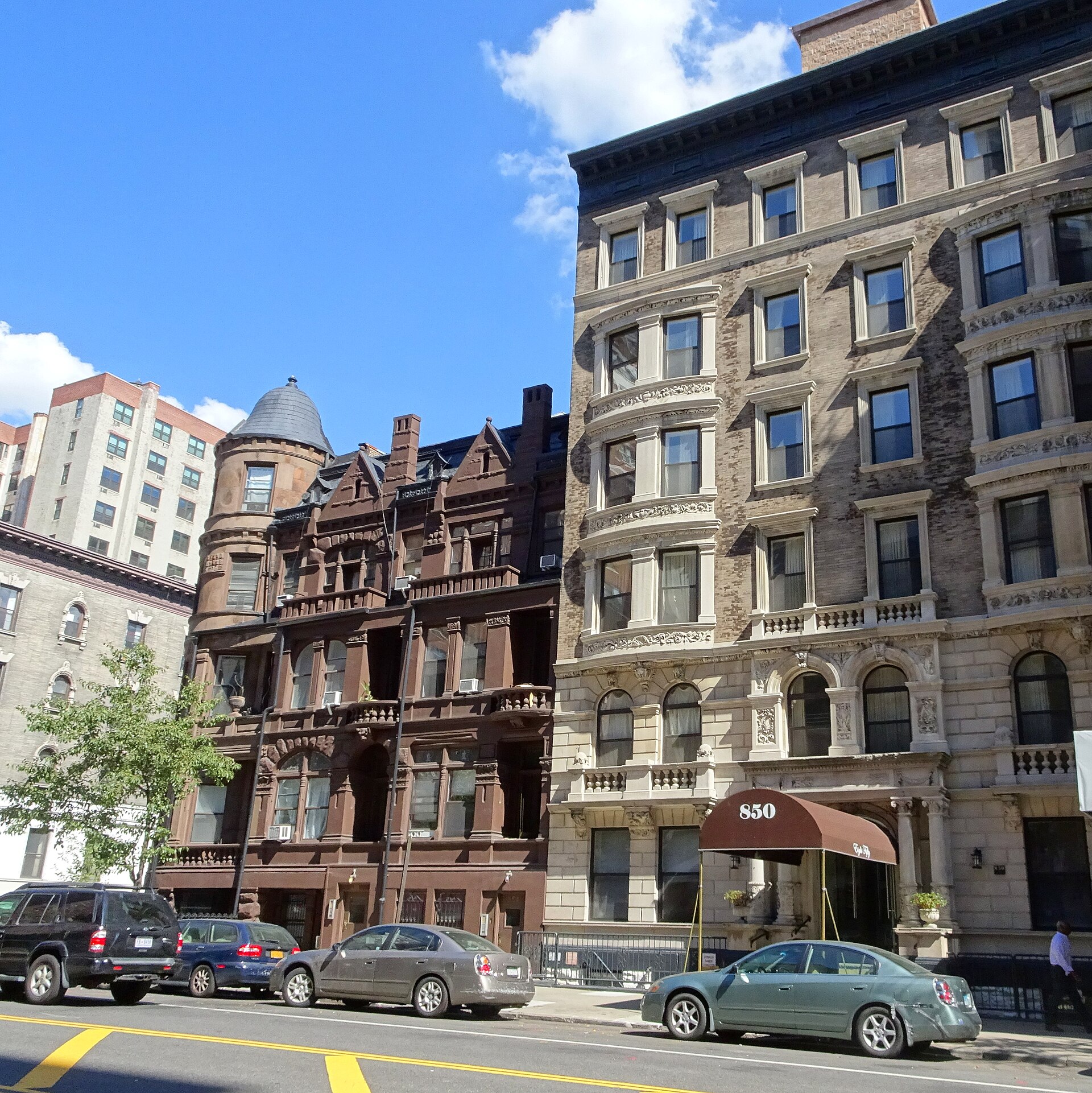
850-854 West End Avenue, Upper West Side-Manhattan Valley You checked the neighborhood.Now check an address ! Photo: Jim.henderson, CC BY 4.0 · Wikimedia Commons

For $34.00 a CrimesLog™ Home Report provides: (where available)

  • Nearest 6 Pre-school Nurseries to Address
  • Nearest 6 Primary Schools to Address
  • Nearest 6 Secondary/High Schools to Address
  • Nearest College and University to Address
  • Nearest to Address Medical Clinics, Hospitals and Pharmacies
  • Nearest 2 Police Station details to Address

The Home Report also provides

  • The CrimesLog™ Home Score is a proprietary Home Safety Measure capturing crime frequency, severity, recency and proximity to Address from police crime reporting point
  • A map indicating police anonymized crime reporting points around Address
  • Crime category trendlines for Address neighborhood
  • List of Reported Crime Incidents around Address radius
  • Downloadable PDF report — A Permanent Copy to Keep and Share to aid your Property Research
  • Our crimes database of almost 60 million records is UPDATED EVERY MONTH from US, UK, CA police sources
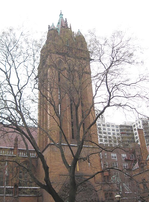
Holy Trinity CoE E88, Upper East Side-Yorkville
Upper East Side-Yorkville · Holy Trinity CoE E88
Photo: Jim.henderson, Public domain · Wikimedia Commons
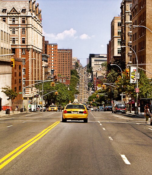
Amsterdam Avenue Looking North at Columbia University, Morningside Heights
Morningside Heights · Amsterdam Avenue Looking North at Columbia University
Photo: Gino maccanti from spain, CC BY 2.0 · Wikimedia Commons
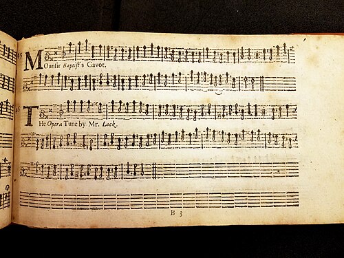
"The Opera Tune by Mr. Lock" as It Appears in the 1669 Edition of Apollo's Banquet, Upper West Side-Lincoln Square
Upper West Side-Lincoln Square · "The Opera Tune by Mr. Lock" as It Appears in the 1669 Edition of Apollo's Banquet
Photo: Kosboot, CC0 · Wikimedia Commons
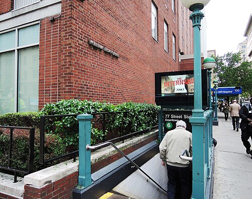
77 St IRT Station Downtown, Upper East Side-Carnegie Hill
Upper East Side-Carnegie Hill · 77 St IRT Station Downtown
Photo: Jim.henderson, CC0 · Wikimedia Commons
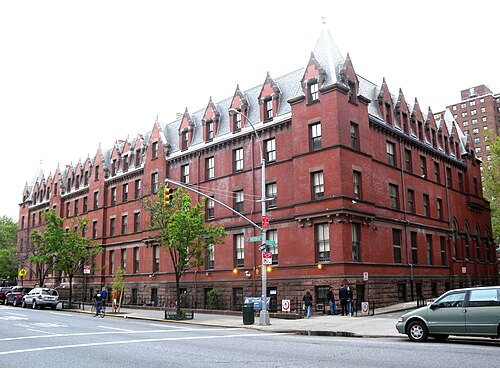
AYH Amst 103, Upper West Side-Manhattan Valley
Upper West Side-Manhattan Valley · AYH Amst 103
Photo: Jim.henderson, Public domain · Wikimedia Commons
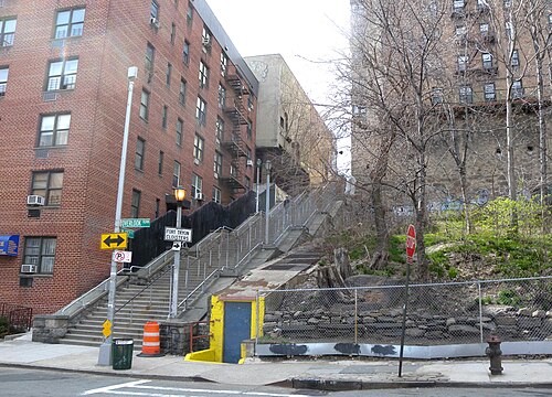
187 St Steps, Washington Heights (North)
Washington Heights (North) · 187 St Steps
Photo: Jim.henderson, Public domain · Wikimedia Commons
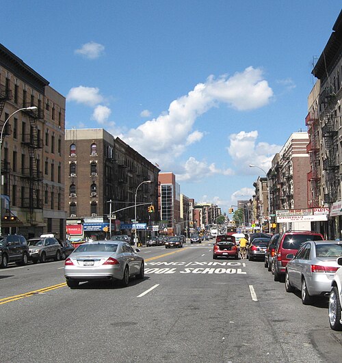
Amsterdam Avenue 164, Washington Heights (South)
Washington Heights (South) · Amsterdam Avenue 164
Photo: Jim.henderson, Public domain · Wikimedia Commons
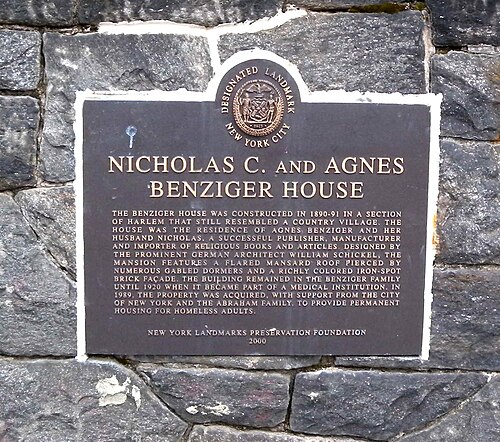
Benziger 345 Edgecomb Plaque, Hamilton Heights-Sugar Hill
Hamilton Heights-Sugar Hill · Benziger 345 Edgecomb Plaque
Photo: Jim.henderson, Public domain · Wikimedia Commons

How neighborhoods moved each quarter

2022

Whole-area crime rate 15.9 to 17.5 per 1,000 (high: Q2 2022).

No neighborhood moved more than three places in a quarter.

2023

Whole-area crime rate 15.8 to 17.7 per 1,000 (high: Q3 2023).

Big moves (4+ places in a quarter): moved up Washington Heights (South) 9th→5th (Q4)

2024

Whole-area crime rate 15.5 to 17.2 per 1,000 (high: Q3 2024).

No neighborhood moved more than three places in a quarter.

2025

Whole-area crime rate 16.0 to 17.1 per 1,000 (high: Q2 2025).

No neighborhood moved more than three places in a quarter.

2026

Whole-area crime rate 15.2 to 16.7 per 1,000 (high: Q2 2026). 2 quarters so far.

Big moves (4+ places in a quarter): moved up Upper East Side-Carnegie Hill 9th→5th (Q1)

Reported Safety Incidents

In Q2 2026: public order incidents were 49% (7,486), property incidents were 24% (3,610), violent incidents were 18% (2,823) and vehicle crimes were 5% (838).

Recorded crime here is grouped into violent crime, property crime (burglary and theft), vehicle crime and public order offences, so you can compare how safe each neighborhood is for the kind of crime that matters to you.

Read category comparisons with care. A category that jumps while the total hardly moves looks like a change in how offences are classified, not in what happened: Q1 2026: violent down 45% while the total moved 5%. The whole-area rate is the steadier guide.

Places we left out, and places to read with care

Left out: Central Park; Highbridge Park; Inwood Hill Park. They have almost no residents: their crimes are against visitors, so a rate per resident says little about living there.

Randall's Island (40.9 per 1,000 from 98 crimes among 2,395 residents) is a place with few residents (under 3,000): a rate on so few people says little about living there, so it is not named as the lowest or highest.

The 16 neighborhoods on the map

Manhattan North is made of 16 neighborhoods compared here, each in its own colour on the map. They are the City Planning “Neighborhood Tabulation Areas”: 918,254 residents between them.

  • East Harlem (North)
  • East Harlem (South)
  • Hamilton Heights-Sugar Hill
  • Harlem (North)
  • Harlem (South)
  • Inwood
  • Manhattanville-West Harlem
  • Morningside Heights
  • Randall's Island
  • Upper East Side-Carnegie Hill
  • Upper East Side-Yorkville
  • Upper West Side (Central)
  • Upper West Side-Lincoln Square
  • Upper West Side-Manhattan Valley
  • Washington Heights (North)
  • Washington Heights (South)

All 16 neighborhoods, Q2 2026

Crimes per 1,000 residents, Q2 2026, lowest first. The last two columns compare with Q1 2022.
#NeighborhoodResidentsAllViolentPropertyVehiclePublic orderRate vs Q1 2022Places gained
1Upper East Side-Yorkville78,5495.90.61.60.13.4down31%–
2Upper West Side (Central)101,15310.11.42.70.55.2up11%–
3Morningside Heights37,71610.21.92.60.74.6down2%–
4Upper West Side-Lincoln Square69,90913.21.53.90.27.4up25%–
5Upper East Side-Carnegie Hill56,07313.61.34.60.57.1down20%up4
6Upper West Side-Manhattan Valley50,13213.72.63.00.67.2down3%–
7Washington Heights (North)74,03014.72.93.21.07.1down0%up1
8Washington Heights (South)76,07915.83.73.81.26.5up8%down1
9Hamilton Heights-Sugar Hill53,59816.83.44.01.17.5down6%up1
10Inwood36,85018.44.33.92.37.1up38%down5
11East Harlem (South)61,87521.14.34.01.010.8up16%–
12Harlem (North)86,56522.74.65.11.011.0up23%–
13Manhattanville-West Harlem21,63824.75.16.21.510.9up5%–
14Harlem (South)48,44628.44.76.20.815.9up15%–
15East Harlem (North)63,24630.16.26.62.014.4down3%–
16Randall's Island †2,39540.97.19.611.711.7down9%–

† Randall's Island is a place with few residents. A rate on a very small number of residents or crimes is not comparable with the others.

Photographs

95 photographs of the 16 neighborhoods run along the reel; click one to see it full size. Each is credited here and under the large view.

All 95 photographs and their credits
  1. Upper East Side-Yorkville · Holy Trinity CoE E88. Photo: Jim.henderson, Public domain · Wikimedia Commons
  2. Morningside Heights · Amsterdam Avenue Looking North at Columbia University. Photo: Gino maccanti from spain, CC BY 2.0 · Wikimedia Commons
  3. Upper West Side-Lincoln Square · "The Opera Tune by Mr. Lock" as It Appears in the 1669 Edition of Apollo's Banquet. Photo: Kosboot, CC0 · Wikimedia Commons
  4. Upper East Side-Carnegie Hill · 77 St IRT Station Downtown (IRT = Interborough Rapid Transit, a New York City subway division). Photo: Jim.henderson, CC0 · Wikimedia Commons
  5. Upper West Side-Manhattan Valley · AYH Amst 103. Photo: Jim.henderson, Public domain · Wikimedia Commons
  6. Washington Heights (North) · 187 St Steps. Photo: Jim.henderson, Public domain · Wikimedia Commons
  7. Washington Heights (South) · Amsterdam Avenue 164. Photo: Jim.henderson, Public domain · Wikimedia Commons
  8. Hamilton Heights-Sugar Hill · Benziger 345 Edgecomb Plaque. Photo: Jim.henderson, Public domain · Wikimedia Commons
  9. Inwood · 207 Yard Fr Univ Heights Br. Photo: Jim.henderson, CC0 · Wikimedia Commons
  10. East Harlem (South) · 2d Avenue 103 St Washington NYCHA. Photo: Jim.henderson, CC0 · Wikimedia Commons
  11. Harlem (North) · Harlem Mcdonalds. Photo: Aude, CC BY 2.5 · Wikimedia Commons
  12. Manhattanville-West Harlem · 137st IRT St (IRT = Interborough Rapid Transit, a New York City subway division). Photo: Jim.henderson, Public domain · Wikimedia Commons
  13. Harlem (South) · Harlem - Graham Court. Photo: Ajay Suresh from New York, NY, USA, CC BY 2.0 · Wikimedia Commons
  14. East Harlem (North) · 126st Bus Depot. Photo: Jim.henderson, Public domain · Wikimedia Commons
  15. Randall's Island · Little Hell Gate in 2008. Photo: Jim.henderson, Public domain · Wikimedia Commons
  16. Central Park · Central Park. Photo: Jorge Láscar from Australia, CC BY 2.0 · Wikimedia Commons
  17. Highbridge Park · 33 Precinct Edgecomb 170. Photo: Jim.henderson, CC0 · Wikimedia Commons
  18. Inwood Hill Park · Former Harlem River. Photo: Jim.henderson, Public domain · Wikimedia Commons
  19. Upper East Side-Yorkville · 1615 First Avenue. Photo: Eden, Janine and Jim from New York City, CC BY 2.0 · Wikimedia Commons
  20. Morningside Heights · Columbia Teachers College Pale. Photo: Jim.henderson, CC0 · Wikimedia Commons
  21. Upper West Side-Lincoln Square · Elinor Bunin Monroe Film Center, November 27, 2023. Photo: D. Benjamin Miller, CC0 · Wikimedia Commons
  22. Upper East Side-Carnegie Hill · 898 Park Avenue 79th St Co-Op. Photo: Jim.henderson, CC BY 4.0 · Wikimedia Commons
  23. Upper West Side-Manhattan Valley · 106st Columbus Avenue. Photo: Jim.henderson, CC0 · Wikimedia Commons
  24. Washington Heights (South) · 2025 Summer Streets, August 9, 163rd St & Broadway 01. Photo: SWinxy, CC BY 4.0 · Wikimedia Commons
  25. Hamilton Heights-Sugar Hill · 1854 10th Avenue 32d Precinct 2021. Photo: Jim.henderson, CC BY 4.0 · Wikimedia Commons
  26. Inwood · Audubon Partnership W207. Photo: Jim.henderson, CC0 · Wikimedia Commons
  27. East Harlem (South) · 203 PARK AVENUE, NORTH FROM 98TH STREET N.Y.C. and H R.R.R. TRACKS. Photo: unknown author, Public domain · Wikimedia Commons
  28. Harlem (North) · 211 W141 Borromeo Roman Catholic Church 1888. Photo: Jim.henderson, CC0 · Wikimedia Commons
  29. Manhattanville-West Harlem · Croton-gatehouse. Photo: Americasroof, CC BY 3.0 · Wikimedia Commons
  30. East Harlem (North) · Associated SM E116. Photo: Jim.henderson, CC0 · Wikimedia Commons
  31. Randall's Island · East River Plaza Harlem River. Photo: Jim.henderson, CC0 · Wikimedia Commons
  32. Central Park · Central Park. Photo: Jorge Láscar from Australia, CC BY 2.0 · Wikimedia Commons
  33. Upper East Side-Yorkville · 400 East 85th Street. Photo: Eden, Janine and Jim from New York City, CC BY 2.0 · Wikimedia Commons
  34. Morningside Heights · Columbia Russell Hall Tower. Photo: Jim.henderson, CC0 · Wikimedia Commons
  35. Upper East Side-Carnegie Hill · 898 Park Avenue Co-Op. Photo: Jim.henderson, CC BY 4.0 · Wikimedia Commons
  36. Upper West Side-Manhattan Valley · 4.15.12StrausPark100thTitanicAnniversaryByLuigiNovi9. Photo: Nightscream, CC BY 3.0 · Wikimedia Commons
  37. Hamilton Heights-Sugar Hill · ACP Jr PS 153 in 2021. Photo: Jim.henderson, CC BY 4.0 · Wikimedia Commons
  38. Inwood · Church of the Good Shepherd, NYC. Photo: Kenneth C. Zirkel, CC BY 4.0 · Wikimedia Commons
  39. East Harlem (South) · 2076 First Avenue. Photo: Eden, Janine and Jim from New York City, CC BY 2.0 · Wikimedia Commons
  40. Harlem (North) · Drew Hamilton NYCHA. Photo: Jim.henderson, CC0 · Wikimedia Commons
  41. Manhattanville-West Harlem · Annunciation Roman Catholic Church Cloudy Gps. Photo: Jim.henderson, CC0 · Wikimedia Commons
  42. East Harlem (North) · 34 East 125 St Cloudy. Photo: Jim.henderson, CC0 · Wikimedia Commons
  43. Randall's Island · Little Hell Gate Meander. Photo: Jim.henderson, CC0 · Wikimedia Commons
  44. Central Park · Central Park, New York, NY, USA. Photo: Raman Patel, CC BY 3.0 · Wikimedia Commons
  45. Upper East Side-Yorkville · Avenue Church NYC at 1745 1st Avenue in NYC. Photo: Pisek1745, CC0 · Wikimedia Commons
  46. Morningside Heights · Alma Mater. Photo: Bohao Zhao, CC BY 3.0 · Wikimedia Commons
  47. Upper East Side-Carnegie Hill · 79th Street Transverse. Photo: Eden, Janine and Jim from New York City, CC BY 2.0 · Wikimedia Commons
  48. Upper West Side-Manhattan Valley · Ascension Roman Catholic Church 107 St. Photo: Jim.henderson, CC BY 3.0 · Wikimedia Commons
  49. Hamilton Heights-Sugar Hill · 563 W145 St 2021. Photo: Jim.henderson, CC BY 4.0 · Wikimedia Commons
  50. Inwood · Inwood, Manhattan, NYC. Photo: AmaboDucem (talk), Public domain · Wikimedia Commons
  51. East Harlem (South) · 2033 First Avenue. Photo: Eden, Janine and Jim from New York City, CC BY 2.0 · Wikimedia Commons
  52. Manhattanville-West Harlem · City College of New York - Bernard and Anne Spitzer School of Architecture. Photo: Ajay Suresh from New York, NY, USA, CC BY 2.0 · Wikimedia Commons
  53. East Harlem (North) · 126th. St. Manhattan, New York, 6 April, 2011 - Flickr - PhillipC. Photo: Phillip Capper from Wellington, New Zealand, CC BY 2.0 · Wikimedia Commons
  54. Randall's Island · Amtrak Northb Train Randalls Island. Photo: Jim.henderson, CC0 · Wikimedia Commons
  55. Central Park · Central Park, New York, NY, USA. Photo: Raman Patel, CC BY 3.0 · Wikimedia Commons
  56. Upper East Side-Yorkville · Avenue Church NYC. Photo: Pisek1745, CC0 · Wikimedia Commons
  57. Morningside Heights · Apartment Houses, Claremont Avenue Near 116th St., New York City LCCN2002698451. Photo: Miscellaneous Items in High Demand, PPOC, Library of Congress, Public domain · Wikimedia Commons
  58. Upper East Side-Carnegie Hill · (USA-New York) Metropolitan Transportation Authority 6184 NY-MTA-BB8222 M79 2024-06-19. Photo: S5A-0043, CC BY 4.0 · Wikimedia Commons
  59. Upper West Side-Manhattan Valley · 245 W103 St Bogie Plaque. Photo: Jim.henderson, CC BY 3.0 · Wikimedia Commons
  60. Hamilton Heights-Sugar Hill · 2025 Summer Streets, August 9, 144th St & Broadway 02. Photo: SWinxy, CC BY 4.0 · Wikimedia Commons
  61. Manhattanville-West Harlem · City College of New York - Welcome. Photo: Ajay Suresh from New York, NY, USA, CC BY 2.0 · Wikimedia Commons
  62. East Harlem (North) · Banca Commerciale Italiana Trust 2256 2d Avenue 116 St East Harlem. Photo: Jim.henderson, CC BY 3.0 · Wikimedia Commons
  63. Randall's Island · Icahn Stadium 2008. Photo: Jim.henderson at English Wikipedia, Public domain · Wikimedia Commons
  64. Central Park · Central Park, New York, United States (Unsplash). Photo: David outerwoodsmedia, CC0 · Wikimedia Commons
  65. Morningside Heights · Columbia Business School - Uris Hall. Photo: Ajay Suresh from New York, NY, USA, CC BY 2.0 · Wikimedia Commons
  66. Upper East Side-Carnegie Hill · (USA-New York) Metropolitan Transportation Authority 6231 NY-MTA-BC2149 M79 2024-06-19. Photo: S5A-0043, CC BY 4.0 · Wikimedia Commons
  67. Upper West Side-Manhattan Valley · 850-854 West End Avenue. Photo: Jim.henderson, CC BY 4.0 · Wikimedia Commons
  68. Manhattanville-West Harlem · 135 St Gatehouse 2020 (0). Photo: Jim.henderson, CC BY 4.0 · Wikimedia Commons
  69. East Harlem (North) · 34 East 125th Street. Photo: Eden, Janine and Jim from New York City, CC BY 2.0 · Wikimedia Commons
  70. Randall's Island · Acela Crosses Little Hell Gate Southbound Fr Under TBB. Photo: Jim.henderson, CC0 · Wikimedia Commons
  71. Central Park · Central Park, New York, United States (Unsplash 7FAhq93 Ir8). Photo: Chanan Greenblatt chanan, CC0 · Wikimedia Commons
  72. Morningside Heights · CX45 6838. Photo: MTATransitFan, CC BY 3.0 · Wikimedia Commons
  73. Upper East Side-Carnegie Hill · (USA-New York) Metropolitan Transportation Authority 6155 NY-MTA-BB7975 M79 2024-06-19. Photo: S5A-0043, CC BY 4.0 · Wikimedia Commons
  74. Upper West Side-Manhattan Valley · 2680 Broadway. Photo: Jim.henderson, CC BY 4.0 · Wikimedia Commons
  75. Manhattanville-West Harlem · 137th Street – City College Northbound Elevator Structure. Photo: Reconrabbit, CC0 · Wikimedia Commons
  76. East Harlem (North) · 2336 First Avenue. Photo: Eden, Janine and Jim from New York City, CC BY 2.0 · Wikimedia Commons
  77. Randall's Island · Hell Gate Randalls Arcade. Photo: Jim.henderson, CC BY 3.0 · Wikimedia Commons
  78. Central Park · Central Park, New York, United States (Unsplash EtVyMCyJJfQ). Photo: Matthew Pla mattpla, CC0 · Wikimedia Commons
  79. Morningside Heights · Academy 6405. Photo: MTATransitFan, CC BY 3.0 · Wikimedia Commons
  80. Upper West Side-Manhattan Valley · Bloomingdale NYPL W100 St 2021. Photo: Jim.henderson, CC BY 4.0 · Wikimedia Commons
  81. Manhattanville-West Harlem · Downtown 1 Train Approaching 125th Street Station June 2026 1. Photo: 4300streetcar, CC BY 4.0 · Wikimedia Commons
  82. East Harlem (North) · 125th Street Library. Photo: Eden, Janine and Jim from New York City, CC BY 2.0 · Wikimedia Commons
  83. Randall's Island · Brompton Tourist Under Hellgate Arcade. Photo: Jim.henderson, CC BY 3.0 · Wikimedia Commons
  84. Central Park · Bethesda Fountain In Central Park. Photo: Emiliano Carchia, CC BY 3.0 · Wikimedia Commons
  85. Morningside Heights · Academy 1618. Photo: MTATransitFan, CC BY 3.0 · Wikimedia Commons
  86. East Harlem (North) · 201 East 125th Street. Photo: Eden, Janine and Jim from New York City, CC BY 2.0 · Wikimedia Commons
  87. Randall's Island · February 1 Snow Storm. Photo: Metropolitan Transportation Authority of the State of New York from United States of America, CC BY 2.0 · Wikimedia Commons
  88. Central Park · 4953 M86. Photo: MTATransitFan, CC BY 3.0 · Wikimedia Commons
  89. Morningside Heights · 9625 NIS. Photo: MTATransitFan, CC BY 3.0 · Wikimedia Commons
  90. Randall's Island · Acela Crosses Little Hell Gate Southbound Fr Under TBB Cropped. Photo: Jim.henderson, CC0 · Wikimedia Commons
  91. Central Park · Baseball Fields in Central Park. Photo: Maarten Heerlien from Voorschoten, The Netherlands, CC BY 2.0 · Wikimedia Commons
  92. Morningside Heights · Avery Architectural and Fine Arts Library. Photo: ajay_suresh, CC BY 2.0 · Wikimedia Commons
  93. Randall's Island · Little Hell Gate Bridge. Photo: Plantsmushrooms, CC BY 4.0 · Wikimedia Commons
  94. Morningside Heights · 2018-Pulitzer-Prizes-photo-studio. Photo: Fuzheado, CC0 · Wikimedia Commons
  95. Randall's Island · Manhattan Psych Center 2022. Photo: User:Jim.henderson, CC BY 4.0 · Wikimedia Commons

Sources and notes

CrimesLog sources crime incident data published by the New York City Police Department (NYPD) through the NYC Open Data Portal, containing public sector information governed by the NYC Open Data Law (Local Law 11 of 2012) and the NYC.gov Terms of Use.

Population: U.S. Census Bureau, American Community Survey 5-year estimates (public domain).

First-place medal: 1st Place Medal emoji icon by Icons8.

Neighborhood boundaries are defined by NYC Department of City Planning, 2020 Neighborhood Tabulation Areas (NYC Open Data), merged and simplified by CrimesLog. The photographs are credited under each picture.

Rates are recorded crimes per 1,000 residents, quarter by quarter; where a neighborhood has fewer than 100 residents the rate would be worked out on 100 (those places are left out of the race). A count of recorded crime is not a verdict on any neighborhood.