Los Angeles, California · Neighborhood crime trends

Los Angeles Westside and South Bay

19 neighborhoods - a quarterly race to the lowest crime rate.

Crime Trends: Neighborhoods compared - each quarter from Q1 2022

Los Angeles as a whole averaged 14.4 crimes for every 1,000 residents per quarter in Q2 2026, while Westside and South Bay averaged 10.8, hence it is generally safer when all crimes are considered.

How do the 19 neighborhoods of Westside and South Bay compare? In Q2 2026 the police recorded 4,749 crimes across them, 10.8 for every 1,000 residents. That is 2.1% below a year earlier and 17.2% below Q1 2022, the first quarter we track.

Beverlywood has the lowest rate of the everyday neighborhoods (4.2 per 1,000), followed by Bel-Air (4.4) and Beverly Crest (4.9). Westchester has the highest (23.6).

Use the RACE CHARTS below to watch all 19 LOS ANGELES WESTSIDE AND SOUTH BAY NEIGHBORHOODs race across 18 quarter periods from Q1 2022 to Q2 2026 - one crime category at a time or all together. The race chart can be used to compare average crime rates by category against Los Angeles's average.

Neighborhood boundaries are defined by Mapping L.A. (Los Angeles Times, CC BY 4.0) and simplified by CrimesLog.
Lowest rate (everyday)
lowest rateBeverlywood
4.2 crimes per 1,000 residents, Q2 2026
Highest rate
upWestchester
23.6 per 1,000, Q2 2026
Whole area, Q2 2026
10.8 per 1,000
down 2.1% below a year earlier · down 17.2% below Q1 2022
Compared
19 neighborhoods
441,500 residents · 18 quarters

Los Angeles Westside and South Bay neighborhood quarterly crime race

Press ▶︎ to watch Q1 2022 to Q2 2026. Tick one crime category or several; hover a bar for the neighborhood. Property crimes includes burglaries and thefts.

Crime categories
Indicated: crimes rate per 1000 residents per quarterAll · safest at the top · square-root scale · Q1 2022 to Q2 2026015108.0Bel-Air6.0Beverly Crest8.0Beverlywood9.6Brentwood16.0Century City11.8Cheviot Hills13.6Del Rey7.8Mar Vista7.0Pacific Palisades10.6Palms12.7Pico-Robertson10.9Playa del Rey12.6Playa Vista20.4Rancho Park16.4Sawtelle23.5Venice15.8West Los Angeles23.8Westchester6.7WestwoodLos Angeles Q2 2026 average all crimes (14.4)Numbers are crimes per 1,000 residents per quarter. Zero-crime quarters show 0 and rank safest.
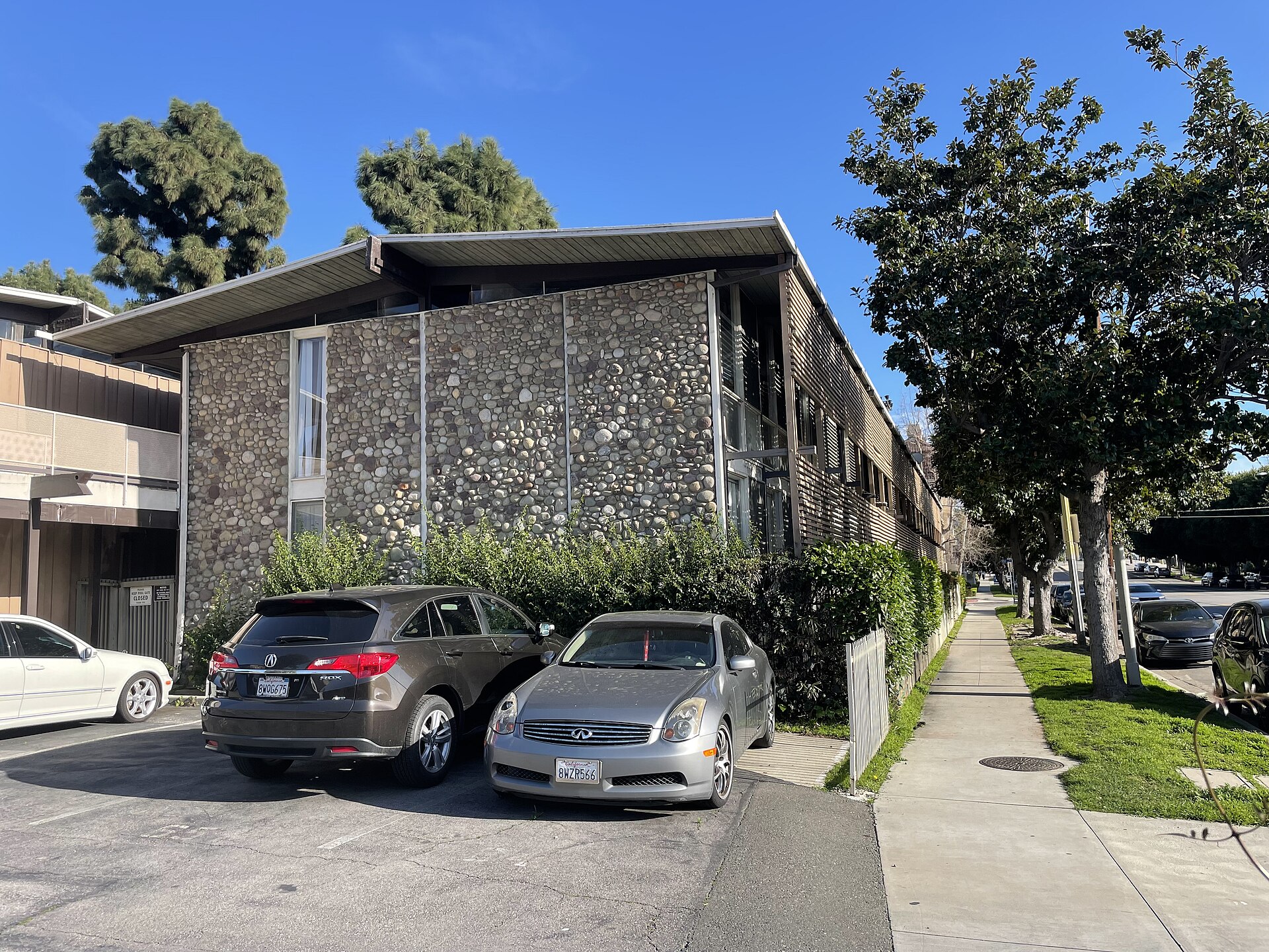
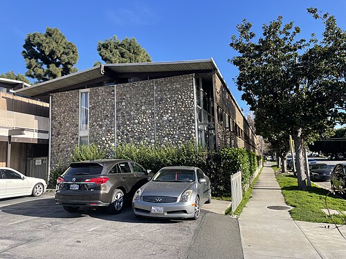
Sepulveda Rose Apartments Side View, Palms You checked the neighborhood.Now check an address ! Photo: Blervis, CC0 · Wikimedia Commons

For $34.00 a CrimesLog™ Home Report provides: (where available)

  • Nearest 6 Pre-school Nurseries to Address
  • Nearest 6 Primary Schools to Address
  • Nearest 6 Secondary/High Schools to Address
  • Nearest College and University to Address
  • Nearest to Address Medical Clinics, Hospitals and Pharmacies
  • Nearest 2 Police Station details to Address

The Home Report also provides

  • The CrimesLog™ Home Score is a proprietary Home Safety Measure capturing crime frequency, severity, recency and proximity to Address from police crime reporting point
  • A map indicating police anonymized crime reporting points around Address
  • Crime category trendlines for Address neighborhood
  • List of Reported Crime Incidents around Address radius
  • Downloadable PDF report — A Permanent Copy to Keep and Share to aid your Property Research
  • Our crimes database of almost 60 million records is UPDATED EVERY MONTH from US, UK, CA police sources
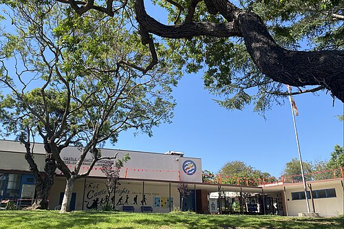
2024-07 - LAUSD - Castle Heights School - 9755 Cattaraugus Avenue, Los Angeles, CA 90034 USA 02, Beverlywood
Beverlywood · 2024-07 - LAUSD - Castle Heights School - 9755 Cattaraugus Avenue, Los Angeles, CA 90034 USA 02
Photo: Jengod, CC0 · Wikimedia Commons
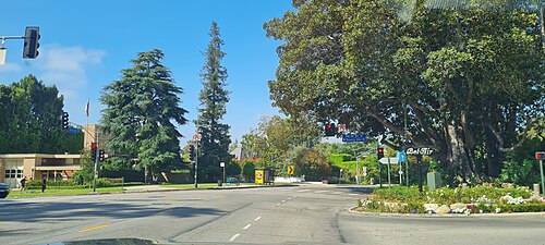
Bel Air, Los Angeles, Bel-Air
Bel-Air · Bel Air, Los Angeles
Photo: Derbrauni, CC BY 4.0 · Wikimedia Commons
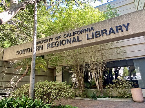
University of California Southern Regional Library at UCLA Entrance 2024 September 01, Westwood
Westwood · University of California Southern Regional Library at UCLA Entrance 2024 September 01
Photo: Jengod, CC0 · Wikimedia Commons
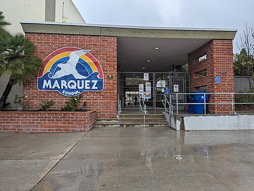
Exterior Photo of Marquez Charter School, Pacific Palisades
Pacific Palisades · Exterior Photo of Marquez Charter School
Photo: Jackg98, CC BY 4.0 · Wikimedia Commons
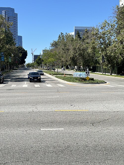
Avenue of the Stars, Century City (Los Angeles) from Pico Bld, Cheviot Hills
Cheviot Hills · Avenue of the Stars, Century City (Los Angeles) from Pico Bld
Photo: Alexis Doine, CC0 · Wikimedia Commons
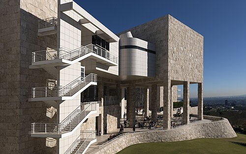
A Portion of the Getty Center in Los Angeles, California, One of Two Art Museums That Are Part of the Getty Museum LCCN2, Brentwood
Brentwood · A Portion of the Getty Center in Los Angeles, California, One of Two Art Museums That Are Part of the Getty Museum LCCN2
Photo: Carol M. Highsmith, Public domain · Wikimedia Commons
Sepulveda Rose Apartments Side View, Palms
Palms · Sepulveda Rose Apartments Side View
Photo: Blervis, CC0 · Wikimedia Commons
Museum of Tolerance, Social Lab, Pico-Robertson
Pico-Robertson · Museum of Tolerance, Social Lab
Photo: Alexis Doine, CC0 · Wikimedia Commons

How neighborhoods moved each quarter

2022

Whole-area crime rate 12.7 to 13.4 per 1,000 (high: Q2 2022).

Big moves (4+ places in a quarter): moved down Beverly Crest 1st→5th (Q2) moved up Del Rey 13th→9th (Q2) moved down Bel-Air 2nd→7th (Q3) moved up Cheviot Hills 11th→4th (Q4) moved down Beverlywood 3rd→7th (Q4)

2023

Whole-area crime rate 13.1 to 13.8 per 1,000 (high: Q3 2023).

Big moves (4+ places in a quarter): moved up Beverlywood 7th→1st (Q1) moved up Bel-Air 8th→3rd (Q1) moved down Westwood 1st→7th (Q1) moved up Beverly Crest 5th→1st (Q2) moved up West Los Angeles 14th→7th (Q2) moved down Beverlywood 1st→8th (Q2) moved down Pico-Robertson 10th→14th (Q2) moved down Brentwood 3rd→7th (Q4) moved up Playa del Rey 13th→8th (Q4)

2024

Whole-area crime rate 12.1 to 12.5 per 1,000 (high: Q3 2024).

Big moves (4+ places in a quarter): moved up Beverlywood 6th→1st (Q1) moved up Brentwood 7th→3rd (Q1) moved up Playa Vista 14th→7th (Q1) moved down Bel-Air 1st→10th (Q1) moved down Playa del Rey 8th→14th (Q1) moved up Mar Vista 6th→1st (Q2) moved up Bel-Air 10th→2nd (Q2) moved up Westwood 7th→2nd (Q3) moved down Bel-Air 2nd→7th (Q3) moved up Pico-Robertson 13th→9th (Q3) moved up Playa del Rey 14th→10th (Q3) moved down Playa Vista 8th→14th (Q3) moved up Pacific Palisades 5th→1st (Q4) moved up Playa del Rey 10th→2nd (Q4) moved down Westwood 2nd→6th (Q4) moved up Cheviot Hills 12th→8th (Q4) moved down Beverly Crest 3rd→9th (Q4)

2025

Whole-area crime rate 10.3 to 11.3 per 1,000 (high: Q1 2025).

Big moves (4+ places in a quarter): moved up Westwood 6th→2nd (Q1) moved up Cheviot Hills 8th→3rd (Q1) moved down Playa del Rey 2nd→8th (Q1) moved up Bel-Air 10th→4th (Q2) moved up Playa Vista 13th→9th (Q2) moved down Cheviot Hills 3rd→10th (Q2) moved down Bel-Air 4th→8th (Q3) moved up Palms 9th→5th (Q4) moved down Beverlywood 2nd→6th (Q4) moved down Playa Vista 10th→14th (Q4)

2026

Whole-area crime rate 10.3 to 10.8 per 1,000 (high: Q2 2026). 2 quarters so far.

Big moves (4+ places in a quarter): moved up Cheviot Hills 9th→2nd (Q1) moved down Brentwood 3rd→7th (Q1) moved down Palms 5th→10th (Q1) moved down Pacific Palisades 1st→5th (Q2) moved down Cheviot Hills 2nd→6th (Q2) moved down Playa del Rey 9th→14th (Q2)

Reported Safety Incidents

In Q2 2026: property incidents were 53% (2,504), vehicle crimes were 20% (944), violent incidents were 17% (797) and public order incidents were 10% (452).

Recorded crime here is grouped into violent crime, property crime (burglary and theft), vehicle crime and public order offences, so you can compare how safe each neighborhood is for the kind of crime that matters to you.

Places we left out, and places to read with care

No place is left out: every neighborhood in this race has residents to count.

The 19 neighborhoods on the map

Westside and South Bay is made of 19 neighborhoods compared here, each in its own colour on the map. They are the neighborhoods of Mapping L.A. (Los Angeles Times, CC BY 4.0), grouped into five areas of the city by CrimesLog: 441,500 residents between them.

  • Bel-Air
  • Beverly Crest
  • Beverlywood
  • Brentwood
  • Century City
  • Cheviot Hills
  • Del Rey
  • Mar Vista
  • Pacific Palisades
  • Palms
  • Pico-Robertson
  • Playa del Rey
  • Playa Vista
  • Rancho Park
  • Sawtelle
  • Venice
  • West Los Angeles
  • Westchester
  • Westwood

All 19 neighborhoods, Q2 2026

Crimes per 1,000 residents, Q2 2026, lowest first. The last two columns compare with Q1 2022.
#NeighborhoodResidentsAllViolentPropertyVehiclePublic orderRate vs Q1 2022Places gained
1Beverlywood6,2684.20.82.20.50.5down48%up5
2Bel-Air7,5404.40.33.60.30.3down45%up3
3Beverly Crest9,8504.90.82.70.90.3down19%down2
4Westwood55,6075.30.93.30.90.3down20%down2
5Pacific Palisades23,6795.50.93.40.70.3down22%down2
6Cheviot Hills7,2026.41.13.21.10.8down46%up4
7Brentwood33,5296.51.13.81.00.6down32%–
8Mar Vista36,7707.51.14.31.60.5down3%down4
9Palms42,6278.21.43.32.60.8down23%down1
10Pico-Robertson19,0718.71.74.71.20.9down32%up2
11Playa Vista13,9788.71.15.41.70.2down31%–
12West Los Angeles15,5039.61.74.82.10.8down40%up2
13Del Rey29,34010.62.14.72.90.8down22%–
14Playa del Rey10,68312.12.54.92.91.7up10%down5
15Sawtelle40,11212.81.86.82.71.4down22%up1
16Rancho Park4,46813.72.08.12.90.7down33%up1
17Venice35,07120.04.89.53.02.5down15%up1
18Century City7,44422.41.818.81.50.4up40%down3
19Westchester42,75823.63.312.05.22.8down1%–

Photographs

81 photographs of the 19 neighborhoods run along the reel; click one to see it full size. Each is credited here and under the large view.

All 81 photographs and their credits
  1. Beverlywood · 2024-07 - LAUSD - Castle Heights School - 9755 Cattaraugus Avenue, Los Angeles, CA 90034 USA 02. Photo: Jengod, CC0 · Wikimedia Commons
  2. Bel-Air · Bel Air, Los Angeles. Photo: Derbrauni, CC BY 4.0 · Wikimedia Commons
  3. Westwood · University of California Southern Regional Library at UCLA Entrance 2024 September 01. Photo: Jengod, CC0 · Wikimedia Commons
  4. Pacific Palisades · Exterior Photo of Marquez Charter School. Photo: Jackg98, CC BY 4.0 · Wikimedia Commons
  5. Cheviot Hills · Avenue of the Stars, Century City (Los Angeles) from Pico Bld. Photo: Alexis Doine, CC0 · Wikimedia Commons
  6. Brentwood · A Portion of the Getty Center in Los Angeles, California, One of Two Art Museums That Are Part of the Getty Museum LCCN2. Photo: Carol M. Highsmith, Public domain · Wikimedia Commons
  7. Palms · Sepulveda Rose Apartments Side View. Photo: Blervis, CC0 · Wikimedia Commons
  8. Pico-Robertson · Museum of Tolerance, Social Lab. Photo: Alexis Doine, CC0 · Wikimedia Commons
  9. West Los Angeles · Sign Neighborhood Rancho Park, Los Angeles. Photo: Alexis Doine, CC0 · Wikimedia Commons
  10. Del Rey · Centinela Avenue 7. Photo: Mx. Granger, CC0 · Wikimedia Commons
  11. Playa del Rey · Shoutout to the Sidewalk (Unsplash). Photo: Marion Michele marion_michele, CC0 · Wikimedia Commons
  12. Sawtelle · Centinela Avenue 2. Photo: Mx. Granger, CC0 · Wikimedia Commons
  13. Venice · Los Angeles CA 20220925 (19). Photo: Sony 1992, CC0 · Wikimedia Commons
  14. Century City · Avenue of the Stars & Century City Center Construction 2024. Photo: Alexis Doine, CC0 · Wikimedia Commons
  15. Westchester · South Bay Los Angeles CA 20210211 (226). Photo: Sony 1992, CC0 · Wikimedia Commons
  16. Bel-Air · Los Angeles. Photo: sergei.gussev, CC BY 2.0 · Flickr
  17. Westwood · Boulevard Montmartre, Mardi Graslabel QS:Lavk,"Montmartre Bedom, Kielcek (Trutca Ke Pissarro)"label QS:Lfr,"Boulevard Mo. Photo: Camille Pissarro, CC0 · Wikimedia Commons
  18. Pacific Palisades · Eames House. Photo: edward stojakovic from Portland, OR, United States, CC BY 2.0 · Wikimedia Commons
  19. Cheviot Hills · The Century Towers, Los Angeles (Aug. 2024). Photo: Alexis Doine, CC0 · Wikimedia Commons
  20. Brentwood · The Getty Museum, Los Angeles, United States (Unsplash). Photo: Vladimir Kudinov madbyte, CC0 · Wikimedia Commons
  21. Palms · Sepulveda Rose Apartments at the Corner of Rose and Sepulveda. Photo: Blervis, CC0 · Wikimedia Commons
  22. Pico-Robertson · Harry and Jeanette Weinberg Building (Simon Wiesenthal Center), Los Angeles. Photo: Alexis Doine, CC0 · Wikimedia Commons
  23. West Los Angeles · Office Building, 1990 Westwood Boulevard (Los Angeles). Photo: Alexis Doine, CC0 · Wikimedia Commons
  24. Del Rey · Centinela Avenue 5. Photo: Mx. Granger, CC0 · Wikimedia Commons
  25. Sawtelle · Sawtelle, Los Angeles, CA, USA - Panoramio - Peter Boy12qq12 (11). Photo: peter boy12qq12, CC BY 3.0 · Wikimedia Commons
  26. Century City · InterContinental Los Angeles Century City at Beverly Hills, Sept. 2024. Photo: Alexis Doine, CC0 · Wikimedia Commons
  27. Westchester · South Bay Los Angeles CA 20210211 (359). Photo: Sony 1992, CC0 · Wikimedia Commons
  28. Westwood · Bottom of Bunche Hall, UCLA. Photo: ideowl, CC BY 2.0 · Wikimedia Commons
  29. Pacific Palisades · Eames House. Photo: edward stojakovic, CC BY 2.0 · Wikimedia Commons
  30. Cheviot Hills · West Pico Boulevard at Century City (August 2024). Photo: Alexis Doine, CC0 · Wikimedia Commons
  31. Brentwood · From the Getty Museum - Panoramio - Alistair Cunningham. Photo: Alistair Cunningham, CC BY 3.0 · Wikimedia Commons
  32. Palms · Sepulveda Rose Apartments Line. Photo: Blervis, CC0 · Wikimedia Commons
  33. Pico-Robertson · Museum of Tolerance, Los Angeles, August 2024. Photo: Alexis Doine, CC0 · Wikimedia Commons
  34. West Los Angeles · Los Angeles California Temple from Overland Avenue (WestWood, L.A.) 2024. Photo: Alexis Doine, CC0 · Wikimedia Commons
  35. Sawtelle · Sawtelle, Los Angeles, CA, USA - Panoramio - Peter Boy12qq12 (14). Photo: peter boy12qq12, CC BY 3.0 · Wikimedia Commons
  36. Century City · Century Plaza Towers Century Park. Photo: Tony Hisgett from Birmingham, UK, CC BY 2.0 · Wikimedia Commons
  37. Westwood · Church of Saint Paul the Apostle (Westwood) & Ohio Avenue (Aug. 2024). Photo: Alexis Doine, CC0 · Wikimedia Commons
  38. Pacific Palisades · Eames House. Photo: edward stojakovic, CC BY 2.0 · Wikimedia Commons
  39. Brentwood · Getty Museum. Photo: Rennett Stowe from USA, CC BY 2.0 · Wikimedia Commons
  40. Palms · Sepulveda Rose Apartments Pool. Photo: Blervis, CC0 · Wikimedia Commons
  41. Pico-Robertson · Interior of Museum of Tolerance (Aug. 2024). Photo: Alexis Doine, CC0 · Wikimedia Commons
  42. West Los Angeles · St. Timothy School, Rancho Park (August 2024). Photo: Alexis Doine, CC0 · Wikimedia Commons
  43. Sawtelle · Sawtelle, Los Angeles, CA, USA - Panoramio - Peter Boy12qq12 (15). Photo: peter boy12qq12, CC BY 3.0 · Wikimedia Commons
  44. Century City · The Century Towers, Los Angeles (Sept. 2024). Photo: Alexis Doine, CC0 · Wikimedia Commons
  45. Westwood · Church Tower of Saint Paul the Apostle (Westwood). Photo: Alexis Doine, CC0 · Wikimedia Commons
  46. Pacific Palisades · 17518 Castellammare Drive. Photo: DanielMichaelPerry, CC0 · Wikimedia Commons
  47. Brentwood · Getty Center Architecture (Unsplash). Photo: Armando Castillejos acastillejos, CC0 · Wikimedia Commons
  48. Palms · Historical Clock Tower - Worth Avenue. PALM BEACH, FL. USA. Photo: Rob Olivera, CC BY 2.0 · Flickr
  49. West Los Angeles · 11111 Santa Monica Boulevard Tower, Los Angeles, October 2024. Photo: Alexis Doine, CC0 · Wikimedia Commons
  50. Sawtelle · Fantasy Island. Photo: Tony Hisgett from Birmingham, UK, CC BY 2.0 · Wikimedia Commons
  51. Century City · Century Plaza Towers. Photo: Tony Hisgett from Birmingham, UK, CC BY 2.0 · Wikimedia Commons
  52. Westwood · The Manor, Holmby Hills, Los Angeles, in 2008. Photo: Atwater Village Newbie, CC BY 2.0 · Wikimedia Commons
  53. Pacific Palisades · Los Angeles County. Photo: sergei.gussev, CC BY 2.0 · Flickr
  54. Brentwood · Getty Museum -6. Photo: Kevin Dooley from Chandler, AZ, USA, CC BY 2.0 · Wikimedia Commons
  55. West Los Angeles · Chinese Bible Church, West Pico Boulevard, LA. Photo: Alexis Doine, CC0 · Wikimedia Commons
  56. Sawtelle · Psychic, South Sepulveda Boulevard (Los Angeles) Oct. 2024. Photo: Alexis Doine, CC0 · Wikimedia Commons
  57. Century City · (From the Left) Park Elm I, Century Plaza South Tower & Constellation Place, from Westfield Century City. Photo: Alexis Doine, CC0 · Wikimedia Commons
  58. Westwood · Westwood Boulevard from Santa Monica Boulevard (August 2024). Photo: Alexis Doine, CC0 · Wikimedia Commons
  59. Pacific Palisades · Los Angeles County. Photo: sergei.gussev, CC BY 2.0 · Flickr
  60. Brentwood · 2024 Getty Center 08. Photo: Derbrauni, CC BY 4.0 · Wikimedia Commons
  61. West Los Angeles · Church Tower. Photo: Tony Hisgett from Birmingham, UK, CC BY 2.0 · Wikimedia Commons
  62. Sawtelle · Centinela Avenue 3. Photo: Mx. Granger, CC0 · Wikimedia Commons
  63. Century City · 2121 Avenue of the Stars (Fox Plaza), Sept. 2024. Photo: Alexis Doine, CC0 · Wikimedia Commons
  64. Westwood · Palisades Fire from UCLA 0668. Photo: BulkyOS, CC BY 4.0 · Wikimedia Commons
  65. Brentwood · 2024 Getty Center 05. Photo: Derbrauni, CC BY 4.0 · Wikimedia Commons
  66. West Los Angeles · Office Buildings, South Sepulveda Boulevard (Los Angeles), October 2024. Photo: Alexis Doine, CC0 · Wikimedia Commons
  67. Sawtelle · Sawtelle, Los Angeles, CA, USA - Panoramio - Peter Boy12qq12 (16). Photo: peter boy12qq12, CC BY 3.0 · Wikimedia Commons
  68. Century City · Anderson Towers, (1800 & 1900 Avenue of the Stars), Century City. Photo: Alexis Doine, CC0 · Wikimedia Commons
  69. Brentwood · Sweet Rose 1. Photo: Mx. Granger, CC0 · Wikimedia Commons
  70. West Los Angeles · Park Elm I (Left) & Century Plaza South Tower (Right) at Century City. Photo: Alexis Doine, CC0 · Wikimedia Commons
  71. Sawtelle · Sawtelle, Los Angeles, CA, USA - Panoramio - Peter Boy12qq12 (17). Photo: peter boy12qq12, CC BY 3.0 · Wikimedia Commons
  72. Century City · Century Park East (Street) & Century Park East Building. Photo: Alexis Doine, CC0 · Wikimedia Commons
  73. Brentwood · Commemorative Plaque for J. Paul Getty (Getty Center). Photo: Alexis Doine, CC0 · Wikimedia Commons
  74. West Los Angeles · Construction Site Westwood Bld, X Mississippi Avenue (August 2024). Photo: Alexis Doine, CC0 · Wikimedia Commons
  75. Sawtelle · West Los Angeles Streetcar Depot on the Grounds of the Sawtelle Veterans Home. Photo: SBW, CC BY 4.0 · Wikimedia Commons
  76. Century City · Watt Plaza North Tower (Century City). Photo: Alexis Doine, CC0 · Wikimedia Commons
  77. Brentwood · JackieRobinsonStadium. Photo: CASportsFan, CC0 · Wikimedia Commons
  78. West Los Angeles · Public Bookcase Thayer Avenue X Missouri Avenue (Westwood, Los Angeles). Photo: Alexis Doine, CC0 · Wikimedia Commons
  79. Century City · Fairmont Century Plaza, The Century & 2121 Avenue of the Stars (Century City). Photo: Alexis Doine, CC0 · Wikimedia Commons
  80. Century City · Century Park Plaza, Century City, Los Angeles. Photo: Alexis Doine, CC0 · Wikimedia Commons
  81. Century City · AMC Century City Entrance in September 2024. Photo: Alexis Doine, CC0 · Wikimedia Commons

Sources and notes

CrimesLog sources crime incident data published by the Los Angeles Police Department (LAPD) through the City of Los Angeles Open Data Portal (data.lacity.org), containing public sector information released under the Los Angeles Open Data Portal Terms of Use.

Population: U.S. Census Bureau, American Community Survey 5-year estimates (public domain).

First-place medal: 1st Place Medal emoji icon by Icons8.

Neighborhood boundaries are defined by Mapping L.A. (Los Angeles Times, CC BY 4.0), grouped into five areas of the city by CrimesLog and simplified by CrimesLog. The photographs are credited under each picture.

Rates are recorded crimes per 1,000 residents, quarter by quarter; where a neighborhood has fewer than 100 residents the rate would be worked out on 100 (those places are left out of the race). A count of recorded crime is not a verdict on any neighborhood.