Baton Rouge, Louisiana · Neighborhood crime trends

Baton Rouge District 12 (south)

14 neighborhoods - a quarterly race to the lowest crime rate.

Crime Trends: Neighborhoods compared - each quarter from Q1 2022

Baton Rouge as a whole averaged 27.4 crimes for every 1,000 residents per quarter in Q2 2026, while Metro Council District 12 (south) averaged 5.4 (leaving out 6 places with almost no residents), hence it is generally safer when all crimes are considered.

How do the 14 neighborhoods of Metro Council District 12 (south) compare? In Q2 2026 the police recorded 68 crimes across them, 5.4 for every 1,000 residents. That is 24.4% below a year earlier and 46.5% below Q1 2022, the first quarter we track.

Central Highland has the lowest rate of the everyday neighborhoods (1.4 per 1,000), followed by Kenilworth (2.7) and Magnolia Woods (2.9). Lake Villas has the highest (14.7).

Use the RACE CHARTS below to watch all 14 BATON ROUGE DISTRICT 12 (SOUTH) NEIGHBORHOODs race across 18 quarter periods from Q1 2022 to Q2 2026 - one crime category at a time or all together. The race chart can be used to compare average crime rates by category against Baton Rouge's average.

Neighborhood boundaries are defined by EBRGIS, City of Baton Rouge / Parish of East Baton Rouge, with gaps between neighborhood areas filled to the nearest neighborhood by CrimesLog, and simplified by CrimesLog.
Lowest rate (everyday)
lowest rateCentral Highland
1.4 crimes per 1,000 residents, Q2 2026
Highest rate
upLake Villas
14.7 per 1,000, Q2 2026
Whole area, Q2 2026
5.4 per 1,000
down 24.4% below a year earlier · down 46.5% below Q1 2022
Compared
14 neighborhoods
12,510 residents · 18 quarters

Baton Rouge District 12 (south) neighborhood quarterly crime race

Press ▶︎ to watch Q1 2022 to Q2 2026. Tick one crime category or several; hover a bar for the neighborhood. Property crimes includes burglaries and thefts.

Crime categories
Indicated: crimes rate per 1000 residents per quarterAll · safest at the top · square-root scale · Q1 2022 to Q2 202601510251.4Central Highland20.4Highland Creek2.1Kenilworth32.0Lake Villas30.5Lynnewood Village9.7Magnolia Pointe1.7Magnolia Woods16.6Mayfair North13.7Mayfair Park/East/Heights18.9South Highlands2.7Staring Court3.7The Estates At Worthington Lake2.9The Myrtles6.2WoodgateBaton Rouge Q2 2026 average all crimes (27.4)Numbers are crimes per 1,000 residents per quarter. Zero-crime quarters show 0 and rank safest. Not included, no residents: Highland Bluff; Lakeside; Santa Rosa; South Hills; University Villas; Walden.
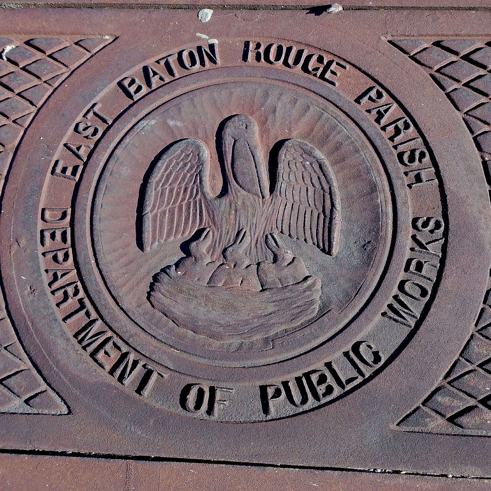
Department of Public Works. East Baton Rouge Parish, Inniswold Estates/Jefferson Terrace You checked the neighborhood.Now check an address ! Photo: Paul Lowry, CC BY 2.0 · Wikimedia Commons

For $34.00 a CrimesLog™ Home Report provides: (where available)

  • Nearest 6 Pre-school Nurseries to Address
  • Nearest 6 Primary Schools to Address
  • Nearest 6 Secondary/High Schools to Address
  • Nearest College and University to Address
  • Nearest to Address Medical Clinics, Hospitals and Pharmacies
  • Nearest 2 Police Station details to Address

The Home Report also provides

  • The CrimesLog™ Home Score is a proprietary Home Safety Measure capturing crime frequency, severity, recency and proximity to Address from police crime reporting point
  • A map indicating police anonymized crime reporting points around Address
  • Crime category trendlines for Address neighborhood
  • List of Reported Crime Incidents around Address radius
  • Downloadable PDF report — A Permanent Copy to Keep and Share to aid your Property Research
  • Our crimes database of almost 60 million records is UPDATED EVERY MONTH from US, UK, CA police sources
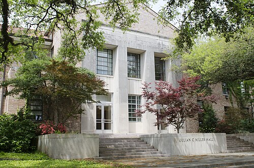
Julian C. Miller Hall, Louisiana State University, Baton Rouge, Louisiana (4), Baton Rouge
Baton Rouge · Julian C. Miller Hall, Louisiana State University, Baton Rouge, Louisiana (4)
Photo: davidpinter, CC BY 3.0 · Wikimedia Commons
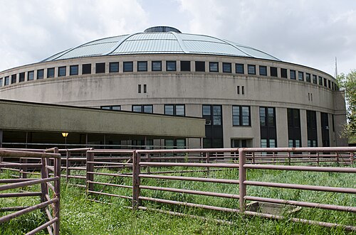
John M. Parker Agricultural Coliseum, Louisiana State University, Baton Rouge, Louisiana 2014 (3), Baton Rouge
Baton Rouge · John M. Parker Agricultural Coliseum, Louisiana State University, Baton Rouge, Louisiana 2014 (3)
Photo: davidpinter, CC BY 3.0 · Wikimedia Commons
LSU AgCenter Livestock Exhibit Building, Louisiana State University, Baton Rouge, Louisiana (9), Baton Rouge
Baton Rouge · LSU AgCenter Livestock Exhibit Building, Louisiana State University, Baton Rouge, Louisiana (9)
Photo: davidpinter, CC BY 3.0 · Wikimedia Commons
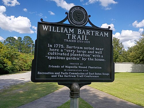
William Bartram Trail Marker, Magnolia Mound Plantation, Baton Rouge, Baton Rouge
Baton Rouge · William Bartram Trail Marker, Magnolia Mound Plantation, Baton Rouge
Photo: Paul Lowry, CC BY 4.0 · Wikimedia Commons
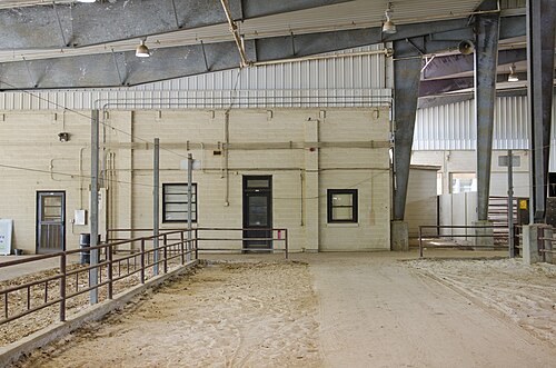
LSU AgCenter Livestock Exhibit Building, John S. Sullivan, Jr. Livestock Show Office (2), Baton Rouge
Baton Rouge · LSU AgCenter Livestock Exhibit Building, John S. Sullivan, Jr. Livestock Show Office (2)
Photo: davidpinter, CC BY 3.0 · Wikimedia Commons
Charles E. Coates Hall, Louisiana State University, Baton Rouge, Louisiana 2014 (4), Baton Rouge
Baton Rouge · Charles E. Coates Hall, Louisiana State University, Baton Rouge, Louisiana 2014 (4)
Photo: davidpinter, CC BY 3.0 · Wikimedia Commons
John J. Audubon Hall, Louisiana State University, Baton Rouge, Louisiana 2014, Baton Rouge
Baton Rouge · John J. Audubon Hall, Louisiana State University, Baton Rouge, Louisiana 2014
Photo: davidpinter, CC BY 3.0 · Wikimedia Commons
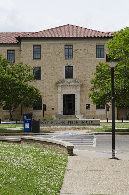
Huey P. Long Field House, Baton Rouge, Baton Rouge
Baton Rouge · Huey P. Long Field House, Baton Rouge
Photo: davidpinter, CC BY 3.0 · Wikimedia Commons

How neighborhoods moved each quarter

2022

Whole-area crime rate 9.0 to 10.2 per 1,000 (high: Q1 2022).

Big moves (4+ places in a quarter): moved down Kenilworth 3rd→7th (Q2) moved up Kenilworth 7th→2nd (Q3) moved up Woodgate 8th→4th (Q3) moved down Staring Court 1st→6th (Q3) moved up Mayfair North 13th→9th (Q3) moved down Magnolia Pointe 9th→13th (Q3) moved up The Estates At Worthington Lake 8th→2nd (Q4) moved up Magnolia Pointe 13th→3rd (Q4) moved down Kenilworth 2nd→6th (Q4) moved up South Highlands 14th→10th (Q4) moved down Mayfair Park/East/Heights 7th→13th (Q4) moved down Woodgate 4th→14th (Q4)

2023

Whole-area crime rate 8.3 to 12.0 per 1,000 (high: Q2 2023).

Big moves (4+ places in a quarter): moved down The Estates At Worthington Lake 2nd→6th (Q1) moved up Woodgate 14th→7th (Q1) moved up Mayfair Park/East/Heights 13th→9th (Q1) moved down The Myrtles 1st→10th (Q1) moved up Woodgate 7th→2nd (Q2) moved up The Myrtles 10th→4th (Q2) moved down Magnolia Woods 3rd→7th (Q2) moved down Magnolia Pointe 1st→8th (Q2) moved up Mayfair North 13th→9th (Q2) moved up Kenilworth 6th→2nd (Q3) moved up Lynnewood Village 13th→6th (Q3) moved down The Estates At Worthington Lake 5th→9th (Q3) moved down Mayfair North 9th→14th (Q3) moved up Magnolia Woods 7th→2nd (Q4) moved up Magnolia Pointe 11th→4th (Q4) moved down Woodgate 1st→9th (Q4) moved down Lynnewood Village 6th→14th (Q4)

2024

Whole-area crime rate 6.2 to 7.9 per 1,000 (high: Q1 2024).

Big moves (4+ places in a quarter): moved up The Myrtles 5th→1st (Q1) moved up Staring Court 7th→2nd (Q1) moved up Woodgate 9th→3rd (Q1) moved up Lynnewood Village 14th→4th (Q1) moved down Kenilworth 1st→5th (Q1) moved down Magnolia Woods 2nd→6th (Q1) moved down Central Highland 3rd→9th (Q1) moved down Mayfair Park/East/Heights 6th→10th (Q1) moved up Central Highland 9th→3rd (Q2) moved down The Myrtles 1st→5th (Q2) moved down Woodgate 3rd→8th (Q2) moved down Magnolia Pointe 7th→11th (Q2) moved up The Estates At Worthington Lake 7th→3rd (Q3) moved up Magnolia Pointe 11th→6th (Q3) moved down Lynnewood Village 2nd→13th (Q3) moved up Magnolia Pointe 6th→2nd (Q4) moved up Woodgate 11th→3rd (Q4) moved up Lynnewood Village 13th→4th (Q4) moved down Staring Court 1st→7th (Q4) moved down The Myrtles 2nd→8th (Q4) moved down Highland Creek 7th→14th (Q4)

2025

Whole-area crime rate 6.6 to 8.2 per 1,000 (high: Q4 2025).

Big moves (4+ places in a quarter): moved up South Highlands 13th→3rd (Q1) moved down Magnolia Pointe 2nd→8th (Q1) moved up Highland Creek 14th→10th (Q1) moved down Woodgate 3rd→13th (Q1) moved up The Myrtles 11th→3rd (Q2) moved up Woodgate 13th→4th (Q2) moved down The Estates At Worthington Lake 1st→8th (Q2) moved down South Highlands 3rd→11th (Q2) moved up Magnolia Pointe 9th→5th (Q3) moved up Highland Creek 13th→6th (Q3) moved up Mayfair North 14th→10th (Q3) moved down Lynnewood Village 1st→12th (Q3) moved down Woodgate 4th→14th (Q3) moved up The Estates At Worthington Lake 11th→2nd (Q4) moved down Staring Court 1st→5th (Q4) moved up Woodgate 14th→7th (Q4) moved down Highland Creek 6th→11th (Q4) moved down South Highlands 8th→12th (Q4)

2026

Whole-area crime rate 5.4 to 6.6 per 1,000 (high: Q1 2026). 2 quarters so far.

Big moves (4+ places in a quarter): moved down The Estates At Worthington Lake 2nd→7th (Q1) moved up Magnolia Pointe 6th→2nd (Q2) moved up Woodgate 9th→3rd (Q2) moved up Lynnewood Village 10th→4th (Q2) moved up South Highlands 12th→5th (Q2) moved down Central Highland 2nd→6th (Q2) moved down The Myrtles 1st→8th (Q2) moved down Magnolia Woods 3rd→9th (Q2) moved down The Estates At Worthington Lake 7th→11th (Q2)

Reported Safety Incidents

In Q2 2026: property incidents were 56% (38), violent incidents were 10% (7), vehicle crimes were 10% (7) and public order incidents were 10% (7).

Recorded crime here is grouped into violent crime, property crime (burglary and theft), vehicle crime and public order offences, so you can compare how safe each neighborhood is for the kind of crime that matters to you.

Places we left out, and places to read with care

Left out: Highland Bluff; Lakeside; Santa Rosa; South Hills; University Villas; Walden. They have almost no residents: their crimes are against visitors, so a rate per resident says little about living there.

Lynnewood Village (0.0 per 1,000 from 0 crimes among 131 residents), Woodgate (0.0 per 1,000 from 0 crimes among 162 residents), The Estates At Worthington Lake (7.3 per 1,000 from 2 crimes among 273 residents), Magnolia Pointe (0.0 per 1,000 from 0 crimes among 309 residents), South Highlands (0.0 per 1,000 from 0 crimes among 317 residents), The Myrtles (2.9 per 1,000 from 1 crime among 348 residents), Mayfair North (11.1 per 1,000 from 4 crimes among 361 residents), Staring Court (0.0 per 1,000 from 0 crimes among 367 residents) and Highland Creek (17.3 per 1,000 from 11 crimes among 636 residents) are places with few residents (under 3,000): a rate on so few people says little about living there, so they are not named as the lowest or highest.

The 14 neighborhoods on the map

District 12 (south) is made of 14 neighborhoods compared here, each in its own colour on the map. They are the neighborhood areas of the City of Baton Rouge / Parish of East Baton Rouge (EBRGIS), grouped into Metro Council districts by CrimesLog: 12,510 residents between them.

  • Central Highland
  • Highland Creek
  • Kenilworth
  • Lake Villas
  • Lynnewood Village
  • Magnolia Pointe
  • Magnolia Woods
  • Mayfair North
  • Mayfair Park/East/Heights
  • South Highlands
  • Staring Court
  • The Estates At Worthington Lake
  • The Myrtles
  • Woodgate

All 14 neighborhoods, Q2 2026

Crimes per 1,000 residents, Q2 2026, lowest first. The last two columns compare with Q1 2022.
#NeighborhoodResidentsAllViolentPropertyVehiclePublic orderRate vs Q1 2022Places gained
1Staring Court †3670.00.00.00.00.0down100%up3
2Magnolia Pointe †3090.00.00.00.00.0down100%up6
3Woodgate †1620.00.00.00.00.0down100%up4
4Lynnewood Village †1310.00.00.00.00.0down100%up9
5South Highlands †3170.00.00.00.00.0down100%up6
6Central Highland2,1211.40.00.50.50.0down0%down5
7Kenilworth1,8622.70.51.60.00.5up25%down4
8The Myrtles †3482.90.00.00.00.0down0%down3
9Magnolia Woods2,4112.90.82.10.00.0up75%down7
10Mayfair Park/East/Heights1,2454.80.81.60.80.8down65%down1
11The Estates At Worthington Lake †2737.30.03.70.00.0up100%down5
12Mayfair North †36111.12.82.80.00.0down33%down2
13Lake Villas1,96714.71.07.62.52.0down54%up1
14Highland Creek †63617.30.015.70.01.6down15%down2

† Lynnewood Village, Woodgate, The Estates At Worthington Lake, Magnolia Pointe, South Highlands, The Myrtles, Mayfair North, Staring Court and Highland Creek are places with few residents. A rate on a very small number of residents or crimes is not comparable with the others.

Photographs

102 photographs of the 14 neighborhoods run along the reel; click one to see it full size. Each is credited here and under the large view.

All 102 photographs and their credits
  1. Baton Rouge · Julian C. Miller Hall, Louisiana State University, Baton Rouge, Louisiana (4). Photo: davidpinter, CC BY 3.0 · Wikimedia Commons
  2. Baton Rouge · John M. Parker Agricultural Coliseum, Louisiana State University, Baton Rouge, Louisiana 2014 (3). Photo: davidpinter, CC BY 3.0 · Wikimedia Commons
  3. Baton Rouge · LSU AgCenter Livestock Exhibit Building, Louisiana State University, Baton Rouge, Louisiana (9). Photo: davidpinter, CC BY 3.0 · Wikimedia Commons
  4. Baton Rouge · William Bartram Trail Marker, Magnolia Mound Plantation, Baton Rouge. Photo: Paul Lowry, CC BY 4.0 · Wikimedia Commons
  5. Baton Rouge · LSU AgCenter Livestock Exhibit Building, John S. Sullivan, Jr. Livestock Show Office (2). Photo: davidpinter, CC BY 3.0 · Wikimedia Commons
  6. Baton Rouge · Charles E. Coates Hall, Louisiana State University, Baton Rouge, Louisiana 2014 (4). Photo: davidpinter, CC BY 3.0 · Wikimedia Commons
  7. Baton Rouge · John J. Audubon Hall, Louisiana State University, Baton Rouge, Louisiana 2014. Photo: davidpinter, CC BY 3.0 · Wikimedia Commons
  8. Baton Rouge · Huey P. Long Field House, Baton Rouge. Photo: davidpinter, CC BY 3.0 · Wikimedia Commons
  9. Baton Rouge · Coates Hall Covered Walkway, Louisiana State University, Baton Rouge, Louisiana. Photo: davidpinter, CC BY 3.0 · Wikimedia Commons
  10. Baton Rouge · Baton Rouge - View from State Capitol, April 2024. Photo: xiquinhosilva, CC BY 4.0 · Wikimedia Commons
  11. Baton Rouge · Thomas D. Boyd Hall, Louisiana State University, Baton Rouge, Louisiana 2014. Photo: davidpinter, CC BY 3.0 · Wikimedia Commons
  12. Baton Rouge · Coates Hall Covered Walkway, Louisiana State University, Baton Rouge, Louisiana (2). Photo: davidpinter, CC BY 3.0 · Wikimedia Commons
  13. Baton Rouge · Baton Rouge, Louisiana. Photo: davidpinter, CC BY 3.0 · Wikimedia Commons
  14. Baton Rouge · Louisiana State University Baseball Stadium, Baton Rouge, Louisiana. Photo: davidpinter, CC BY 3.0 · Wikimedia Commons
  15. Baton Rouge · 4-H Mini Barn, Louisiana State University, Baton Rouge, Louisiana. Photo: davidpinter, CC BY 3.0 · Wikimedia Commons
  16. Baton Rouge · Italian Renaissance Architecture, National Register of Historic Places Plaque, Louisiana State University, Baton Rouge. Photo: davidpinter, CC BY 3.0 · Wikimedia Commons
  17. Baton Rouge · Louisiana State Capitol 2012. Photo: thepipe26, CC BY 2.0 · Wikimedia Commons
  18. Baton Rouge · Paul M. Hebert Law Center, Louisiana State University, Baton Rouge, Louisiana 2014 (2). Photo: davidpinter, CC BY 3.0 · Wikimedia Commons
  19. Baton Rouge · Louisiana State University Baseball Stadium, Baton Rouge, Louisiana. Photo: davidpinter, CC BY 3.0 · Wikimedia Commons
  20. Baton Rouge · Paul M. Hebert Law Center, Louisiana State University, Baton Rouge, Louisiana 2014 (3). Photo: davidpinter, CC BY 3.0 · Wikimedia Commons
  21. Baton Rouge · Magnolia Mound Plantation, Baton Rouge July 2025. Photo: Paul Lowry, CC BY 4.0 · Wikimedia Commons
  22. Baton Rouge · Mary Bird Perkins Cancer Center - Baton Rouge Louisiana. Photo: Paul Lowry, CC BY 2.0 · Wikimedia Commons
  23. Baton Rouge · Baton Rouge, Louisiana. Photo: davidpinter, CC BY 3.0 · Wikimedia Commons
  24. Baton Rouge · Balconies - Beauregard Town, Baton Rouge Louisiana 2023. Photo: Paul Lowry, CC BY 2.0 · Wikimedia Commons
  25. Baton Rouge · Baton Rouge, Louisiana. Photo: davidpinter, CC BY 3.0 · Wikimedia Commons
  26. Baton Rouge · Louisiana State University Baseball Stadium, Baton Rouge, Louisiana. Photo: davidpinter, CC BY 3.0 · Wikimedia Commons
  27. Baton Rouge · Marriott Baton Rouge A. Photo: WhisperToMe, CC0 · Wikimedia Commons
  28. Baton Rouge · Tin Roof Brewery - Baton Rouge Louisiana. Photo: Paul Lowry, CC BY 2.0 · Wikimedia Commons
  29. Baton Rouge · Baton Rouge - Old State Capitol Front April 2024. Photo: xiquinhosilva, CC BY 4.0 · Wikimedia Commons
  30. Baton Rouge · Baton Rouge - Old State Capitol from the Riverfront, April 2024. Photo: xiquinhosilva, CC BY 4.0 · Wikimedia Commons
  31. Baton Rouge · Covered Walkway in the Quad, Louisiana State University, Baton Rouge, Louisiana. Photo: davidpinter, CC BY 3.0 · Wikimedia Commons
  32. Baton Rouge · Tin Roof Brewery in Baton Rouge. Photo: Paul Lowry, CC BY 2.0 · Wikimedia Commons
  33. Baton Rouge · Paul M. Hebert Law Center, Louisiana State University, Baton Rouge, Louisiana 2014. Photo: davidpinter, CC BY 3.0 · Wikimedia Commons
  34. Baton Rouge · Covered Walkway in the Quad, Louisiana State University, Baton Rouge, Louisiana (4). Photo: davidpinter, CC BY 3.0 · Wikimedia Commons
  35. Baton Rouge · Baton Rouge, Louisiana - Old State Capitol Castle, April 2024. Photo: xiquinhosilva, CC BY 2.0 · Wikimedia Commons
  36. Baton Rouge · Baton Rouge - Old State Capitol April 2024. Photo: xiquinhosilva, CC BY 4.0 · Wikimedia Commons
  37. Baton Rouge · Louisiana State Capitol - Bell. Photo: xiquinhosilva, CC BY 4.0 · Wikimedia Commons
  38. Baton Rouge · Louisiana State Capitol April 2024. Photo: xiquinhosilva, CC BY 4.0 · Wikimedia Commons
  39. Baton Rouge · Louisiana State Capitol, 2016. Photo: Jim Bowen, CC BY 2.0 · Wikimedia Commons
  40. Beauregard Town · Royal Street, Beauregard Town, Baton Rouge LA. Photo: Paul Lowry, CC BY 2.0 · Wikimedia Commons
  41. Garden District · House on Government Street, Baton Rouge LA Oct 2024. Photo: Paul Lowry, CC BY 2.0 · Wikimedia Commons
  42. Historic Spanish Town · Baton Rouge April 2024 - State Library of Louisiana. Photo: xiquinhosilva, CC BY 4.0 · Wikimedia Commons
  43. North Gate Merchants · Louie's Cafe, Baton Rouge 2013. Photo: Corey Taratuta, CC BY 2.0 · Wikimedia Commons
  44. Ogden Park · Baton Rouge High School, Oct 2024. Photo: Paul Lowry, CC BY 2.0 · Wikimedia Commons
  45. Tigerland · Louisiana State University Baseball Stadium, Baton Rouge, Louisiana. Photo: davidpinter, CC BY 3.0 · Wikimedia Commons
  46. Goodwood · Baton Rouge Main Library, April 2026. Photo: Paul Lowry, CC BY 4.0 · Wikimedia Commons
  47. Homewood · Piccadilly Cafeteria, Baton Rouge December 2024. Photo: Paul Lowry, CC BY 2.0 · Wikimedia Commons
  48. Inniswold Estates/Jefferson Terrace · Department of Public Works. East Baton Rouge Parish. Photo: Paul Lowry, CC BY 2.0 · Wikimedia Commons
  49. Westminster/Pine Park · Veracruz Restaurant, Baton Rouge May 2025. Photo: Paul Lowry, CC BY 2.0 · Wikimedia Commons
  50. Wimbeldon Estates · Mall of Louisiana. Photo: Aaron Manning, CC BY 3.0 · Wikimedia Commons
  51. College Town · Blake Hall, Louisiana State University, Baton Rouge, Louisiana. Photo: davidpinter, CC BY 3.0 · Wikimedia Commons
  52. Pollard Estates · New Orleans French Quarter Apartment Living Room 2. Photo: Corey Taratuta, CC BY 2.0 · Wikimedia Commons
  53. Southside · Baton Rouge Magnolia Ridge by University Lake Oct 2016. Photo: ClayJar.com, CC BY 2.0 · Wikimedia Commons
  54. Zee Zee Gardens · The Overpass Merchant Restaurant Baton Rouge November 2019 03. Photo: Jeff Hitchcock, CC BY 2.0 · Wikimedia Commons
  55. Hermitage/Cross Creek · Ministerio Internacional Monte Sinaí - Baton Rouge. Photo: Paul Lowry, CC BY 2.0 · Wikimedia Commons
  56. Goodwood Homesites · Amazon Fulfillment Warehouse, Baton Rouge Louisiana April 2025. Photo: Paul Lowry, CC BY 2.0 · Wikimedia Commons
  57. Bernard Terrace · Planned Parenthood, Baton Rouge LA Oct 2024. Photo: Paul Lowry, CC BY 2.0 · Wikimedia Commons
  58. Sherwood Lake · Starbox Falafel, Baton Rouge LA July 2025 - Exterior. Photo: Paul Lowry, CC BY 4.0 · Wikimedia Commons
  59. Beauregard Town · Baton Rouge April 2024 - Louisiana Art & Science Museum. Photo: xiquinhosilva, CC BY 4.0 · Wikimedia Commons
  60. Garden District · Corner Store, Government Street, Baton Rouge LA Oct 2024. Photo: Paul Lowry, CC BY 2.0 · Wikimedia Commons
  61. Historic Spanish Town · Baton Rouge, Louisiana. Photo: davidpinter, CC BY 3.0 · Wikimedia Commons
  62. North Gate Merchants · Thomas D. Boyd Hall, Louisiana State University, Baton Rouge, Louisiana 2014 (3). Photo: davidpinter, CC BY 3.0 · Wikimedia Commons
  63. Ogden Park · World War Memorial Baton Rouge LA. Photo: Paul Lowry, CC BY 2.0 · Wikimedia Commons
  64. Tigerland · Louisiana State University Baseball Stadium, Baton Rouge, Louisiana. Photo: davidpinter, CC BY 3.0 · Wikimedia Commons
  65. Goodwood · Bingham & Taylor Gas - Baton Rouge Street Furniture. Photo: Paul Lowry, CC BY 2.0 · Wikimedia Commons
  66. Homewood · You Stay in Your Car - Oil Change Shop, Baton Rouge Louisiana, December 2024. Photo: Paul Lowry, CC BY 2.0 · Wikimedia Commons
  67. Wimbeldon Estates · Swaggart's Family Worship Center. Photo: Paul Lowry, CC BY 2.0 · Wikimedia Commons
  68. College Town · Joan C. Miller Hall, Louisiana State University, Baton Rouge, Louisiana. Photo: davidpinter, CC BY 3.0 · Wikimedia Commons
  69. Zee Zee Gardens · The Overpass Merchant Restaurant Baton Rouge November 2019 01. Photo: Jeff Hitchcock, CC BY 2.0 · Wikimedia Commons
  70. Goodwood Homesites · ALDI, Baton Rouge Louisiana April 2025. Photo: Paul Lowry, CC BY 2.0 · Wikimedia Commons
  71. Bernard Terrace · Baton Rouge + Music Studios. Photo: Paul Lowry, CC BY 2.0 · Wikimedia Commons
  72. Beauregard Town · Baton Rouge - Public Library. Photo: xiquinhosilva, CC BY 4.0 · Wikimedia Commons
  73. Garden District · Ragusa's Automotive, Baton Rouge. Photo: Paul Lowry, CC BY 2.0 · Wikimedia Commons
  74. Historic Spanish Town · Goudechaux. Photo: thepipe26, CC BY 2.0 · Wikimedia Commons
  75. North Gate Merchants · Magnolia Mound - The Big House. Photo: Jim Bowen, CC BY 2.0 · Wikimedia Commons
  76. Homewood · Capitol Wellness Solutions - Louisiana Medical Marijuana Dispensary, Baton Rouge 2024. Photo: Paul Lowry, CC BY 2.0 · Wikimedia Commons
  77. College Town · Herget Hall, Louisiana State University, Baton Rouge, Louisiana (2). Photo: davidpinter, CC BY 3.0 · Wikimedia Commons
  78. Beauregard Town · Baton Rouge - Library at Rhorer Plaza. Photo: xiquinhosilva, CC BY 4.0 · Wikimedia Commons
  79. Garden District · Pelican to Mars, Baton Rouge LA. Photo: Paul Lowry, CC BY 2.0 · Wikimedia Commons
  80. Historic Spanish Town · Baton Rouge, Louisiana. Photo: davidpinter, CC BY 3.0 · Wikimedia Commons
  81. North Gate Merchants · Kitchen Building at Magnolia Mound, Louisiana. Photo: Jim Bowen, CC BY 2.0 · Wikimedia Commons
  82. Homewood · Fresenius Kidney Care, Baton Rouge, Louisiana. Photo: Paul Lowry, CC BY 2.0 · Wikimedia Commons
  83. College Town · Julian C. Miller Hall, Louisiana State University, Baton Rouge, Louisiana (6). Photo: davidpinter, CC BY 3.0 · Wikimedia Commons
  84. Beauregard Town · Baton Rouge - Modernist City Hall. Photo: xiquinhosilva, CC BY 4.0 · Wikimedia Commons
  85. Historic Spanish Town · Baton Rouge, Louisiana. Photo: davidpinter, CC BY 3.0 · Wikimedia Commons
  86. North Gate Merchants · Thomas D. Boyd Hall, Louisiana State University, Baton Rouge, Louisiana 2014 (2). Photo: davidpinter, CC BY 3.0 · Wikimedia Commons
  87. Homewood · Air Release Valve - Baton Rouge December 2024. Photo: Paul Lowry, CC BY 2.0 · Wikimedia Commons
  88. Beauregard Town · Baton Rouge April 2024 - Battle Ship. Photo: xiquinhosilva, CC BY 4.0 · Wikimedia Commons
  89. Historic Spanish Town · Louisiana Capitol Building During Landry Inauguration. Photo: Ktkvtsh, CC BY 4.0 · Wikimedia Commons
  90. North Gate Merchants · Slaves Quarters at Magnolia Mound, Baton Rouge Louisiana. Photo: Jim Bowen, CC BY 2.0 · Wikimedia Commons
  91. Beauregard Town · Baton Rouge - Raising Cane's River Center Arena. Photo: xiquinhosilva, CC BY 4.0 · Wikimedia Commons
  92. Historic Spanish Town · Baton Rouge, Louisiana. Photo: davidpinter, CC BY 3.0 · Wikimedia Commons
  93. North Gate Merchants · Manager's Quarters at Magnolia Mound, Louisiana. Photo: Jim Bowen, CC BY 2.0 · Wikimedia Commons
  94. Beauregard Town · Baton Rouge Riverfont April 2024. Photo: xiquinhosilva, CC BY 4.0 · Wikimedia Commons
  95. Historic Spanish Town · Baton Rouge, Louisiana. Photo: davidpinter, CC BY 3.0 · Wikimedia Commons
  96. North Gate Merchants · Baton Rouge City Market Bell. Photo: Paul Lowry, CC BY 4.0 · Wikimedia Commons
  97. Beauregard Town · Greyhound at Baton Rouge Greyhound Station with COVID-19 Mask. Photo: Paul Lowry, CC BY 2.0 · Wikimedia Commons
  98. North Gate Merchants · George Peabody Hall and Troy H. Middleton Library, Louisiana State University, Baton Rouge, Louisiana. Photo: davidpinter, CC BY 3.0 · Wikimedia Commons
  99. Beauregard Town · Baton Rouge Louisiana Waterfront Aerial View. Photo: Michael Maples, U.S. Army Corps of Engineers, Public domain · Wikimedia Commons
  100. North Gate Merchants · David F. Boyd Hall, Louisiana State University, Baton Rouge, Louisiana. Photo: davidpinter, CC BY 3.0 · Wikimedia Commons
  101. Beauregard Town · Hot Stuff Restaurant, Interior, Baton Rouge, Louisiana July 2025. Photo: Paul Lowry, CC BY 4.0 · Wikimedia Commons
  102. North Gate Merchants · John J. Audubon Hall, Louisiana State University, Baton Rouge, Louisiana 2014 (2). Photo: davidpinter, CC BY 3.0 · Wikimedia Commons

Sources and notes

CrimesLog sources crime incident data published by the Baton Rouge Police Department (BRPD) through the Open Data BR platform (data.brla.gov), containing public sector information released under a Public Domain licence.

Population: U.S. Census Bureau, American Community Survey 5-year estimates (public domain).

First-place medal: 1st Place Medal emoji icon by Icons8.

Neighborhood boundaries are defined by EBRGIS, City of Baton Rouge / Parish of East Baton Rouge (gaps between neighborhood areas filled to the nearest neighborhood by CrimesLog), grouped into Metro Council districts and simplified by CrimesLog. The photographs are credited under each picture.

Rates are recorded crimes per 1,000 residents, quarter by quarter; where a neighborhood has fewer than 100 residents the rate would be worked out on 100 (those places are left out of the race). A count of recorded crime is not a verdict on any neighborhood.